ESA TPM Map Catalogue - Product List
back to previous node |
list of download URLs
Collection G2_Portugal_2021
GEOSAT-2 Portugal Coverage 2021 collection. More details here.
List of available products (latitude from 41.7263 to 41.8047 dg, longitude from -6.82437 to -6.68 dg)..
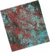
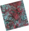
DE2_OPER_HRA_PSH_1C_20210719T104637_N41-836_W006-832_0001
Download Product | Product Info | Browse
Platform Short Name | GEOSAT |
Platform Serial Identifier | 2 |
Product Type | HRA_PSH_1C |
Start Date | 2021-07-19T10:46:37Z |
Stop Date | 2021-07-19T10:46:40Z |
Original Name | DE2_PSH_L1C_000000_20210719T104637_20210719T104640_DE2_38380_F2A3.zip |
Footprint | 41.7884354779 -6.73560529213 41.9125135576 -6.77722418977 41.884182314 -6.92951024358 41.7603008781 -6.88649654807 41.7884354779 -6.73560529213 |
Orbit Direction | ASCENDING |
Scene Centre Longitude | W006 |
Scene Centre Latitude | N41 |
Cloud Cover Percentage | -1 |
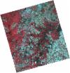
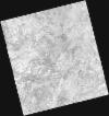
DE2_OPER_HRA_PM4_1C_20210719T104637_N41-836_W006-832_0001
Download Product | Product Info | Browse
Platform Short Name | GEOSAT |
Platform Serial Identifier | 2 |
Product Type | HRA_PM4_1C |
Start Date | 2021-07-19T10:46:37Z |
Stop Date | 2021-07-19T10:46:40Z |
Original Name | DE2_PM4_L1C_000000_20210719T104637_20210719T104640_DE2_38380_F2A3.zip |
Footprint | 41.7884354779 -6.73560529213 41.9125135576 -6.77722418977 41.884182314 -6.92951024358 41.7603008781 -6.88649654807 41.7884354779 -6.73560529213 |
Orbit Direction | ASCENDING |
Scene Centre Longitude | W006 |
Scene Centre Latitude | N41 |
Cloud Cover Percentage | -1 |
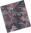
DE2_OPER_HRA_PSH_1C_20210719T104636_N41-723_W006-794_0001
Download Product | Product Info | Browse
Platform Short Name | GEOSAT |
Platform Serial Identifier | 2 |
Product Type | HRA_PSH_1C |
Start Date | 2021-07-19T10:46:36Z |
Stop Date | 2021-07-19T10:46:38Z |
Original Name | DE2_PSH_L1C_000000_20210719T104636_20210719T104638_DE2_38380_9D28.zip |
Footprint | 41.6759560921 -6.69720891667 41.7999474156 -6.73947866877 41.7717420577 -6.89083094896 41.6477187477 -6.84866502882 41.6759560921 -6.69720891667 |
Orbit Direction | ASCENDING |
Scene Centre Longitude | W006 |
Scene Centre Latitude | N41 |
Cloud Cover Percentage | -1 |
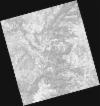
DE2_OPER_HRA_PM4_1C_20210719T104636_N41-723_W006-794_0001
Download Product | Product Info | Browse
Platform Short Name | GEOSAT |
Platform Serial Identifier | 2 |
Product Type | HRA_PM4_1C |
Start Date | 2021-07-19T10:46:36Z |
Stop Date | 2021-07-19T10:46:38Z |
Original Name | DE2_PM4_L1C_000000_20210719T104636_20210719T104638_DE2_38380_9D28.zip |
Footprint | 41.6759560921 -6.69720891667 41.7999474156 -6.73947866877 41.7717420577 -6.89083094896 41.6477187477 -6.84866502882 41.6759560921 -6.69720891667 |
Orbit Direction | ASCENDING |
Scene Centre Longitude | W006 |
Scene Centre Latitude | N41 |
Cloud Cover Percentage | -1 |
DE2_OPER_HRA_PSH_1C_20210701T105703_N41-705_W006-880_0001
Download Product | Product Info | Browse
Platform Short Name | GEOSAT |
Platform Serial Identifier | 2 |
Product Type | HRA_PSH_1C |
Start Date | 2021-07-01T10:57:03Z |
Stop Date | 2021-07-01T10:57:06Z |
Original Name | DE2_PSH_L1C_000000_20210701T105703_20210701T105706_DE2_38113_2D2B.zip |
Footprint | 41.6557622546 -6.7867090942 41.7799342199 -6.82343067458 41.7549717091 -6.97422775257 41.6308411777 -6.93722638425 41.6557622546 -6.7867090942 |
Orbit Direction | ASCENDING |
Scene Centre Longitude | W006 |
Scene Centre Latitude | N41 |
Cloud Cover Percentage | -1 |
DE2_OPER_HRA_PM4_1C_20210701T105703_N41-705_W006-880_0001
Download Product | Product Info | Browse
Platform Short Name | GEOSAT |
Platform Serial Identifier | 2 |
Product Type | HRA_PM4_1C |
Start Date | 2021-07-01T10:57:03Z |
Stop Date | 2021-07-01T10:57:06Z |
Original Name | DE2_PM4_L1C_000000_20210701T105703_20210701T105706_DE2_38113_2D2B.zip |
Footprint | 41.6557622546 -6.7867090942 41.7799342199 -6.82343067458 41.7549717091 -6.97422775257 41.6308411777 -6.93722638425 41.6557622546 -6.7867090942 |
Orbit Direction | ASCENDING |
Scene Centre Longitude | W006 |
Scene Centre Latitude | N41 |
Cloud Cover Percentage | -1 |
DE2_OPER_HRA_PSH_1C_20210417T105058_N41-791_W006-689_0001
Download Product | Product Info | Browse
Platform Short Name | GEOSAT |
Platform Serial Identifier | 2 |
Product Type | HRA_PSH_1C |
Start Date | 2021-04-17T10:50:58Z |
Stop Date | 2021-04-17T10:51:00Z |
Original Name | DE2_PSH_L1C_000000_20210417T105058_20210417T105100_DE2_37000_BAB5.zip |
Footprint | 41.7437724307 -6.59468345396 41.8669490856 -6.63501615612 41.8397308525 -6.78375644366 41.7165934359 -6.74319673126 41.7437724307 -6.59468345396 |
Orbit Direction | ASCENDING |
Scene Centre Longitude | W006 |
Scene Centre Latitude | N41 |
Cloud Cover Percentage | -1 |
DE2_OPER_HRA_PM4_1C_20210417T105058_N41-791_W006-689_0001
Download Product | Product Info | Browse
Platform Short Name | GEOSAT |
Platform Serial Identifier | 2 |
Product Type | HRA_PM4_1C |
Start Date | 2021-04-17T10:50:58Z |
Stop Date | 2021-04-17T10:51:00Z |
Original Name | DE2_PM4_L1C_000000_20210417T105058_20210417T105100_DE2_37000_BAB5.zip |
Footprint | 41.7437724307 -6.59468345396 41.8669490856 -6.63501615612 41.8397308525 -6.78375644366 41.7165934359 -6.74319673126 41.7437724307 -6.59468345396 |
Orbit Direction | ASCENDING |
Scene Centre Longitude | W006 |
Scene Centre Latitude | N41 |
Cloud Cover Percentage | -1 |
DE2_OPER_HRA_PSH_1C_20210417T105056_N41-680_W006-652_0001
Download Product | Product Info | Browse
Platform Short Name | GEOSAT |
Platform Serial Identifier | 2 |
Product Type | HRA_PSH_1C |
Start Date | 2021-04-17T10:50:56Z |
Stop Date | 2021-04-17T10:50:58Z |
Original Name | DE2_PSH_L1C_000000_20210417T105056_20210417T105058_DE2_37000_C957.zip |
Footprint | 41.6320908538 -6.55850692075 41.7551838441 -6.59837060352 41.7279913097 -6.74711678625 41.6049541934 -6.70688236422 41.6320908538 -6.55850692075 |
Orbit Direction | ASCENDING |
Scene Centre Longitude | W006 |
Scene Centre Latitude | N41 |
Cloud Cover Percentage | -1 |
DE2_OPER_HRA_PM4_1C_20210417T105056_N41-680_W006-652_0001
Download Product | Product Info | Browse
Platform Short Name | GEOSAT |
Platform Serial Identifier | 2 |
Product Type | HRA_PM4_1C |
Start Date | 2021-04-17T10:50:56Z |
Stop Date | 2021-04-17T10:50:58Z |
Original Name | DE2_PM4_L1C_000000_20210417T105056_20210417T105058_DE2_37000_C957.zip |
Footprint | 41.6320908538 -6.55850692075 41.7551838441 -6.59837060352 41.7279913097 -6.74711678625 41.6049541934 -6.70688236422 41.6320908538 -6.55850692075 |
Orbit Direction | ASCENDING |
Scene Centre Longitude | W006 |
Scene Centre Latitude | N41 |
Cloud Cover Percentage | -1 |