ESA TPM Map Catalogue - Product List
back to previous node |
list of download URLs

Collection G2_Portugal_2021
GEOSAT-2 Portugal Coverage 2021 collection. More details here.
List of available products (latitude from 41.7263 to 41.8047 dg, longitude from -8.255 to -8.11063 dg)..
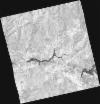
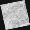
DE2_OPER_HRA_PSH_1C_20210519T110528_N41-705_W008-045_0001
Download Product | Product Info | Browse
Platform Short Name | GEOSAT |
Platform Serial Identifier | 2 |
Product Type | HRA_PSH_1C |
Start Date | 2021-05-19T11:05:28Z |
Stop Date | 2021-05-19T11:05:31Z |
Original Name | DE2_PSH_L1C_000000_20210519T110528_20210519T110531_DE2_37475_D2BA.zip |
Footprint | 41.6551712821 -7.94942324132 41.7813091821 -7.98603899743 41.7566125983 -8.14195135553 41.6306361516 -8.10422241894 41.6551712821 -7.94942324132 |
Orbit Direction | ASCENDING |
Scene Centre Longitude | W008 |
Scene Centre Latitude | N41 |
Cloud Cover Percentage | -1 |
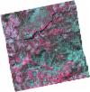
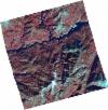
DE2_OPER_HRA_PM4_1C_20210519T110528_N41-705_W008-045_0001
Download Product | Product Info | Browse
Platform Short Name | GEOSAT |
Platform Serial Identifier | 2 |
Product Type | HRA_PM4_1C |
Start Date | 2021-05-19T11:05:28Z |
Stop Date | 2021-05-19T11:05:31Z |
Original Name | DE2_PM4_L1C_000000_20210519T110528_20210519T110531_DE2_37475_D2BA.zip |
Footprint | 41.6551712821 -7.94942324132 41.7813091821 -7.98603899743 41.7566125983 -8.14195135553 41.6306361516 -8.10422241894 41.6551712821 -7.94942324132 |
Orbit Direction | ASCENDING |
Scene Centre Longitude | W008 |
Scene Centre Latitude | N41 |
Cloud Cover Percentage | -1 |
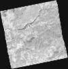
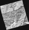
DE2_OPER_HRA_PSH_1C_20210406T111258_N41-800_W008-305_0001
Download Product | Product Info | Browse
Platform Short Name | GEOSAT |
Platform Serial Identifier | 2 |
Product Type | HRA_PSH_1C |
Start Date | 2021-04-06T11:12:58Z |
Stop Date | 2021-04-06T11:13:00Z |
Original Name | DE2_PSH_L1C_000000_20210406T111258_20210406T111300_DE2_36837_2493.zip |
Footprint | 41.7463723144 -8.20202698498 41.880123631 -8.2367199408 41.8553161254 -8.40928647261 41.7215108676 -8.37516780442 41.7463723144 -8.20202698498 |
Orbit Direction | ASCENDING |
Scene Centre Longitude | W008 |
Scene Centre Latitude | N41 |
Cloud Cover Percentage | -1 |
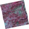
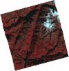
DE2_OPER_HRA_PM4_1C_20210406T111258_N41-800_W008-305_0001
Download Product | Product Info | Browse
Platform Short Name | GEOSAT |
Platform Serial Identifier | 2 |
Product Type | HRA_PM4_1C |
Start Date | 2021-04-06T11:12:58Z |
Stop Date | 2021-04-06T11:13:00Z |
Original Name | DE2_PM4_L1C_000000_20210406T111258_20210406T111300_DE2_36837_2493.zip |
Footprint | 41.7463723144 -8.20202698498 41.880123631 -8.2367199408 41.8553161254 -8.40928647261 41.7215108676 -8.37516780442 41.7463723144 -8.20202698498 |
Orbit Direction | ASCENDING |
Scene Centre Longitude | W008 |
Scene Centre Latitude | N41 |
Cloud Cover Percentage | -1 |
DE2_OPER_HRA_PSH_1C_20210406T111256_N41-679_W008-274_0001
Download Product | Product Info | Browse
Platform Short Name | GEOSAT |
Platform Serial Identifier | 2 |
Product Type | HRA_PSH_1C |
Start Date | 2021-04-06T11:12:56Z |
Stop Date | 2021-04-06T11:12:58Z |
Original Name | DE2_PSH_L1C_000000_20210406T111256_20210406T111258_DE2_36837_BAC7.zip |
Footprint | 41.6251938809 -8.16932845652 41.7586868775 -8.20589822618 41.7337022765 -8.37981141787 41.6003565395 -8.34179636108 41.6251938809 -8.16932845652 |
Orbit Direction | ASCENDING |
Scene Centre Longitude | W008 |
Scene Centre Latitude | N41 |
Cloud Cover Percentage | -1 |
DE2_OPER_HRA_PM4_1C_20210406T111256_N41-679_W008-274_0001
Download Product | Product Info | Browse
Platform Short Name | GEOSAT |
Platform Serial Identifier | 2 |
Product Type | HRA_PM4_1C |
Start Date | 2021-04-06T11:12:56Z |
Stop Date | 2021-04-06T11:12:58Z |
Original Name | DE2_PM4_L1C_000000_20210406T111256_20210406T111258_DE2_36837_BAC7.zip |
Footprint | 41.6251938809 -8.16932845652 41.7586868775 -8.20589822618 41.7337022765 -8.37981141787 41.6003565395 -8.34179636108 41.6251938809 -8.16932845652 |
Orbit Direction | ASCENDING |
Scene Centre Longitude | W008 |
Scene Centre Latitude | N41 |
Cloud Cover Percentage | -1 |
DE2_OPER_HRA_PSH_1C_20210108T105350_N41-851_W008-193_0001
Download Product | Product Info | Browse
Platform Short Name | GEOSAT |
Platform Serial Identifier | 2 |
Product Type | HRA_PSH_1C |
Start Date | 2021-01-08T10:53:50Z |
Stop Date | 2021-01-08T10:53:53Z |
Original Name | DE2_PSH_L1C_000000_20210108T105350_20210108T105353_DE2_35531_38E8.zip |
Footprint | 41.8033092684 -8.08907353166 41.930660519 -8.13601326248 41.8996947217 -8.29619880288 41.7719576415 -8.25171083816 41.8033092684 -8.08907353166 |
Orbit Direction | ASCENDING |
Scene Centre Longitude | W008 |
Scene Centre Latitude | N41 |
Cloud Cover Percentage | -1 |
DE2_OPER_HRA_PM4_1C_20210108T105350_N41-851_W008-193_0001
Download Product | Product Info | Browse
Platform Short Name | GEOSAT |
Platform Serial Identifier | 2 |
Product Type | HRA_PM4_1C |
Start Date | 2021-01-08T10:53:50Z |
Stop Date | 2021-01-08T10:53:53Z |
Original Name | DE2_PM4_L1C_000000_20210108T105350_20210108T105353_DE2_35531_38E8.zip |
Footprint | 41.8033092684 -8.08907353166 41.930660519 -8.13601326248 41.8996947217 -8.29619880288 41.7719576415 -8.25171083816 41.8033092684 -8.08907353166 |
Orbit Direction | ASCENDING |
Scene Centre Longitude | W008 |
Scene Centre Latitude | N41 |
Cloud Cover Percentage | -1 |
DE2_OPER_HRA_PSH_1C_20210108T105348_N41-735_W008-152_0001
Download Product | Product Info | Browse
Platform Short Name | GEOSAT |
Platform Serial Identifier | 2 |
Product Type | HRA_PSH_1C |
Start Date | 2021-01-08T10:53:48Z |
Stop Date | 2021-01-08T10:53:51Z |
Original Name | DE2_PSH_L1C_000000_20210108T105348_20210108T105351_DE2_35531_6B08.zip |
Footprint | 41.687204411 -8.05029491056 41.8152723312 -8.09245275442 41.7838578875 -8.25549856635 41.6558853059 -8.21279205745 41.687204411 -8.05029491056 |
Orbit Direction | ASCENDING |
Scene Centre Longitude | W008 |
Scene Centre Latitude | N41 |
Cloud Cover Percentage | -1 |
DE2_OPER_HRA_PM4_1C_20210108T105348_N41-735_W008-152_0001
Download Product | Product Info | Browse
Platform Short Name | GEOSAT |
Platform Serial Identifier | 2 |
Product Type | HRA_PM4_1C |
Start Date | 2021-01-08T10:53:48Z |
Stop Date | 2021-01-08T10:53:51Z |
Original Name | DE2_PM4_L1C_000000_20210108T105348_20210108T105351_DE2_35531_6B08.zip |
Footprint | 41.687204411 -8.05029491056 41.8152723312 -8.09245275442 41.7838578875 -8.25549856635 41.6558853059 -8.21279205745 41.687204411 -8.05029491056 |
Orbit Direction | ASCENDING |
Scene Centre Longitude | W008 |
Scene Centre Latitude | N41 |
Cloud Cover Percentage | -1 |