ESA TPM Map Catalogue - Product List
back to previous node |
list of download URLs
Collection G2_Portugal_2021
GEOSAT-2 Portugal Coverage 2021 collection. More details here.
List of available products (latitude from 41.7263 to 41.8047 dg, longitude from -8.39938 to -8.255 dg)..
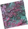
DE2_OPER_HRA_PSH_1C_20210708T110907_N41-806_W008-453_0001
Download Product | Product Info | Browse
Platform Short Name | GEOSAT |
Platform Serial Identifier | 2 |
Product Type | HRA_PSH_1C |
Start Date | 2021-07-08T11:09:07Z |
Stop Date | 2021-07-08T11:09:10Z |
Original Name | DE2_PSH_L1C_000000_20210708T110907_20210708T110910_DE2_38217_1EBD.zip |
Footprint | 41.7527086159 -8.35233955362 41.8841728761 -8.385897407 41.8591493575 -8.55533786894 41.7279915944 -8.51884703032 41.7527086159 -8.35233955362 |
Orbit Direction | ASCENDING |
Scene Centre Longitude | W008 |
Scene Centre Latitude | N41 |
Cloud Cover Percentage | -1 |
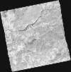
DE2_OPER_HRA_PM4_1C_20210708T110907_N41-806_W008-453_0001
Download Product | Product Info | Browse
Platform Short Name | GEOSAT |
Platform Serial Identifier | 2 |
Product Type | HRA_PM4_1C |
Start Date | 2021-07-08T11:09:07Z |
Stop Date | 2021-07-08T11:09:10Z |
Original Name | DE2_PM4_L1C_000000_20210708T110907_20210708T110910_DE2_38217_1EBD.zip |
Footprint | 41.7527086159 -8.35233955362 41.8841728761 -8.385897407 41.8591493575 -8.55533786894 41.7279915944 -8.51884703032 41.7527086159 -8.35233955362 |
Orbit Direction | ASCENDING |
Scene Centre Longitude | W008 |
Scene Centre Latitude | N41 |
Cloud Cover Percentage | -1 |
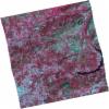
DE2_OPER_HRA_PSH_1C_20210708T110905_N41-687_W008-419_0001
Download Product | Product Info | Browse
Platform Short Name | GEOSAT |
Platform Serial Identifier | 2 |
Product Type | HRA_PSH_1C |
Start Date | 2021-07-08T11:09:05Z |
Stop Date | 2021-07-08T11:09:08Z |
Original Name | DE2_PSH_L1C_000000_20210708T110905_20210708T110908_DE2_38217_4899.zip |
Footprint | 41.6339822684 -8.3170250249 41.7649305229 -8.35504080293 41.7401780192 -8.52205717579 41.6091112494 -8.48468101311 41.6339822684 -8.3170250249 |
Orbit Direction | ASCENDING |
Scene Centre Longitude | W008 |
Scene Centre Latitude | N41 |
Cloud Cover Percentage | -1 |
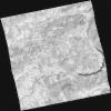
DE2_OPER_HRA_PM4_1C_20210708T110905_N41-687_W008-419_0001
Download Product | Product Info | Browse
Platform Short Name | GEOSAT |
Platform Serial Identifier | 2 |
Product Type | HRA_PM4_1C |
Start Date | 2021-07-08T11:09:05Z |
Stop Date | 2021-07-08T11:09:08Z |
Original Name | DE2_PM4_L1C_000000_20210708T110905_20210708T110908_DE2_38217_4899.zip |
Footprint | 41.6339822684 -8.3170250249 41.7649305229 -8.35504080293 41.7401780192 -8.52205717579 41.6091112494 -8.48468101311 41.6339822684 -8.3170250249 |
Orbit Direction | ASCENDING |
Scene Centre Longitude | W008 |
Scene Centre Latitude | N41 |
Cloud Cover Percentage | -1 |
DE2_OPER_HRA_PSH_1C_20210406T111258_N41-800_W008-305_0001
Download Product | Product Info | Browse
Platform Short Name | GEOSAT |
Platform Serial Identifier | 2 |
Product Type | HRA_PSH_1C |
Start Date | 2021-04-06T11:12:58Z |
Stop Date | 2021-04-06T11:13:00Z |
Original Name | DE2_PSH_L1C_000000_20210406T111258_20210406T111300_DE2_36837_2493.zip |
Footprint | 41.7463723144 -8.20202698498 41.880123631 -8.2367199408 41.8553161254 -8.40928647261 41.7215108676 -8.37516780442 41.7463723144 -8.20202698498 |
Orbit Direction | ASCENDING |
Scene Centre Longitude | W008 |
Scene Centre Latitude | N41 |
Cloud Cover Percentage | -1 |
DE2_OPER_HRA_PM4_1C_20210406T111258_N41-800_W008-305_0001
Download Product | Product Info | Browse
Platform Short Name | GEOSAT |
Platform Serial Identifier | 2 |
Product Type | HRA_PM4_1C |
Start Date | 2021-04-06T11:12:58Z |
Stop Date | 2021-04-06T11:13:00Z |
Original Name | DE2_PM4_L1C_000000_20210406T111258_20210406T111300_DE2_36837_2493.zip |
Footprint | 41.7463723144 -8.20202698498 41.880123631 -8.2367199408 41.8553161254 -8.40928647261 41.7215108676 -8.37516780442 41.7463723144 -8.20202698498 |
Orbit Direction | ASCENDING |
Scene Centre Longitude | W008 |
Scene Centre Latitude | N41 |
Cloud Cover Percentage | -1 |
DE2_OPER_HRA_PSH_1C_20210406T111256_N41-679_W008-274_0001
Download Product | Product Info | Browse
Platform Short Name | GEOSAT |
Platform Serial Identifier | 2 |
Product Type | HRA_PSH_1C |
Start Date | 2021-04-06T11:12:56Z |
Stop Date | 2021-04-06T11:12:58Z |
Original Name | DE2_PSH_L1C_000000_20210406T111256_20210406T111258_DE2_36837_BAC7.zip |
Footprint | 41.6251938809 -8.16932845652 41.7586868775 -8.20589822618 41.7337022765 -8.37981141787 41.6003565395 -8.34179636108 41.6251938809 -8.16932845652 |
Orbit Direction | ASCENDING |
Scene Centre Longitude | W008 |
Scene Centre Latitude | N41 |
Cloud Cover Percentage | -1 |
DE2_OPER_HRA_PM4_1C_20210406T111256_N41-679_W008-274_0001
Download Product | Product Info | Browse
Platform Short Name | GEOSAT |
Platform Serial Identifier | 2 |
Product Type | HRA_PM4_1C |
Start Date | 2021-04-06T11:12:56Z |
Stop Date | 2021-04-06T11:12:58Z |
Original Name | DE2_PM4_L1C_000000_20210406T111256_20210406T111258_DE2_36837_BAC7.zip |
Footprint | 41.6251938809 -8.16932845652 41.7586868775 -8.20589822618 41.7337022765 -8.37981141787 41.6003565395 -8.34179636108 41.6251938809 -8.16932845652 |
Orbit Direction | ASCENDING |
Scene Centre Longitude | W008 |
Scene Centre Latitude | N41 |
Cloud Cover Percentage | -1 |