ESA TPM Map Catalogue - Product List
back to previous node |
list of download URLs


Collection G2_Portugal_2021
GEOSAT-2 Portugal Coverage 2021 collection. More details here.
List of available products (latitude from 41.6479 to 41.7263 dg, longitude from -7.75625 to -7.61188 dg)..
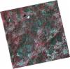
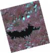
DE2_OPER_HRA_PSH_1C_20210808T110653_N41-758_W007-622_0001
Download Product | Product Info | Browse
Platform Short Name | GEOSAT |
Platform Serial Identifier | 2 |
Product Type | HRA_PSH_1C |
Start Date | 2021-08-08T11:06:53Z |
Stop Date | 2021-08-08T11:06:56Z |
Original Name | DE2_PSH_L1C_000000_20210808T110653_20210808T110656_DE2_38677_3F32.zip |
Footprint | 41.7038115064 -7.51496333285 41.8378860123 -7.55207221184 41.8126103317 -7.73094354916 41.6785595255 -7.69335778103 41.7038115064 -7.51496333285 |
Orbit Direction | ASCENDING |
Scene Centre Longitude | W007 |
Scene Centre Latitude | N41 |
Cloud Cover Percentage | -1 |
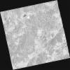
DE2_OPER_HRA_PM4_1C_20210808T110653_N41-758_W007-622_0001
Download Product | Product Info | Browse
Platform Short Name | GEOSAT |
Platform Serial Identifier | 2 |
Product Type | HRA_PM4_1C |
Start Date | 2021-08-08T11:06:53Z |
Stop Date | 2021-08-08T11:06:56Z |
Original Name | DE2_PM4_L1C_000000_20210808T110653_20210808T110656_DE2_38677_3F32.zip |
Footprint | 41.7038115064 -7.51496333285 41.8378860123 -7.55207221184 41.8126103317 -7.73094354916 41.6785595255 -7.69335778103 41.7038115064 -7.51496333285 |
Orbit Direction | ASCENDING |
Scene Centre Longitude | W007 |
Scene Centre Latitude | N41 |
Cloud Cover Percentage | -1 |
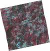
DE2_OPER_HRA_PSH_1C_20210808T110651_N41-636_W007-590_0001
Download Product | Product Info | Browse
Platform Short Name | GEOSAT |
Platform Serial Identifier | 2 |
Product Type | HRA_PSH_1C |
Start Date | 2021-08-08T11:06:51Z |
Stop Date | 2021-08-08T11:06:54Z |
Original Name | DE2_PSH_L1C_000000_20210808T110651_20210808T110654_DE2_38677_9B38.zip |
Footprint | 41.5815733381 -7.48568469778 41.7162669443 -7.51803044423 41.6909367449 -7.69708172049 41.5565334894 -7.66228180036 41.5815733381 -7.48568469778 |
Orbit Direction | ASCENDING |
Scene Centre Longitude | W007 |
Scene Centre Latitude | N41 |
Cloud Cover Percentage | -1 |
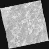
DE2_OPER_HRA_PM4_1C_20210808T110651_N41-636_W007-590_0001
Download Product | Product Info | Browse
Platform Short Name | GEOSAT |
Platform Serial Identifier | 2 |
Product Type | HRA_PM4_1C |
Start Date | 2021-08-08T11:06:51Z |
Stop Date | 2021-08-08T11:06:54Z |
Original Name | DE2_PM4_L1C_000000_20210808T110651_20210808T110654_DE2_38677_9B38.zip |
Footprint | 41.5815733381 -7.48568469778 41.7162669443 -7.51803044423 41.6909367449 -7.69708172049 41.5565334894 -7.66228180036 41.5815733381 -7.48568469778 |
Orbit Direction | ASCENDING |
Scene Centre Longitude | W007 |
Scene Centre Latitude | N41 |
Cloud Cover Percentage | -1 |
DE2_OPER_HRA_PSH_1C_20210506T105639_N41-766_W007-799_0001
Download Product | Product Info | Browse
Platform Short Name | GEOSAT |
Platform Serial Identifier | 2 |
Product Type | HRA_PSH_1C |
Start Date | 2021-05-06T10:56:39Z |
Stop Date | 2021-05-06T10:56:41Z |
Original Name | DE2_PSH_L1C_000000_20210506T105639_20210506T105641_DE2_37282_4EE8.zip |
Footprint | 41.7185557051 -7.70639661124 41.8412499112 -7.74554478565 41.814859442 -7.89286481264 41.6922420756 -7.85312492691 41.7185557051 -7.70639661124 |
Orbit Direction | ASCENDING |
Scene Centre Longitude | W007 |
Scene Centre Latitude | N41 |
Cloud Cover Percentage | -1 |
DE2_OPER_HRA_PM4_1C_20210506T105639_N41-766_W007-799_0001
Download Product | Product Info | Browse
Platform Short Name | GEOSAT |
Platform Serial Identifier | 2 |
Product Type | HRA_PM4_1C |
Start Date | 2021-05-06T10:56:39Z |
Stop Date | 2021-05-06T10:56:41Z |
Original Name | DE2_PM4_L1C_000000_20210506T105639_20210506T105641_DE2_37282_4EE8.zip |
Footprint | 41.7185557051 -7.70639661124 41.8412499112 -7.74554478565 41.814859442 -7.89286481264 41.6922420756 -7.85312492691 41.7185557051 -7.70639661124 |
Orbit Direction | ASCENDING |
Scene Centre Longitude | W007 |
Scene Centre Latitude | N41 |
Cloud Cover Percentage | -1 |
DE2_OPER_HRA_PSH_1C_20210506T105637_N41-655_W007-764_0001
Download Product | Product Info | Browse
Platform Short Name | GEOSAT |
Platform Serial Identifier | 2 |
Product Type | HRA_PSH_1C |
Start Date | 2021-05-06T10:56:37Z |
Stop Date | 2021-05-06T10:56:39Z |
Original Name | DE2_PSH_L1C_000000_20210506T105637_20210506T105639_DE2_37282_AEE5.zip |
Footprint | 41.6071464123 -7.67122732348 41.7299319405 -7.7100550191 41.7035872531 -7.85683544965 41.5808099319 -7.81804924525 41.6071464123 -7.67122732348 |
Orbit Direction | ASCENDING |
Scene Centre Longitude | W007 |
Scene Centre Latitude | N41 |
Cloud Cover Percentage | -1 |
DE2_OPER_HRA_PM4_1C_20210506T105637_N41-655_W007-764_0001
Download Product | Product Info | Browse
Platform Short Name | GEOSAT |
Platform Serial Identifier | 2 |
Product Type | HRA_PM4_1C |
Start Date | 2021-05-06T10:56:37Z |
Stop Date | 2021-05-06T10:56:39Z |
Original Name | DE2_PM4_L1C_000000_20210506T105637_20210506T105639_DE2_37282_AEE5.zip |
Footprint | 41.6071464123 -7.67122732348 41.7299319405 -7.7100550191 41.7035872531 -7.85683544965 41.5808099319 -7.81804924525 41.6071464123 -7.67122732348 |
Orbit Direction | ASCENDING |
Scene Centre Longitude | W007 |
Scene Centre Latitude | N41 |
Cloud Cover Percentage | -1 |