ESA TPM Map Catalogue - Product List
back to previous node |
list of download URLs


Collection G2_Portugal_2021
GEOSAT-2 Portugal Coverage 2021 collection. More details here.
List of available products (latitude from 41.6479 to 41.7263 dg, longitude from -7.90062 to -7.75625 dg)..
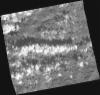
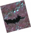
DE2_OPER_HRA_PM4_1C_20211116T110817_N41-649_W007-876_0001
Download Product | Product Info | Browse
Platform Short Name | GEOSAT |
Platform Serial Identifier | 2 |
Product Type | HRA_PM4_1C |
Start Date | 2021-11-16T11:08:17Z |
Stop Date | 2021-11-16T11:08:20Z |
Original Name | DE2_PM4_L1C_000000_20211116T110817_20211116T110820_DE2_40161_09A9.zip |
Footprint | 41.5916025906 -7.75885825757 41.7334330247 -7.79612733619 41.7071275005 -7.99260532433 41.5659214313 -7.95775159798 41.5916025906 -7.75885825757 |
Orbit Direction | ASCENDING |
Scene Centre Longitude | W007 |
Scene Centre Latitude | N41 |
Cloud Cover Percentage | -1 |
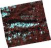
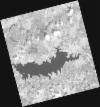
DE2_OPER_HRA_PSH_1C_20211116T110817_N41-649_W007-876_0001
Download Product | Product Info | Browse
Platform Short Name | GEOSAT |
Platform Serial Identifier | 2 |
Product Type | HRA_PSH_1C |
Start Date | 2021-11-16T11:08:17Z |
Stop Date | 2021-11-16T11:08:20Z |
Original Name | DE2_PSH_L1C_000000_20211116T110817_20211116T110820_DE2_40161_09A9.zip |
Footprint | 41.5916025906 -7.75885825757 41.7334330247 -7.79612733619 41.7071275005 -7.99260532433 41.5659214313 -7.95775159798 41.5916025906 -7.75885825757 |
Orbit Direction | ASCENDING |
Scene Centre Longitude | W007 |
Scene Centre Latitude | N41 |
Cloud Cover Percentage | -1 |
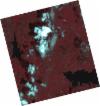
DE2_OPER_HRA_PSH_1C_20210531T105845_N41-779_W007-893_0001
Download Product | Product Info | Browse
Platform Short Name | GEOSAT |
Platform Serial Identifier | 2 |
Product Type | HRA_PSH_1C |
Start Date | 2021-05-31T10:58:45Z |
Stop Date | 2021-05-31T10:58:48Z |
Original Name | DE2_PSH_L1C_000000_20210531T105845_20210531T105848_DE2_37653_F2E4.zip |
Footprint | 41.730962948 -7.80022251205 41.8537256004 -7.83858899551 41.8281552567 -7.98596839246 41.7054190974 -7.94746075295 41.730962948 -7.80022251205 |
Orbit Direction | ASCENDING |
Scene Centre Longitude | W007 |
Scene Centre Latitude | N41 |
Cloud Cover Percentage | -1 |
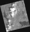
DE2_OPER_HRA_PM4_1C_20210531T105845_N41-779_W007-893_0001
Download Product | Product Info | Browse
Platform Short Name | GEOSAT |
Platform Serial Identifier | 2 |
Product Type | HRA_PM4_1C |
Start Date | 2021-05-31T10:58:45Z |
Stop Date | 2021-05-31T10:58:48Z |
Original Name | DE2_PM4_L1C_000000_20210531T105845_20210531T105848_DE2_37653_F2E4.zip |
Footprint | 41.730962948 -7.80022251205 41.8537256004 -7.83858899551 41.8281552567 -7.98596839246 41.7054190974 -7.94746075295 41.730962948 -7.80022251205 |
Orbit Direction | ASCENDING |
Scene Centre Longitude | W007 |
Scene Centre Latitude | N41 |
Cloud Cover Percentage | -1 |
DE2_OPER_HRA_PSH_1C_20210506T105639_N41-766_W007-799_0001
Download Product | Product Info | Browse
Platform Short Name | GEOSAT |
Platform Serial Identifier | 2 |
Product Type | HRA_PSH_1C |
Start Date | 2021-05-06T10:56:39Z |
Stop Date | 2021-05-06T10:56:41Z |
Original Name | DE2_PSH_L1C_000000_20210506T105639_20210506T105641_DE2_37282_4EE8.zip |
Footprint | 41.7185557051 -7.70639661124 41.8412499112 -7.74554478565 41.814859442 -7.89286481264 41.6922420756 -7.85312492691 41.7185557051 -7.70639661124 |
Orbit Direction | ASCENDING |
Scene Centre Longitude | W007 |
Scene Centre Latitude | N41 |
Cloud Cover Percentage | -1 |
DE2_OPER_HRA_PM4_1C_20210506T105639_N41-766_W007-799_0001
Download Product | Product Info | Browse
Platform Short Name | GEOSAT |
Platform Serial Identifier | 2 |
Product Type | HRA_PM4_1C |
Start Date | 2021-05-06T10:56:39Z |
Stop Date | 2021-05-06T10:56:41Z |
Original Name | DE2_PM4_L1C_000000_20210506T105639_20210506T105641_DE2_37282_4EE8.zip |
Footprint | 41.7185557051 -7.70639661124 41.8412499112 -7.74554478565 41.814859442 -7.89286481264 41.6922420756 -7.85312492691 41.7185557051 -7.70639661124 |
Orbit Direction | ASCENDING |
Scene Centre Longitude | W007 |
Scene Centre Latitude | N41 |
Cloud Cover Percentage | -1 |
DE2_OPER_HRA_PSH_1C_20210506T105637_N41-655_W007-764_0001
Download Product | Product Info | Browse
Platform Short Name | GEOSAT |
Platform Serial Identifier | 2 |
Product Type | HRA_PSH_1C |
Start Date | 2021-05-06T10:56:37Z |
Stop Date | 2021-05-06T10:56:39Z |
Original Name | DE2_PSH_L1C_000000_20210506T105637_20210506T105639_DE2_37282_AEE5.zip |
Footprint | 41.6071464123 -7.67122732348 41.7299319405 -7.7100550191 41.7035872531 -7.85683544965 41.5808099319 -7.81804924525 41.6071464123 -7.67122732348 |
Orbit Direction | ASCENDING |
Scene Centre Longitude | W007 |
Scene Centre Latitude | N41 |
Cloud Cover Percentage | -1 |
DE2_OPER_HRA_PM4_1C_20210506T105637_N41-655_W007-764_0001
Download Product | Product Info | Browse
Platform Short Name | GEOSAT |
Platform Serial Identifier | 2 |
Product Type | HRA_PM4_1C |
Start Date | 2021-05-06T10:56:37Z |
Stop Date | 2021-05-06T10:56:39Z |
Original Name | DE2_PM4_L1C_000000_20210506T105637_20210506T105639_DE2_37282_AEE5.zip |
Footprint | 41.6071464123 -7.67122732348 41.7299319405 -7.7100550191 41.7035872531 -7.85683544965 41.5808099319 -7.81804924525 41.6071464123 -7.67122732348 |
Orbit Direction | ASCENDING |
Scene Centre Longitude | W007 |
Scene Centre Latitude | N41 |
Cloud Cover Percentage | -1 |