ESA TPM Map Catalogue - Product List
back to previous node |
list of download URLs
Collection G2_Portugal_2021
GEOSAT-2 Portugal Coverage 2021 collection. More details here.
List of available products (latitude from 41.5694 to 41.6479 dg, longitude from -7.2575 to -7.11312 dg)..
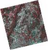
DE2_OPER_HRA_PSH_1C_20210625T110031_N41-675_W007-177_0001
Download Product | Product Info | BrowsePlatform Short Name | GEOSAT |
Platform Serial Identifier | 2 |
Product Type | HRA_PSH_1C |
Start Date | 2021-06-25T11:00:31Z |
Stop Date | 2021-06-25T11:00:33Z |
Original Name | DE2_PSH_L1C_000000_20210625T110031_20210625T110033_DE2_38024_6690.zip |
Footprint | 41.624983733 -7.08144777237 41.7509085377 -7.11775197725 41.7260484986 -7.27329004266 41.6002556818 -7.23588999234 41.624983733 -7.08144777237 |
Orbit Direction | ASCENDING |
Scene Centre Longitude | W007 |
Scene Centre Latitude | N41 |
Cloud Cover Percentage | -1 |
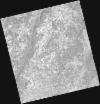
DE2_OPER_HRA_PM4_1C_20210625T110031_N41-675_W007-177_0001
Download Product | Product Info | BrowsePlatform Short Name | GEOSAT |
Platform Serial Identifier | 2 |
Product Type | HRA_PM4_1C |
Start Date | 2021-06-25T11:00:31Z |
Stop Date | 2021-06-25T11:00:33Z |
Original Name | DE2_PM4_L1C_000000_20210625T110031_20210625T110033_DE2_38024_6690.zip |
Footprint | 41.624983733 -7.08144777237 41.7509085377 -7.11775197725 41.7260484986 -7.27329004266 41.6002556818 -7.23588999234 41.624983733 -7.08144777237 |
Orbit Direction | ASCENDING |
Scene Centre Longitude | W007 |
Scene Centre Latitude | N41 |
Cloud Cover Percentage | -1 |
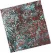
DE2_OPER_HRA_PSH_1C_20210625T110029_N41-561_W007-143_0001
Download Product | Product Info | BrowsePlatform Short Name | GEOSAT |
Platform Serial Identifier | 2 |
Product Type | HRA_PSH_1C |
Start Date | 2021-06-25T11:00:29Z |
Stop Date | 2021-06-25T11:00:32Z |
Original Name | DE2_PSH_L1C_000000_20210625T110029_20210625T110032_DE2_38024_8F23.zip |
Footprint | 41.5107640878 -7.04862593848 41.6367209817 -7.08451227045 41.6119563145 -7.23902754728 41.4861095111 -7.20245439757 41.5107640878 -7.04862593848 |
Orbit Direction | ASCENDING |
Scene Centre Longitude | W007 |
Scene Centre Latitude | N41 |
Cloud Cover Percentage | -1 |
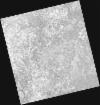
DE2_OPER_HRA_PM4_1C_20210625T110029_N41-561_W007-143_0001
Download Product | Product Info | BrowsePlatform Short Name | GEOSAT |
Platform Serial Identifier | 2 |
Product Type | HRA_PM4_1C |
Start Date | 2021-06-25T11:00:29Z |
Stop Date | 2021-06-25T11:00:32Z |
Original Name | DE2_PM4_L1C_000000_20210625T110029_20210625T110032_DE2_38024_8F23.zip |
Footprint | 41.5107640878 -7.04862593848 41.6367209817 -7.08451227045 41.6119563145 -7.23902754728 41.4861095111 -7.20245439757 41.5107640878 -7.04862593848 |
Orbit Direction | ASCENDING |
Scene Centre Longitude | W007 |
Scene Centre Latitude | N41 |
Cloud Cover Percentage | -1 |
DE2_OPER_HRA_PSH_1C_20210323T104816_N41-677_W007-294_0001
Download Product | Product Info | BrowsePlatform Short Name | GEOSAT |
Platform Serial Identifier | 2 |
Product Type | HRA_PSH_1C |
Start Date | 2021-03-23T10:48:16Z |
Stop Date | 2021-03-23T10:48:19Z |
Original Name | DE2_PSH_L1C_000000_20210323T104816_20210323T104819_DE2_36629_5F23.zip |
Footprint | 41.6213132057 -7.23557709461 41.7494065294 -7.27100434172 41.7328282686 -7.3513032051 41.6052569691 -7.31852803929 41.6213132057 -7.23557709461 |
Orbit Direction | ASCENDING |
Scene Centre Longitude | W007 |
Scene Centre Latitude | N41 |
Cloud Cover Percentage | -1 |
DE2_OPER_HRA_PM4_1C_20210323T104816_N41-677_W007-294_0001
Download Product | Product Info | BrowsePlatform Short Name | GEOSAT |
Platform Serial Identifier | 2 |
Product Type | HRA_PM4_1C |
Start Date | 2021-03-23T10:48:16Z |
Stop Date | 2021-03-23T10:48:19Z |
Original Name | DE2_PM4_L1C_000000_20210323T104816_20210323T104819_DE2_36629_5F23.zip |
Footprint | 41.6213132057 -7.23557709461 41.7494065294 -7.27100434172 41.7328282686 -7.3513032051 41.6052569691 -7.31852803929 41.6213132057 -7.23557709461 |
Orbit Direction | ASCENDING |
Scene Centre Longitude | W007 |
Scene Centre Latitude | N41 |
Cloud Cover Percentage | -1 |
DE2_OPER_HRA_PSH_1C_20210323T104814_N41-558_W007-263_0001
Download Product | Product Info | BrowsePlatform Short Name | GEOSAT |
Platform Serial Identifier | 2 |
Product Type | HRA_PSH_1C |
Start Date | 2021-03-23T10:48:14Z |
Stop Date | 2021-03-23T10:48:17Z |
Original Name | DE2_PSH_L1C_000000_20210323T104814_20210323T104817_DE2_36629_5706.zip |
Footprint | 41.4989833245 -7.20451541179 41.6323509964 -7.24263221681 41.6169547789 -7.32208592483 41.4837489433 -7.28315350343 41.4989833245 -7.20451541179 |
Orbit Direction | ASCENDING |
Scene Centre Longitude | W007 |
Scene Centre Latitude | N41 |
Cloud Cover Percentage | -1 |
DE2_OPER_HRA_PM4_1C_20210323T104814_N41-558_W007-263_0001
Download Product | Product Info | BrowsePlatform Short Name | GEOSAT |
Platform Serial Identifier | 2 |
Product Type | HRA_PM4_1C |
Start Date | 2021-03-23T10:48:14Z |
Stop Date | 2021-03-23T10:48:17Z |
Original Name | DE2_PM4_L1C_000000_20210323T104814_20210323T104817_DE2_36629_5706.zip |
Footprint | 41.4989833245 -7.20451541179 41.6323509964 -7.24263221681 41.6169547789 -7.32208592483 41.4837489433 -7.28315350343 41.4989833245 -7.20451541179 |
Orbit Direction | ASCENDING |
Scene Centre Longitude | W007 |
Scene Centre Latitude | N41 |
Cloud Cover Percentage | -1 |
