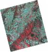
ESA TPM Map Catalogue - Product List
back to previous node |
list of download URLs
Collection G2_Portugal_2021
GEOSAT-2 Portugal Coverage 2021 collection. More details here.
List of available products (latitude from 41.491 to 41.5694 dg, longitude from -7.11312 to -6.96875 dg)..
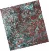
DE2_OPER_HRA_PSH_1C_20210625T110029_N41-561_W007-143_0001
Download Product | Product Info | BrowsePlatform Short Name | GEOSAT |
Platform Serial Identifier | 2 |
Product Type | HRA_PSH_1C |
Start Date | 2021-06-25T11:00:29Z |
Stop Date | 2021-06-25T11:00:32Z |
Original Name | DE2_PSH_L1C_000000_20210625T110029_20210625T110032_DE2_38024_8F23.zip |
Footprint | 41.5107640878 -7.04862593848 41.6367209817 -7.08451227045 41.6119563145 -7.23902754728 41.4861095111 -7.20245439757 41.5107640878 -7.04862593848 |
Orbit Direction | ASCENDING |
Scene Centre Longitude | W007 |
Scene Centre Latitude | N41 |
Cloud Cover Percentage | -1 |
DE2_OPER_HRA_PM4_1C_20210625T110029_N41-561_W007-143_0001
Download Product | Product Info | BrowsePlatform Short Name | GEOSAT |
Platform Serial Identifier | 2 |
Product Type | HRA_PM4_1C |
Start Date | 2021-06-25T11:00:29Z |
Stop Date | 2021-06-25T11:00:32Z |
Original Name | DE2_PM4_L1C_000000_20210625T110029_20210625T110032_DE2_38024_8F23.zip |
Footprint | 41.5107640878 -7.04862593848 41.6367209817 -7.08451227045 41.6119563145 -7.23902754728 41.4861095111 -7.20245439757 41.5107640878 -7.04862593848 |
Orbit Direction | ASCENDING |
Scene Centre Longitude | W007 |
Scene Centre Latitude | N41 |
Cloud Cover Percentage | -1 |
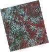
DE2_OPER_HRA_PSH_1C_20210625T110027_N41-447_W007-110_0001
Download Product | Product Info | BrowsePlatform Short Name | GEOSAT |
Platform Serial Identifier | 2 |
Product Type | HRA_PSH_1C |
Start Date | 2021-06-25T11:00:27Z |
Stop Date | 2021-06-25T11:00:30Z |
Original Name | DE2_PSH_L1C_000000_20210625T110027_20210625T110030_DE2_38024_E45E.zip |
Footprint | 41.39659133 -7.01601796678 41.5224311171 -7.05187074178 41.4977612352 -7.20585202728 41.3719283486 -7.16965012741 41.39659133 -7.01601796678 |
Orbit Direction | ASCENDING |
Scene Centre Longitude | W007 |
Scene Centre Latitude | N41 |
Cloud Cover Percentage | -1 |
DE2_OPER_HRA_PM4_1C_20210625T110027_N41-447_W007-110_0001
Download Product | Product Info | BrowsePlatform Short Name | GEOSAT |
Platform Serial Identifier | 2 |
Product Type | HRA_PM4_1C |
Start Date | 2021-06-25T11:00:27Z |
Stop Date | 2021-06-25T11:00:30Z |
Original Name | DE2_PM4_L1C_000000_20210625T110027_20210625T110030_DE2_38024_E45E.zip |
Footprint | 41.39659133 -7.01601796678 41.5224311171 -7.05187074178 41.4977612352 -7.20585202728 41.3719283486 -7.16965012741 41.39659133 -7.01601796678 |
Orbit Direction | ASCENDING |
Scene Centre Longitude | W007 |
Scene Centre Latitude | N41 |
Cloud Cover Percentage | -1 |
DE2_OPER_HRA_PSH_1C_20210606T105518_N41-606_W007-005_0001
Download Product | Product Info | BrowsePlatform Short Name | GEOSAT |
Platform Serial Identifier | 2 |
Product Type | HRA_PSH_1C |
Start Date | 2021-06-06T10:55:18Z |
Stop Date | 2021-06-06T10:55:20Z |
Original Name | DE2_PSH_L1C_000000_20210606T105518_20210606T105520_DE2_37742_C47C.zip |
Footprint | 41.5574356913 -6.91368048235 41.6804110066 -6.95133060726 41.654899364 -7.09838469603 41.5319135271 -7.06055800805 41.5574356913 -6.91368048235 |
Orbit Direction | ASCENDING |
Scene Centre Longitude | W007 |
Scene Centre Latitude | N41 |
Cloud Cover Percentage | -1 |
DE2_OPER_HRA_PM4_1C_20210606T105518_N41-606_W007-005_0001
Download Product | Product Info | BrowsePlatform Short Name | GEOSAT |
Platform Serial Identifier | 2 |
Product Type | HRA_PM4_1C |
Start Date | 2021-06-06T10:55:18Z |
Stop Date | 2021-06-06T10:55:20Z |
Original Name | DE2_PM4_L1C_000000_20210606T105518_20210606T105520_DE2_37742_C47C.zip |
Footprint | 41.5574356913 -6.91368048235 41.6804110066 -6.95133060726 41.654899364 -7.09838469603 41.5319135271 -7.06055800805 41.5574356913 -6.91368048235 |
Orbit Direction | ASCENDING |
Scene Centre Longitude | W007 |
Scene Centre Latitude | N41 |
Cloud Cover Percentage | -1 |
DE2_OPER_HRA_PSH_1C_20210606T105516_N41-494_W006-971_0001
Download Product | Product Info | BrowsePlatform Short Name | GEOSAT |
Platform Serial Identifier | 2 |
Product Type | HRA_PSH_1C |
Start Date | 2021-06-06T10:55:16Z |
Stop Date | 2021-06-06T10:55:18Z |
Original Name | DE2_PSH_L1C_000000_20210606T105516_20210606T105518_DE2_37742_4E6D.zip |
Footprint | 41.4457590685 -6.87957459228 41.5688062133 -6.91713735545 41.5432944667 -7.06408415229 41.4202302464 -7.02637277579 41.4457590685 -6.87957459228 |
Orbit Direction | ASCENDING |
Scene Centre Longitude | W006 |
Scene Centre Latitude | N41 |
Cloud Cover Percentage | -1 |
DE2_OPER_HRA_PM4_1C_20210606T105516_N41-494_W006-971_0001
Download Product | Product Info | BrowsePlatform Short Name | GEOSAT |
Platform Serial Identifier | 2 |
Product Type | HRA_PM4_1C |
Start Date | 2021-06-06T10:55:16Z |
Stop Date | 2021-06-06T10:55:18Z |
Original Name | DE2_PM4_L1C_000000_20210606T105516_20210606T105518_DE2_37742_4E6D.zip |
Footprint | 41.4457590685 -6.87957459228 41.5688062133 -6.91713735545 41.5432944667 -7.06408415229 41.4202302464 -7.02637277579 41.4457590685 -6.87957459228 |
Orbit Direction | ASCENDING |
Scene Centre Longitude | W006 |
Scene Centre Latitude | N41 |
Cloud Cover Percentage | -1 |
