ESA TPM Map Catalogue - Product List
back to previous node |
list of download URLs
Collection G2_Portugal_2021
GEOSAT-2 Portugal Coverage 2021 collection. More details here.
List of available products (latitude from 41.491 to 41.5694 dg, longitude from -8.045 to -7.90062 dg)..
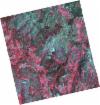
DE2_OPER_HRA_PSH_1C_20211116T110815_N41-520_W007-844_0001
Download Product | Product Info | Browse
Platform Short Name | GEOSAT |
Platform Serial Identifier | 2 |
Product Type | HRA_PSH_1C |
Start Date | 2021-11-16T11:08:15Z |
Stop Date | 2021-11-16T11:08:18Z |
Original Name | DE2_PSH_L1C_000000_20211116T110815_20211116T110818_DE2_40161_4616.zip |
Footprint | 41.4624980153 -7.7307445876 41.6047448172 -7.76228752619 41.578918255 -7.96217598986 41.4372798495 -7.9242627466 41.4624980153 -7.7307445876 |
Orbit Direction | ASCENDING |
Scene Centre Longitude | W007 |
Scene Centre Latitude | N41 |
Cloud Cover Percentage | -1 |
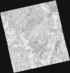
DE2_OPER_HRA_PM4_1C_20211116T110815_N41-520_W007-844_0001
Download Product | Product Info | Browse
Platform Short Name | GEOSAT |
Platform Serial Identifier | 2 |
Product Type | HRA_PM4_1C |
Start Date | 2021-11-16T11:08:15Z |
Stop Date | 2021-11-16T11:08:18Z |
Original Name | DE2_PM4_L1C_000000_20211116T110815_20211116T110818_DE2_40161_4616.zip |
Footprint | 41.4624980153 -7.7307445876 41.6047448172 -7.76228752619 41.578918255 -7.96217598986 41.4372798495 -7.9242627466 41.4624980153 -7.7307445876 |
Orbit Direction | ASCENDING |
Scene Centre Longitude | W007 |
Scene Centre Latitude | N41 |
Cloud Cover Percentage | -1 |
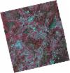
DE2_OPER_HRA_PSH_1C_20210727T111357_N41-508_W008-131_0001
Download Product | Product Info | Browse
Platform Short Name | GEOSAT |
Platform Serial Identifier | 2 |
Product Type | HRA_PSH_1C |
Start Date | 2021-07-27T11:13:57Z |
Stop Date | 2021-07-27T11:14:00Z |
Original Name | DE2_PSH_L1C_000000_20210727T111357_20210727T111400_DE2_38499_BCC3.zip |
Footprint | 41.4495959435 -8.01248351412 41.5922928795 -8.05037367381 41.5666849508 -8.24983854727 41.4236711483 -8.2145082249 41.4495959435 -8.01248351412 |
Orbit Direction | ASCENDING |
Scene Centre Longitude | W008 |
Scene Centre Latitude | N41 |
Cloud Cover Percentage | -1 |
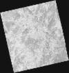
DE2_OPER_HRA_PM4_1C_20210727T111357_N41-508_W008-131_0001
Download Product | Product Info | Browse
Platform Short Name | GEOSAT |
Platform Serial Identifier | 2 |
Product Type | HRA_PM4_1C |
Start Date | 2021-07-27T11:13:57Z |
Stop Date | 2021-07-27T11:14:00Z |
Original Name | DE2_PM4_L1C_000000_20210727T111357_20210727T111400_DE2_38499_BCC3.zip |
Footprint | 41.4495959435 -8.01248351412 41.5922928795 -8.05037367381 41.5666849508 -8.24983854727 41.4236711483 -8.2145082249 41.4495959435 -8.01248351412 |
Orbit Direction | ASCENDING |
Scene Centre Longitude | W008 |
Scene Centre Latitude | N41 |
Cloud Cover Percentage | -1 |
DE2_OPER_HRA_PSH_1C_20210519T110526_N41-591_W008-011_0001
Download Product | Product Info | Browse
Platform Short Name | GEOSAT |
Platform Serial Identifier | 2 |
Product Type | HRA_PSH_1C |
Start Date | 2021-05-19T11:05:26Z |
Stop Date | 2021-05-19T11:05:29Z |
Original Name | DE2_PSH_L1C_000000_20210519T110526_20210519T110529_DE2_37475_9FFD.zip |
Footprint | 41.5407299578 -7.91532076995 41.6668149922 -7.95286459006 41.6423326975 -8.10722142156 41.5160922153 -8.0711004907 41.5407299578 -7.91532076995 |
Orbit Direction | ASCENDING |
Scene Centre Longitude | W008 |
Scene Centre Latitude | N41 |
Cloud Cover Percentage | -1 |
DE2_OPER_HRA_PM4_1C_20210519T110526_N41-591_W008-011_0001
Download Product | Product Info | Browse
Platform Short Name | GEOSAT |
Platform Serial Identifier | 2 |
Product Type | HRA_PM4_1C |
Start Date | 2021-05-19T11:05:26Z |
Stop Date | 2021-05-19T11:05:29Z |
Original Name | DE2_PM4_L1C_000000_20210519T110526_20210519T110529_DE2_37475_9FFD.zip |
Footprint | 41.5407299578 -7.91532076995 41.6668149922 -7.95286459006 41.6423326975 -8.10722142156 41.5160922153 -8.0711004907 41.5407299578 -7.91532076995 |
Orbit Direction | ASCENDING |
Scene Centre Longitude | W008 |
Scene Centre Latitude | N41 |
Cloud Cover Percentage | -1 |
DE2_OPER_HRA_PSH_1C_20210519T110524_N41-477_W007-978_0001
Download Product | Product Info | Browse
Platform Short Name | GEOSAT |
Platform Serial Identifier | 2 |
Product Type | HRA_PSH_1C |
Start Date | 2021-05-19T11:05:24Z |
Stop Date | 2021-05-19T11:05:27Z |
Original Name | DE2_PSH_L1C_000000_20210519T110524_20210519T110527_DE2_37475_A0FA.zip |
Footprint | 41.4265743906 -7.88335768923 41.5523742645 -7.91869637357 41.5277000953 -8.07470115937 41.4020083754 -8.03782451312 41.4265743906 -7.88335768923 |
Orbit Direction | ASCENDING |
Scene Centre Longitude | W007 |
Scene Centre Latitude | N41 |
Cloud Cover Percentage | -1 |
DE2_OPER_HRA_PM4_1C_20210519T110524_N41-477_W007-978_0001
Download Product | Product Info | Browse
Platform Short Name | GEOSAT |
Platform Serial Identifier | 2 |
Product Type | HRA_PM4_1C |
Start Date | 2021-05-19T11:05:24Z |
Stop Date | 2021-05-19T11:05:27Z |
Original Name | DE2_PM4_L1C_000000_20210519T110524_20210519T110527_DE2_37475_A0FA.zip |
Footprint | 41.4265743906 -7.88335768923 41.5523742645 -7.91869637357 41.5277000953 -8.07470115937 41.4020083754 -8.03782451312 41.4265743906 -7.88335768923 |
Orbit Direction | ASCENDING |
Scene Centre Longitude | W007 |
Scene Centre Latitude | N41 |
Cloud Cover Percentage | -1 |