ESA TPM Map Catalogue - Product List
back to previous node |
list of download URLs
Collection G2_Portugal_2021
GEOSAT-2 Portugal Coverage 2021 collection. More details here.
List of available products (latitude from 41.491 to 41.5694 dg, longitude from -8.18938 to -8.045 dg)..
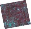
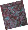
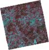
DE2_OPER_HRA_PSH_1C_20210727T111357_N41-508_W008-131_0001
Download Product | Product Info | Browse
Platform Short Name | GEOSAT |
Platform Serial Identifier | 2 |
Product Type | HRA_PSH_1C |
Start Date | 2021-07-27T11:13:57Z |
Stop Date | 2021-07-27T11:14:00Z |
Original Name | DE2_PSH_L1C_000000_20210727T111357_20210727T111400_DE2_38499_BCC3.zip |
Footprint | 41.4495959435 -8.01248351412 41.5922928795 -8.05037367381 41.5666849508 -8.24983854727 41.4236711483 -8.2145082249 41.4495959435 -8.01248351412 |
Orbit Direction | ASCENDING |
Scene Centre Longitude | W008 |
Scene Centre Latitude | N41 |
Cloud Cover Percentage | -1 |
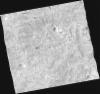
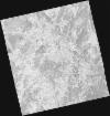
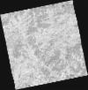
DE2_OPER_HRA_PM4_1C_20210727T111357_N41-508_W008-131_0001
Download Product | Product Info | Browse
Platform Short Name | GEOSAT |
Platform Serial Identifier | 2 |
Product Type | HRA_PM4_1C |
Start Date | 2021-07-27T11:13:57Z |
Stop Date | 2021-07-27T11:14:00Z |
Original Name | DE2_PM4_L1C_000000_20210727T111357_20210727T111400_DE2_38499_BCC3.zip |
Footprint | 41.4495959435 -8.01248351412 41.5922928795 -8.05037367381 41.5666849508 -8.24983854727 41.4236711483 -8.2145082249 41.4495959435 -8.01248351412 |
Orbit Direction | ASCENDING |
Scene Centre Longitude | W008 |
Scene Centre Latitude | N41 |
Cloud Cover Percentage | -1 |
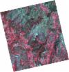
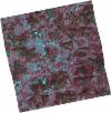
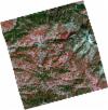
DE2_OPER_HRA_PSH_1C_20210519T110526_N41-591_W008-011_0001
Download Product | Product Info | Browse
Platform Short Name | GEOSAT |
Platform Serial Identifier | 2 |
Product Type | HRA_PSH_1C |
Start Date | 2021-05-19T11:05:26Z |
Stop Date | 2021-05-19T11:05:29Z |
Original Name | DE2_PSH_L1C_000000_20210519T110526_20210519T110529_DE2_37475_9FFD.zip |
Footprint | 41.5407299578 -7.91532076995 41.6668149922 -7.95286459006 41.6423326975 -8.10722142156 41.5160922153 -8.0711004907 41.5407299578 -7.91532076995 |
Orbit Direction | ASCENDING |
Scene Centre Longitude | W008 |
Scene Centre Latitude | N41 |
Cloud Cover Percentage | -1 |
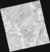
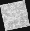
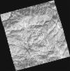
DE2_OPER_HRA_PM4_1C_20210519T110526_N41-591_W008-011_0001
Download Product | Product Info | Browse
Platform Short Name | GEOSAT |
Platform Serial Identifier | 2 |
Product Type | HRA_PM4_1C |
Start Date | 2021-05-19T11:05:26Z |
Stop Date | 2021-05-19T11:05:29Z |
Original Name | DE2_PM4_L1C_000000_20210519T110526_20210519T110529_DE2_37475_9FFD.zip |
Footprint | 41.5407299578 -7.91532076995 41.6668149922 -7.95286459006 41.6423326975 -8.10722142156 41.5160922153 -8.0711004907 41.5407299578 -7.91532076995 |
Orbit Direction | ASCENDING |
Scene Centre Longitude | W008 |
Scene Centre Latitude | N41 |
Cloud Cover Percentage | -1 |
DE2_OPER_HRA_PSH_1C_20210519T110524_N41-477_W007-978_0001
Download Product | Product Info | Browse
Platform Short Name | GEOSAT |
Platform Serial Identifier | 2 |
Product Type | HRA_PSH_1C |
Start Date | 2021-05-19T11:05:24Z |
Stop Date | 2021-05-19T11:05:27Z |
Original Name | DE2_PSH_L1C_000000_20210519T110524_20210519T110527_DE2_37475_A0FA.zip |
Footprint | 41.4265743906 -7.88335768923 41.5523742645 -7.91869637357 41.5277000953 -8.07470115937 41.4020083754 -8.03782451312 41.4265743906 -7.88335768923 |
Orbit Direction | ASCENDING |
Scene Centre Longitude | W007 |
Scene Centre Latitude | N41 |
Cloud Cover Percentage | -1 |
DE2_OPER_HRA_PM4_1C_20210519T110524_N41-477_W007-978_0001
Download Product | Product Info | Browse
Platform Short Name | GEOSAT |
Platform Serial Identifier | 2 |
Product Type | HRA_PM4_1C |
Start Date | 2021-05-19T11:05:24Z |
Stop Date | 2021-05-19T11:05:27Z |
Original Name | DE2_PM4_L1C_000000_20210519T110524_20210519T110527_DE2_37475_A0FA.zip |
Footprint | 41.4265743906 -7.88335768923 41.5523742645 -7.91869637357 41.5277000953 -8.07470115937 41.4020083754 -8.03782451312 41.4265743906 -7.88335768923 |
Orbit Direction | ASCENDING |
Scene Centre Longitude | W007 |
Scene Centre Latitude | N41 |
Cloud Cover Percentage | -1 |
DE2_OPER_HRA_PSH_1C_20210406T111254_N41-558_W008-241_0001
Download Product | Product Info | Browse
Platform Short Name | GEOSAT |
Platform Serial Identifier | 2 |
Product Type | HRA_PSH_1C |
Start Date | 2021-04-06T11:12:54Z |
Stop Date | 2021-04-06T11:12:56Z |
Original Name | DE2_PSH_L1C_000000_20210406T111254_20210406T111256_DE2_36837_0E3F.zip |
Footprint | 41.5037560361 -8.13781232538 41.637573341 -8.17264544098 41.612834929 -8.34436100248 41.4790330095 -8.30924908814 41.5037560361 -8.13781232538 |
Orbit Direction | ASCENDING |
Scene Centre Longitude | W008 |
Scene Centre Latitude | N41 |
Cloud Cover Percentage | -1 |
DE2_OPER_HRA_PM4_1C_20210406T111254_N41-558_W008-241_0001
Download Product | Product Info | Browse
Platform Short Name | GEOSAT |
Platform Serial Identifier | 2 |
Product Type | HRA_PM4_1C |
Start Date | 2021-04-06T11:12:54Z |
Stop Date | 2021-04-06T11:12:56Z |
Original Name | DE2_PM4_L1C_000000_20210406T111254_20210406T111256_DE2_36837_0E3F.zip |
Footprint | 41.5037560361 -8.13781232538 41.637573341 -8.17264544098 41.612834929 -8.34436100248 41.4790330095 -8.30924908814 41.5037560361 -8.13781232538 |
Orbit Direction | ASCENDING |
Scene Centre Longitude | W008 |
Scene Centre Latitude | N41 |
Cloud Cover Percentage | -1 |
DE2_OPER_HRA_PSH_1C_20210406T111252_N41-436_W008-209_0001
Download Product | Product Info | Browse
Platform Short Name | GEOSAT |
Platform Serial Identifier | 2 |
Product Type | HRA_PSH_1C |
Start Date | 2021-04-06T11:12:52Z |
Stop Date | 2021-04-06T11:12:54Z |
Original Name | DE2_PSH_L1C_000000_20210406T111252_20210406T111254_DE2_36837_7684.zip |
Footprint | 41.3823569151 -8.10572769195 41.5162534354 -8.14048674273 41.4914425638 -8.31256742943 41.3575361135 -8.27782607713 41.3823569151 -8.10572769195 |
Orbit Direction | ASCENDING |
Scene Centre Longitude | W008 |
Scene Centre Latitude | N41 |
Cloud Cover Percentage | -1 |
DE2_OPER_HRA_PM4_1C_20210406T111252_N41-436_W008-209_0001
Download Product | Product Info | Browse
Platform Short Name | GEOSAT |
Platform Serial Identifier | 2 |
Product Type | HRA_PM4_1C |
Start Date | 2021-04-06T11:12:52Z |
Stop Date | 2021-04-06T11:12:54Z |
Original Name | DE2_PM4_L1C_000000_20210406T111252_20210406T111254_DE2_36837_7684.zip |
Footprint | 41.3823569151 -8.10572769195 41.5162534354 -8.14048674273 41.4914425638 -8.31256742943 41.3575361135 -8.27782607713 41.3823569151 -8.10572769195 |
Orbit Direction | ASCENDING |
Scene Centre Longitude | W008 |
Scene Centre Latitude | N41 |
Cloud Cover Percentage | -1 |
DE2_OPER_HRA_PSH_1C_20210108T105347_N41-619_W008-112_0001
Download Product | Product Info | Browse
Platform Short Name | GEOSAT |
Platform Serial Identifier | 2 |
Product Type | HRA_PSH_1C |
Start Date | 2021-01-08T10:53:47Z |
Stop Date | 2021-01-08T10:53:49Z |
Original Name | DE2_PSH_L1C_000000_20210108T105347_20210108T105349_DE2_35531_C463.zip |
Footprint | 41.5711985169 -8.00906837516 41.6990013353 -8.05466418083 41.6678769747 -8.21589832497 41.5400567933 -8.17044588318 41.5711985169 -8.00906837516 |
Orbit Direction | ASCENDING |
Scene Centre Longitude | W008 |
Scene Centre Latitude | N41 |
Cloud Cover Percentage | -1 |
DE2_OPER_HRA_PM4_1C_20210108T105347_N41-619_W008-112_0001
Download Product | Product Info | Browse
Platform Short Name | GEOSAT |
Platform Serial Identifier | 2 |
Product Type | HRA_PM4_1C |
Start Date | 2021-01-08T10:53:47Z |
Stop Date | 2021-01-08T10:53:49Z |
Original Name | DE2_PM4_L1C_000000_20210108T105347_20210108T105349_DE2_35531_C463.zip |
Footprint | 41.5711985169 -8.00906837516 41.6990013353 -8.05466418083 41.6678769747 -8.21589832497 41.5400567933 -8.17044588318 41.5711985169 -8.00906837516 |
Orbit Direction | ASCENDING |
Scene Centre Longitude | W008 |
Scene Centre Latitude | N41 |
Cloud Cover Percentage | -1 |