ESA TPM Map Catalogue - Product List
back to previous node |
list of download URLs
Collection G2_Portugal_2021
GEOSAT-2 Portugal Coverage 2021 collection. More details here.
List of available products (latitude from 41.491 to 41.5694 dg, longitude from -8.39938 to -8.255 dg)..
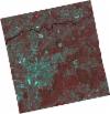
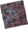
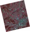
DE2_OPER_HRA_PSH_1C_20210708T110903_N41-568_W008-386_0001
Download Product | Product Info | Browse
Platform Short Name | GEOSAT |
Platform Serial Identifier | 2 |
Product Type | HRA_PSH_1C |
Start Date | 2021-07-08T11:09:03Z |
Stop Date | 2021-07-08T11:09:06Z |
Original Name | DE2_PSH_L1C_000000_20210708T110903_20210708T110906_DE2_38217_9255.zip |
Footprint | 41.5149618361 -8.28539948464 41.6461477858 -8.32029191259 41.6212795883 -8.48811325077 41.4900157594 -8.45334420457 41.5149618361 -8.28539948464 |
Orbit Direction | ASCENDING |
Scene Centre Longitude | W008 |
Scene Centre Latitude | N41 |
Cloud Cover Percentage | -1 |
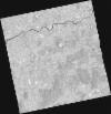
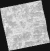
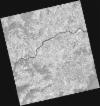
DE2_OPER_HRA_PM4_1C_20210708T110903_N41-568_W008-386_0001
Download Product | Product Info | Browse
Platform Short Name | GEOSAT |
Platform Serial Identifier | 2 |
Product Type | HRA_PM4_1C |
Start Date | 2021-07-08T11:09:03Z |
Stop Date | 2021-07-08T11:09:06Z |
Original Name | DE2_PM4_L1C_000000_20210708T110903_20210708T110906_DE2_38217_9255.zip |
Footprint | 41.5149618361 -8.28539948464 41.6461477858 -8.32029191259 41.6212795883 -8.48811325077 41.4900157594 -8.45334420457 41.5149618361 -8.28539948464 |
Orbit Direction | ASCENDING |
Scene Centre Longitude | W008 |
Scene Centre Latitude | N41 |
Cloud Cover Percentage | -1 |
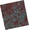
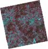
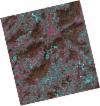
DE2_OPER_HRA_PSH_1C_20210708T110901_N41-449_W008-354_0001
Download Product | Product Info | Browse
Platform Short Name | GEOSAT |
Platform Serial Identifier | 2 |
Product Type | HRA_PSH_1C |
Start Date | 2021-07-08T11:09:01Z |
Stop Date | 2021-07-08T11:09:04Z |
Original Name | DE2_PSH_L1C_000000_20210708T110901_20210708T110904_DE2_38217_0D73.zip |
Footprint | 41.3959481542 -8.25337509666 41.5271736368 -8.288321626 41.5022831441 -8.4560447733 41.3711760501 -8.41994705498 41.3959481542 -8.25337509666 |
Orbit Direction | ASCENDING |
Scene Centre Longitude | W008 |
Scene Centre Latitude | N41 |
Cloud Cover Percentage | -1 |
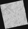
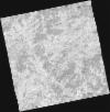
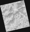
DE2_OPER_HRA_PM4_1C_20210708T110901_N41-449_W008-354_0001
Download Product | Product Info | Browse
Platform Short Name | GEOSAT |
Platform Serial Identifier | 2 |
Product Type | HRA_PM4_1C |
Start Date | 2021-07-08T11:09:01Z |
Stop Date | 2021-07-08T11:09:04Z |
Original Name | DE2_PM4_L1C_000000_20210708T110901_20210708T110904_DE2_38217_0D73.zip |
Footprint | 41.3959481542 -8.25337509666 41.5271736368 -8.288321626 41.5022831441 -8.4560447733 41.3711760501 -8.41994705498 41.3959481542 -8.25337509666 |
Orbit Direction | ASCENDING |
Scene Centre Longitude | W008 |
Scene Centre Latitude | N41 |
Cloud Cover Percentage | -1 |
DE2_OPER_HRA_PSH_1C_20210406T111254_N41-558_W008-241_0001
Download Product | Product Info | Browse
Platform Short Name | GEOSAT |
Platform Serial Identifier | 2 |
Product Type | HRA_PSH_1C |
Start Date | 2021-04-06T11:12:54Z |
Stop Date | 2021-04-06T11:12:56Z |
Original Name | DE2_PSH_L1C_000000_20210406T111254_20210406T111256_DE2_36837_0E3F.zip |
Footprint | 41.5037560361 -8.13781232538 41.637573341 -8.17264544098 41.612834929 -8.34436100248 41.4790330095 -8.30924908814 41.5037560361 -8.13781232538 |
Orbit Direction | ASCENDING |
Scene Centre Longitude | W008 |
Scene Centre Latitude | N41 |
Cloud Cover Percentage | -1 |
DE2_OPER_HRA_PM4_1C_20210406T111254_N41-558_W008-241_0001
Download Product | Product Info | Browse
Platform Short Name | GEOSAT |
Platform Serial Identifier | 2 |
Product Type | HRA_PM4_1C |
Start Date | 2021-04-06T11:12:54Z |
Stop Date | 2021-04-06T11:12:56Z |
Original Name | DE2_PM4_L1C_000000_20210406T111254_20210406T111256_DE2_36837_0E3F.zip |
Footprint | 41.5037560361 -8.13781232538 41.637573341 -8.17264544098 41.612834929 -8.34436100248 41.4790330095 -8.30924908814 41.5037560361 -8.13781232538 |
Orbit Direction | ASCENDING |
Scene Centre Longitude | W008 |
Scene Centre Latitude | N41 |
Cloud Cover Percentage | -1 |
DE2_OPER_HRA_PSH_1C_20210406T111252_N41-436_W008-209_0001
Download Product | Product Info | Browse
Platform Short Name | GEOSAT |
Platform Serial Identifier | 2 |
Product Type | HRA_PSH_1C |
Start Date | 2021-04-06T11:12:52Z |
Stop Date | 2021-04-06T11:12:54Z |
Original Name | DE2_PSH_L1C_000000_20210406T111252_20210406T111254_DE2_36837_7684.zip |
Footprint | 41.3823569151 -8.10572769195 41.5162534354 -8.14048674273 41.4914425638 -8.31256742943 41.3575361135 -8.27782607713 41.3823569151 -8.10572769195 |
Orbit Direction | ASCENDING |
Scene Centre Longitude | W008 |
Scene Centre Latitude | N41 |
Cloud Cover Percentage | -1 |
DE2_OPER_HRA_PM4_1C_20210406T111252_N41-436_W008-209_0001
Download Product | Product Info | Browse
Platform Short Name | GEOSAT |
Platform Serial Identifier | 2 |
Product Type | HRA_PM4_1C |
Start Date | 2021-04-06T11:12:52Z |
Stop Date | 2021-04-06T11:12:54Z |
Original Name | DE2_PM4_L1C_000000_20210406T111252_20210406T111254_DE2_36837_7684.zip |
Footprint | 41.3823569151 -8.10572769195 41.5162534354 -8.14048674273 41.4914425638 -8.31256742943 41.3575361135 -8.27782607713 41.3823569151 -8.10572769195 |
Orbit Direction | ASCENDING |
Scene Centre Longitude | W008 |
Scene Centre Latitude | N41 |
Cloud Cover Percentage | -1 |
DE2_OPER_HRA_PSH_1C_20210318T110656_N41-575_W008-463_0001
Download Product | Product Info | Browse
Platform Short Name | GEOSAT |
Platform Serial Identifier | 2 |
Product Type | HRA_PSH_1C |
Start Date | 2021-03-18T11:06:56Z |
Stop Date | 2021-03-18T11:06:58Z |
Original Name | DE2_PSH_L1C_000000_20210318T110656_20210318T110658_DE2_36555_6D96.zip |
Footprint | 41.5255257704 -8.36943393957 41.650187835 -8.40567910041 41.6251936058 -8.55706608505 41.50060893 -8.52004867473 41.5255257704 -8.36943393957 |
Orbit Direction | ASCENDING |
Scene Centre Longitude | W008 |
Scene Centre Latitude | N41 |
Cloud Cover Percentage | -1 |
DE2_OPER_HRA_PM4_1C_20210318T110656_N41-575_W008-463_0001
Download Product | Product Info | Browse
Platform Short Name | GEOSAT |
Platform Serial Identifier | 2 |
Product Type | HRA_PM4_1C |
Start Date | 2021-03-18T11:06:56Z |
Stop Date | 2021-03-18T11:06:58Z |
Original Name | DE2_PM4_L1C_000000_20210318T110656_20210318T110658_DE2_36555_6D96.zip |
Footprint | 41.5255257704 -8.36943393957 41.650187835 -8.40567910041 41.6251936058 -8.55706608505 41.50060893 -8.52004867473 41.5255257704 -8.36943393957 |
Orbit Direction | ASCENDING |
Scene Centre Longitude | W008 |
Scene Centre Latitude | N41 |
Cloud Cover Percentage | -1 |
DE2_OPER_HRA_PSH_1C_20210318T110654_N41-462_W008-429_0001
Download Product | Product Info | Browse
Platform Short Name | GEOSAT |
Platform Serial Identifier | 2 |
Product Type | HRA_PSH_1C |
Start Date | 2021-03-18T11:06:54Z |
Stop Date | 2021-03-18T11:06:56Z |
Original Name | DE2_PSH_L1C_000000_20210318T110654_20210318T110656_DE2_36555_E88A.zip |
Footprint | 41.4124860194 -8.33604164108 41.5369968276 -8.37317971143 41.5121150196 -8.52363066749 41.3876769428 -8.48605658512 41.4124860194 -8.33604164108 |
Orbit Direction | ASCENDING |
Scene Centre Longitude | W008 |
Scene Centre Latitude | N41 |
Cloud Cover Percentage | -1 |
DE2_OPER_HRA_PM4_1C_20210318T110654_N41-462_W008-429_0001
Download Product | Product Info | Browse
Platform Short Name | GEOSAT |
Platform Serial Identifier | 2 |
Product Type | HRA_PM4_1C |
Start Date | 2021-03-18T11:06:54Z |
Stop Date | 2021-03-18T11:06:56Z |
Original Name | DE2_PM4_L1C_000000_20210318T110654_20210318T110656_DE2_36555_E88A.zip |
Footprint | 41.4124860194 -8.33604164108 41.5369968276 -8.37317971143 41.5121150196 -8.52363066749 41.3876769428 -8.48605658512 41.4124860194 -8.33604164108 |
Orbit Direction | ASCENDING |
Scene Centre Longitude | W008 |
Scene Centre Latitude | N41 |
Cloud Cover Percentage | -1 |