ESA TPM Map Catalogue - Product List
back to previous node |
list of download URLs

Collection G2_Portugal_2021
GEOSAT-2 Portugal Coverage 2021 collection. More details here.
List of available products (latitude from 41.4126 to 41.491 dg, longitude from -7.4675 to -7.32313 dg)..
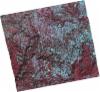
DE2_OPER_HRA_PSH_1C_20211022T110841_N41-517_W007-392_0001
Download Product | Product Info | Browse
Platform Short Name | GEOSAT |
Platform Serial Identifier | 2 |
Product Type | HRA_PSH_1C |
Start Date | 2021-10-22T11:08:41Z |
Stop Date | 2021-10-22T11:08:44Z |
Original Name | DE2_PSH_L1C_000000_20211022T110841_20211022T110844_DE2_39790_F2BD.zip |
Footprint | 41.4576202689 -7.27012197968 41.60296389 -7.30543881639 41.5764496742 -7.51757019791 41.4314537907 -7.47876694811 41.4576202689 -7.27012197968 |
Orbit Direction | ASCENDING |
Scene Centre Longitude | W007 |
Scene Centre Latitude | N41 |
Cloud Cover Percentage | -1 |
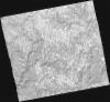
DE2_OPER_HRA_PM4_1C_20211022T110841_N41-517_W007-392_0001
Download Product | Product Info | Browse
Platform Short Name | GEOSAT |
Platform Serial Identifier | 2 |
Product Type | HRA_PM4_1C |
Start Date | 2021-10-22T11:08:41Z |
Stop Date | 2021-10-22T11:08:44Z |
Original Name | DE2_PM4_L1C_000000_20211022T110841_20211022T110844_DE2_39790_F2BD.zip |
Footprint | 41.4576202689 -7.27012197968 41.60296389 -7.30543881639 41.5764496742 -7.51757019791 41.4314537907 -7.47876694811 41.4576202689 -7.27012197968 |
Orbit Direction | ASCENDING |
Scene Centre Longitude | W007 |
Scene Centre Latitude | N41 |
Cloud Cover Percentage | -1 |
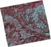
DE2_OPER_HRA_PSH_1C_20211022T110838_N41-384_W007-359_0001
Download Product | Product Info | Browse
Platform Short Name | GEOSAT |
Platform Serial Identifier | 2 |
Product Type | HRA_PSH_1C |
Start Date | 2021-10-22T11:08:38Z |
Stop Date | 2021-10-22T11:08:41Z |
Original Name | DE2_PSH_L1C_000000_20211022T110838_20211022T110841_DE2_39790_6D16.zip |
Footprint | 41.3255804078 -7.23672532803 41.4710346778 -7.2740674646 41.443396829 -7.48180080855 41.2993184238 -7.4459831104 41.3255804078 -7.23672532803 |
Orbit Direction | ASCENDING |
Scene Centre Longitude | W007 |
Scene Centre Latitude | N41 |
Cloud Cover Percentage | -1 |
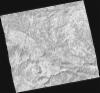
DE2_OPER_HRA_PM4_1C_20211022T110838_N41-384_W007-359_0001
Download Product | Product Info | Browse
Platform Short Name | GEOSAT |
Platform Serial Identifier | 2 |
Product Type | HRA_PM4_1C |
Start Date | 2021-10-22T11:08:38Z |
Stop Date | 2021-10-22T11:08:41Z |
Original Name | DE2_PM4_L1C_000000_20211022T110838_20211022T110841_DE2_39790_6D16.zip |
Footprint | 41.3255804078 -7.23672532803 41.4710346778 -7.2740674646 41.443396829 -7.48180080855 41.2993184238 -7.4459831104 41.3255804078 -7.23672532803 |
Orbit Direction | ASCENDING |
Scene Centre Longitude | W007 |
Scene Centre Latitude | N41 |
Cloud Cover Percentage | -1 |
DE2_OPER_HRA_PSH_1C_20210808T110649_N41-514_W007-558_0001
Download Product | Product Info | Browse
Platform Short Name | GEOSAT |
Platform Serial Identifier | 2 |
Product Type | HRA_PSH_1C |
Start Date | 2021-08-08T11:06:49Z |
Stop Date | 2021-08-08T11:06:52Z |
Original Name | DE2_PSH_L1C_000000_20210808T110649_20210808T110652_DE2_38677_D6A6.zip |
Footprint | 41.4598213624 -7.45257367898 41.5940344727 -7.48910987905 41.5691496261 -7.66436930994 41.4346962444 -7.62978652945 41.4598213624 -7.45257367898 |
Orbit Direction | ASCENDING |
Scene Centre Longitude | W007 |
Scene Centre Latitude | N41 |
Cloud Cover Percentage | -1 |
DE2_OPER_HRA_PM4_1C_20210808T110649_N41-514_W007-558_0001
Download Product | Product Info | Browse
Platform Short Name | GEOSAT |
Platform Serial Identifier | 2 |
Product Type | HRA_PM4_1C |
Start Date | 2021-08-08T11:06:49Z |
Stop Date | 2021-08-08T11:06:52Z |
Original Name | DE2_PM4_L1C_000000_20210808T110649_20210808T110652_DE2_38677_D6A6.zip |
Footprint | 41.4598213624 -7.45257367898 41.5940344727 -7.48910987905 41.5691496261 -7.66436930994 41.4346962444 -7.62978652945 41.4598213624 -7.45257367898 |
Orbit Direction | ASCENDING |
Scene Centre Longitude | W007 |
Scene Centre Latitude | N41 |
Cloud Cover Percentage | -1 |
DE2_OPER_HRA_PSH_1C_20210808T110647_N41-392_W007-526_0001
Download Product | Product Info | Browse
Platform Short Name | GEOSAT |
Platform Serial Identifier | 2 |
Product Type | HRA_PSH_1C |
Start Date | 2021-08-08T11:06:47Z |
Stop Date | 2021-08-08T11:06:50Z |
Original Name | DE2_PSH_L1C_000000_20210808T110647_20210808T110650_DE2_38677_9956.zip |
Footprint | 41.3381055898 -7.41998191636 41.4723461081 -7.4551140434 41.4470506532 -7.633656657 41.3129890444 -7.59668689517 41.3381055898 -7.41998191636 |
Orbit Direction | ASCENDING |
Scene Centre Longitude | W007 |
Scene Centre Latitude | N41 |
Cloud Cover Percentage | -1 |
DE2_OPER_HRA_PM4_1C_20210808T110647_N41-392_W007-526_0001
Download Product | Product Info | Browse
Platform Short Name | GEOSAT |
Platform Serial Identifier | 2 |
Product Type | HRA_PM4_1C |
Start Date | 2021-08-08T11:06:47Z |
Stop Date | 2021-08-08T11:06:50Z |
Original Name | DE2_PM4_L1C_000000_20210808T110647_20210808T110650_DE2_38677_9956.zip |
Footprint | 41.3381055898 -7.41998191636 41.4723461081 -7.4551140434 41.4470506532 -7.633656657 41.3129890444 -7.59668689517 41.3381055898 -7.41998191636 |
Orbit Direction | ASCENDING |
Scene Centre Longitude | W007 |
Scene Centre Latitude | N41 |
Cloud Cover Percentage | -1 |