ESA TPM Map Catalogue - Product List
back to previous node |
list of download URLs


Collection G2_Portugal_2021
GEOSAT-2 Portugal Coverage 2021 collection. More details here.
List of available products (latitude from 41.4126 to 41.491 dg, longitude from -7.75625 to -7.61188 dg)..
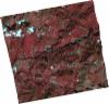
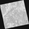
DE2_OPER_HRA_PSH_1C_20211116T110815_N41-520_W007-844_0001
Download Product | Product Info | Browse
Platform Short Name | GEOSAT |
Platform Serial Identifier | 2 |
Product Type | HRA_PSH_1C |
Start Date | 2021-11-16T11:08:15Z |
Stop Date | 2021-11-16T11:08:18Z |
Original Name | DE2_PSH_L1C_000000_20211116T110815_20211116T110818_DE2_40161_4616.zip |
Footprint | 41.4624980153 -7.7307445876 41.6047448172 -7.76228752619 41.578918255 -7.96217598986 41.4372798495 -7.9242627466 41.4624980153 -7.7307445876 |
Orbit Direction | ASCENDING |
Scene Centre Longitude | W007 |
Scene Centre Latitude | N41 |
Cloud Cover Percentage | -1 |
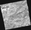
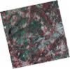
DE2_OPER_HRA_PM4_1C_20211116T110815_N41-520_W007-844_0001
Download Product | Product Info | Browse
Platform Short Name | GEOSAT |
Platform Serial Identifier | 2 |
Product Type | HRA_PM4_1C |
Start Date | 2021-11-16T11:08:15Z |
Stop Date | 2021-11-16T11:08:18Z |
Original Name | DE2_PM4_L1C_000000_20211116T110815_20211116T110818_DE2_40161_4616.zip |
Footprint | 41.4624980153 -7.7307445876 41.6047448172 -7.76228752619 41.578918255 -7.96217598986 41.4372798495 -7.9242627466 41.4624980153 -7.7307445876 |
Orbit Direction | ASCENDING |
Scene Centre Longitude | W007 |
Scene Centre Latitude | N41 |
Cloud Cover Percentage | -1 |
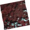
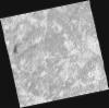
DE2_OPER_HRA_PSH_1C_20211116T110813_N41-392_W007-813_0001
Download Product | Product Info | Browse
Platform Short Name | GEOSAT |
Platform Serial Identifier | 2 |
Product Type | HRA_PSH_1C |
Start Date | 2021-11-16T11:08:13Z |
Stop Date | 2021-11-16T11:08:16Z |
Original Name | DE2_PSH_L1C_000000_20211116T110813_20211116T110816_DE2_40161_ECB2.zip |
Footprint | 41.3344483742 -7.69577759733 41.4756759836 -7.73364032208 41.4505167411 -7.92673778747 41.3080768194 -7.89688599644 41.3344483742 -7.69577759733 |
Orbit Direction | ASCENDING |
Scene Centre Longitude | W007 |
Scene Centre Latitude | N41 |
Cloud Cover Percentage | -1 |
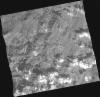
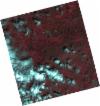
DE2_OPER_HRA_PM4_1C_20211116T110813_N41-392_W007-813_0001
Download Product | Product Info | Browse
Platform Short Name | GEOSAT |
Platform Serial Identifier | 2 |
Product Type | HRA_PM4_1C |
Start Date | 2021-11-16T11:08:13Z |
Stop Date | 2021-11-16T11:08:16Z |
Original Name | DE2_PM4_L1C_000000_20211116T110813_20211116T110816_DE2_40161_ECB2.zip |
Footprint | 41.3344483742 -7.69577759733 41.4756759836 -7.73364032208 41.4505167411 -7.92673778747 41.3080768194 -7.89688599644 41.3344483742 -7.69577759733 |
Orbit Direction | ASCENDING |
Scene Centre Longitude | W007 |
Scene Centre Latitude | N41 |
Cloud Cover Percentage | -1 |
DE2_OPER_HRA_PSH_1C_20210808T110649_N41-514_W007-558_0001
Download Product | Product Info | Browse
Platform Short Name | GEOSAT |
Platform Serial Identifier | 2 |
Product Type | HRA_PSH_1C |
Start Date | 2021-08-08T11:06:49Z |
Stop Date | 2021-08-08T11:06:52Z |
Original Name | DE2_PSH_L1C_000000_20210808T110649_20210808T110652_DE2_38677_D6A6.zip |
Footprint | 41.4598213624 -7.45257367898 41.5940344727 -7.48910987905 41.5691496261 -7.66436930994 41.4346962444 -7.62978652945 41.4598213624 -7.45257367898 |
Orbit Direction | ASCENDING |
Scene Centre Longitude | W007 |
Scene Centre Latitude | N41 |
Cloud Cover Percentage | -1 |
DE2_OPER_HRA_PM4_1C_20210808T110649_N41-514_W007-558_0001
Download Product | Product Info | Browse
Platform Short Name | GEOSAT |
Platform Serial Identifier | 2 |
Product Type | HRA_PM4_1C |
Start Date | 2021-08-08T11:06:49Z |
Stop Date | 2021-08-08T11:06:52Z |
Original Name | DE2_PM4_L1C_000000_20210808T110649_20210808T110652_DE2_38677_D6A6.zip |
Footprint | 41.4598213624 -7.45257367898 41.5940344727 -7.48910987905 41.5691496261 -7.66436930994 41.4346962444 -7.62978652945 41.4598213624 -7.45257367898 |
Orbit Direction | ASCENDING |
Scene Centre Longitude | W007 |
Scene Centre Latitude | N41 |
Cloud Cover Percentage | -1 |
DE2_OPER_HRA_PSH_1C_20210808T110647_N41-392_W007-526_0001
Download Product | Product Info | Browse
Platform Short Name | GEOSAT |
Platform Serial Identifier | 2 |
Product Type | HRA_PSH_1C |
Start Date | 2021-08-08T11:06:47Z |
Stop Date | 2021-08-08T11:06:50Z |
Original Name | DE2_PSH_L1C_000000_20210808T110647_20210808T110650_DE2_38677_9956.zip |
Footprint | 41.3381055898 -7.41998191636 41.4723461081 -7.4551140434 41.4470506532 -7.633656657 41.3129890444 -7.59668689517 41.3381055898 -7.41998191636 |
Orbit Direction | ASCENDING |
Scene Centre Longitude | W007 |
Scene Centre Latitude | N41 |
Cloud Cover Percentage | -1 |
DE2_OPER_HRA_PM4_1C_20210808T110647_N41-392_W007-526_0001
Download Product | Product Info | Browse
Platform Short Name | GEOSAT |
Platform Serial Identifier | 2 |
Product Type | HRA_PM4_1C |
Start Date | 2021-08-08T11:06:47Z |
Stop Date | 2021-08-08T11:06:50Z |
Original Name | DE2_PM4_L1C_000000_20210808T110647_20210808T110650_DE2_38677_9956.zip |
Footprint | 41.3381055898 -7.41998191636 41.4723461081 -7.4551140434 41.4470506532 -7.633656657 41.3129890444 -7.59668689517 41.3381055898 -7.41998191636 |
Orbit Direction | ASCENDING |
Scene Centre Longitude | W007 |
Scene Centre Latitude | N41 |
Cloud Cover Percentage | -1 |
DE2_OPER_HRA_PSH_1C_20210506T105635_N41-544_W007-728_0001
Download Product | Product Info | Browse
Platform Short Name | GEOSAT |
Platform Serial Identifier | 2 |
Product Type | HRA_PSH_1C |
Start Date | 2021-05-06T10:56:35Z |
Stop Date | 2021-05-06T10:56:38Z |
Original Name | DE2_PSH_L1C_000000_20210506T105635_20210506T105638_DE2_37282_B3CD.zip |
Footprint | 41.4958404887 -7.63556975264 41.6185363744 -7.67479243574 41.5921895124 -7.82169305387 41.4696113517 -7.7819625116 41.4958404887 -7.63556975264 |
Orbit Direction | ASCENDING |
Scene Centre Longitude | W007 |
Scene Centre Latitude | N41 |
Cloud Cover Percentage | -1 |
DE2_OPER_HRA_PM4_1C_20210506T105635_N41-544_W007-728_0001
Download Product | Product Info | Browse
Platform Short Name | GEOSAT |
Platform Serial Identifier | 2 |
Product Type | HRA_PM4_1C |
Start Date | 2021-05-06T10:56:35Z |
Stop Date | 2021-05-06T10:56:38Z |
Original Name | DE2_PM4_L1C_000000_20210506T105635_20210506T105638_DE2_37282_B3CD.zip |
Footprint | 41.4958404887 -7.63556975264 41.6185363744 -7.67479243574 41.5921895124 -7.82169305387 41.4696113517 -7.7819625116 41.4958404887 -7.63556975264 |
Orbit Direction | ASCENDING |
Scene Centre Longitude | W007 |
Scene Centre Latitude | N41 |
Cloud Cover Percentage | -1 |
DE2_OPER_HRA_PSH_1C_20210506T105633_N41-432_W007-692_0001
Download Product | Product Info | Browse
Platform Short Name | GEOSAT |
Platform Serial Identifier | 2 |
Product Type | HRA_PSH_1C |
Start Date | 2021-05-06T10:56:33Z |
Stop Date | 2021-05-06T10:56:36Z |
Original Name | DE2_PSH_L1C_000000_20210506T105633_20210506T105636_DE2_37282_40AB.zip |
Footprint | 41.3845252621 -7.60019069832 41.5072001561 -7.63932134728 41.4809058368 -7.78573953693 41.3582767283 -7.74636464338 41.3845252621 -7.60019069832 |
Orbit Direction | ASCENDING |
Scene Centre Longitude | W007 |
Scene Centre Latitude | N41 |
Cloud Cover Percentage | -1 |
DE2_OPER_HRA_PM4_1C_20210506T105633_N41-432_W007-692_0001
Download Product | Product Info | Browse
Platform Short Name | GEOSAT |
Platform Serial Identifier | 2 |
Product Type | HRA_PM4_1C |
Start Date | 2021-05-06T10:56:33Z |
Stop Date | 2021-05-06T10:56:36Z |
Original Name | DE2_PM4_L1C_000000_20210506T105633_20210506T105636_DE2_37282_40AB.zip |
Footprint | 41.3845252621 -7.60019069832 41.5072001561 -7.63932134728 41.4809058368 -7.78573953693 41.3582767283 -7.74636464338 41.3845252621 -7.60019069832 |
Orbit Direction | ASCENDING |
Scene Centre Longitude | W007 |
Scene Centre Latitude | N41 |
Cloud Cover Percentage | -1 |