ESA TPM Map Catalogue - Product List
back to previous node |
list of download URLs
Collection G2_Portugal_2021
GEOSAT-2 Portugal Coverage 2021 collection. More details here.
List of available products (latitude from 41.3342 to 41.4126 dg, longitude from -8.39938 to -8.255 dg)..
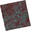
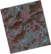
DE2_OPER_HRA_PSH_1C_20210708T110901_N41-449_W008-354_0001
Download Product | Product Info | Browse
Platform Short Name | GEOSAT |
Platform Serial Identifier | 2 |
Product Type | HRA_PSH_1C |
Start Date | 2021-07-08T11:09:01Z |
Stop Date | 2021-07-08T11:09:04Z |
Original Name | DE2_PSH_L1C_000000_20210708T110901_20210708T110904_DE2_38217_0D73.zip |
Footprint | 41.3959481542 -8.25337509666 41.5271736368 -8.288321626 41.5022831441 -8.4560447733 41.3711760501 -8.41994705498 41.3959481542 -8.25337509666 |
Orbit Direction | ASCENDING |
Scene Centre Longitude | W008 |
Scene Centre Latitude | N41 |
Cloud Cover Percentage | -1 |
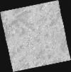
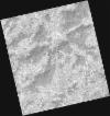
DE2_OPER_HRA_PM4_1C_20210708T110901_N41-449_W008-354_0001
Download Product | Product Info | Browse
Platform Short Name | GEOSAT |
Platform Serial Identifier | 2 |
Product Type | HRA_PM4_1C |
Start Date | 2021-07-08T11:09:01Z |
Stop Date | 2021-07-08T11:09:04Z |
Original Name | DE2_PM4_L1C_000000_20210708T110901_20210708T110904_DE2_38217_0D73.zip |
Footprint | 41.3959481542 -8.25337509666 41.5271736368 -8.288321626 41.5022831441 -8.4560447733 41.3711760501 -8.41994705498 41.3959481542 -8.25337509666 |
Orbit Direction | ASCENDING |
Scene Centre Longitude | W008 |
Scene Centre Latitude | N41 |
Cloud Cover Percentage | -1 |
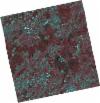
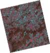
DE2_OPER_HRA_PSH_1C_20210708T110859_N41-329_W008-322_0001
Download Product | Product Info | Browse
Platform Short Name | GEOSAT |
Platform Serial Identifier | 2 |
Product Type | HRA_PSH_1C |
Start Date | 2021-07-08T11:08:59Z |
Stop Date | 2021-07-08T11:09:02Z |
Original Name | DE2_PSH_L1C_000000_20210708T110859_20210708T110902_DE2_38217_2D9C.zip |
Footprint | 41.2766403385 -8.22145868827 41.4080259073 -8.25734658995 41.383319376 -8.4233015361 41.2518335466 -8.3882579622 41.2766403385 -8.22145868827 |
Orbit Direction | ASCENDING |
Scene Centre Longitude | W008 |
Scene Centre Latitude | N41 |
Cloud Cover Percentage | -1 |
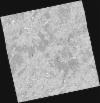
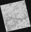
DE2_OPER_HRA_PM4_1C_20210708T110859_N41-329_W008-322_0001
Download Product | Product Info | Browse
Platform Short Name | GEOSAT |
Platform Serial Identifier | 2 |
Product Type | HRA_PM4_1C |
Start Date | 2021-07-08T11:08:59Z |
Stop Date | 2021-07-08T11:09:02Z |
Original Name | DE2_PM4_L1C_000000_20210708T110859_20210708T110902_DE2_38217_2D9C.zip |
Footprint | 41.2766403385 -8.22145868827 41.4080259073 -8.25734658995 41.383319376 -8.4233015361 41.2518335466 -8.3882579622 41.2766403385 -8.22145868827 |
Orbit Direction | ASCENDING |
Scene Centre Longitude | W008 |
Scene Centre Latitude | N41 |
Cloud Cover Percentage | -1 |
DE2_OPER_HRA_PSH_1C_20210406T111252_N41-436_W008-209_0001
Download Product | Product Info | Browse
Platform Short Name | GEOSAT |
Platform Serial Identifier | 2 |
Product Type | HRA_PSH_1C |
Start Date | 2021-04-06T11:12:52Z |
Stop Date | 2021-04-06T11:12:54Z |
Original Name | DE2_PSH_L1C_000000_20210406T111252_20210406T111254_DE2_36837_7684.zip |
Footprint | 41.3823569151 -8.10572769195 41.5162534354 -8.14048674273 41.4914425638 -8.31256742943 41.3575361135 -8.27782607713 41.3823569151 -8.10572769195 |
Orbit Direction | ASCENDING |
Scene Centre Longitude | W008 |
Scene Centre Latitude | N41 |
Cloud Cover Percentage | -1 |
DE2_OPER_HRA_PM4_1C_20210406T111252_N41-436_W008-209_0001
Download Product | Product Info | Browse
Platform Short Name | GEOSAT |
Platform Serial Identifier | 2 |
Product Type | HRA_PM4_1C |
Start Date | 2021-04-06T11:12:52Z |
Stop Date | 2021-04-06T11:12:54Z |
Original Name | DE2_PM4_L1C_000000_20210406T111252_20210406T111254_DE2_36837_7684.zip |
Footprint | 41.3823569151 -8.10572769195 41.5162534354 -8.14048674273 41.4914425638 -8.31256742943 41.3575361135 -8.27782607713 41.3823569151 -8.10572769195 |
Orbit Direction | ASCENDING |
Scene Centre Longitude | W008 |
Scene Centre Latitude | N41 |
Cloud Cover Percentage | -1 |
DE2_OPER_HRA_PSH_1C_20210406T111250_N41-315_W008-176_0001
Download Product | Product Info | Browse
Platform Short Name | GEOSAT |
Platform Serial Identifier | 2 |
Product Type | HRA_PSH_1C |
Start Date | 2021-04-06T11:12:50Z |
Stop Date | 2021-04-06T11:12:52Z |
Original Name | DE2_PSH_L1C_000000_20210406T111250_20210406T111252_DE2_36837_FF84.zip |
Footprint | 41.2611882207 -8.07176738064 41.3947198202 -8.10922755409 41.3700359856 -8.28027962198 41.2360476888 -8.24626582316 41.2611882207 -8.07176738064 |
Orbit Direction | ASCENDING |
Scene Centre Longitude | W008 |
Scene Centre Latitude | N41 |
Cloud Cover Percentage | -1 |
DE2_OPER_HRA_PM4_1C_20210406T111250_N41-315_W008-176_0001
Download Product | Product Info | Browse
Platform Short Name | GEOSAT |
Platform Serial Identifier | 2 |
Product Type | HRA_PM4_1C |
Start Date | 2021-04-06T11:12:50Z |
Stop Date | 2021-04-06T11:12:52Z |
Original Name | DE2_PM4_L1C_000000_20210406T111250_20210406T111252_DE2_36837_FF84.zip |
Footprint | 41.2611882207 -8.07176738064 41.3947198202 -8.10922755409 41.3700359856 -8.28027962198 41.2360476888 -8.24626582316 41.2611882207 -8.07176738064 |
Orbit Direction | ASCENDING |
Scene Centre Longitude | W008 |
Scene Centre Latitude | N41 |
Cloud Cover Percentage | -1 |
DE2_OPER_HRA_PSH_1C_20210318T110654_N41-462_W008-429_0001
Download Product | Product Info | Browse
Platform Short Name | GEOSAT |
Platform Serial Identifier | 2 |
Product Type | HRA_PSH_1C |
Start Date | 2021-03-18T11:06:54Z |
Stop Date | 2021-03-18T11:06:56Z |
Original Name | DE2_PSH_L1C_000000_20210318T110654_20210318T110656_DE2_36555_E88A.zip |
Footprint | 41.4124860194 -8.33604164108 41.5369968276 -8.37317971143 41.5121150196 -8.52363066749 41.3876769428 -8.48605658512 41.4124860194 -8.33604164108 |
Orbit Direction | ASCENDING |
Scene Centre Longitude | W008 |
Scene Centre Latitude | N41 |
Cloud Cover Percentage | -1 |
DE2_OPER_HRA_PM4_1C_20210318T110654_N41-462_W008-429_0001
Download Product | Product Info | Browse
Platform Short Name | GEOSAT |
Platform Serial Identifier | 2 |
Product Type | HRA_PM4_1C |
Start Date | 2021-03-18T11:06:54Z |
Stop Date | 2021-03-18T11:06:56Z |
Original Name | DE2_PM4_L1C_000000_20210318T110654_20210318T110656_DE2_36555_E88A.zip |
Footprint | 41.4124860194 -8.33604164108 41.5369968276 -8.37317971143 41.5121150196 -8.52363066749 41.3876769428 -8.48605658512 41.4124860194 -8.33604164108 |
Orbit Direction | ASCENDING |
Scene Centre Longitude | W008 |
Scene Centre Latitude | N41 |
Cloud Cover Percentage | -1 |
DE2_OPER_HRA_PSH_1C_20210318T110652_N41-349_W008-396_0001
Download Product | Product Info | Browse
Platform Short Name | GEOSAT |
Platform Serial Identifier | 2 |
Product Type | HRA_PSH_1C |
Start Date | 2021-03-18T11:06:52Z |
Stop Date | 2021-03-18T11:06:55Z |
Original Name | DE2_PSH_L1C_000000_20210318T110652_20210318T110655_DE2_36555_9BB9.zip |
Footprint | 41.2994215287 -8.30272680042 41.4241099066 -8.33911851941 41.3992041556 -8.48954564888 41.274574046 -8.45276346601 41.2994215287 -8.30272680042 |
Orbit Direction | ASCENDING |
Scene Centre Longitude | W008 |
Scene Centre Latitude | N41 |
Cloud Cover Percentage | -1 |
DE2_OPER_HRA_PM4_1C_20210318T110652_N41-349_W008-396_0001
Download Product | Product Info | Browse
Platform Short Name | GEOSAT |
Platform Serial Identifier | 2 |
Product Type | HRA_PM4_1C |
Start Date | 2021-03-18T11:06:52Z |
Stop Date | 2021-03-18T11:06:55Z |
Original Name | DE2_PM4_L1C_000000_20210318T110652_20210318T110655_DE2_36555_9BB9.zip |
Footprint | 41.2994215287 -8.30272680042 41.4241099066 -8.33911851941 41.3992041556 -8.48954564888 41.274574046 -8.45276346601 41.2994215287 -8.30272680042 |
Orbit Direction | ASCENDING |
Scene Centre Longitude | W008 |
Scene Centre Latitude | N41 |
Cloud Cover Percentage | -1 |