ESA TPM Map Catalogue - Product List
back to previous node |
list of download URLs
Collection G2_Portugal_2021
GEOSAT-2 Portugal Coverage 2021 collection. More details here.
List of available products (latitude from 41.3342 to 41.4126 dg, longitude from -8.54375 to -8.39938 dg)..
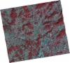
DE2_OPER_HRA_PSH_1C_20211104T111616_N41-438_W008-563_0001
Download Product | Product Info | Browse
Platform Short Name | GEOSAT |
Platform Serial Identifier | 2 |
Product Type | HRA_PSH_1C |
Start Date | 2021-11-04T11:16:16Z |
Stop Date | 2021-11-04T11:16:19Z |
Original Name | DE2_PSH_L1C_000000_20211104T111616_20211104T111619_DE2_39983_CCBA.zip |
Footprint | 41.3748914019 -8.42934916835 41.5282530093 -8.46502396558 41.5015557012 -8.6969805748 41.34809726 -8.66178792823 41.3748914019 -8.42934916835 |
Orbit Direction | ASCENDING |
Scene Centre Longitude | W008 |
Scene Centre Latitude | N41 |
Cloud Cover Percentage | -1 |
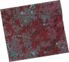
DE2_OPER_HRA_PM4_1C_20211104T111616_N41-438_W008-563_0001
Download Product | Product Info | Browse
Platform Short Name | GEOSAT |
Platform Serial Identifier | 2 |
Product Type | HRA_PM4_1C |
Start Date | 2021-11-04T11:16:16Z |
Stop Date | 2021-11-04T11:16:19Z |
Original Name | DE2_PM4_L1C_000000_20211104T111616_20211104T111619_DE2_39983_CCBA.zip |
Footprint | 41.3748914019 -8.42934916835 41.5282530093 -8.46502396558 41.5015557012 -8.6969805748 41.34809726 -8.66178792823 41.3748914019 -8.42934916835 |
Orbit Direction | ASCENDING |
Scene Centre Longitude | W008 |
Scene Centre Latitude | N41 |
Cloud Cover Percentage | -1 |
DE2_OPER_HRA_PSH_1C_20211104T111614_N41-298_W008-532_0001
Download Product | Product Info | Browse
Platform Short Name | GEOSAT |
Platform Serial Identifier | 2 |
Product Type | HRA_PSH_1C |
Start Date | 2021-11-04T11:16:14Z |
Stop Date | 2021-11-04T11:16:17Z |
Original Name | DE2_PSH_L1C_000000_20211104T111614_20211104T111617_DE2_39983_5118.zip |
Footprint | 41.2353011745 -8.39965286007 41.3890555581 -8.43293919518 41.3622877906 -8.66528335226 41.2086485106 -8.63050705291 41.2353011745 -8.39965286007 |
Orbit Direction | ASCENDING |
Scene Centre Longitude | W008 |
Scene Centre Latitude | N41 |
Cloud Cover Percentage | -1 |
DE2_OPER_HRA_PM4_1C_20211104T111614_N41-298_W008-532_0001
Download Product | Product Info | Browse
Platform Short Name | GEOSAT |
Platform Serial Identifier | 2 |
Product Type | HRA_PM4_1C |
Start Date | 2021-11-04T11:16:14Z |
Stop Date | 2021-11-04T11:16:17Z |
Original Name | DE2_PM4_L1C_000000_20211104T111614_20211104T111617_DE2_39983_5118.zip |
Footprint | 41.2353011745 -8.39965286007 41.3890555581 -8.43293919518 41.3622877906 -8.66528335226 41.2086485106 -8.63050705291 41.2353011745 -8.39965286007 |
Orbit Direction | ASCENDING |
Scene Centre Longitude | W008 |
Scene Centre Latitude | N41 |
Cloud Cover Percentage | -1 |
DE2_OPER_HRA_PSH_1C_20210708T110901_N41-449_W008-354_0001
Download Product | Product Info | Browse
Platform Short Name | GEOSAT |
Platform Serial Identifier | 2 |
Product Type | HRA_PSH_1C |
Start Date | 2021-07-08T11:09:01Z |
Stop Date | 2021-07-08T11:09:04Z |
Original Name | DE2_PSH_L1C_000000_20210708T110901_20210708T110904_DE2_38217_0D73.zip |
Footprint | 41.3959481542 -8.25337509666 41.5271736368 -8.288321626 41.5022831441 -8.4560447733 41.3711760501 -8.41994705498 41.3959481542 -8.25337509666 |
Orbit Direction | ASCENDING |
Scene Centre Longitude | W008 |
Scene Centre Latitude | N41 |
Cloud Cover Percentage | -1 |
DE2_OPER_HRA_PM4_1C_20210708T110901_N41-449_W008-354_0001
Download Product | Product Info | Browse
Platform Short Name | GEOSAT |
Platform Serial Identifier | 2 |
Product Type | HRA_PM4_1C |
Start Date | 2021-07-08T11:09:01Z |
Stop Date | 2021-07-08T11:09:04Z |
Original Name | DE2_PM4_L1C_000000_20210708T110901_20210708T110904_DE2_38217_0D73.zip |
Footprint | 41.3959481542 -8.25337509666 41.5271736368 -8.288321626 41.5022831441 -8.4560447733 41.3711760501 -8.41994705498 41.3959481542 -8.25337509666 |
Orbit Direction | ASCENDING |
Scene Centre Longitude | W008 |
Scene Centre Latitude | N41 |
Cloud Cover Percentage | -1 |
DE2_OPER_HRA_PSH_1C_20210708T110859_N41-329_W008-322_0001
Download Product | Product Info | Browse
Platform Short Name | GEOSAT |
Platform Serial Identifier | 2 |
Product Type | HRA_PSH_1C |
Start Date | 2021-07-08T11:08:59Z |
Stop Date | 2021-07-08T11:09:02Z |
Original Name | DE2_PSH_L1C_000000_20210708T110859_20210708T110902_DE2_38217_2D9C.zip |
Footprint | 41.2766403385 -8.22145868827 41.4080259073 -8.25734658995 41.383319376 -8.4233015361 41.2518335466 -8.3882579622 41.2766403385 -8.22145868827 |
Orbit Direction | ASCENDING |
Scene Centre Longitude | W008 |
Scene Centre Latitude | N41 |
Cloud Cover Percentage | -1 |
DE2_OPER_HRA_PM4_1C_20210708T110859_N41-329_W008-322_0001
Download Product | Product Info | Browse
Platform Short Name | GEOSAT |
Platform Serial Identifier | 2 |
Product Type | HRA_PM4_1C |
Start Date | 2021-07-08T11:08:59Z |
Stop Date | 2021-07-08T11:09:02Z |
Original Name | DE2_PM4_L1C_000000_20210708T110859_20210708T110902_DE2_38217_2D9C.zip |
Footprint | 41.2766403385 -8.22145868827 41.4080259073 -8.25734658995 41.383319376 -8.4233015361 41.2518335466 -8.3882579622 41.2766403385 -8.22145868827 |
Orbit Direction | ASCENDING |
Scene Centre Longitude | W008 |
Scene Centre Latitude | N41 |
Cloud Cover Percentage | -1 |
DE2_OPER_HRA_PSH_1C_20210525T110204_N41-436_W008-588_0001
Download Product | Product Info | Browse
Platform Short Name | GEOSAT |
Platform Serial Identifier | 2 |
Product Type | HRA_PSH_1C |
Start Date | 2021-05-25T11:02:04Z |
Stop Date | 2021-05-25T11:02:06Z |
Original Name | DE2_PSH_L1C_000000_20210525T110204_20210525T110206_DE2_37564_5668.zip |
Footprint | 41.3879981932 -8.49606519864 41.5107517054 -8.53384146509 41.4852305117 -8.68063392188 41.362469725 -8.64265848699 41.3879981932 -8.49606519864 |
Orbit Direction | ASCENDING |
Scene Centre Longitude | W008 |
Scene Centre Latitude | N41 |
Cloud Cover Percentage | -1 |
DE2_OPER_HRA_PM4_1C_20210525T110204_N41-436_W008-588_0001
Download Product | Product Info | Browse
Platform Short Name | GEOSAT |
Platform Serial Identifier | 2 |
Product Type | HRA_PM4_1C |
Start Date | 2021-05-25T11:02:04Z |
Stop Date | 2021-05-25T11:02:06Z |
Original Name | DE2_PM4_L1C_000000_20210525T110204_20210525T110206_DE2_37564_5668.zip |
Footprint | 41.3879981932 -8.49606519864 41.5107517054 -8.53384146509 41.4852305117 -8.68063392188 41.362469725 -8.64265848699 41.3879981932 -8.49606519864 |
Orbit Direction | ASCENDING |
Scene Centre Longitude | W008 |
Scene Centre Latitude | N41 |
Cloud Cover Percentage | -1 |
DE2_OPER_HRA_PSH_1C_20210525T110202_N41-325_W008-553_0001
Download Product | Product Info | Browse
Platform Short Name | GEOSAT |
Platform Serial Identifier | 2 |
Product Type | HRA_PSH_1C |
Start Date | 2021-05-25T11:02:02Z |
Stop Date | 2021-05-25T11:02:04Z |
Original Name | DE2_PSH_L1C_000000_20210525T110202_20210525T110204_DE2_37564_0450.zip |
Footprint | 41.2766503968 -8.46185365274 41.3994172979 -8.49961968239 41.3738708868 -8.64621942956 41.2511706252 -8.60819234462 41.2766503968 -8.46185365274 |
Orbit Direction | ASCENDING |
Scene Centre Longitude | W008 |
Scene Centre Latitude | N41 |
Cloud Cover Percentage | -1 |
DE2_OPER_HRA_PM4_1C_20210525T110202_N41-325_W008-553_0001
Download Product | Product Info | Browse
Platform Short Name | GEOSAT |
Platform Serial Identifier | 2 |
Product Type | HRA_PM4_1C |
Start Date | 2021-05-25T11:02:02Z |
Stop Date | 2021-05-25T11:02:04Z |
Original Name | DE2_PM4_L1C_000000_20210525T110202_20210525T110204_DE2_37564_0450.zip |
Footprint | 41.2766503968 -8.46185365274 41.3994172979 -8.49961968239 41.3738708868 -8.64621942956 41.2511706252 -8.60819234462 41.2766503968 -8.46185365274 |
Orbit Direction | ASCENDING |
Scene Centre Longitude | W008 |
Scene Centre Latitude | N41 |
Cloud Cover Percentage | -1 |
DE2_OPER_HRA_PSH_1C_20210318T110654_N41-462_W008-429_0001
Download Product | Product Info | Browse
Platform Short Name | GEOSAT |
Platform Serial Identifier | 2 |
Product Type | HRA_PSH_1C |
Start Date | 2021-03-18T11:06:54Z |
Stop Date | 2021-03-18T11:06:56Z |
Original Name | DE2_PSH_L1C_000000_20210318T110654_20210318T110656_DE2_36555_E88A.zip |
Footprint | 41.4124860194 -8.33604164108 41.5369968276 -8.37317971143 41.5121150196 -8.52363066749 41.3876769428 -8.48605658512 41.4124860194 -8.33604164108 |
Orbit Direction | ASCENDING |
Scene Centre Longitude | W008 |
Scene Centre Latitude | N41 |
Cloud Cover Percentage | -1 |
DE2_OPER_HRA_PM4_1C_20210318T110654_N41-462_W008-429_0001
Download Product | Product Info | Browse
Platform Short Name | GEOSAT |
Platform Serial Identifier | 2 |
Product Type | HRA_PM4_1C |
Start Date | 2021-03-18T11:06:54Z |
Stop Date | 2021-03-18T11:06:56Z |
Original Name | DE2_PM4_L1C_000000_20210318T110654_20210318T110656_DE2_36555_E88A.zip |
Footprint | 41.4124860194 -8.33604164108 41.5369968276 -8.37317971143 41.5121150196 -8.52363066749 41.3876769428 -8.48605658512 41.4124860194 -8.33604164108 |
Orbit Direction | ASCENDING |
Scene Centre Longitude | W008 |
Scene Centre Latitude | N41 |
Cloud Cover Percentage | -1 |
DE2_OPER_HRA_PSH_1C_20210318T110652_N41-349_W008-396_0001
Download Product | Product Info | Browse
Platform Short Name | GEOSAT |
Platform Serial Identifier | 2 |
Product Type | HRA_PSH_1C |
Start Date | 2021-03-18T11:06:52Z |
Stop Date | 2021-03-18T11:06:55Z |
Original Name | DE2_PSH_L1C_000000_20210318T110652_20210318T110655_DE2_36555_9BB9.zip |
Footprint | 41.2994215287 -8.30272680042 41.4241099066 -8.33911851941 41.3992041556 -8.48954564888 41.274574046 -8.45276346601 41.2994215287 -8.30272680042 |
Orbit Direction | ASCENDING |
Scene Centre Longitude | W008 |
Scene Centre Latitude | N41 |
Cloud Cover Percentage | -1 |
DE2_OPER_HRA_PM4_1C_20210318T110652_N41-349_W008-396_0001
Download Product | Product Info | Browse
Platform Short Name | GEOSAT |
Platform Serial Identifier | 2 |
Product Type | HRA_PM4_1C |
Start Date | 2021-03-18T11:06:52Z |
Stop Date | 2021-03-18T11:06:55Z |
Original Name | DE2_PM4_L1C_000000_20210318T110652_20210318T110655_DE2_36555_9BB9.zip |
Footprint | 41.2994215287 -8.30272680042 41.4241099066 -8.33911851941 41.3992041556 -8.48954564888 41.274574046 -8.45276346601 41.2994215287 -8.30272680042 |
Orbit Direction | ASCENDING |
Scene Centre Longitude | W008 |
Scene Centre Latitude | N41 |
Cloud Cover Percentage | -1 |