ESA TPM Map Catalogue - Product List
back to previous node |
list of download URLs


Collection G2_Portugal_2021
GEOSAT-2 Portugal Coverage 2021 collection. More details here.
List of available products (latitude from 41.2985 to 41.3769 dg, longitude from -7.2575 to -7.11312 dg)..
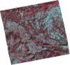
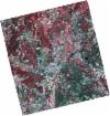
DE2_OPER_HRA_PSH_1C_20211022T110838_N41-384_W007-359_0001
Download Product | Product Info | Browse
Platform Short Name | GEOSAT |
Platform Serial Identifier | 2 |
Product Type | HRA_PSH_1C |
Start Date | 2021-10-22T11:08:38Z |
Stop Date | 2021-10-22T11:08:41Z |
Original Name | DE2_PSH_L1C_000000_20211022T110838_20211022T110841_DE2_39790_6D16.zip |
Footprint | 41.3255804078 -7.23672532803 41.4710346778 -7.2740674646 41.443396829 -7.48180080855 41.2993184238 -7.4459831104 41.3255804078 -7.23672532803 |
Orbit Direction | ASCENDING |
Scene Centre Longitude | W007 |
Scene Centre Latitude | N41 |
Cloud Cover Percentage | -1 |
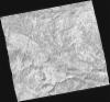
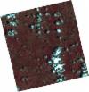
DE2_OPER_HRA_PM4_1C_20211022T110838_N41-384_W007-359_0001
Download Product | Product Info | Browse
Platform Short Name | GEOSAT |
Platform Serial Identifier | 2 |
Product Type | HRA_PM4_1C |
Start Date | 2021-10-22T11:08:38Z |
Stop Date | 2021-10-22T11:08:41Z |
Original Name | DE2_PM4_L1C_000000_20211022T110838_20211022T110841_DE2_39790_6D16.zip |
Footprint | 41.3255804078 -7.23672532803 41.4710346778 -7.2740674646 41.443396829 -7.48180080855 41.2993184238 -7.4459831104 41.3255804078 -7.23672532803 |
Orbit Direction | ASCENDING |
Scene Centre Longitude | W007 |
Scene Centre Latitude | N41 |
Cloud Cover Percentage | -1 |
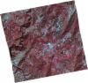
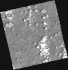
DE2_OPER_HRA_PSH_1C_20211022T110836_N41-253_W007-326_0001
Download Product | Product Info | Browse
Platform Short Name | GEOSAT |
Platform Serial Identifier | 2 |
Product Type | HRA_PSH_1C |
Start Date | 2021-10-22T11:08:36Z |
Stop Date | 2021-10-22T11:08:39Z |
Original Name | DE2_PSH_L1C_000000_20211022T110836_20211022T110839_DE2_39790_6D7D.zip |
Footprint | 41.1934145289 -7.20597061867 41.3390729231 -7.23994668788 41.3127830934 -7.44956084895 41.1675018925 -7.41168845982 41.1934145289 -7.20597061867 |
Orbit Direction | ASCENDING |
Scene Centre Longitude | W007 |
Scene Centre Latitude | N41 |
Cloud Cover Percentage | -1 |
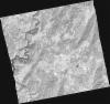
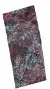
DE2_OPER_HRA_PM4_1C_20211022T110836_N41-253_W007-326_0001
Download Product | Product Info | Browse
Platform Short Name | GEOSAT |
Platform Serial Identifier | 2 |
Product Type | HRA_PM4_1C |
Start Date | 2021-10-22T11:08:36Z |
Stop Date | 2021-10-22T11:08:39Z |
Original Name | DE2_PM4_L1C_000000_20211022T110836_20211022T110839_DE2_39790_6D7D.zip |
Footprint | 41.1934145289 -7.20597061867 41.3390729231 -7.23994668788 41.3127830934 -7.44956084895 41.1675018925 -7.41168845982 41.1934145289 -7.20597061867 |
Orbit Direction | ASCENDING |
Scene Centre Longitude | W007 |
Scene Centre Latitude | N41 |
Cloud Cover Percentage | -1 |
DE2_OPER_HRA_PSH_1C_20210625T110025_N41-332_W007-078_0001
Download Product | Product Info | Browse
Platform Short Name | GEOSAT |
Platform Serial Identifier | 2 |
Product Type | HRA_PSH_1C |
Start Date | 2021-06-25T11:00:25Z |
Stop Date | 2021-06-25T11:00:28Z |
Original Name | DE2_PSH_L1C_000000_20210625T110025_20210625T110028_DE2_38024_D283.zip |
Footprint | 41.2822822588 -6.98356523246 41.4081453223 -7.02008991675 41.3836570648 -7.17272057641 41.2576547149 -7.13681269201 41.2822822588 -6.98356523246 |
Orbit Direction | ASCENDING |
Scene Centre Longitude | W007 |
Scene Centre Latitude | N41 |
Cloud Cover Percentage | -1 |
DE2_OPER_HRA_PM4_1C_20210625T110025_N41-332_W007-078_0001
Download Product | Product Info | Browse
Platform Short Name | GEOSAT |
Platform Serial Identifier | 2 |
Product Type | HRA_PM4_1C |
Start Date | 2021-06-25T11:00:25Z |
Stop Date | 2021-06-25T11:00:28Z |
Original Name | DE2_PM4_L1C_000000_20210625T110025_20210625T110028_DE2_38024_D283.zip |
Footprint | 41.2822822588 -6.98356523246 41.4081453223 -7.02008991675 41.3836570648 -7.17272057641 41.2576547149 -7.13681269201 41.2822822588 -6.98356523246 |
Orbit Direction | ASCENDING |
Scene Centre Longitude | W007 |
Scene Centre Latitude | N41 |
Cloud Cover Percentage | -1 |
DE2_OPER_HRA_PSH_1C_20210619T110353_N41-385_W007-204_0001
Download Product | Product Info | Browse
Platform Short Name | GEOSAT |
Platform Serial Identifier | 2 |
Product Type | HRA_PSH_1C |
Start Date | 2021-06-19T11:03:53Z |
Stop Date | 2021-06-19T11:03:55Z |
Original Name | DE2_PSH_L1C_000000_20210619T110353_20210619T110355_DE2_37935_FEA4.zip |
Footprint | 41.3334803406 -7.1043508054 41.4628965343 -7.14071831548 41.4380897641 -7.30361332659 41.3087523795 -7.26738932178 41.3334803406 -7.1043508054 |
Orbit Direction | ASCENDING |
Scene Centre Longitude | W007 |
Scene Centre Latitude | N41 |
Cloud Cover Percentage | -1 |
DE2_OPER_HRA_PM4_1C_20210619T110353_N41-385_W007-204_0001
Download Product | Product Info | Browse
Platform Short Name | GEOSAT |
Platform Serial Identifier | 2 |
Product Type | HRA_PM4_1C |
Start Date | 2021-06-19T11:03:53Z |
Stop Date | 2021-06-19T11:03:55Z |
Original Name | DE2_PM4_L1C_000000_20210619T110353_20210619T110355_DE2_37935_FEA4.zip |
Footprint | 41.3334803406 -7.1043508054 41.4628965343 -7.14071831548 41.4380897641 -7.30361332659 41.3087523795 -7.26738932178 41.3334803406 -7.1043508054 |
Orbit Direction | ASCENDING |
Scene Centre Longitude | W007 |
Scene Centre Latitude | N41 |
Cloud Cover Percentage | -1 |
DE2_OPER_HRA_PSH_1C_20210323T104810_N41-307_W007-203_0001
Download Product | Product Info | Browse
Platform Short Name | GEOSAT |
Platform Serial Identifier | 2 |
Product Type | HRA_PSH_1C |
Start Date | 2021-03-23T10:48:10Z |
Stop Date | 2021-03-23T10:48:13Z |
Original Name | DE2_PSH_L1C_000000_20210323T104810_20210323T104813_DE2_36629_DE01.zip |
Footprint | 41.2456073489 -7.15048233071 41.3850376928 -7.1779919248 41.3699298557 -7.25626106701 41.2310845114 -7.22830552773 41.2456073489 -7.15048233071 |
Orbit Direction | ASCENDING |
Scene Centre Longitude | W007 |
Scene Centre Latitude | N41 |
Cloud Cover Percentage | -1 |
DE2_OPER_HRA_PM4_1C_20210323T104810_N41-307_W007-203_0001
Download Product | Product Info | Browse
Platform Short Name | GEOSAT |
Platform Serial Identifier | 2 |
Product Type | HRA_PM4_1C |
Start Date | 2021-03-23T10:48:10Z |
Stop Date | 2021-03-23T10:48:13Z |
Original Name | DE2_PM4_L1C_000000_20210323T104810_20210323T104813_DE2_36629_DE01.zip |
Footprint | 41.2456073489 -7.15048233071 41.3850376928 -7.1779919248 41.3699298557 -7.25626106701 41.2310845114 -7.22830552773 41.2456073489 -7.15048233071 |
Orbit Direction | ASCENDING |
Scene Centre Longitude | W007 |
Scene Centre Latitude | N41 |
Cloud Cover Percentage | -1 |
DE2_OPER_HRA_PSH_1C_20210323T104810_N41-316_W007-158_0001
Download Product | Product Info | Browse
Platform Short Name | GEOSAT |
Platform Serial Identifier | 2 |
Product Type | HRA_PSH_1C |
Start Date | 2021-03-23T10:48:10Z |
Stop Date | 2021-03-23T10:48:13Z |
Original Name | DE2_PSH_L1C_000000_20210323T104810_20210323T104813_DE2_36629_DE02.zip |
Footprint | 41.2516403387 -7.13251694345 41.3848940418 -7.17149297926 41.3836956242 -7.1777065003 41.2473013356 -7.15206357666 41.2516403387 -7.13251694345 |
Orbit Direction | ASCENDING |
Scene Centre Longitude | W007 |
Scene Centre Latitude | N41 |
Cloud Cover Percentage | -1 |
DE2_OPER_HRA_PM4_1C_20210323T104810_N41-316_W007-158_0001
Download Product | Product Info | Browse
Platform Short Name | GEOSAT |
Platform Serial Identifier | 2 |
Product Type | HRA_PM4_1C |
Start Date | 2021-03-23T10:48:10Z |
Stop Date | 2021-03-23T10:48:13Z |
Original Name | DE2_PM4_L1C_000000_20210323T104810_20210323T104813_DE2_36629_DE02.zip |
Footprint | 41.2516403387 -7.13251694345 41.3848940418 -7.17149297926 41.3836956242 -7.1777065003 41.2473013356 -7.15206357666 41.2516403387 -7.13251694345 |
Orbit Direction | ASCENDING |
Scene Centre Longitude | W007 |
Scene Centre Latitude | N41 |
Cloud Cover Percentage | -1 |