ESA TPM Map Catalogue - Product List
back to previous node |
list of download URLs

Collection G2_Portugal_2021
GEOSAT-2 Portugal Coverage 2021 collection. More details here.
List of available products (latitude from 41.2985 to 41.3769 dg, longitude from -7.75625 to -7.61188 dg)..
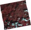
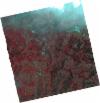
DE2_OPER_HRA_PSH_1C_20211116T110813_N41-392_W007-813_0001
Download Product | Product Info | Browse
Platform Short Name | GEOSAT |
Platform Serial Identifier | 2 |
Product Type | HRA_PSH_1C |
Start Date | 2021-11-16T11:08:13Z |
Stop Date | 2021-11-16T11:08:16Z |
Original Name | DE2_PSH_L1C_000000_20211116T110813_20211116T110816_DE2_40161_ECB2.zip |
Footprint | 41.3344483742 -7.69577759733 41.4756759836 -7.73364032208 41.4505167411 -7.92673778747 41.3080768194 -7.89688599644 41.3344483742 -7.69577759733 |
Orbit Direction | ASCENDING |
Scene Centre Longitude | W007 |
Scene Centre Latitude | N41 |
Cloud Cover Percentage | -1 |
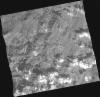
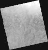
DE2_OPER_HRA_PM4_1C_20211116T110813_N41-392_W007-813_0001
Download Product | Product Info | Browse
Platform Short Name | GEOSAT |
Platform Serial Identifier | 2 |
Product Type | HRA_PM4_1C |
Start Date | 2021-11-16T11:08:13Z |
Stop Date | 2021-11-16T11:08:16Z |
Original Name | DE2_PM4_L1C_000000_20211116T110813_20211116T110816_DE2_40161_ECB2.zip |
Footprint | 41.3344483742 -7.69577759733 41.4756759836 -7.73364032208 41.4505167411 -7.92673778747 41.3080768194 -7.89688599644 41.3344483742 -7.69577759733 |
Orbit Direction | ASCENDING |
Scene Centre Longitude | W007 |
Scene Centre Latitude | N41 |
Cloud Cover Percentage | -1 |
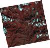
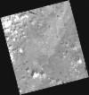
DE2_OPER_HRA_PSH_1C_20211116T110811_N41-263_W007-780_0001
Download Product | Product Info | Browse
Platform Short Name | GEOSAT |
Platform Serial Identifier | 2 |
Product Type | HRA_PSH_1C |
Start Date | 2021-11-16T11:08:11Z |
Stop Date | 2021-11-16T11:08:14Z |
Original Name | DE2_PSH_L1C_000000_20211116T110811_20211116T110814_DE2_40161_C08A.zip |
Footprint | 41.2052576683 -7.66371931547 41.3471728137 -7.69909161691 41.3212745201 -7.89870660999 41.1796806534 -7.86112079725 41.2052576683 -7.66371931547 |
Orbit Direction | ASCENDING |
Scene Centre Longitude | W007 |
Scene Centre Latitude | N41 |
Cloud Cover Percentage | -1 |
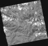
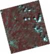
DE2_OPER_HRA_PM4_1C_20211116T110811_N41-263_W007-780_0001
Download Product | Product Info | Browse
Platform Short Name | GEOSAT |
Platform Serial Identifier | 2 |
Product Type | HRA_PM4_1C |
Start Date | 2021-11-16T11:08:11Z |
Stop Date | 2021-11-16T11:08:14Z |
Original Name | DE2_PM4_L1C_000000_20211116T110811_20211116T110814_DE2_40161_C08A.zip |
Footprint | 41.2052576683 -7.66371931547 41.3471728137 -7.69909161691 41.3212745201 -7.89870660999 41.1796806534 -7.86112079725 41.2052576683 -7.66371931547 |
Orbit Direction | ASCENDING |
Scene Centre Longitude | W007 |
Scene Centre Latitude | N41 |
Cloud Cover Percentage | -1 |
DE2_OPER_HRA_PSH_1C_20210714T110527_N41-244_W007-763_0001
Download Product | Product Info | Browse
Platform Short Name | GEOSAT |
Platform Serial Identifier | 2 |
Product Type | HRA_PSH_1C |
Start Date | 2021-07-14T11:05:27Z |
Stop Date | 2021-07-14T11:05:30Z |
Original Name | DE2_PSH_L1C_000000_20210714T110527_20210714T110530_DE2_38306_E71F.zip |
Footprint | 41.1927680581 -7.66502870549 41.3218743268 -7.70038352347 41.2970452449 -7.86359620535 41.1681336073 -7.8266592316 41.1927680581 -7.66502870549 |
Orbit Direction | ASCENDING |
Scene Centre Longitude | W007 |
Scene Centre Latitude | N41 |
Cloud Cover Percentage | -1 |
DE2_OPER_HRA_PM4_1C_20210714T110527_N41-244_W007-763_0001
Download Product | Product Info | Browse
Platform Short Name | GEOSAT |
Platform Serial Identifier | 2 |
Product Type | HRA_PM4_1C |
Start Date | 2021-07-14T11:05:27Z |
Stop Date | 2021-07-14T11:05:30Z |
Original Name | DE2_PM4_L1C_000000_20210714T110527_20210714T110530_DE2_38306_E71F.zip |
Footprint | 41.1927680581 -7.66502870549 41.3218743268 -7.70038352347 41.2970452449 -7.86359620535 41.1681336073 -7.8266592316 41.1927680581 -7.66502870549 |
Orbit Direction | ASCENDING |
Scene Centre Longitude | W007 |
Scene Centre Latitude | N41 |
Cloud Cover Percentage | -1 |
DE2_OPER_HRA_PSH_1C_20210506T105633_N41-432_W007-692_0001
Download Product | Product Info | Browse
Platform Short Name | GEOSAT |
Platform Serial Identifier | 2 |
Product Type | HRA_PSH_1C |
Start Date | 2021-05-06T10:56:33Z |
Stop Date | 2021-05-06T10:56:36Z |
Original Name | DE2_PSH_L1C_000000_20210506T105633_20210506T105636_DE2_37282_40AB.zip |
Footprint | 41.3845252621 -7.60019069832 41.5072001561 -7.63932134728 41.4809058368 -7.78573953693 41.3582767283 -7.74636464338 41.3845252621 -7.60019069832 |
Orbit Direction | ASCENDING |
Scene Centre Longitude | W007 |
Scene Centre Latitude | N41 |
Cloud Cover Percentage | -1 |
DE2_OPER_HRA_PM4_1C_20210506T105633_N41-432_W007-692_0001
Download Product | Product Info | Browse
Platform Short Name | GEOSAT |
Platform Serial Identifier | 2 |
Product Type | HRA_PM4_1C |
Start Date | 2021-05-06T10:56:33Z |
Stop Date | 2021-05-06T10:56:36Z |
Original Name | DE2_PM4_L1C_000000_20210506T105633_20210506T105636_DE2_37282_40AB.zip |
Footprint | 41.3845252621 -7.60019069832 41.5072001561 -7.63932134728 41.4809058368 -7.78573953693 41.3582767283 -7.74636464338 41.3845252621 -7.60019069832 |
Orbit Direction | ASCENDING |
Scene Centre Longitude | W007 |
Scene Centre Latitude | N41 |
Cloud Cover Percentage | -1 |
DE2_OPER_HRA_PSH_1C_20210506T105632_N41-321_W007-657_0001
Download Product | Product Info | Browse
Platform Short Name | GEOSAT |
Platform Serial Identifier | 2 |
Product Type | HRA_PSH_1C |
Start Date | 2021-05-06T10:56:32Z |
Stop Date | 2021-05-06T10:56:34Z |
Original Name | DE2_PSH_L1C_000000_20210506T105632_20210506T105634_DE2_37282_9086.zip |
Footprint | 41.2731913418 -7.5648557346 41.3959244471 -7.60374996573 41.3696775645 -7.74985845181 41.2469381822 -7.7109460102 41.2731913418 -7.5648557346 |
Orbit Direction | ASCENDING |
Scene Centre Longitude | W007 |
Scene Centre Latitude | N41 |
Cloud Cover Percentage | -1 |
DE2_OPER_HRA_PM4_1C_20210506T105632_N41-321_W007-657_0001
Download Product | Product Info | Browse
Platform Short Name | GEOSAT |
Platform Serial Identifier | 2 |
Product Type | HRA_PM4_1C |
Start Date | 2021-05-06T10:56:32Z |
Stop Date | 2021-05-06T10:56:34Z |
Original Name | DE2_PM4_L1C_000000_20210506T105632_20210506T105634_DE2_37282_9086.zip |
Footprint | 41.2731913418 -7.5648557346 41.3959244471 -7.60374996573 41.3696775645 -7.74985845181 41.2469381822 -7.7109460102 41.2731913418 -7.5648557346 |
Orbit Direction | ASCENDING |
Scene Centre Longitude | W007 |
Scene Centre Latitude | N41 |
Cloud Cover Percentage | -1 |