ESA TPM Map Catalogue - Product List
back to previous node |
list of download URLs
Collection G2_Portugal_2021
GEOSAT-2 Portugal Coverage 2021 collection. More details here.
List of available products (latitude from 41.1417 to 41.2201 dg, longitude from -8.045 to -7.90062 dg)..
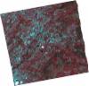
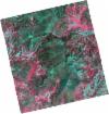
DE2_OPER_HRA_PSH_1C_20210727T111353_N41-248_W008-069_0001
Download Product | Product Info | Browse
Platform Short Name | GEOSAT |
Platform Serial Identifier | 2 |
Product Type | HRA_PSH_1C |
Start Date | 2021-07-27T11:13:53Z |
Stop Date | 2021-07-27T11:13:56Z |
Original Name | DE2_PSH_L1C_000000_20210727T111353_20210727T111356_DE2_38499_0A95.zip |
Footprint | 41.1893866369 -7.95420357524 41.3328300406 -7.98580998805 41.3070995191 -8.18593979747 41.163991602 -8.15045211401 41.1893866369 -7.95420357524 |
Orbit Direction | ASCENDING |
Scene Centre Longitude | W008 |
Scene Centre Latitude | N41 |
Cloud Cover Percentage | -1 |
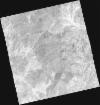
DE2_OPER_HRA_PM4_1C_20210727T111353_N41-248_W008-069_0001
Download Product | Product Info | Browse
Platform Short Name | GEOSAT |
Platform Serial Identifier | 2 |
Product Type | HRA_PM4_1C |
Start Date | 2021-07-27T11:13:53Z |
Stop Date | 2021-07-27T11:13:56Z |
Original Name | DE2_PM4_L1C_000000_20210727T111353_20210727T111356_DE2_38499_0A95.zip |
Footprint | 41.1893866369 -7.95420357524 41.3328300406 -7.98580998805 41.3070995191 -8.18593979747 41.163991602 -8.15045211401 41.1893866369 -7.95420357524 |
Orbit Direction | ASCENDING |
Scene Centre Longitude | W008 |
Scene Centre Latitude | N41 |
Cloud Cover Percentage | -1 |
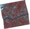
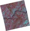
DE2_OPER_HRA_PSH_1C_20210727T111351_N41-118_W008-038_0001
Download Product | Product Info | Browse
Platform Short Name | GEOSAT |
Platform Serial Identifier | 2 |
Product Type | HRA_PSH_1C |
Start Date | 2021-07-27T11:13:51Z |
Stop Date | 2021-07-27T11:13:54Z |
Original Name | DE2_PSH_L1C_000000_20210727T111351_20210727T111354_DE2_38499_B854.zip |
Footprint | 41.0593317154 -7.92221536427 41.2028613351 -7.95534871713 41.177275829 -8.15349948079 41.0334454734 -8.12329621605 41.0593317154 -7.92221536427 |
Orbit Direction | ASCENDING |
Scene Centre Longitude | W008 |
Scene Centre Latitude | N41 |
Cloud Cover Percentage | -1 |
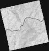
DE2_OPER_HRA_PM4_1C_20210727T111351_N41-118_W008-038_0001
Download Product | Product Info | Browse
Platform Short Name | GEOSAT |
Platform Serial Identifier | 2 |
Product Type | HRA_PM4_1C |
Start Date | 2021-07-27T11:13:51Z |
Stop Date | 2021-07-27T11:13:54Z |
Original Name | DE2_PM4_L1C_000000_20210727T111351_20210727T111354_DE2_38499_B854.zip |
Footprint | 41.0593317154 -7.92221536427 41.2028613351 -7.95534871713 41.177275829 -8.15349948079 41.0334454734 -8.12329621605 41.0593317154 -7.92221536427 |
Orbit Direction | ASCENDING |
Scene Centre Longitude | W008 |
Scene Centre Latitude | N41 |
Cloud Cover Percentage | -1 |
DE2_OPER_HRA_PSH_1C_20210519T110521_N41-249_W007-913_0001
Download Product | Product Info | Browse
Platform Short Name | GEOSAT |
Platform Serial Identifier | 2 |
Product Type | HRA_PSH_1C |
Start Date | 2021-05-19T11:05:21Z |
Stop Date | 2021-05-19T11:05:23Z |
Original Name | DE2_PSH_L1C_000000_20210519T110521_20210519T110523_DE2_37475_553B.zip |
Footprint | 41.1984348662 -7.81822920566 41.3242017794 -7.85530097747 41.2997530749 -8.00815405736 41.1736308187 -7.97358816787 41.1984348662 -7.81822920566 |
Orbit Direction | ASCENDING |
Scene Centre Longitude | W007 |
Scene Centre Latitude | N41 |
Cloud Cover Percentage | -1 |
DE2_OPER_HRA_PM4_1C_20210519T110521_N41-249_W007-913_0001
Download Product | Product Info | Browse
Platform Short Name | GEOSAT |
Platform Serial Identifier | 2 |
Product Type | HRA_PM4_1C |
Start Date | 2021-05-19T11:05:21Z |
Stop Date | 2021-05-19T11:05:23Z |
Original Name | DE2_PM4_L1C_000000_20210519T110521_20210519T110523_DE2_37475_553B.zip |
Footprint | 41.1984348662 -7.81822920566 41.3242017794 -7.85530097747 41.2997530749 -8.00815405736 41.1736308187 -7.97358816787 41.1984348662 -7.81822920566 |
Orbit Direction | ASCENDING |
Scene Centre Longitude | W007 |
Scene Centre Latitude | N41 |
Cloud Cover Percentage | -1 |
DE2_OPER_HRA_PSH_1C_20210519T110519_N41-134_W007-881_0001
Download Product | Product Info | Browse
Platform Short Name | GEOSAT |
Platform Serial Identifier | 2 |
Product Type | HRA_PSH_1C |
Start Date | 2021-05-19T11:05:19Z |
Stop Date | 2021-05-19T11:05:21Z |
Original Name | DE2_PSH_L1C_000000_20210519T110519_20210519T110521_DE2_37475_EC4B.zip |
Footprint | 41.0840356271 -7.78610151938 41.2100380754 -7.82187613431 41.185292566 -7.97675958021 41.0591207468 -7.94173007586 41.0840356271 -7.78610151938 |
Orbit Direction | ASCENDING |
Scene Centre Longitude | W007 |
Scene Centre Latitude | N41 |
Cloud Cover Percentage | -1 |
DE2_OPER_HRA_PM4_1C_20210519T110519_N41-134_W007-881_0001
Download Product | Product Info | Browse
Platform Short Name | GEOSAT |
Platform Serial Identifier | 2 |
Product Type | HRA_PM4_1C |
Start Date | 2021-05-19T11:05:19Z |
Stop Date | 2021-05-19T11:05:21Z |
Original Name | DE2_PM4_L1C_000000_20210519T110519_20210519T110521_DE2_37475_EC4B.zip |
Footprint | 41.0840356271 -7.78610151938 41.2100380754 -7.82187613431 41.185292566 -7.97675958021 41.0591207468 -7.94173007586 41.0840356271 -7.78610151938 |
Orbit Direction | ASCENDING |
Scene Centre Longitude | W007 |
Scene Centre Latitude | N41 |
Cloud Cover Percentage | -1 |