ESA TPM Map Catalogue - Product List
back to previous node |
list of download URLs
Collection G2_Portugal_2021
GEOSAT-2 Portugal Coverage 2021 collection. More details here.
List of available products (latitude from 41.0632 to 41.1417 dg, longitude from -7.11312 to -6.96875 dg)..
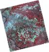
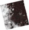
DE2_OPER_HRA_PSH_1C_20210625T110022_N41-104_W007-013_0001
Download Product | Product Info | Browse
Platform Short Name | GEOSAT |
Platform Serial Identifier | 2 |
Product Type | HRA_PSH_1C |
Start Date | 2021-06-25T11:00:22Z |
Stop Date | 2021-06-25T11:00:24Z |
Original Name | DE2_PSH_L1C_000000_20210625T110022_20210625T110024_DE2_38024_3988.zip |
Footprint | 41.0537056631 -6.91822365458 41.1795299245 -6.95540864768 41.1550676411 -7.10748164142 41.0290210321 -7.07154976243 41.0537056631 -6.91822365458 |
Orbit Direction | ASCENDING |
Scene Centre Longitude | W007 |
Scene Centre Latitude | N41 |
Cloud Cover Percentage | -1 |
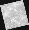
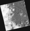
DE2_OPER_HRA_PM4_1C_20210625T110022_N41-104_W007-013_0001
Download Product | Product Info | Browse
Platform Short Name | GEOSAT |
Platform Serial Identifier | 2 |
Product Type | HRA_PM4_1C |
Start Date | 2021-06-25T11:00:22Z |
Stop Date | 2021-06-25T11:00:24Z |
Original Name | DE2_PM4_L1C_000000_20210625T110022_20210625T110024_DE2_38024_3988.zip |
Footprint | 41.0537056631 -6.91822365458 41.1795299245 -6.95540864768 41.1550676411 -7.10748164142 41.0290210321 -7.07154976243 41.0537056631 -6.91822365458 |
Orbit Direction | ASCENDING |
Scene Centre Longitude | W007 |
Scene Centre Latitude | N41 |
Cloud Cover Percentage | -1 |
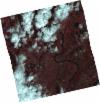
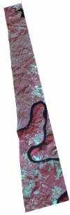
DE2_OPER_HRA_PSH_1C_20210619T110349_N41-150_W007-139_0001
Download Product | Product Info | Browse
Platform Short Name | GEOSAT |
Platform Serial Identifier | 2 |
Product Type | HRA_PSH_1C |
Start Date | 2021-06-19T11:03:49Z |
Stop Date | 2021-06-19T11:03:52Z |
Original Name | DE2_PSH_L1C_000000_20210619T110349_20210619T110352_DE2_37935_691C.zip |
Footprint | 41.0982702185 -7.04059957525 41.2280102051 -7.0759311291 41.2031211107 -7.23827324193 41.0736321636 -7.20341147683 41.0982702185 -7.04059957525 |
Orbit Direction | ASCENDING |
Scene Centre Longitude | W007 |
Scene Centre Latitude | N41 |
Cloud Cover Percentage | -1 |
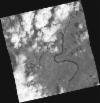
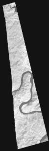
DE2_OPER_HRA_PM4_1C_20210619T110349_N41-150_W007-139_0001
Download Product | Product Info | Browse
Platform Short Name | GEOSAT |
Platform Serial Identifier | 2 |
Product Type | HRA_PM4_1C |
Start Date | 2021-06-19T11:03:49Z |
Stop Date | 2021-06-19T11:03:52Z |
Original Name | DE2_PM4_L1C_000000_20210619T110349_20210619T110352_DE2_37935_691C.zip |
Footprint | 41.0982702185 -7.04059957525 41.2280102051 -7.0759311291 41.2031211107 -7.23827324193 41.0736321636 -7.20341147683 41.0982702185 -7.04059957525 |
Orbit Direction | ASCENDING |
Scene Centre Longitude | W007 |
Scene Centre Latitude | N41 |
Cloud Cover Percentage | -1 |
DE2_OPER_HRA_PSH_1C_20210619T110347_N41-033_W007-107_0001
Download Product | Product Info | Browse
Platform Short Name | GEOSAT |
Platform Serial Identifier | 2 |
Product Type | HRA_PSH_1C |
Start Date | 2021-06-19T11:03:47Z |
Stop Date | 2021-06-19T11:03:50Z |
Original Name | DE2_PSH_L1C_000000_20210619T110347_20210619T110350_DE2_37935_9A70.zip |
Footprint | 40.980608158 -7.00867013402 41.1102972402 -7.04351102239 41.0855016486 -7.20643641146 40.955971364 -7.17011477435 40.980608158 -7.00867013402 |
Orbit Direction | ASCENDING |
Scene Centre Longitude | W007 |
Scene Centre Latitude | N41 |
Cloud Cover Percentage | -1 |
DE2_OPER_HRA_PM4_1C_20210619T110347_N41-033_W007-107_0001
Download Product | Product Info | Browse
Platform Short Name | GEOSAT |
Platform Serial Identifier | 2 |
Product Type | HRA_PM4_1C |
Start Date | 2021-06-19T11:03:47Z |
Stop Date | 2021-06-19T11:03:50Z |
Original Name | DE2_PM4_L1C_000000_20210619T110347_20210619T110350_DE2_37935_9A70.zip |
Footprint | 40.980608158 -7.00867013402 41.1102972402 -7.04351102239 41.0855016486 -7.20643641146 40.955971364 -7.17011477435 40.980608158 -7.00867013402 |
Orbit Direction | ASCENDING |
Scene Centre Longitude | W007 |
Scene Centre Latitude | N41 |
Cloud Cover Percentage | -1 |
DE2_OPER_HRA_PSH_1C_20210323T104808_N41-176_W007-128_0001
Download Product | Product Info | Browse
Platform Short Name | GEOSAT |
Platform Serial Identifier | 2 |
Product Type | HRA_PSH_1C |
Start Date | 2021-03-23T10:48:08Z |
Stop Date | 2021-03-23T10:48:11Z |
Original Name | DE2_PSH_L1C_000000_20210323T104808_20210323T104811_DE2_36629_DE02.zip |
Footprint | 41.1046007912 -7.09132827781 41.2546880491 -7.13507982307 41.2511679914 -7.15306454041 41.0960123649 -7.13574525251 41.1046007912 -7.09132827781 |
Orbit Direction | ASCENDING |
Scene Centre Longitude | W007 |
Scene Centre Latitude | N41 |
Cloud Cover Percentage | -1 |
DE2_OPER_HRA_PM4_1C_20210323T104808_N41-176_W007-128_0001
Download Product | Product Info | Browse
Platform Short Name | GEOSAT |
Platform Serial Identifier | 2 |
Product Type | HRA_PM4_1C |
Start Date | 2021-03-23T10:48:08Z |
Stop Date | 2021-03-23T10:48:11Z |
Original Name | DE2_PM4_L1C_000000_20210323T104808_20210323T104811_DE2_36629_DE02.zip |
Footprint | 41.1046007912 -7.09132827781 41.2546880491 -7.13507982307 41.2511679914 -7.15306454041 41.0960123649 -7.13574525251 41.1046007912 -7.09132827781 |
Orbit Direction | ASCENDING |
Scene Centre Longitude | W007 |
Scene Centre Latitude | N41 |
Cloud Cover Percentage | -1 |