ESA TPM Map Catalogue - Product List
back to previous node |
list of download URLs
Collection G2_Portugal_2021
GEOSAT-2 Portugal Coverage 2021 collection. More details here.
List of available products (latitude from 41.0632 to 41.1417 dg, longitude from -7.90062 to -7.75625 dg)..
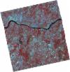
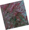
DE2_OPER_HRA_PSH_1C_20210714T110525_N41-127_W007-732_0001
Download Product | Product Info | Browse
Platform Short Name | GEOSAT |
Platform Serial Identifier | 2 |
Product Type | HRA_PSH_1C |
Start Date | 2021-07-14T11:05:25Z |
Stop Date | 2021-07-14T11:05:28Z |
Original Name | DE2_PSH_L1C_000000_20210714T110525_20210714T110528_DE2_38306_F917.zip |
Footprint | 41.0756048246 -7.63408420233 41.2047231093 -7.6683101363 41.1800212063 -7.8303904538 41.0509625583 -7.79547344546 41.0756048246 -7.63408420233 |
Orbit Direction | ASCENDING |
Scene Centre Longitude | W007 |
Scene Centre Latitude | N41 |
Cloud Cover Percentage | -1 |
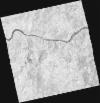
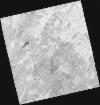
DE2_OPER_HRA_PM4_1C_20210714T110525_N41-127_W007-732_0001
Download Product | Product Info | Browse
Platform Short Name | GEOSAT |
Platform Serial Identifier | 2 |
Product Type | HRA_PM4_1C |
Start Date | 2021-07-14T11:05:25Z |
Stop Date | 2021-07-14T11:05:28Z |
Original Name | DE2_PM4_L1C_000000_20210714T110525_20210714T110528_DE2_38306_F917.zip |
Footprint | 41.0756048246 -7.63408420233 41.2047231093 -7.6683101363 41.1800212063 -7.8303904538 41.0509625583 -7.79547344546 41.0756048246 -7.63408420233 |
Orbit Direction | ASCENDING |
Scene Centre Longitude | W007 |
Scene Centre Latitude | N41 |
Cloud Cover Percentage | -1 |
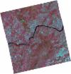
DE2_OPER_HRA_PSH_1C_20210519T110519_N41-134_W007-881_0001
Download Product | Product Info | Browse
Platform Short Name | GEOSAT |
Platform Serial Identifier | 2 |
Product Type | HRA_PSH_1C |
Start Date | 2021-05-19T11:05:19Z |
Stop Date | 2021-05-19T11:05:21Z |
Original Name | DE2_PSH_L1C_000000_20210519T110519_20210519T110521_DE2_37475_EC4B.zip |
Footprint | 41.0840356271 -7.78610151938 41.2100380754 -7.82187613431 41.185292566 -7.97675958021 41.0591207468 -7.94173007586 41.0840356271 -7.78610151938 |
Orbit Direction | ASCENDING |
Scene Centre Longitude | W007 |
Scene Centre Latitude | N41 |
Cloud Cover Percentage | -1 |
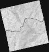
DE2_OPER_HRA_PM4_1C_20210519T110519_N41-134_W007-881_0001
Download Product | Product Info | Browse
Platform Short Name | GEOSAT |
Platform Serial Identifier | 2 |
Product Type | HRA_PM4_1C |
Start Date | 2021-05-19T11:05:19Z |
Stop Date | 2021-05-19T11:05:21Z |
Original Name | DE2_PM4_L1C_000000_20210519T110519_20210519T110521_DE2_37475_EC4B.zip |
Footprint | 41.0840356271 -7.78610151938 41.2100380754 -7.82187613431 41.185292566 -7.97675958021 41.0591207468 -7.94173007586 41.0840356271 -7.78610151938 |
Orbit Direction | ASCENDING |
Scene Centre Longitude | W007 |
Scene Centre Latitude | N41 |
Cloud Cover Percentage | -1 |
DE2_OPER_HRA_PSH_1C_20210519T110517_N41-020_W007-849_0001
Download Product | Product Info | Browse
Platform Short Name | GEOSAT |
Platform Serial Identifier | 2 |
Product Type | HRA_PSH_1C |
Start Date | 2021-05-19T11:05:17Z |
Stop Date | 2021-05-19T11:05:19Z |
Original Name | DE2_PSH_L1C_000000_20210519T110517_20210519T110519_DE2_37475_D6E7.zip |
Footprint | 40.9694278791 -7.75505580672 41.095699111 -7.78958400501 41.070945308 -7.94412042231 40.9448055222 -7.90874534319 40.9694278791 -7.75505580672 |
Orbit Direction | ASCENDING |
Scene Centre Longitude | W007 |
Scene Centre Latitude | N41 |
Cloud Cover Percentage | -1 |
DE2_OPER_HRA_PM4_1C_20210519T110517_N41-020_W007-849_0001
Download Product | Product Info | Browse
Platform Short Name | GEOSAT |
Platform Serial Identifier | 2 |
Product Type | HRA_PM4_1C |
Start Date | 2021-05-19T11:05:17Z |
Stop Date | 2021-05-19T11:05:19Z |
Original Name | DE2_PM4_L1C_000000_20210519T110517_20210519T110519_DE2_37475_D6E7.zip |
Footprint | 40.9694412921 -7.7550466412 41.0956869152 -7.78970925515 41.0709383894 -7.94410267869 40.9448124458 -7.90876304948 40.9694412921 -7.7550466412 |
Orbit Direction | ASCENDING |
Scene Centre Longitude | W007 |
Scene Centre Latitude | N41 |
Cloud Cover Percentage | -1 |