ESA TPM Map Catalogue - Product List
back to previous node |
list of download URLs

Collection G2_Portugal_2021
GEOSAT-2 Portugal Coverage 2021 collection. More details here.
List of available products (latitude from 41.0632 to 41.1417 dg, longitude from -8.255 to -8.11063 dg)..
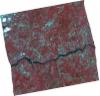
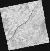
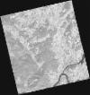
DE2_OPER_HRA_PSH_1C_20210727T111351_N41-118_W008-038_0001
Download Product | Product Info | Browse
Platform Short Name | GEOSAT |
Platform Serial Identifier | 2 |
Product Type | HRA_PSH_1C |
Start Date | 2021-07-27T11:13:51Z |
Stop Date | 2021-07-27T11:13:54Z |
Original Name | DE2_PSH_L1C_000000_20210727T111351_20210727T111354_DE2_38499_B854.zip |
Footprint | 41.0593317154 -7.92221536427 41.2028613351 -7.95534871713 41.177275829 -8.15349948079 41.0334454734 -8.12329621605 41.0593317154 -7.92221536427 |
Orbit Direction | ASCENDING |
Scene Centre Longitude | W008 |
Scene Centre Latitude | N41 |
Cloud Cover Percentage | -1 |
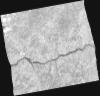
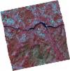
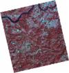
DE2_OPER_HRA_PM4_1C_20210727T111351_N41-118_W008-038_0001
Download Product | Product Info | Browse
Platform Short Name | GEOSAT |
Platform Serial Identifier | 2 |
Product Type | HRA_PM4_1C |
Start Date | 2021-07-27T11:13:51Z |
Stop Date | 2021-07-27T11:13:54Z |
Original Name | DE2_PM4_L1C_000000_20210727T111351_20210727T111354_DE2_38499_B854.zip |
Footprint | 41.0593317154 -7.92221536427 41.2028613351 -7.95534871713 41.177275829 -8.15349948079 41.0334454734 -8.12329621605 41.0593317154 -7.92221536427 |
Orbit Direction | ASCENDING |
Scene Centre Longitude | W008 |
Scene Centre Latitude | N41 |
Cloud Cover Percentage | -1 |
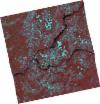
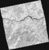
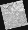
DE2_OPER_HRA_PSH_1C_20210708T110856_N41-091_W008-258_0001
Download Product | Product Info | Browse
Platform Short Name | GEOSAT |
Platform Serial Identifier | 2 |
Product Type | HRA_PSH_1C |
Start Date | 2021-07-08T11:08:56Z |
Stop Date | 2021-07-08T11:08:58Z |
Original Name | DE2_PSH_L1C_000000_20210708T110856_20210708T110858_DE2_38217_CF7A.zip |
Footprint | 41.0375614198 -8.15978014051 41.1694941014 -8.19221414421 41.1446078022 -8.35913690653 41.0130162983 -8.32407593265 41.0375614198 -8.15978014051 |
Orbit Direction | ASCENDING |
Scene Centre Longitude | W008 |
Scene Centre Latitude | N41 |
Cloud Cover Percentage | -1 |
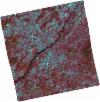
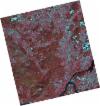
DE2_OPER_HRA_PM4_1C_20210708T110856_N41-091_W008-258_0001
Download Product | Product Info | Browse
Platform Short Name | GEOSAT |
Platform Serial Identifier | 2 |
Product Type | HRA_PM4_1C |
Start Date | 2021-07-08T11:08:56Z |
Stop Date | 2021-07-08T11:08:58Z |
Original Name | DE2_PM4_L1C_000000_20210708T110856_20210708T110858_DE2_38217_CF7A.zip |
Footprint | 41.0375614198 -8.15978014051 41.1694941014 -8.19221414421 41.1446078022 -8.35913690653 41.0130162983 -8.32407593265 41.0375614198 -8.15978014051 |
Orbit Direction | ASCENDING |
Scene Centre Longitude | W008 |
Scene Centre Latitude | N41 |
Cloud Cover Percentage | -1 |
DE2_OPER_HRA_PSH_1C_20210406T111248_N41-194_W008-144_0001
Download Product | Product Info | Browse
Platform Short Name | GEOSAT |
Platform Serial Identifier | 2 |
Product Type | HRA_PSH_1C |
Start Date | 2021-04-06T11:12:48Z |
Stop Date | 2021-04-06T11:12:50Z |
Original Name | DE2_PSH_L1C_000000_20210406T111248_20210406T111250_DE2_36837_1B96.zip |
Footprint | 41.1395467228 -8.04171534074 41.2736347009 -8.07458197086 41.2485680303 -8.24861043456 41.1147019602 -8.21345933437 41.1395467228 -8.04171534074 |
Orbit Direction | ASCENDING |
Scene Centre Longitude | W008 |
Scene Centre Latitude | N41 |
Cloud Cover Percentage | -1 |
DE2_OPER_HRA_PM4_1C_20210406T111248_N41-194_W008-144_0001
Download Product | Product Info | Browse
Platform Short Name | GEOSAT |
Platform Serial Identifier | 2 |
Product Type | HRA_PM4_1C |
Start Date | 2021-04-06T11:12:48Z |
Stop Date | 2021-04-06T11:12:50Z |
Original Name | DE2_PM4_L1C_000000_20210406T111248_20210406T111250_DE2_36837_1B96.zip |
Footprint | 41.1395467228 -8.04171534074 41.2736347009 -8.07458197086 41.2485680303 -8.24861043456 41.1147019602 -8.21345933437 41.1395467228 -8.04171534074 |
Orbit Direction | ASCENDING |
Scene Centre Longitude | W008 |
Scene Centre Latitude | N41 |
Cloud Cover Percentage | -1 |
DE2_OPER_HRA_PSH_1C_20210406T111246_N41-072_W008-113_0001
Download Product | Product Info | Browse
Platform Short Name | GEOSAT |
Platform Serial Identifier | 2 |
Product Type | HRA_PSH_1C |
Start Date | 2021-04-06T11:12:46Z |
Stop Date | 2021-04-06T11:12:48Z |
Original Name | DE2_PSH_L1C_000000_20210406T111246_20210406T111248_DE2_36837_9DCB.zip |
Footprint | 41.0180737818 -8.01200820386 41.1518467161 -8.04548691156 41.1271204011 -8.21658121304 40.9934339421 -8.18181227132 41.0180737818 -8.01200820386 |
Orbit Direction | ASCENDING |
Scene Centre Longitude | W008 |
Scene Centre Latitude | N41 |
Cloud Cover Percentage | -1 |
DE2_OPER_HRA_PM4_1C_20210406T111246_N41-072_W008-113_0001
Download Product | Product Info | Browse
Platform Short Name | GEOSAT |
Platform Serial Identifier | 2 |
Product Type | HRA_PM4_1C |
Start Date | 2021-04-06T11:12:46Z |
Stop Date | 2021-04-06T11:12:48Z |
Original Name | DE2_PM4_L1C_000000_20210406T111246_20210406T111248_DE2_36837_9DCB.zip |
Footprint | 41.0180737818 -8.01200820386 41.1518467161 -8.04548691156 41.1271204011 -8.21658121304 40.9934339421 -8.18181227132 41.0180737818 -8.01200820386 |
Orbit Direction | ASCENDING |
Scene Centre Longitude | W008 |
Scene Centre Latitude | N41 |
Cloud Cover Percentage | -1 |
DE2_OPER_HRA_PSH_1C_20210318T110648_N41-122_W008-329_0001
Download Product | Product Info | Browse
Platform Short Name | GEOSAT |
Platform Serial Identifier | 2 |
Product Type | HRA_PSH_1C |
Start Date | 2021-03-18T11:06:48Z |
Stop Date | 2021-03-18T11:06:51Z |
Original Name | DE2_PSH_L1C_000000_20210318T110648_20210318T110651_DE2_36555_A2FB.zip |
Footprint | 41.0729755904 -8.23634714042 41.1977726166 -8.27309132277 41.1729212093 -8.42288850248 41.0481496069 -8.38594503883 41.0729755904 -8.23634714042 |
Orbit Direction | ASCENDING |
Scene Centre Longitude | W008 |
Scene Centre Latitude | N41 |
Cloud Cover Percentage | -1 |
DE2_OPER_HRA_PM4_1C_20210318T110648_N41-122_W008-329_0001
Download Product | Product Info | Browse
Platform Short Name | GEOSAT |
Platform Serial Identifier | 2 |
Product Type | HRA_PM4_1C |
Start Date | 2021-03-18T11:06:48Z |
Stop Date | 2021-03-18T11:06:51Z |
Original Name | DE2_PM4_L1C_000000_20210318T110648_20210318T110651_DE2_36555_A2FB.zip |
Footprint | 41.0729755904 -8.23634714042 41.1977726166 -8.27309132277 41.1729212093 -8.42288850248 41.0481496069 -8.38594503883 41.0729755904 -8.23634714042 |
Orbit Direction | ASCENDING |
Scene Centre Longitude | W008 |
Scene Centre Latitude | N41 |
Cloud Cover Percentage | -1 |
DE2_OPER_HRA_PSH_1C_20210318T110647_N41-009_W008-296_0001
Download Product | Product Info | Browse
Platform Short Name | GEOSAT |
Platform Serial Identifier | 2 |
Product Type | HRA_PSH_1C |
Start Date | 2021-03-18T11:06:47Z |
Stop Date | 2021-03-18T11:06:49Z |
Original Name | DE2_PSH_L1C_000000_20210318T110647_20210318T110649_DE2_36555_4D6C.zip |
Footprint | 40.9596074118 -8.20419878629 41.0845243614 -8.23982974128 41.0597144945 -8.38947920849 40.9348199113 -8.35339111105 40.9596074118 -8.20419878629 |
Orbit Direction | ASCENDING |
Scene Centre Longitude | W008 |
Scene Centre Latitude | N41 |
Cloud Cover Percentage | -1 |
DE2_OPER_HRA_PM4_1C_20210318T110647_N41-009_W008-296_0001
Download Product | Product Info | Browse
Platform Short Name | GEOSAT |
Platform Serial Identifier | 2 |
Product Type | HRA_PM4_1C |
Start Date | 2021-03-18T11:06:47Z |
Stop Date | 2021-03-18T11:06:49Z |
Original Name | DE2_PM4_L1C_000000_20210318T110647_20210318T110649_DE2_36555_4D6C.zip |
Footprint | 40.9596074118 -8.20419878629 41.0845243614 -8.23982974128 41.0597144945 -8.38947920849 40.9348199113 -8.35339111105 40.9596074118 -8.20419878629 |
Orbit Direction | ASCENDING |
Scene Centre Longitude | W008 |
Scene Centre Latitude | N41 |
Cloud Cover Percentage | -1 |