ESA TPM Map Catalogue - Product List
back to previous node |
list of download URLs
Collection G2_Portugal_2021
GEOSAT-2 Portugal Coverage 2021 collection. More details here.
List of available products (latitude from 40.9064 to 40.9848 dg, longitude from -7.11312 to -6.96875 dg)..
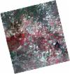
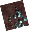
DE2_OPER_HRA_PSH_1C_20210625T110018_N40-875_W006-948_0001
Download Product | Product Info | Browse
Platform Short Name | GEOSAT |
Platform Serial Identifier | 2 |
Product Type | HRA_PSH_1C |
Start Date | 2021-06-25T11:00:18Z |
Stop Date | 2021-06-25T11:00:20Z |
Original Name | DE2_PSH_L1C_000000_20210625T110018_20210625T110020_DE2_38024_FC7A.zip |
Footprint | 40.8248131543 -6.85415580484 40.9509873866 -6.88924385184 40.9262849105 -7.04252833665 40.8002293903 -7.00664947423 40.8248131543 -6.85415580484 |
Orbit Direction | ASCENDING |
Scene Centre Longitude | W006 |
Scene Centre Latitude | N40 |
Cloud Cover Percentage | -1 |
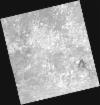
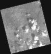
DE2_OPER_HRA_PM4_1C_20210625T110018_N40-875_W006-948_0001
Download Product | Product Info | Browse
Platform Short Name | GEOSAT |
Platform Serial Identifier | 2 |
Product Type | HRA_PM4_1C |
Start Date | 2021-06-25T11:00:18Z |
Stop Date | 2021-06-25T11:00:20Z |
Original Name | DE2_PM4_L1C_000000_20210625T110018_20210625T110020_DE2_38024_FC7A.zip |
Footprint | 40.8248131543 -6.85415580484 40.9509873866 -6.88924385184 40.9262849105 -7.04252833665 40.8002293903 -7.00664947423 40.8248131543 -6.85415580484 |
Orbit Direction | ASCENDING |
Scene Centre Longitude | W006 |
Scene Centre Latitude | N40 |
Cloud Cover Percentage | -1 |
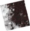
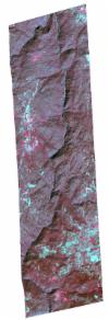
DE2_OPER_HRA_PSH_1C_20210619T110347_N41-033_W007-107_0001
Download Product | Product Info | Browse
Platform Short Name | GEOSAT |
Platform Serial Identifier | 2 |
Product Type | HRA_PSH_1C |
Start Date | 2021-06-19T11:03:47Z |
Stop Date | 2021-06-19T11:03:50Z |
Original Name | DE2_PSH_L1C_000000_20210619T110347_20210619T110350_DE2_37935_9A70.zip |
Footprint | 40.980608158 -7.00867013402 41.1102972402 -7.04351102239 41.0855016486 -7.20643641146 40.955971364 -7.17011477435 40.980608158 -7.00867013402 |
Orbit Direction | ASCENDING |
Scene Centre Longitude | W007 |
Scene Centre Latitude | N41 |
Cloud Cover Percentage | -1 |
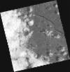
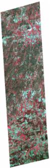
DE2_OPER_HRA_PM4_1C_20210619T110347_N41-033_W007-107_0001
Download Product | Product Info | Browse
Platform Short Name | GEOSAT |
Platform Serial Identifier | 2 |
Product Type | HRA_PM4_1C |
Start Date | 2021-06-19T11:03:47Z |
Stop Date | 2021-06-19T11:03:50Z |
Original Name | DE2_PM4_L1C_000000_20210619T110347_20210619T110350_DE2_37935_9A70.zip |
Footprint | 40.980608158 -7.00867013402 41.1102972402 -7.04351102239 41.0855016486 -7.20643641146 40.955971364 -7.17011477435 40.980608158 -7.00867013402 |
Orbit Direction | ASCENDING |
Scene Centre Longitude | W007 |
Scene Centre Latitude | N41 |
Cloud Cover Percentage | -1 |
DE2_OPER_HRA_PSH_1C_20210430T105941_N40-914_W006-897_0001
Download Product | Product Info | Browse
Platform Short Name | GEOSAT |
Platform Serial Identifier | 2 |
Product Type | HRA_PSH_1C |
Start Date | 2021-04-30T10:59:41Z |
Stop Date | 2021-04-30T10:59:44Z |
Original Name | DE2_PSH_L1C_000000_20210430T105941_20210430T105944_DE2_37193_C8A2.zip |
Footprint | 40.8646470025 -6.80476373229 40.9889768859 -6.84127086898 40.964163153 -6.98988765675 40.8398563151 -6.95366396167 40.8646470025 -6.80476373229 |
Orbit Direction | ASCENDING |
Scene Centre Longitude | W006 |
Scene Centre Latitude | N40 |
Cloud Cover Percentage | -1 |
DE2_OPER_HRA_PM4_1C_20210430T105941_N40-914_W006-897_0001
Download Product | Product Info | Browse
Platform Short Name | GEOSAT |
Platform Serial Identifier | 2 |
Product Type | HRA_PM4_1C |
Start Date | 2021-04-30T10:59:41Z |
Stop Date | 2021-04-30T10:59:44Z |
Original Name | DE2_PM4_L1C_000000_20210430T105941_20210430T105944_DE2_37193_C8A2.zip |
Footprint | 40.8646470025 -6.80476373229 40.9889768859 -6.84127086898 40.964163153 -6.98988765675 40.8398563151 -6.95366396167 40.8646470025 -6.80476373229 |
Orbit Direction | ASCENDING |
Scene Centre Longitude | W006 |
Scene Centre Latitude | N40 |
Cloud Cover Percentage | -1 |
DE2_OPER_HRA_PSH_1C_20210323T104805_N40-909_W007-102_0001
Download Product | Product Info | Browse
Platform Short Name | GEOSAT |
Platform Serial Identifier | 2 |
Product Type | HRA_PSH_1C |
Start Date | 2021-03-23T10:48:05Z |
Stop Date | 2021-03-23T10:48:07Z |
Original Name | DE2_PSH_L1C_000000_20210323T104805_20210323T104807_DE2_36629_DE01.zip |
Footprint | 40.8545474133 -7.07959160928 40.9715893046 -7.08520303163 40.9629742725 -7.1257972754 40.8486140534 -7.12007415313 40.8545474133 -7.07959160928 |
Orbit Direction | ASCENDING |
Scene Centre Longitude | W007 |
Scene Centre Latitude | N40 |
Cloud Cover Percentage | -1 |
DE2_OPER_HRA_PSH_1C_20210323T104805_N40-916_W007-063_0001
Download Product | Product Info | Browse
Platform Short Name | GEOSAT |
Platform Serial Identifier | 2 |
Product Type | HRA_PSH_1C |
Start Date | 2021-03-23T10:48:05Z |
Stop Date | 2021-03-23T10:48:07Z |
Original Name | DE2_PSH_L1C_000000_20210323T104805_20210323T104807_DE2_36629_DE02.zip |
Footprint | 40.8607476706 -7.04094492967 40.9789695231 -7.04673854297 40.9714623959 -7.08569693034 40.8545126138 -7.07953033185 40.8607476706 -7.04094492967 |
Orbit Direction | ASCENDING |
Scene Centre Longitude | W007 |
Scene Centre Latitude | N40 |
Cloud Cover Percentage | -1 |
DE2_OPER_HRA_PM4_1C_20210323T104805_N40-909_W007-102_0001
Download Product | Product Info | Browse
Platform Short Name | GEOSAT |
Platform Serial Identifier | 2 |
Product Type | HRA_PM4_1C |
Start Date | 2021-03-23T10:48:05Z |
Stop Date | 2021-03-23T10:48:07Z |
Original Name | DE2_PM4_L1C_000000_20210323T104805_20210323T104807_DE2_36629_DE01.zip |
Footprint | 40.8545474133 -7.07959160928 40.9715893046 -7.08520303163 40.9629742725 -7.1257972754 40.8486140534 -7.12007415313 40.8545474133 -7.07959160928 |
Orbit Direction | ASCENDING |
Scene Centre Longitude | W007 |
Scene Centre Latitude | N40 |
Cloud Cover Percentage | -1 |
DE2_OPER_HRA_PM4_1C_20210323T104805_N40-916_W007-063_0001
Download Product | Product Info | Browse
Platform Short Name | GEOSAT |
Platform Serial Identifier | 2 |
Product Type | HRA_PM4_1C |
Start Date | 2021-03-23T10:48:05Z |
Stop Date | 2021-03-23T10:48:07Z |
Original Name | DE2_PM4_L1C_000000_20210323T104805_20210323T104807_DE2_36629_DE02.zip |
Footprint | 40.8607476706 -7.04094492967 40.9789695231 -7.04673854297 40.9714623959 -7.08569693034 40.8545126138 -7.07953033185 40.8607476706 -7.04094492967 |
Orbit Direction | ASCENDING |
Scene Centre Longitude | W007 |
Scene Centre Latitude | N40 |
Cloud Cover Percentage | -1 |