ESA TPM Map Catalogue - Product List
back to previous node |
list of download URLs
Collection G2_Portugal_2021
GEOSAT-2 Portugal Coverage 2021 collection. More details here.
List of available products (latitude from 40.9064 to 40.9848 dg, longitude from -7.2575 to -7.11312 dg)..
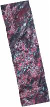
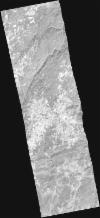
DE2_OPER_HRA_PSH_1C_20211022T110832_N40-989_W007-259_0001
Download Product | Product Info | BrowsePlatform Short Name | GEOSAT |
Platform Serial Identifier | 2 |
Product Type | HRA_PSH_1C |
Start Date | 2021-10-22T11:08:32Z |
Stop Date | 2021-10-22T11:08:35Z |
Original Name | DE2_PSH_L1C_000000_20211022T110832_20211022T110835_DE2_39790_EBE1.zip |
Footprint | 40.9296004986 -7.13660170301 41.0748610962 -7.17543560912 41.0489209115 -7.38171308713 40.9035402884 -7.34398263338 40.9296004986 -7.13660170301 |
Orbit Direction | ASCENDING |
Scene Centre Longitude | W007 |
Scene Centre Latitude | N40 |
Cloud Cover Percentage | -1 |
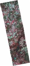
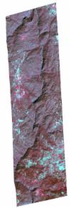
DE2_OPER_HRA_PM4_1C_20211022T110832_N40-989_W007-259_0001
Download Product | Product Info | BrowsePlatform Short Name | GEOSAT |
Platform Serial Identifier | 2 |
Product Type | HRA_PM4_1C |
Start Date | 2021-10-22T11:08:32Z |
Stop Date | 2021-10-22T11:08:35Z |
Original Name | DE2_PM4_L1C_000000_20211022T110832_20211022T110835_DE2_39790_EBE1.zip |
Footprint | 40.9296004986 -7.13660170301 41.0748610962 -7.17543560912 41.0489209115 -7.38171308713 40.9035402884 -7.34398263338 40.9296004986 -7.13660170301 |
Orbit Direction | ASCENDING |
Scene Centre Longitude | W007 |
Scene Centre Latitude | N40 |
Cloud Cover Percentage | -1 |
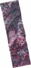
DE2_OPER_HRA_PSH_1C_20211022T110830_N40-853_W007-253_0001
Download Product | Product Info | BrowsePlatform Short Name | GEOSAT |
Platform Serial Identifier | 2 |
Product Type | HRA_PSH_1C |
Start Date | 2021-10-22T11:08:30Z |
Stop Date | 2021-10-22T11:08:33Z |
Original Name | DE2_PSH_L1C_000000_20211022T110830_20211022T110833_DE2_39790_DE02.zip |
Footprint | 40.7840407457 -7.20832528499 40.9299449193 -7.2450703497 40.9232636241 -7.2987151937 40.7773712697 -7.26166852767 40.7840407457 -7.20832528499 |
Orbit Direction | ASCENDING |
Scene Centre Longitude | W007 |
Scene Centre Latitude | N40 |
Cloud Cover Percentage | -1 |
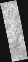
DE2_OPER_HRA_PSH_1C_20211022T110830_N40-860_W007-200_0001
Download Product | Product Info | BrowsePlatform Short Name | GEOSAT |
Platform Serial Identifier | 2 |
Product Type | HRA_PSH_1C |
Start Date | 2021-10-22T11:08:30Z |
Stop Date | 2021-10-22T11:08:33Z |
Original Name | DE2_PSH_L1C_000000_20211022T110830_20211022T110833_DE2_39790_DE03.zip |
Footprint | 40.7906458476 -7.15630670154 40.9367120852 -7.1907443915 40.9298514605 -7.24514408526 40.7839741875 -7.20882481274 40.7906458476 -7.15630670154 |
Orbit Direction | ASCENDING |
Scene Centre Longitude | W007 |
Scene Centre Latitude | N40 |
Cloud Cover Percentage | -1 |
DE2_OPER_HRA_PSH_1C_20211022T110830_N40-866_W007-149_0001
Download Product | Product Info | BrowsePlatform Short Name | GEOSAT |
Platform Serial Identifier | 2 |
Product Type | HRA_PSH_1C |
Start Date | 2021-10-22T11:08:30Z |
Stop Date | 2021-10-22T11:08:33Z |
Original Name | DE2_PSH_L1C_000000_20211022T110830_20211022T110833_DE2_39790_DE04.zip |
Footprint | 40.7970905197 -7.10500264035 40.9431869448 -7.1391509667 40.936380761 -7.19331020118 40.7902876396 -7.15925886985 40.7970905197 -7.10500264035 |
Orbit Direction | ASCENDING |
Scene Centre Longitude | W007 |
Scene Centre Latitude | N40 |
Cloud Cover Percentage | -1 |
DE2_OPER_HRA_PM4_1C_20211022T110830_N40-853_W007-253_0001
Download Product | Product Info | BrowsePlatform Short Name | GEOSAT |
Platform Serial Identifier | 2 |
Product Type | HRA_PM4_1C |
Start Date | 2021-10-22T11:08:30Z |
Stop Date | 2021-10-22T11:08:33Z |
Original Name | DE2_PM4_L1C_000000_20211022T110830_20211022T110833_DE2_39790_DE02.zip |
Footprint | 40.7840407457 -7.20832528499 40.9299449193 -7.2450703497 40.9232636241 -7.2987151937 40.7773712697 -7.26166852767 40.7840407457 -7.20832528499 |
Orbit Direction | ASCENDING |
Scene Centre Longitude | W007 |
Scene Centre Latitude | N40 |
Cloud Cover Percentage | -1 |
DE2_OPER_HRA_PM4_1C_20211022T110830_N40-860_W007-200_0001
Download Product | Product Info | BrowsePlatform Short Name | GEOSAT |
Platform Serial Identifier | 2 |
Product Type | HRA_PM4_1C |
Start Date | 2021-10-22T11:08:30Z |
Stop Date | 2021-10-22T11:08:33Z |
Original Name | DE2_PM4_L1C_000000_20211022T110830_20211022T110833_DE2_39790_DE03.zip |
Footprint | 40.7906458476 -7.15630670154 40.9367120852 -7.1907443915 40.9298514605 -7.24514408526 40.7839741875 -7.20882481274 40.7906458476 -7.15630670154 |
Orbit Direction | ASCENDING |
Scene Centre Longitude | W007 |
Scene Centre Latitude | N40 |
Cloud Cover Percentage | -1 |
DE2_OPER_HRA_PM4_1C_20211022T110830_N40-866_W007-149_0001
Download Product | Product Info | BrowsePlatform Short Name | GEOSAT |
Platform Serial Identifier | 2 |
Product Type | HRA_PM4_1C |
Start Date | 2021-10-22T11:08:30Z |
Stop Date | 2021-10-22T11:08:33Z |
Original Name | DE2_PM4_L1C_000000_20211022T110830_20211022T110833_DE2_39790_DE04.zip |
Footprint | 40.7970905197 -7.10500264035 40.9431869448 -7.1391509667 40.936380761 -7.19331020118 40.7902876396 -7.15925886985 40.7970905197 -7.10500264035 |
Orbit Direction | ASCENDING |
Scene Centre Longitude | W007 |
Scene Centre Latitude | N40 |
Cloud Cover Percentage | -1 |
DE2_OPER_HRA_PSH_1C_20210619T110347_N41-033_W007-107_0001
Download Product | Product Info | BrowsePlatform Short Name | GEOSAT |
Platform Serial Identifier | 2 |
Product Type | HRA_PSH_1C |
Start Date | 2021-06-19T11:03:47Z |
Stop Date | 2021-06-19T11:03:50Z |
Original Name | DE2_PSH_L1C_000000_20210619T110347_20210619T110350_DE2_37935_9A70.zip |
Footprint | 40.980608158 -7.00867013402 41.1102972402 -7.04351102239 41.0855016486 -7.20643641146 40.955971364 -7.17011477435 40.980608158 -7.00867013402 |
Orbit Direction | ASCENDING |
Scene Centre Longitude | W007 |
Scene Centre Latitude | N41 |
Cloud Cover Percentage | -1 |
DE2_OPER_HRA_PM4_1C_20210619T110347_N41-033_W007-107_0001
Download Product | Product Info | BrowsePlatform Short Name | GEOSAT |
Platform Serial Identifier | 2 |
Product Type | HRA_PM4_1C |
Start Date | 2021-06-19T11:03:47Z |
Stop Date | 2021-06-19T11:03:50Z |
Original Name | DE2_PM4_L1C_000000_20210619T110347_20210619T110350_DE2_37935_9A70.zip |
Footprint | 40.980608158 -7.00867013402 41.1102972402 -7.04351102239 41.0855016486 -7.20643641146 40.955971364 -7.17011477435 40.980608158 -7.00867013402 |
Orbit Direction | ASCENDING |
Scene Centre Longitude | W007 |
Scene Centre Latitude | N41 |
Cloud Cover Percentage | -1 |
DE2_OPER_HRA_PSH_1C_20210323T104805_N40-909_W007-102_0001
Download Product | Product Info | BrowsePlatform Short Name | GEOSAT |
Platform Serial Identifier | 2 |
Product Type | HRA_PSH_1C |
Start Date | 2021-03-23T10:48:05Z |
Stop Date | 2021-03-23T10:48:07Z |
Original Name | DE2_PSH_L1C_000000_20210323T104805_20210323T104807_DE2_36629_DE01.zip |
Footprint | 40.8545474133 -7.07959160928 40.9715893046 -7.08520303163 40.9629742725 -7.1257972754 40.8486140534 -7.12007415313 40.8545474133 -7.07959160928 |
Orbit Direction | ASCENDING |
Scene Centre Longitude | W007 |
Scene Centre Latitude | N40 |
Cloud Cover Percentage | -1 |
DE2_OPER_HRA_PM4_1C_20210323T104805_N40-909_W007-102_0001
Download Product | Product Info | BrowsePlatform Short Name | GEOSAT |
Platform Serial Identifier | 2 |
Product Type | HRA_PM4_1C |
Start Date | 2021-03-23T10:48:05Z |
Stop Date | 2021-03-23T10:48:07Z |
Original Name | DE2_PM4_L1C_000000_20210323T104805_20210323T104807_DE2_36629_DE01.zip |
Footprint | 40.8545474133 -7.07959160928 40.9715893046 -7.08520303163 40.9629742725 -7.1257972754 40.8486140534 -7.12007415313 40.8545474133 -7.07959160928 |
Orbit Direction | ASCENDING |
Scene Centre Longitude | W007 |
Scene Centre Latitude | N40 |
Cloud Cover Percentage | -1 |


