ESA TPM Map Catalogue - Product List
back to previous node |
list of download URLs

Collection G2_Portugal_2021
GEOSAT-2 Portugal Coverage 2021 collection. More details here.
List of available products (latitude from 40.9064 to 40.9848 dg, longitude from -7.90062 to -7.75625 dg)..
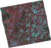
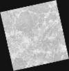
DE2_OPER_HRA_PSH_1C_20210727T111347_N40-858_W007-974_0001
Download Product | Product Info | Browse
Platform Short Name | GEOSAT |
Platform Serial Identifier | 2 |
Product Type | HRA_PSH_1C |
Start Date | 2021-07-27T11:13:47Z |
Stop Date | 2021-07-27T11:13:50Z |
Original Name | DE2_PSH_L1C_000000_20210727T111347_20210727T111350_DE2_38499_586E.zip |
Footprint | 40.7996749053 -7.85829748452 40.9427718356 -7.89384590405 40.9163688104 -8.09269284329 40.7742549025 -8.05442266103 40.7996749053 -7.85829748452 |
Orbit Direction | ASCENDING |
Scene Centre Longitude | W007 |
Scene Centre Latitude | N40 |
Cloud Cover Percentage | -1 |
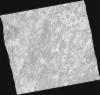
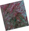
DE2_OPER_HRA_PM4_1C_20210727T111347_N40-858_W007-974_0001
Download Product | Product Info | Browse
Platform Short Name | GEOSAT |
Platform Serial Identifier | 2 |
Product Type | HRA_PM4_1C |
Start Date | 2021-07-27T11:13:47Z |
Stop Date | 2021-07-27T11:13:50Z |
Original Name | DE2_PM4_L1C_000000_20210727T111347_20210727T111350_DE2_38499_586E.zip |
Footprint | 40.7996749053 -7.85829748452 40.9427718356 -7.89384590405 40.9163688104 -8.09269284329 40.7742549025 -8.05442266103 40.7996749053 -7.85829748452 |
Orbit Direction | ASCENDING |
Scene Centre Longitude | W007 |
Scene Centre Latitude | N40 |
Cloud Cover Percentage | -1 |
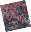
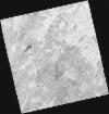
DE2_OPER_HRA_PSH_1C_20210714T110523_N41-010_W007-700_0001
Download Product | Product Info | Browse
Platform Short Name | GEOSAT |
Platform Serial Identifier | 2 |
Product Type | HRA_PSH_1C |
Start Date | 2021-07-14T11:05:23Z |
Stop Date | 2021-07-14T11:05:26Z |
Original Name | DE2_PSH_L1C_000000_20210714T110523_20210714T110526_DE2_38306_7ED3.zip |
Footprint | 40.9585590401 -7.60251945443 41.0876031328 -7.63693417857 41.0629267109 -7.79865595703 40.9338476387 -7.76418722737 40.9585590401 -7.60251945443 |
Orbit Direction | ASCENDING |
Scene Centre Longitude | W007 |
Scene Centre Latitude | N41 |
Cloud Cover Percentage | -1 |
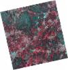
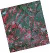
DE2_OPER_HRA_PM4_1C_20210714T110523_N41-010_W007-700_0001
Download Product | Product Info | Browse
Platform Short Name | GEOSAT |
Platform Serial Identifier | 2 |
Product Type | HRA_PM4_1C |
Start Date | 2021-07-14T11:05:23Z |
Stop Date | 2021-07-14T11:05:26Z |
Original Name | DE2_PM4_L1C_000000_20210714T110523_20210714T110526_DE2_38306_7ED3.zip |
Footprint | 40.9585590401 -7.60251945443 41.0876031328 -7.63693417857 41.0629267109 -7.79865595703 40.9338476387 -7.76418722737 40.9585590401 -7.60251945443 |
Orbit Direction | ASCENDING |
Scene Centre Longitude | W007 |
Scene Centre Latitude | N41 |
Cloud Cover Percentage | -1 |
DE2_OPER_HRA_PSH_1C_20210714T110522_N40-893_W007-668_0001
Download Product | Product Info | Browse
Platform Short Name | GEOSAT |
Platform Serial Identifier | 2 |
Product Type | HRA_PSH_1C |
Start Date | 2021-07-14T11:05:22Z |
Stop Date | 2021-07-14T11:05:24Z |
Original Name | DE2_PSH_L1C_000000_20210714T110522_20210714T110524_DE2_38306_FCC0.zip |
Footprint | 40.8415324963 -7.5706239893 40.9705766238 -7.60520731032 40.9457749678 -7.76761804956 40.8169293106 -7.7314462467 40.8415324963 -7.5706239893 |
Orbit Direction | ASCENDING |
Scene Centre Longitude | W007 |
Scene Centre Latitude | N40 |
Cloud Cover Percentage | -1 |
DE2_OPER_HRA_PM4_1C_20210714T110522_N40-893_W007-668_0001
Download Product | Product Info | Browse
Platform Short Name | GEOSAT |
Platform Serial Identifier | 2 |
Product Type | HRA_PM4_1C |
Start Date | 2021-07-14T11:05:22Z |
Stop Date | 2021-07-14T11:05:24Z |
Original Name | DE2_PM4_L1C_000000_20210714T110522_20210714T110524_DE2_38306_FCC0.zip |
Footprint | 40.8415324963 -7.5706239893 40.9705766238 -7.60520731032 40.9457749678 -7.76761804956 40.8169293106 -7.7314462467 40.8415324963 -7.5706239893 |
Orbit Direction | ASCENDING |
Scene Centre Longitude | W007 |
Scene Centre Latitude | N40 |
Cloud Cover Percentage | -1 |
DE2_OPER_HRA_PSH_1C_20210519T110517_N41-020_W007-849_0001
Download Product | Product Info | Browse
Platform Short Name | GEOSAT |
Platform Serial Identifier | 2 |
Product Type | HRA_PSH_1C |
Start Date | 2021-05-19T11:05:17Z |
Stop Date | 2021-05-19T11:05:19Z |
Original Name | DE2_PSH_L1C_000000_20210519T110517_20210519T110519_DE2_37475_D6E7.zip |
Footprint | 40.9694278791 -7.75505580672 41.095699111 -7.78958400501 41.070945308 -7.94412042231 40.9448055222 -7.90874534319 40.9694278791 -7.75505580672 |
Orbit Direction | ASCENDING |
Scene Centre Longitude | W007 |
Scene Centre Latitude | N41 |
Cloud Cover Percentage | -1 |
DE2_OPER_HRA_PM4_1C_20210519T110517_N41-020_W007-849_0001
Download Product | Product Info | Browse
Platform Short Name | GEOSAT |
Platform Serial Identifier | 2 |
Product Type | HRA_PM4_1C |
Start Date | 2021-05-19T11:05:17Z |
Stop Date | 2021-05-19T11:05:19Z |
Original Name | DE2_PM4_L1C_000000_20210519T110517_20210519T110519_DE2_37475_D6E7.zip |
Footprint | 40.9694412921 -7.7550466412 41.0956869152 -7.78970925515 41.0709383894 -7.94410267869 40.9448124458 -7.90876304948 40.9694412921 -7.7550466412 |
Orbit Direction | ASCENDING |
Scene Centre Longitude | W007 |
Scene Centre Latitude | N41 |
Cloud Cover Percentage | -1 |
DE2_OPER_HRA_PSH_1C_20210519T110515_N40-905_W007-817_0001
Download Product | Product Info | Browse
Platform Short Name | GEOSAT |
Platform Serial Identifier | 2 |
Product Type | HRA_PSH_1C |
Start Date | 2021-05-19T11:05:15Z |
Stop Date | 2021-05-19T11:05:18Z |
Original Name | DE2_PSH_L1C_000000_20210519T110515_20210519T110518_DE2_37475_69AE.zip |
Footprint | 40.8550977356 -7.72254108337 40.9811148707 -7.75810782956 40.9564304692 -7.91208293791 40.8305632269 -7.87538836251 40.8550977356 -7.72254108337 |
Orbit Direction | ASCENDING |
Scene Centre Longitude | W007 |
Scene Centre Latitude | N40 |
Cloud Cover Percentage | -1 |
DE2_OPER_HRA_PM4_1C_20210519T110515_N40-905_W007-817_0001
Download Product | Product Info | Browse
Platform Short Name | GEOSAT |
Platform Serial Identifier | 2 |
Product Type | HRA_PM4_1C |
Start Date | 2021-05-19T11:05:15Z |
Stop Date | 2021-05-19T11:05:18Z |
Original Name | DE2_PM4_L1C_000000_20210519T110515_20210519T110518_DE2_37475_69AE.zip |
Footprint | 40.8550977356 -7.72254108337 40.9811148707 -7.75810782956 40.9564304692 -7.91208293791 40.8305632269 -7.87538836251 40.8550977356 -7.72254108337 |
Orbit Direction | ASCENDING |
Scene Centre Longitude | W007 |
Scene Centre Latitude | N40 |
Cloud Cover Percentage | -1 |