ESA TPM Map Catalogue - Product List
back to previous node |
list of download URLs
Collection G2_Portugal_2021
GEOSAT-2 Portugal Coverage 2021 collection. More details here.
List of available products (latitude from 40.8707 to 40.9492 dg, longitude from -8.18938 to -8.045 dg)..
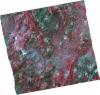
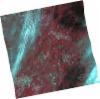
DE2_OPER_HRA_PSH_1C_20210727T111349_N40-986_W008-006_0001
Download Product | Product Info | Browse
Platform Short Name | GEOSAT |
Platform Serial Identifier | 2 |
Product Type | HRA_PSH_1C |
Start Date | 2021-07-27T11:13:49Z |
Stop Date | 2021-07-27T11:13:52Z |
Original Name | DE2_PSH_L1C_000000_20210727T111349_20210727T111352_DE2_38499_52DF.zip |
Footprint | 40.929585362 -7.88977217382 41.0726548853 -7.9251580754 41.04120093 -8.12501363715 40.9040161442 -8.08725171963 40.929585362 -7.88977217382 |
Orbit Direction | ASCENDING |
Scene Centre Longitude | W008 |
Scene Centre Latitude | N40 |
Cloud Cover Percentage | -1 |
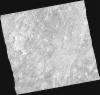
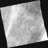
DE2_OPER_HRA_PM4_1C_20210727T111349_N40-986_W008-006_0001
Download Product | Product Info | Browse
Platform Short Name | GEOSAT |
Platform Serial Identifier | 2 |
Product Type | HRA_PM4_1C |
Start Date | 2021-07-27T11:13:49Z |
Stop Date | 2021-07-27T11:13:52Z |
Original Name | DE2_PM4_L1C_000000_20210727T111349_20210727T111352_DE2_38499_52DF.zip |
Footprint | 40.929585362 -7.88977217382 41.0726548853 -7.9251580754 41.04120093 -8.12501363715 40.9040161442 -8.08725171963 40.929585362 -7.88977217382 |
Orbit Direction | ASCENDING |
Scene Centre Longitude | W008 |
Scene Centre Latitude | N40 |
Cloud Cover Percentage | -1 |
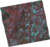
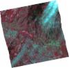
DE2_OPER_HRA_PSH_1C_20210727T111347_N40-858_W007-974_0001
Download Product | Product Info | Browse
Platform Short Name | GEOSAT |
Platform Serial Identifier | 2 |
Product Type | HRA_PSH_1C |
Start Date | 2021-07-27T11:13:47Z |
Stop Date | 2021-07-27T11:13:50Z |
Original Name | DE2_PSH_L1C_000000_20210727T111347_20210727T111350_DE2_38499_586E.zip |
Footprint | 40.7996749053 -7.85829748452 40.9427718356 -7.89384590405 40.9163688104 -8.09269284329 40.7742549025 -8.05442266103 40.7996749053 -7.85829748452 |
Orbit Direction | ASCENDING |
Scene Centre Longitude | W007 |
Scene Centre Latitude | N40 |
Cloud Cover Percentage | -1 |
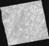
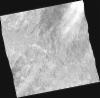
DE2_OPER_HRA_PM4_1C_20210727T111347_N40-858_W007-974_0001
Download Product | Product Info | Browse
Platform Short Name | GEOSAT |
Platform Serial Identifier | 2 |
Product Type | HRA_PM4_1C |
Start Date | 2021-07-27T11:13:47Z |
Stop Date | 2021-07-27T11:13:50Z |
Original Name | DE2_PM4_L1C_000000_20210727T111347_20210727T111350_DE2_38499_586E.zip |
Footprint | 40.7996749053 -7.85829748452 40.9427718356 -7.89384590405 40.9163688104 -8.09269284329 40.7742549025 -8.05442266103 40.7996749053 -7.85829748452 |
Orbit Direction | ASCENDING |
Scene Centre Longitude | W007 |
Scene Centre Latitude | N40 |
Cloud Cover Percentage | -1 |
DE2_OPER_HRA_PSH_1C_20210702T111222_N40-980_W008-197_0001
Download Product | Product Info | Browse
Platform Short Name | GEOSAT |
Platform Serial Identifier | 2 |
Product Type | HRA_PSH_1C |
Start Date | 2021-07-02T11:12:22Z |
Stop Date | 2021-07-02T11:12:25Z |
Original Name | DE2_PSH_L1C_000000_20210702T111222_20210702T111225_DE2_38128_6141.zip |
Footprint | 40.9246857067 -8.08841929548 41.0612401949 -8.1242482361 41.036248333 -8.30441385303 40.8987823128 -8.27178892065 40.9246857067 -8.08841929548 |
Orbit Direction | ASCENDING |
Scene Centre Longitude | W008 |
Scene Centre Latitude | N40 |
Cloud Cover Percentage | -1 |
DE2_OPER_HRA_PM4_1C_20210702T111222_N40-980_W008-197_0001
Download Product | Product Info | Browse
Platform Short Name | GEOSAT |
Platform Serial Identifier | 2 |
Product Type | HRA_PM4_1C |
Start Date | 2021-07-02T11:12:22Z |
Stop Date | 2021-07-02T11:12:25Z |
Original Name | DE2_PM4_L1C_000000_20210702T111222_20210702T111225_DE2_38128_6141.zip |
Footprint | 40.9246857067 -8.08841929548 41.0612401949 -8.1242482361 41.036248333 -8.30441385303 40.8987823128 -8.27178892065 40.9246857067 -8.08841929548 |
Orbit Direction | ASCENDING |
Scene Centre Longitude | W008 |
Scene Centre Latitude | N40 |
Cloud Cover Percentage | -1 |
DE2_OPER_HRA_PSH_1C_20210702T111220_N40-855_W008-164_0001
Download Product | Product Info | Browse
Platform Short Name | GEOSAT |
Platform Serial Identifier | 2 |
Product Type | HRA_PSH_1C |
Start Date | 2021-07-02T11:12:20Z |
Stop Date | 2021-07-02T11:12:23Z |
Original Name | DE2_PSH_L1C_000000_20210702T111220_20210702T111223_DE2_38128_A3D0.zip |
Footprint | 40.7997417184 -8.05550135529 40.9369312656 -8.09142261971 40.9107990664 -8.27352728412 40.7743778053 -8.23815917588 40.7997417184 -8.05550135529 |
Orbit Direction | ASCENDING |
Scene Centre Longitude | W008 |
Scene Centre Latitude | N40 |
Cloud Cover Percentage | -1 |
DE2_OPER_HRA_PM4_1C_20210702T111220_N40-855_W008-164_0001
Download Product | Product Info | Browse
Platform Short Name | GEOSAT |
Platform Serial Identifier | 2 |
Product Type | HRA_PM4_1C |
Start Date | 2021-07-02T11:12:20Z |
Stop Date | 2021-07-02T11:12:23Z |
Original Name | DE2_PM4_L1C_000000_20210702T111220_20210702T111223_DE2_38128_A3D0.zip |
Footprint | 40.7997417184 -8.05550135529 40.9369312656 -8.09142261971 40.9107990664 -8.27352728412 40.7743778053 -8.23815917588 40.7997417184 -8.05550135529 |
Orbit Direction | ASCENDING |
Scene Centre Longitude | W008 |
Scene Centre Latitude | N40 |
Cloud Cover Percentage | -1 |