ESA TPM Map Catalogue - Product List
back to previous node |
list of download URLs
Collection G2_Portugal_2021
GEOSAT-2 Portugal Coverage 2021 collection. More details here.
List of available products (latitude from 40.7923 to 40.8707 dg, longitude from -7.11312 to -6.96875 dg)..
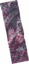
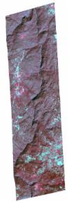
DE2_OPER_HRA_PSH_1C_20211022T110830_N40-866_W007-149_0001
Download Product | Product Info | BrowsePlatform Short Name | GEOSAT |
Platform Serial Identifier | 2 |
Product Type | HRA_PSH_1C |
Start Date | 2021-10-22T11:08:30Z |
Stop Date | 2021-10-22T11:08:33Z |
Original Name | DE2_PSH_L1C_000000_20211022T110830_20211022T110833_DE2_39790_DE04.zip |
Footprint | 40.7970905197 -7.10500264035 40.9431869448 -7.1391509667 40.936380761 -7.19331020118 40.7902876396 -7.15925886985 40.7970905197 -7.10500264035 |
Orbit Direction | ASCENDING |
Scene Centre Longitude | W007 |
Scene Centre Latitude | N40 |
Cloud Cover Percentage | -1 |
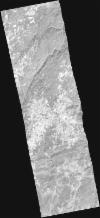
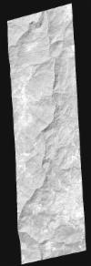
DE2_OPER_HRA_PM4_1C_20211022T110830_N40-866_W007-149_0001
Download Product | Product Info | BrowsePlatform Short Name | GEOSAT |
Platform Serial Identifier | 2 |
Product Type | HRA_PM4_1C |
Start Date | 2021-10-22T11:08:30Z |
Stop Date | 2021-10-22T11:08:33Z |
Original Name | DE2_PM4_L1C_000000_20211022T110830_20211022T110833_DE2_39790_DE04.zip |
Footprint | 40.7970905197 -7.10500264035 40.9431869448 -7.1391509667 40.936380761 -7.19331020118 40.7902876396 -7.15925886985 40.7970905197 -7.10500264035 |
Orbit Direction | ASCENDING |
Scene Centre Longitude | W007 |
Scene Centre Latitude | N40 |
Cloud Cover Percentage | -1 |
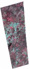
DE2_OPER_HRA_PSH_1C_20210927T110817_N40-757_W006-984_0001
Download Product | Product Info | BrowsePlatform Short Name | GEOSAT |
Platform Serial Identifier | 2 |
Product Type | HRA_PSH_1C |
Start Date | 2021-09-27T11:08:17Z |
Stop Date | 2021-09-27T11:08:20Z |
Original Name | DE2_PSH_L1C_000000_20210927T110817_20210927T110820_DE2_39419_5A4A.zip |
Footprint | 40.6980588454 -6.8663876716 40.842946647 -6.89972226749 40.8171335625 -7.10244027184 40.6721535177 -7.06956543863 40.6980588454 -6.8663876716 |
Orbit Direction | ASCENDING |
Scene Centre Longitude | W006 |
Scene Centre Latitude | N40 |
Cloud Cover Percentage | -1 |
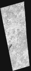
DE2_OPER_HRA_PM4_1C_20210927T110817_N40-757_W006-984_0001
Download Product | Product Info | BrowsePlatform Short Name | GEOSAT |
Platform Serial Identifier | 2 |
Product Type | HRA_PM4_1C |
Start Date | 2021-09-27T11:08:17Z |
Stop Date | 2021-09-27T11:08:20Z |
Original Name | DE2_PM4_L1C_000000_20210927T110817_20210927T110820_DE2_39419_5A4A.zip |
Footprint | 40.6980588454 -6.8663876716 40.842946647 -6.89972226749 40.8171335625 -7.10244027184 40.6721535177 -7.06956543863 40.6980588454 -6.8663876716 |
Orbit Direction | ASCENDING |
Scene Centre Longitude | W006 |
Scene Centre Latitude | N40 |
Cloud Cover Percentage | -1 |
DE2_OPER_HRA_PSH_1C_20210625T110018_N40-875_W006-948_0001
Download Product | Product Info | BrowsePlatform Short Name | GEOSAT |
Platform Serial Identifier | 2 |
Product Type | HRA_PSH_1C |
Start Date | 2021-06-25T11:00:18Z |
Stop Date | 2021-06-25T11:00:20Z |
Original Name | DE2_PSH_L1C_000000_20210625T110018_20210625T110020_DE2_38024_FC7A.zip |
Footprint | 40.8248131543 -6.85415580484 40.9509873866 -6.88924385184 40.9262849105 -7.04252833665 40.8002293903 -7.00664947423 40.8248131543 -6.85415580484 |
Orbit Direction | ASCENDING |
Scene Centre Longitude | W006 |
Scene Centre Latitude | N40 |
Cloud Cover Percentage | -1 |
DE2_OPER_HRA_PM4_1C_20210625T110018_N40-875_W006-948_0001
Download Product | Product Info | BrowsePlatform Short Name | GEOSAT |
Platform Serial Identifier | 2 |
Product Type | HRA_PM4_1C |
Start Date | 2021-06-25T11:00:18Z |
Stop Date | 2021-06-25T11:00:20Z |
Original Name | DE2_PM4_L1C_000000_20210625T110018_20210625T110020_DE2_38024_FC7A.zip |
Footprint | 40.8248131543 -6.85415580484 40.9509873866 -6.88924385184 40.9262849105 -7.04252833665 40.8002293903 -7.00664947423 40.8248131543 -6.85415580484 |
Orbit Direction | ASCENDING |
Scene Centre Longitude | W006 |
Scene Centre Latitude | N40 |
Cloud Cover Percentage | -1 |
DE2_OPER_HRA_PSH_1C_20210625T110016_N40-761_W006-916_0001
Download Product | Product Info | BrowsePlatform Short Name | GEOSAT |
Platform Serial Identifier | 2 |
Product Type | HRA_PSH_1C |
Start Date | 2021-06-25T11:00:16Z |
Stop Date | 2021-06-25T11:00:18Z |
Original Name | DE2_PSH_L1C_000000_20210625T110016_20210625T110018_DE2_38024_8E5B.zip |
Footprint | 40.7104479545 -6.82221418611 40.8364891307 -6.85754173621 40.8118817349 -7.01008854072 40.6857968044 -6.97473309479 40.7104479545 -6.82221418611 |
Orbit Direction | ASCENDING |
Scene Centre Longitude | W006 |
Scene Centre Latitude | N40 |
Cloud Cover Percentage | -1 |
DE2_OPER_HRA_PM4_1C_20210625T110016_N40-761_W006-916_0001
Download Product | Product Info | BrowsePlatform Short Name | GEOSAT |
Platform Serial Identifier | 2 |
Product Type | HRA_PM4_1C |
Start Date | 2021-06-25T11:00:16Z |
Stop Date | 2021-06-25T11:00:18Z |
Original Name | DE2_PM4_L1C_000000_20210625T110016_20210625T110018_DE2_38024_8E5B.zip |
Footprint | 40.7104479545 -6.82221418611 40.8364891307 -6.85754173621 40.8118817349 -7.01008854072 40.6857968044 -6.97473309479 40.7104479545 -6.82221418611 |
Orbit Direction | ASCENDING |
Scene Centre Longitude | W006 |
Scene Centre Latitude | N40 |
Cloud Cover Percentage | -1 |
DE2_OPER_HRA_PSH_1C_20210619T110343_N40-797_W007-043_0001
Download Product | Product Info | BrowsePlatform Short Name | GEOSAT |
Platform Serial Identifier | 2 |
Product Type | HRA_PSH_1C |
Start Date | 2021-06-19T11:03:43Z |
Stop Date | 2021-06-19T11:03:46Z |
Original Name | DE2_PSH_L1C_000000_20210619T110343_20210619T110346_DE2_37935_51A2.zip |
Footprint | 40.7453402661 -6.94439548885 40.8748173467 -6.98088098536 40.8502611432 -7.14124691494 40.7206273884 -7.1058415993 40.7453402661 -6.94439548885 |
Orbit Direction | ASCENDING |
Scene Centre Longitude | W007 |
Scene Centre Latitude | N40 |
Cloud Cover Percentage | -1 |
DE2_OPER_HRA_PM4_1C_20210619T110343_N40-797_W007-043_0001
Download Product | Product Info | BrowsePlatform Short Name | GEOSAT |
Platform Serial Identifier | 2 |
Product Type | HRA_PM4_1C |
Start Date | 2021-06-19T11:03:43Z |
Stop Date | 2021-06-19T11:03:46Z |
Original Name | DE2_PM4_L1C_000000_20210619T110343_20210619T110346_DE2_37935_51A2.zip |
Footprint | 40.7453402661 -6.94439548885 40.8748173467 -6.98088098536 40.8502611432 -7.14124691494 40.7206273884 -7.1058415993 40.7453402661 -6.94439548885 |
Orbit Direction | ASCENDING |
Scene Centre Longitude | W007 |
Scene Centre Latitude | N40 |
Cloud Cover Percentage | -1 |
DE2_OPER_HRA_PSH_1C_20210323T104805_N40-909_W007-102_0001
Download Product | Product Info | BrowsePlatform Short Name | GEOSAT |
Platform Serial Identifier | 2 |
Product Type | HRA_PSH_1C |
Start Date | 2021-03-23T10:48:05Z |
Stop Date | 2021-03-23T10:48:07Z |
Original Name | DE2_PSH_L1C_000000_20210323T104805_20210323T104807_DE2_36629_DE01.zip |
Footprint | 40.8545474133 -7.07959160928 40.9715893046 -7.08520303163 40.9629742725 -7.1257972754 40.8486140534 -7.12007415313 40.8545474133 -7.07959160928 |
Orbit Direction | ASCENDING |
Scene Centre Longitude | W007 |
Scene Centre Latitude | N40 |
Cloud Cover Percentage | -1 |
DE2_OPER_HRA_PSH_1C_20210323T104805_N40-916_W007-063_0001
Download Product | Product Info | BrowsePlatform Short Name | GEOSAT |
Platform Serial Identifier | 2 |
Product Type | HRA_PSH_1C |
Start Date | 2021-03-23T10:48:05Z |
Stop Date | 2021-03-23T10:48:07Z |
Original Name | DE2_PSH_L1C_000000_20210323T104805_20210323T104807_DE2_36629_DE02.zip |
Footprint | 40.8607476706 -7.04094492967 40.9789695231 -7.04673854297 40.9714623959 -7.08569693034 40.8545126138 -7.07953033185 40.8607476706 -7.04094492967 |
Orbit Direction | ASCENDING |
Scene Centre Longitude | W007 |
Scene Centre Latitude | N40 |
Cloud Cover Percentage | -1 |
DE2_OPER_HRA_PM4_1C_20210323T104805_N40-909_W007-102_0001
Download Product | Product Info | BrowsePlatform Short Name | GEOSAT |
Platform Serial Identifier | 2 |
Product Type | HRA_PM4_1C |
Start Date | 2021-03-23T10:48:05Z |
Stop Date | 2021-03-23T10:48:07Z |
Original Name | DE2_PM4_L1C_000000_20210323T104805_20210323T104807_DE2_36629_DE01.zip |
Footprint | 40.8545474133 -7.07959160928 40.9715893046 -7.08520303163 40.9629742725 -7.1257972754 40.8486140534 -7.12007415313 40.8545474133 -7.07959160928 |
Orbit Direction | ASCENDING |
Scene Centre Longitude | W007 |
Scene Centre Latitude | N40 |
Cloud Cover Percentage | -1 |
DE2_OPER_HRA_PM4_1C_20210323T104805_N40-916_W007-063_0001
Download Product | Product Info | BrowsePlatform Short Name | GEOSAT |
Platform Serial Identifier | 2 |
Product Type | HRA_PM4_1C |
Start Date | 2021-03-23T10:48:05Z |
Stop Date | 2021-03-23T10:48:07Z |
Original Name | DE2_PM4_L1C_000000_20210323T104805_20210323T104807_DE2_36629_DE02.zip |
Footprint | 40.8607476706 -7.04094492967 40.9789695231 -7.04673854297 40.9714623959 -7.08569693034 40.8545126138 -7.07953033185 40.8607476706 -7.04094492967 |
Orbit Direction | ASCENDING |
Scene Centre Longitude | W007 |
Scene Centre Latitude | N40 |
Cloud Cover Percentage | -1 |
DE2_OPER_HRA_PSH_1C_20210323T104803_N40-745_W007-066_0001
Download Product | Product Info | BrowsePlatform Short Name | GEOSAT |
Platform Serial Identifier | 2 |
Product Type | HRA_PSH_1C |
Start Date | 2021-03-23T10:48:03Z |
Stop Date | 2021-03-23T10:48:05Z |
Original Name | DE2_PSH_L1C_000000_20210323T104803_20210323T104805_DE2_36629_0BAC.zip |
Footprint | 40.6761128475 -7.02841916714 40.8282081954 -7.04112946869 40.8138879204 -7.11545301801 40.6654344498 -7.08109807192 40.6761128475 -7.02841916714 |
Orbit Direction | ASCENDING |
Scene Centre Longitude | W007 |
Scene Centre Latitude | N40 |
Cloud Cover Percentage | -1 |
DE2_OPER_HRA_PM4_1C_20210323T104803_N40-745_W007-066_0001
Download Product | Product Info | BrowsePlatform Short Name | GEOSAT |
Platform Serial Identifier | 2 |
Product Type | HRA_PM4_1C |
Start Date | 2021-03-23T10:48:03Z |
Stop Date | 2021-03-23T10:48:05Z |
Original Name | DE2_PM4_L1C_000000_20210323T104803_20210323T104805_DE2_36629_0BAC.zip |
Footprint | 40.6761128475 -7.02841916714 40.8282081954 -7.04112946869 40.8138879204 -7.11545301801 40.6654344498 -7.08109807192 40.6761128475 -7.02841916714 |
Orbit Direction | ASCENDING |
Scene Centre Longitude | W007 |
Scene Centre Latitude | N40 |
Cloud Cover Percentage | -1 |
