ESA TPM Map Catalogue - Product List
back to previous node |
list of download URLs

Collection G2_Portugal_2021
GEOSAT-2 Portugal Coverage 2021 collection. More details here.
List of available products (latitude from 40.7923 to 40.8707 dg, longitude from -7.4675 to -7.32313 dg)..
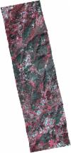
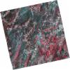
DE2_OPER_HRA_PSH_1C_20211022T110830_N40-847_W007-303_0001
Download Product | Product Info | Browse
Platform Short Name | GEOSAT |
Platform Serial Identifier | 2 |
Product Type | HRA_PSH_1C |
Start Date | 2021-10-22T11:08:30Z |
Stop Date | 2021-10-22T11:08:33Z |
Original Name | DE2_PSH_L1C_000000_20211022T110830_20211022T110833_DE2_39790_DE01.zip |
Footprint | 40.7778638367 -7.25849176611 40.9237137426 -7.29579997717 40.9171253411 -7.348150054 40.7711478388 -7.31209300409 40.7778638367 -7.25849176611 |
Orbit Direction | ASCENDING |
Scene Centre Longitude | W007 |
Scene Centre Latitude | N40 |
Cloud Cover Percentage | -1 |
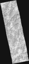
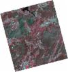
DE2_OPER_HRA_PM4_1C_20211022T110830_N40-847_W007-303_0001
Download Product | Product Info | Browse
Platform Short Name | GEOSAT |
Platform Serial Identifier | 2 |
Product Type | HRA_PM4_1C |
Start Date | 2021-10-22T11:08:30Z |
Stop Date | 2021-10-22T11:08:33Z |
Original Name | DE2_PM4_L1C_000000_20211022T110830_20211022T110833_DE2_39790_DE01.zip |
Footprint | 40.7778638367 -7.25849176611 40.9237137426 -7.29579997717 40.9171253411 -7.348150054 40.7711478388 -7.31209300409 40.7778638367 -7.25849176611 |
Orbit Direction | ASCENDING |
Scene Centre Longitude | W007 |
Scene Centre Latitude | N40 |
Cloud Cover Percentage | -1 |
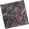
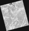
DE2_OPER_HRA_PSH_1C_20210808T110639_N40-904_W007-399_0001
Download Product | Product Info | Browse
Platform Short Name | GEOSAT |
Platform Serial Identifier | 2 |
Product Type | HRA_PSH_1C |
Start Date | 2021-08-08T11:06:39Z |
Stop Date | 2021-08-08T11:06:42Z |
Original Name | DE2_PSH_L1C_000000_20210808T110639_20210808T110642_DE2_38677_5D22.zip |
Footprint | 40.8502483279 -7.29429440191 40.9845084899 -7.32943247684 40.9595223476 -7.50431632248 40.8253310061 -7.46846958619 40.8502483279 -7.29429440191 |
Orbit Direction | ASCENDING |
Scene Centre Longitude | W007 |
Scene Centre Latitude | N40 |
Cloud Cover Percentage | -1 |
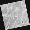
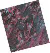
DE2_OPER_HRA_PM4_1C_20210808T110639_N40-904_W007-399_0001
Download Product | Product Info | Browse
Platform Short Name | GEOSAT |
Platform Serial Identifier | 2 |
Product Type | HRA_PM4_1C |
Start Date | 2021-08-08T11:06:39Z |
Stop Date | 2021-08-08T11:06:42Z |
Original Name | DE2_PM4_L1C_000000_20210808T110639_20210808T110642_DE2_38677_5D22.zip |
Footprint | 40.8502483279 -7.29429440191 40.9845084899 -7.32943247684 40.9595223476 -7.50431632248 40.8253310061 -7.46846958619 40.8502483279 -7.29429440191 |
Orbit Direction | ASCENDING |
Scene Centre Longitude | W007 |
Scene Centre Latitude | N40 |
Cloud Cover Percentage | -1 |
DE2_OPER_HRA_PSH_1C_20210808T110637_N40-783_W007-367_0001
Download Product | Product Info | Browse
Platform Short Name | GEOSAT |
Platform Serial Identifier | 2 |
Product Type | HRA_PSH_1C |
Start Date | 2021-08-08T11:06:37Z |
Stop Date | 2021-08-08T11:06:40Z |
Original Name | DE2_PSH_L1C_000000_20210808T110637_20210808T110640_DE2_38677_2D66.zip |
Footprint | 40.7284394017 -7.26224126176 40.8626278151 -7.29813247733 40.8377349529 -7.47202695405 40.7035497296 -7.43602785821 40.7284394017 -7.26224126176 |
Orbit Direction | ASCENDING |
Scene Centre Longitude | W007 |
Scene Centre Latitude | N40 |
Cloud Cover Percentage | -1 |
DE2_OPER_HRA_PM4_1C_20210808T110637_N40-783_W007-367_0001
Download Product | Product Info | Browse
Platform Short Name | GEOSAT |
Platform Serial Identifier | 2 |
Product Type | HRA_PM4_1C |
Start Date | 2021-08-08T11:06:37Z |
Stop Date | 2021-08-08T11:06:40Z |
Original Name | DE2_PM4_L1C_000000_20210808T110637_20210808T110640_DE2_38677_2D66.zip |
Footprint | 40.7284394017 -7.26224126176 40.8626278151 -7.29813247733 40.8377349529 -7.47202695405 40.7035497296 -7.43602785821 40.7284394017 -7.26224126176 |
Orbit Direction | ASCENDING |
Scene Centre Longitude | W007 |
Scene Centre Latitude | N40 |
Cloud Cover Percentage | -1 |
DE2_OPER_HRA_PSH_1C_20210506T105624_N40-875_W007-516_0001
Download Product | Product Info | Browse
Platform Short Name | GEOSAT |
Platform Serial Identifier | 2 |
Product Type | HRA_PSH_1C |
Start Date | 2021-05-06T10:56:24Z |
Stop Date | 2021-05-06T10:56:27Z |
Original Name | DE2_PSH_L1C_000000_20210506T105624_20210506T105627_DE2_37282_5293.zip |
Footprint | 40.8275832322 -7.42500529843 40.9503175854 -7.46349052003 40.9241531431 -7.60884724017 40.8013957559 -7.57016971053 40.8275832322 -7.42500529843 |
Orbit Direction | ASCENDING |
Scene Centre Longitude | W007 |
Scene Centre Latitude | N40 |
Cloud Cover Percentage | -1 |
DE2_OPER_HRA_PM4_1C_20210506T105624_N40-875_W007-516_0001
Download Product | Product Info | Browse
Platform Short Name | GEOSAT |
Platform Serial Identifier | 2 |
Product Type | HRA_PM4_1C |
Start Date | 2021-05-06T10:56:24Z |
Stop Date | 2021-05-06T10:56:27Z |
Original Name | DE2_PM4_L1C_000000_20210506T105624_20210506T105627_DE2_37282_5293.zip |
Footprint | 40.8275832322 -7.42500529843 40.9503175854 -7.46349052003 40.9241531431 -7.60884724017 40.8013957559 -7.57016971053 40.8275832322 -7.42500529843 |
Orbit Direction | ASCENDING |
Scene Centre Longitude | W007 |
Scene Centre Latitude | N40 |
Cloud Cover Percentage | -1 |
DE2_OPER_HRA_PSH_1C_20210506T105622_N40-764_W007-481_0001
Download Product | Product Info | Browse
Platform Short Name | GEOSAT |
Platform Serial Identifier | 2 |
Product Type | HRA_PSH_1C |
Start Date | 2021-05-06T10:56:22Z |
Stop Date | 2021-05-06T10:56:25Z |
Original Name | DE2_PSH_L1C_000000_20210506T105622_20210506T105625_DE2_37282_CE3D.zip |
Footprint | 40.7164019043 -7.38998965232 40.8389802325 -7.42844500555 40.8128158897 -7.57363260255 40.6902744314 -7.53493185203 40.7164019043 -7.38998965232 |
Orbit Direction | ASCENDING |
Scene Centre Longitude | W007 |
Scene Centre Latitude | N40 |
Cloud Cover Percentage | -1 |
DE2_OPER_HRA_PM4_1C_20210506T105622_N40-764_W007-481_0001
Download Product | Product Info | Browse
Platform Short Name | GEOSAT |
Platform Serial Identifier | 2 |
Product Type | HRA_PM4_1C |
Start Date | 2021-05-06T10:56:22Z |
Stop Date | 2021-05-06T10:56:25Z |
Original Name | DE2_PM4_L1C_000000_20210506T105622_20210506T105625_DE2_37282_CE3D.zip |
Footprint | 40.7164019043 -7.38998965232 40.8389802325 -7.42844500555 40.8128158897 -7.57363260255 40.6902744314 -7.53493185203 40.7164019043 -7.38998965232 |
Orbit Direction | ASCENDING |
Scene Centre Longitude | W007 |
Scene Centre Latitude | N40 |
Cloud Cover Percentage | -1 |