ESA TPM Map Catalogue - Product List
back to previous node |
list of download URLs

Collection G2_Portugal_2021
GEOSAT-2 Portugal Coverage 2021 collection. More details here.
List of available products (latitude from 40.7923 to 40.8707 dg, longitude from -7.75625 to -7.61188 dg)..
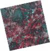
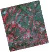
DE2_OPER_HRA_PSH_1C_20210714T110522_N40-893_W007-668_0001
Download Product | Product Info | Browse
Platform Short Name | GEOSAT |
Platform Serial Identifier | 2 |
Product Type | HRA_PSH_1C |
Start Date | 2021-07-14T11:05:22Z |
Stop Date | 2021-07-14T11:05:24Z |
Original Name | DE2_PSH_L1C_000000_20210714T110522_20210714T110524_DE2_38306_FCC0.zip |
Footprint | 40.8415324963 -7.5706239893 40.9705766238 -7.60520731032 40.9457749678 -7.76761804956 40.8169293106 -7.7314462467 40.8415324963 -7.5706239893 |
Orbit Direction | ASCENDING |
Scene Centre Longitude | W007 |
Scene Centre Latitude | N40 |
Cloud Cover Percentage | -1 |
DE2_OPER_HRA_PM4_1C_20210714T110522_N40-893_W007-668_0001
Download Product | Product Info | Browse
Platform Short Name | GEOSAT |
Platform Serial Identifier | 2 |
Product Type | HRA_PM4_1C |
Start Date | 2021-07-14T11:05:22Z |
Stop Date | 2021-07-14T11:05:24Z |
Original Name | DE2_PM4_L1C_000000_20210714T110522_20210714T110524_DE2_38306_FCC0.zip |
Footprint | 40.8415324963 -7.5706239893 40.9705766238 -7.60520731032 40.9457749678 -7.76761804956 40.8169293106 -7.7314462467 40.8415324963 -7.5706239893 |
Orbit Direction | ASCENDING |
Scene Centre Longitude | W007 |
Scene Centre Latitude | N40 |
Cloud Cover Percentage | -1 |
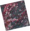
DE2_OPER_HRA_PSH_1C_20210714T110520_N40-776_W007-636_0001
Download Product | Product Info | Browse
Platform Short Name | GEOSAT |
Platform Serial Identifier | 2 |
Product Type | HRA_PSH_1C |
Start Date | 2021-07-14T11:05:20Z |
Stop Date | 2021-07-14T11:05:22Z |
Original Name | DE2_PSH_L1C_000000_20210714T110520_20210714T110522_DE2_38306_422D.zip |
Footprint | 40.7245625878 -7.53763458638 40.8534862714 -7.57408630359 40.8288705031 -7.73480315903 40.699949313 -7.69841658051 40.7245625878 -7.53763458638 |
Orbit Direction | ASCENDING |
Scene Centre Longitude | W007 |
Scene Centre Latitude | N40 |
Cloud Cover Percentage | -1 |
DE2_OPER_HRA_PM4_1C_20210714T110520_N40-776_W007-636_0001
Download Product | Product Info | Browse
Platform Short Name | GEOSAT |
Platform Serial Identifier | 2 |
Product Type | HRA_PM4_1C |
Start Date | 2021-07-14T11:05:20Z |
Stop Date | 2021-07-14T11:05:22Z |
Original Name | DE2_PM4_L1C_000000_20210714T110520_20210714T110522_DE2_38306_422D.zip |
Footprint | 40.7245625878 -7.53763458638 40.8534862714 -7.57408630359 40.8288705031 -7.73480315903 40.699949313 -7.69841658051 40.7245625878 -7.53763458638 |
Orbit Direction | ASCENDING |
Scene Centre Longitude | W007 |
Scene Centre Latitude | N40 |
Cloud Cover Percentage | -1 |
DE2_OPER_HRA_PSH_1C_20210519T110515_N40-905_W007-817_0001
Download Product | Product Info | Browse
Platform Short Name | GEOSAT |
Platform Serial Identifier | 2 |
Product Type | HRA_PSH_1C |
Start Date | 2021-05-19T11:05:15Z |
Stop Date | 2021-05-19T11:05:18Z |
Original Name | DE2_PSH_L1C_000000_20210519T110515_20210519T110518_DE2_37475_69AE.zip |
Footprint | 40.8550977356 -7.72254108337 40.9811148707 -7.75810782956 40.9564304692 -7.91208293791 40.8305632269 -7.87538836251 40.8550977356 -7.72254108337 |
Orbit Direction | ASCENDING |
Scene Centre Longitude | W007 |
Scene Centre Latitude | N40 |
Cloud Cover Percentage | -1 |
DE2_OPER_HRA_PM4_1C_20210519T110515_N40-905_W007-817_0001
Download Product | Product Info | Browse
Platform Short Name | GEOSAT |
Platform Serial Identifier | 2 |
Product Type | HRA_PM4_1C |
Start Date | 2021-05-19T11:05:15Z |
Stop Date | 2021-05-19T11:05:18Z |
Original Name | DE2_PM4_L1C_000000_20210519T110515_20210519T110518_DE2_37475_69AE.zip |
Footprint | 40.8550977356 -7.72254108337 40.9811148707 -7.75810782956 40.9564304692 -7.91208293791 40.8305632269 -7.87538836251 40.8550977356 -7.72254108337 |
Orbit Direction | ASCENDING |
Scene Centre Longitude | W007 |
Scene Centre Latitude | N40 |
Cloud Cover Percentage | -1 |
DE2_OPER_HRA_PSH_1C_20210519T110513_N40-791_W007-784_0001
Download Product | Product Info | Browse
Platform Short Name | GEOSAT |
Platform Serial Identifier | 2 |
Product Type | HRA_PSH_1C |
Start Date | 2021-05-19T11:05:13Z |
Stop Date | 2021-05-19T11:05:16Z |
Original Name | DE2_PSH_L1C_000000_20210519T110513_20210519T110516_DE2_37475_B023.zip |
Footprint | 40.7407873351 -7.68975064114 40.8667762727 -7.72595657682 40.8422008122 -7.87921280818 40.7161720354 -7.84314727918 40.7407873351 -7.68975064114 |
Orbit Direction | ASCENDING |
Scene Centre Longitude | W007 |
Scene Centre Latitude | N40 |
Cloud Cover Percentage | -1 |
DE2_OPER_HRA_PM4_1C_20210519T110513_N40-791_W007-784_0001
Download Product | Product Info | Browse
Platform Short Name | GEOSAT |
Platform Serial Identifier | 2 |
Product Type | HRA_PM4_1C |
Start Date | 2021-05-19T11:05:13Z |
Stop Date | 2021-05-19T11:05:16Z |
Original Name | DE2_PM4_L1C_000000_20210519T110513_20210519T110516_DE2_37475_B023.zip |
Footprint | 40.7407873351 -7.68975064114 40.8667762727 -7.72595657682 40.8422008122 -7.87921280818 40.7161720354 -7.84314727918 40.7407873351 -7.68975064114 |
Orbit Direction | ASCENDING |
Scene Centre Longitude | W007 |
Scene Centre Latitude | N40 |
Cloud Cover Percentage | -1 |