ESA TPM Map Catalogue - Product List
back to previous node |
list of download URLs

Collection G2_Portugal_2021
GEOSAT-2 Portugal Coverage 2021 collection. More details here.
List of available products (latitude from 40.7923 to 40.8707 dg, longitude from -7.90062 to -7.75625 dg)..
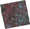
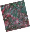
DE2_OPER_HRA_PSH_1C_20210727T111347_N40-858_W007-974_0001
Download Product | Product Info | Browse
Platform Short Name | GEOSAT |
Platform Serial Identifier | 2 |
Product Type | HRA_PSH_1C |
Start Date | 2021-07-27T11:13:47Z |
Stop Date | 2021-07-27T11:13:50Z |
Original Name | DE2_PSH_L1C_000000_20210727T111347_20210727T111350_DE2_38499_586E.zip |
Footprint | 40.7996749053 -7.85829748452 40.9427718356 -7.89384590405 40.9163688104 -8.09269284329 40.7742549025 -8.05442266103 40.7996749053 -7.85829748452 |
Orbit Direction | ASCENDING |
Scene Centre Longitude | W007 |
Scene Centre Latitude | N40 |
Cloud Cover Percentage | -1 |
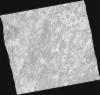
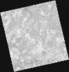
DE2_OPER_HRA_PM4_1C_20210727T111347_N40-858_W007-974_0001
Download Product | Product Info | Browse
Platform Short Name | GEOSAT |
Platform Serial Identifier | 2 |
Product Type | HRA_PM4_1C |
Start Date | 2021-07-27T11:13:47Z |
Stop Date | 2021-07-27T11:13:50Z |
Original Name | DE2_PM4_L1C_000000_20210727T111347_20210727T111350_DE2_38499_586E.zip |
Footprint | 40.7996749053 -7.85829748452 40.9427718356 -7.89384590405 40.9163688104 -8.09269284329 40.7742549025 -8.05442266103 40.7996749053 -7.85829748452 |
Orbit Direction | ASCENDING |
Scene Centre Longitude | W007 |
Scene Centre Latitude | N40 |
Cloud Cover Percentage | -1 |
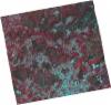
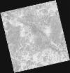
DE2_OPER_HRA_PSH_1C_20210727T111345_N40-728_W007-942_0001
Download Product | Product Info | Browse
Platform Short Name | GEOSAT |
Platform Serial Identifier | 2 |
Product Type | HRA_PSH_1C |
Start Date | 2021-07-27T11:13:45Z |
Stop Date | 2021-07-27T11:13:48Z |
Original Name | DE2_PSH_L1C_000000_20210727T111345_20210727T111348_DE2_38499_A009.zip |
Footprint | 40.6698947576 -7.82477211475 40.8129668183 -7.86127980979 40.7874656666 -8.05799538177 40.644066649 -8.0244279222 40.6698947576 -7.82477211475 |
Orbit Direction | ASCENDING |
Scene Centre Longitude | W007 |
Scene Centre Latitude | N40 |
Cloud Cover Percentage | -1 |
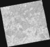
DE2_OPER_HRA_PM4_1C_20210727T111345_N40-728_W007-942_0001
Download Product | Product Info | Browse
Platform Short Name | GEOSAT |
Platform Serial Identifier | 2 |
Product Type | HRA_PM4_1C |
Start Date | 2021-07-27T11:13:45Z |
Stop Date | 2021-07-27T11:13:48Z |
Original Name | DE2_PM4_L1C_000000_20210727T111345_20210727T111348_DE2_38499_A009.zip |
Footprint | 40.6698947576 -7.82477211475 40.8129668183 -7.86127980979 40.7874656666 -8.05799538177 40.644066649 -8.0244279222 40.6698947576 -7.82477211475 |
Orbit Direction | ASCENDING |
Scene Centre Longitude | W007 |
Scene Centre Latitude | N40 |
Cloud Cover Percentage | -1 |
DE2_OPER_HRA_PSH_1C_20210519T110515_N40-905_W007-817_0001
Download Product | Product Info | Browse
Platform Short Name | GEOSAT |
Platform Serial Identifier | 2 |
Product Type | HRA_PSH_1C |
Start Date | 2021-05-19T11:05:15Z |
Stop Date | 2021-05-19T11:05:18Z |
Original Name | DE2_PSH_L1C_000000_20210519T110515_20210519T110518_DE2_37475_69AE.zip |
Footprint | 40.8550977356 -7.72254108337 40.9811148707 -7.75810782956 40.9564304692 -7.91208293791 40.8305632269 -7.87538836251 40.8550977356 -7.72254108337 |
Orbit Direction | ASCENDING |
Scene Centre Longitude | W007 |
Scene Centre Latitude | N40 |
Cloud Cover Percentage | -1 |
DE2_OPER_HRA_PM4_1C_20210519T110515_N40-905_W007-817_0001
Download Product | Product Info | Browse
Platform Short Name | GEOSAT |
Platform Serial Identifier | 2 |
Product Type | HRA_PM4_1C |
Start Date | 2021-05-19T11:05:15Z |
Stop Date | 2021-05-19T11:05:18Z |
Original Name | DE2_PM4_L1C_000000_20210519T110515_20210519T110518_DE2_37475_69AE.zip |
Footprint | 40.8550977356 -7.72254108337 40.9811148707 -7.75810782956 40.9564304692 -7.91208293791 40.8305632269 -7.87538836251 40.8550977356 -7.72254108337 |
Orbit Direction | ASCENDING |
Scene Centre Longitude | W007 |
Scene Centre Latitude | N40 |
Cloud Cover Percentage | -1 |
DE2_OPER_HRA_PSH_1C_20210519T110513_N40-791_W007-784_0001
Download Product | Product Info | Browse
Platform Short Name | GEOSAT |
Platform Serial Identifier | 2 |
Product Type | HRA_PSH_1C |
Start Date | 2021-05-19T11:05:13Z |
Stop Date | 2021-05-19T11:05:16Z |
Original Name | DE2_PSH_L1C_000000_20210519T110513_20210519T110516_DE2_37475_B023.zip |
Footprint | 40.7407873351 -7.68975064114 40.8667762727 -7.72595657682 40.8422008122 -7.87921280818 40.7161720354 -7.84314727918 40.7407873351 -7.68975064114 |
Orbit Direction | ASCENDING |
Scene Centre Longitude | W007 |
Scene Centre Latitude | N40 |
Cloud Cover Percentage | -1 |
DE2_OPER_HRA_PM4_1C_20210519T110513_N40-791_W007-784_0001
Download Product | Product Info | Browse
Platform Short Name | GEOSAT |
Platform Serial Identifier | 2 |
Product Type | HRA_PM4_1C |
Start Date | 2021-05-19T11:05:13Z |
Stop Date | 2021-05-19T11:05:16Z |
Original Name | DE2_PM4_L1C_000000_20210519T110513_20210519T110516_DE2_37475_B023.zip |
Footprint | 40.7407873351 -7.68975064114 40.8667762727 -7.72595657682 40.8422008122 -7.87921280818 40.7161720354 -7.84314727918 40.7407873351 -7.68975064114 |
Orbit Direction | ASCENDING |
Scene Centre Longitude | W007 |
Scene Centre Latitude | N40 |
Cloud Cover Percentage | -1 |