ESA TPM Map Catalogue - Product List
back to previous node |
list of download URLs
Collection G2_Portugal_2021
GEOSAT-2 Portugal Coverage 2021 collection. More details here.
List of available products (latitude from 40.7923 to 40.8707 dg, longitude from -8.255 to -8.11063 dg)..
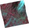
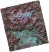
DE2_OPER_HRA_PSH_1C_20210702T111220_N40-855_W008-164_0001
Download Product | Product Info | Browse
Platform Short Name | GEOSAT |
Platform Serial Identifier | 2 |
Product Type | HRA_PSH_1C |
Start Date | 2021-07-02T11:12:20Z |
Stop Date | 2021-07-02T11:12:23Z |
Original Name | DE2_PSH_L1C_000000_20210702T111220_20210702T111223_DE2_38128_A3D0.zip |
Footprint | 40.7997417184 -8.05550135529 40.9369312656 -8.09142261971 40.9107990664 -8.27352728412 40.7743778053 -8.23815917588 40.7997417184 -8.05550135529 |
Orbit Direction | ASCENDING |
Scene Centre Longitude | W008 |
Scene Centre Latitude | N40 |
Cloud Cover Percentage | -1 |
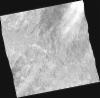
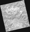
DE2_OPER_HRA_PM4_1C_20210702T111220_N40-855_W008-164_0001
Download Product | Product Info | Browse
Platform Short Name | GEOSAT |
Platform Serial Identifier | 2 |
Product Type | HRA_PM4_1C |
Start Date | 2021-07-02T11:12:20Z |
Stop Date | 2021-07-02T11:12:23Z |
Original Name | DE2_PM4_L1C_000000_20210702T111220_20210702T111223_DE2_38128_A3D0.zip |
Footprint | 40.7997417184 -8.05550135529 40.9369312656 -8.09142261971 40.9107990664 -8.27352728412 40.7743778053 -8.23815917588 40.7997417184 -8.05550135529 |
Orbit Direction | ASCENDING |
Scene Centre Longitude | W008 |
Scene Centre Latitude | N40 |
Cloud Cover Percentage | -1 |
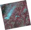
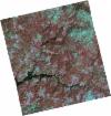
DE2_OPER_HRA_PSH_1C_20210702T111218_N40-731_W008-133_0001
Download Product | Product Info | Browse
Platform Short Name | GEOSAT |
Platform Serial Identifier | 2 |
Product Type | HRA_PSH_1C |
Start Date | 2021-07-02T11:12:18Z |
Stop Date | 2021-07-02T11:12:21Z |
Original Name | DE2_PSH_L1C_000000_20210702T111218_20210702T111221_DE2_38128_363D.zip |
Footprint | 40.6750569502 -8.02585762553 40.8123798601 -8.05928817641 40.7871077923 -8.24139157969 40.6498359686 -8.20695917825 40.6750569502 -8.02585762553 |
Orbit Direction | ASCENDING |
Scene Centre Longitude | W008 |
Scene Centre Latitude | N40 |
Cloud Cover Percentage | -1 |
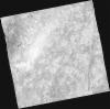
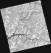
DE2_OPER_HRA_PM4_1C_20210702T111218_N40-731_W008-133_0001
Download Product | Product Info | Browse
Platform Short Name | GEOSAT |
Platform Serial Identifier | 2 |
Product Type | HRA_PM4_1C |
Start Date | 2021-07-02T11:12:18Z |
Stop Date | 2021-07-02T11:12:21Z |
Original Name | DE2_PM4_L1C_000000_20210702T111218_20210702T111221_DE2_38128_363D.zip |
Footprint | 40.6750569502 -8.02585762553 40.8123798601 -8.05928817641 40.7871077923 -8.24139157969 40.6498359686 -8.20695917825 40.6750569502 -8.02585762553 |
Orbit Direction | ASCENDING |
Scene Centre Longitude | W008 |
Scene Centre Latitude | N40 |
Cloud Cover Percentage | -1 |
DE2_OPER_HRA_PSH_1C_20210318T110645_N40-896_W008-264_0001
Download Product | Product Info | Browse
Platform Short Name | GEOSAT |
Platform Serial Identifier | 2 |
Product Type | HRA_PSH_1C |
Start Date | 2021-03-18T11:06:45Z |
Stop Date | 2021-03-18T11:06:47Z |
Original Name | DE2_PSH_L1C_000000_20210318T110645_20210318T110647_DE2_36555_2324.zip |
Footprint | 40.8462882974 -8.17193415429 40.9711891534 -8.20739339179 40.9463779886 -8.35670000865 40.8215071606 -8.32102563662 40.8462882974 -8.17193415429 |
Orbit Direction | ASCENDING |
Scene Centre Longitude | W008 |
Scene Centre Latitude | N40 |
Cloud Cover Percentage | -1 |
DE2_OPER_HRA_PM4_1C_20210318T110645_N40-896_W008-264_0001
Download Product | Product Info | Browse
Platform Short Name | GEOSAT |
Platform Serial Identifier | 2 |
Product Type | HRA_PM4_1C |
Start Date | 2021-03-18T11:06:45Z |
Stop Date | 2021-03-18T11:06:47Z |
Original Name | DE2_PM4_L1C_000000_20210318T110645_20210318T110647_DE2_36555_2324.zip |
Footprint | 40.8462882974 -8.17193415429 40.9711891534 -8.20739339179 40.9463779886 -8.35670000865 40.8215071606 -8.32102563662 40.8462882974 -8.17193415429 |
Orbit Direction | ASCENDING |
Scene Centre Longitude | W008 |
Scene Centre Latitude | N40 |
Cloud Cover Percentage | -1 |
DE2_OPER_HRA_PSH_1C_20210318T110643_N40-783_W008-231_0001
Download Product | Product Info | Browse
Platform Short Name | GEOSAT |
Platform Serial Identifier | 2 |
Product Type | HRA_PSH_1C |
Start Date | 2021-03-18T11:06:43Z |
Stop Date | 2021-03-18T11:06:45Z |
Original Name | DE2_PSH_L1C_000000_20210318T110643_20210318T110645_DE2_36555_A024.zip |
Footprint | 40.7332486638 -8.13784509281 40.8578661429 -8.17537611082 40.833073217 -8.3243501334 40.7083604591 -8.28779797992 40.7332486638 -8.13784509281 |
Orbit Direction | ASCENDING |
Scene Centre Longitude | W008 |
Scene Centre Latitude | N40 |
Cloud Cover Percentage | -1 |
DE2_OPER_HRA_PM4_1C_20210318T110643_N40-783_W008-231_0001
Download Product | Product Info | Browse
Platform Short Name | GEOSAT |
Platform Serial Identifier | 2 |
Product Type | HRA_PM4_1C |
Start Date | 2021-03-18T11:06:43Z |
Stop Date | 2021-03-18T11:06:45Z |
Original Name | DE2_PM4_L1C_000000_20210318T110643_20210318T110645_DE2_36555_A024.zip |
Footprint | 40.7332486638 -8.13784509281 40.8578661429 -8.17537611082 40.833073217 -8.3243501334 40.7083604591 -8.28779797992 40.7332486638 -8.13784509281 |
Orbit Direction | ASCENDING |
Scene Centre Longitude | W008 |
Scene Centre Latitude | N40 |
Cloud Cover Percentage | -1 |