ESA TPM Map Catalogue - Product List
back to previous node |
list of download URLs


Collection G2_Portugal_2021
GEOSAT-2 Portugal Coverage 2021 collection. More details here.
List of available products (latitude from 40.7923 to 40.8707 dg, longitude from -8.39938 to -8.255 dg)..
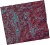
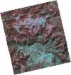
DE2_OPER_HRA_PSH_1C_20211104T111607_N40-881_W008-438_0001
Download Product | Product Info | Browse
Platform Short Name | GEOSAT |
Platform Serial Identifier | 2 |
Product Type | HRA_PSH_1C |
Start Date | 2021-11-04T11:16:07Z |
Stop Date | 2021-11-04T11:16:10Z |
Original Name | DE2_PSH_L1C_000000_20211104T111607_20211104T111610_DE2_39983_5F0E.zip |
Footprint | 40.8184547757 -8.30988672517 40.9711500148 -8.33829307745 40.9442632481 -8.57009390318 40.7906769928 -8.53477167005 40.8184547757 -8.30988672517 |
Orbit Direction | ASCENDING |
Scene Centre Longitude | W008 |
Scene Centre Latitude | N40 |
Cloud Cover Percentage | -1 |
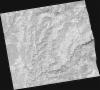
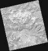
DE2_OPER_HRA_PM4_1C_20211104T111607_N40-881_W008-438_0001
Download Product | Product Info | Browse
Platform Short Name | GEOSAT |
Platform Serial Identifier | 2 |
Product Type | HRA_PM4_1C |
Start Date | 2021-11-04T11:16:07Z |
Stop Date | 2021-11-04T11:16:10Z |
Original Name | DE2_PM4_L1C_000000_20211104T111607_20211104T111610_DE2_39983_5F0E.zip |
Footprint | 40.8184547757 -8.30988672517 40.9711500148 -8.33829307745 40.9442632481 -8.57009390318 40.7906769928 -8.53477167005 40.8184547757 -8.30988672517 |
Orbit Direction | ASCENDING |
Scene Centre Longitude | W008 |
Scene Centre Latitude | N40 |
Cloud Cover Percentage | -1 |
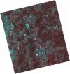
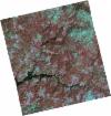
DE2_OPER_HRA_PSH_1C_20211104T111605_N40-741_W008-407_0001
Download Product | Product Info | Browse
Platform Short Name | GEOSAT |
Platform Serial Identifier | 2 |
Product Type | HRA_PSH_1C |
Start Date | 2021-11-04T11:16:05Z |
Stop Date | 2021-11-04T11:16:08Z |
Original Name | DE2_PSH_L1C_000000_20211104T111605_20211104T111608_DE2_39983_1BDE.zip |
Footprint | 40.677844157 -8.2751925405 40.8310985053 -8.31373172179 40.8049121079 -8.53798883862 40.6513274707 -8.50299742542 40.677844157 -8.2751925405 |
Orbit Direction | ASCENDING |
Scene Centre Longitude | W008 |
Scene Centre Latitude | N40 |
Cloud Cover Percentage | -1 |
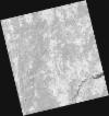
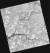
DE2_OPER_HRA_PM4_1C_20211104T111605_N40-741_W008-407_0001
Download Product | Product Info | Browse
Platform Short Name | GEOSAT |
Platform Serial Identifier | 2 |
Product Type | HRA_PM4_1C |
Start Date | 2021-11-04T11:16:05Z |
Stop Date | 2021-11-04T11:16:08Z |
Original Name | DE2_PM4_L1C_000000_20211104T111605_20211104T111608_DE2_39983_1BDE.zip |
Footprint | 40.677844157 -8.2751925405 40.8310985053 -8.31373172179 40.8049121079 -8.53798883862 40.6513274707 -8.50299742542 40.677844157 -8.2751925405 |
Orbit Direction | ASCENDING |
Scene Centre Longitude | W008 |
Scene Centre Latitude | N40 |
Cloud Cover Percentage | -1 |
DE2_OPER_HRA_PSH_1C_20210525T110155_N40-879_W008-417_0001
Download Product | Product Info | Browse
Platform Short Name | GEOSAT |
Platform Serial Identifier | 2 |
Product Type | HRA_PSH_1C |
Start Date | 2021-05-25T11:01:55Z |
Stop Date | 2021-05-25T11:01:57Z |
Original Name | DE2_PSH_L1C_000000_20210525T110155_20210525T110157_DE2_37564_5DD6.zip |
Footprint | 40.8306170919 -8.32604732074 40.9534411812 -8.36332394508 40.9280000195 -8.50893856686 40.8052672466 -8.47121027121 40.8306170919 -8.32604732074 |
Orbit Direction | ASCENDING |
Scene Centre Longitude | W008 |
Scene Centre Latitude | N40 |
Cloud Cover Percentage | -1 |
DE2_OPER_HRA_PM4_1C_20210525T110155_N40-879_W008-417_0001
Download Product | Product Info | Browse
Platform Short Name | GEOSAT |
Platform Serial Identifier | 2 |
Product Type | HRA_PM4_1C |
Start Date | 2021-05-25T11:01:55Z |
Stop Date | 2021-05-25T11:01:57Z |
Original Name | DE2_PM4_L1C_000000_20210525T110155_20210525T110157_DE2_37564_5DD6.zip |
Footprint | 40.8306170919 -8.32604732074 40.9534411812 -8.36332394508 40.9280000195 -8.50893856686 40.8052672466 -8.47121027121 40.8306170919 -8.32604732074 |
Orbit Direction | ASCENDING |
Scene Centre Longitude | W008 |
Scene Centre Latitude | N40 |
Cloud Cover Percentage | -1 |
DE2_OPER_HRA_PSH_1C_20210525T110153_N40-767_W008-383_0001
Download Product | Product Info | Browse
Platform Short Name | GEOSAT |
Platform Serial Identifier | 2 |
Product Type | HRA_PSH_1C |
Start Date | 2021-05-25T11:01:53Z |
Stop Date | 2021-05-25T11:01:55Z |
Original Name | DE2_PSH_L1C_000000_20210525T110153_20210525T110155_DE2_37564_B7C3.zip |
Footprint | 40.7191699543 -8.29206067426 40.8420144603 -8.32943710012 40.8166738993 -8.47458803099 40.6938137031 -8.43702916499 40.7191699543 -8.29206067426 |
Orbit Direction | ASCENDING |
Scene Centre Longitude | W008 |
Scene Centre Latitude | N40 |
Cloud Cover Percentage | -1 |
DE2_OPER_HRA_PM4_1C_20210525T110153_N40-767_W008-383_0001
Download Product | Product Info | Browse
Platform Short Name | GEOSAT |
Platform Serial Identifier | 2 |
Product Type | HRA_PM4_1C |
Start Date | 2021-05-25T11:01:53Z |
Stop Date | 2021-05-25T11:01:55Z |
Original Name | DE2_PM4_L1C_000000_20210525T110153_20210525T110155_DE2_37564_B7C3.zip |
Footprint | 40.7191699543 -8.29206067426 40.8420144603 -8.32943710012 40.8166738993 -8.47458803099 40.6938137031 -8.43702916499 40.7191699543 -8.29206067426 |
Orbit Direction | ASCENDING |
Scene Centre Longitude | W008 |
Scene Centre Latitude | N40 |
Cloud Cover Percentage | -1 |
DE2_OPER_HRA_PSH_1C_20210318T110645_N40-896_W008-264_0001
Download Product | Product Info | Browse
Platform Short Name | GEOSAT |
Platform Serial Identifier | 2 |
Product Type | HRA_PSH_1C |
Start Date | 2021-03-18T11:06:45Z |
Stop Date | 2021-03-18T11:06:47Z |
Original Name | DE2_PSH_L1C_000000_20210318T110645_20210318T110647_DE2_36555_2324.zip |
Footprint | 40.8462882974 -8.17193415429 40.9711891534 -8.20739339179 40.9463779886 -8.35670000865 40.8215071606 -8.32102563662 40.8462882974 -8.17193415429 |
Orbit Direction | ASCENDING |
Scene Centre Longitude | W008 |
Scene Centre Latitude | N40 |
Cloud Cover Percentage | -1 |
DE2_OPER_HRA_PM4_1C_20210318T110645_N40-896_W008-264_0001
Download Product | Product Info | Browse
Platform Short Name | GEOSAT |
Platform Serial Identifier | 2 |
Product Type | HRA_PM4_1C |
Start Date | 2021-03-18T11:06:45Z |
Stop Date | 2021-03-18T11:06:47Z |
Original Name | DE2_PM4_L1C_000000_20210318T110645_20210318T110647_DE2_36555_2324.zip |
Footprint | 40.8462882974 -8.17193415429 40.9711891534 -8.20739339179 40.9463779886 -8.35670000865 40.8215071606 -8.32102563662 40.8462882974 -8.17193415429 |
Orbit Direction | ASCENDING |
Scene Centre Longitude | W008 |
Scene Centre Latitude | N40 |
Cloud Cover Percentage | -1 |
DE2_OPER_HRA_PSH_1C_20210318T110643_N40-783_W008-231_0001
Download Product | Product Info | Browse
Platform Short Name | GEOSAT |
Platform Serial Identifier | 2 |
Product Type | HRA_PSH_1C |
Start Date | 2021-03-18T11:06:43Z |
Stop Date | 2021-03-18T11:06:45Z |
Original Name | DE2_PSH_L1C_000000_20210318T110643_20210318T110645_DE2_36555_A024.zip |
Footprint | 40.7332486638 -8.13784509281 40.8578661429 -8.17537611082 40.833073217 -8.3243501334 40.7083604591 -8.28779797992 40.7332486638 -8.13784509281 |
Orbit Direction | ASCENDING |
Scene Centre Longitude | W008 |
Scene Centre Latitude | N40 |
Cloud Cover Percentage | -1 |
DE2_OPER_HRA_PM4_1C_20210318T110643_N40-783_W008-231_0001
Download Product | Product Info | Browse
Platform Short Name | GEOSAT |
Platform Serial Identifier | 2 |
Product Type | HRA_PM4_1C |
Start Date | 2021-03-18T11:06:43Z |
Stop Date | 2021-03-18T11:06:45Z |
Original Name | DE2_PM4_L1C_000000_20210318T110643_20210318T110645_DE2_36555_A024.zip |
Footprint | 40.7332486638 -8.13784509281 40.8578661429 -8.17537611082 40.833073217 -8.3243501334 40.7083604591 -8.28779797992 40.7332486638 -8.13784509281 |
Orbit Direction | ASCENDING |
Scene Centre Longitude | W008 |
Scene Centre Latitude | N40 |
Cloud Cover Percentage | -1 |