ESA TPM Map Catalogue - Product List
back to previous node |
list of download URLs
Collection G2_Portugal_2021
GEOSAT-2 Portugal Coverage 2021 collection. More details here.
List of available products (latitude from 40.7923 to 40.8707 dg, longitude from -8.68812 to -8.54375 dg)..
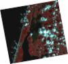
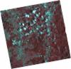
DE2_OPER_HRA_PSH_1C_20210915T111547_N40-794_W008-657_0001
Download Product | Product Info | Browse
Platform Short Name | GEOSAT |
Platform Serial Identifier | 2 |
Product Type | HRA_PSH_1C |
Start Date | 2021-09-15T11:15:47Z |
Stop Date | 2021-09-15T11:15:50Z |
Original Name | DE2_PSH_L1C_000000_20210915T111547_20210915T111550_DE2_39241_25C3.zip |
Footprint | 40.734432857 -8.53722434918 40.879891489 -8.57240671368 40.8540274573 -8.77867242987 40.7084272677 -8.74319618387 40.734432857 -8.53722434918 |
Orbit Direction | ASCENDING |
Scene Centre Longitude | W008 |
Scene Centre Latitude | N40 |
Cloud Cover Percentage | -1 |
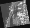
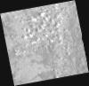
DE2_OPER_HRA_PM4_1C_20210915T111547_N40-794_W008-657_0001
Download Product | Product Info | Browse
Platform Short Name | GEOSAT |
Platform Serial Identifier | 2 |
Product Type | HRA_PM4_1C |
Start Date | 2021-09-15T11:15:47Z |
Stop Date | 2021-09-15T11:15:50Z |
Original Name | DE2_PM4_L1C_000000_20210915T111547_20210915T111550_DE2_39241_25C3.zip |
Footprint | 40.734432857 -8.53722434918 40.879891489 -8.57240671368 40.8540274573 -8.77867242987 40.7084272677 -8.74319618387 40.734432857 -8.53722434918 |
Orbit Direction | ASCENDING |
Scene Centre Longitude | W008 |
Scene Centre Latitude | N40 |
Cloud Cover Percentage | -1 |
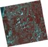
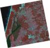
DE2_OPER_HRA_PSH_1C_20210626T111550_N40-925_W008-554_0001
Download Product | Product Info | Browse
Platform Short Name | GEOSAT |
Platform Serial Identifier | 2 |
Product Type | HRA_PSH_1C |
Start Date | 2021-06-26T11:15:50Z |
Stop Date | 2021-06-26T11:15:53Z |
Original Name | DE2_PSH_L1C_000000_20210626T111550_20210626T111553_DE2_38039_1287.zip |
Footprint | 40.8678744651 -8.44175199497 41.0086553613 -8.47670487227 40.9831911414 -8.66781363878 40.8424123149 -8.63264638147 40.8678744651 -8.44175199497 |
Orbit Direction | ASCENDING |
Scene Centre Longitude | W008 |
Scene Centre Latitude | N40 |
Cloud Cover Percentage | -1 |
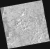
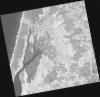
DE2_OPER_HRA_PM4_1C_20210626T111550_N40-925_W008-554_0001
Download Product | Product Info | Browse
Platform Short Name | GEOSAT |
Platform Serial Identifier | 2 |
Product Type | HRA_PM4_1C |
Start Date | 2021-06-26T11:15:50Z |
Stop Date | 2021-06-26T11:15:53Z |
Original Name | DE2_PM4_L1C_000000_20210626T111550_20210626T111553_DE2_38039_1287.zip |
Footprint | 40.8678744651 -8.44175199497 41.0086553613 -8.47670487227 40.9831911414 -8.66781363878 40.8424123149 -8.63264638147 40.8678744651 -8.44175199497 |
Orbit Direction | ASCENDING |
Scene Centre Longitude | W008 |
Scene Centre Latitude | N40 |
Cloud Cover Percentage | -1 |
DE2_OPER_HRA_PSH_1C_20210626T111548_N40-797_W008-523_0001
Download Product | Product Info | Browse
Platform Short Name | GEOSAT |
Platform Serial Identifier | 2 |
Product Type | HRA_PSH_1C |
Start Date | 2021-06-26T11:15:48Z |
Stop Date | 2021-06-26T11:15:51Z |
Original Name | DE2_PSH_L1C_000000_20210626T111548_20210626T111551_DE2_38039_968B.zip |
Footprint | 40.7401356351 -8.41122474854 40.8808777598 -8.44542598723 40.8554690953 -8.63589335364 40.7147924572 -8.60073399547 40.7401356351 -8.41122474854 |
Orbit Direction | ASCENDING |
Scene Centre Longitude | W008 |
Scene Centre Latitude | N40 |
Cloud Cover Percentage | -1 |
DE2_OPER_HRA_PM4_1C_20210626T111548_N40-797_W008-523_0001
Download Product | Product Info | Browse
Platform Short Name | GEOSAT |
Platform Serial Identifier | 2 |
Product Type | HRA_PM4_1C |
Start Date | 2021-06-26T11:15:48Z |
Stop Date | 2021-06-26T11:15:51Z |
Original Name | DE2_PM4_L1C_000000_20210626T111548_20210626T111551_DE2_38039_968B.zip |
Footprint | 40.7401356351 -8.41122474854 40.8808777598 -8.44542598723 40.8554690953 -8.63589335364 40.7147924572 -8.60073399547 40.7401356351 -8.41122474854 |
Orbit Direction | ASCENDING |
Scene Centre Longitude | W008 |
Scene Centre Latitude | N40 |
Cloud Cover Percentage | -1 |
DE2_OPER_HRA_PSH_1C_20210325T111906_N40-824_W008-611_0001
Download Product | Product Info | Browse
Platform Short Name | GEOSAT |
Platform Serial Identifier | 2 |
Product Type | HRA_PSH_1C |
Start Date | 2021-03-25T11:19:06Z |
Stop Date | 2021-03-25T11:19:09Z |
Original Name | DE2_PSH_L1C_000000_20210325T111906_20210325T111909_DE2_36659_3B52.zip |
Footprint | 40.7668708303 -8.49848527598 40.907082326 -8.5332532939 40.8815464389 -8.72545447062 40.7405873283 -8.69052047911 40.7668708303 -8.49848527598 |
Orbit Direction | ASCENDING |
Scene Centre Longitude | W008 |
Scene Centre Latitude | N40 |
Cloud Cover Percentage | -1 |
DE2_OPER_HRA_PM4_1C_20210325T111906_N40-824_W008-611_0001
Download Product | Product Info | Browse
Platform Short Name | GEOSAT |
Platform Serial Identifier | 2 |
Product Type | HRA_PM4_1C |
Start Date | 2021-03-25T11:19:06Z |
Stop Date | 2021-03-25T11:19:09Z |
Original Name | DE2_PM4_L1C_000000_20210325T111906_20210325T111909_DE2_36659_3B52.zip |
Footprint | 40.7668708303 -8.49848527598 40.907082326 -8.5332532939 40.8815464389 -8.72545447062 40.7405873283 -8.69052047911 40.7668708303 -8.49848527598 |
Orbit Direction | ASCENDING |
Scene Centre Longitude | W008 |
Scene Centre Latitude | N40 |
Cloud Cover Percentage | -1 |