ESA TPM Map Catalogue - Product List
back to previous node |
list of download URLs
Collection G2_Portugal_2021
GEOSAT-2 Portugal Coverage 2021 collection. More details here.
List of available products (latitude from 40.7139 to 40.7923 dg, longitude from -7.2575 to -7.11312 dg)..
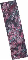
DE2_OPER_HRA_PSH_1C_20211022T110830_N40-853_W007-253_0001
Download Product | Product Info | BrowsePlatform Short Name | GEOSAT |
Platform Serial Identifier | 2 |
Product Type | HRA_PSH_1C |
Start Date | 2021-10-22T11:08:30Z |
Stop Date | 2021-10-22T11:08:33Z |
Original Name | DE2_PSH_L1C_000000_20211022T110830_20211022T110833_DE2_39790_DE02.zip |
Footprint | 40.7840407457 -7.20832528499 40.9299449193 -7.2450703497 40.9232636241 -7.2987151937 40.7773712697 -7.26166852767 40.7840407457 -7.20832528499 |
Orbit Direction | ASCENDING |
Scene Centre Longitude | W007 |
Scene Centre Latitude | N40 |
Cloud Cover Percentage | -1 |
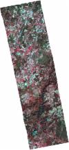
DE2_OPER_HRA_PSH_1C_20211022T110830_N40-860_W007-200_0001
Download Product | Product Info | BrowsePlatform Short Name | GEOSAT |
Platform Serial Identifier | 2 |
Product Type | HRA_PSH_1C |
Start Date | 2021-10-22T11:08:30Z |
Stop Date | 2021-10-22T11:08:33Z |
Original Name | DE2_PSH_L1C_000000_20211022T110830_20211022T110833_DE2_39790_DE03.zip |
Footprint | 40.7906458476 -7.15630670154 40.9367120852 -7.1907443915 40.9298514605 -7.24514408526 40.7839741875 -7.20882481274 40.7906458476 -7.15630670154 |
Orbit Direction | ASCENDING |
Scene Centre Longitude | W007 |
Scene Centre Latitude | N40 |
Cloud Cover Percentage | -1 |
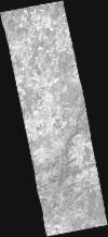
DE2_OPER_HRA_PM4_1C_20211022T110830_N40-853_W007-253_0001
Download Product | Product Info | BrowsePlatform Short Name | GEOSAT |
Platform Serial Identifier | 2 |
Product Type | HRA_PM4_1C |
Start Date | 2021-10-22T11:08:30Z |
Stop Date | 2021-10-22T11:08:33Z |
Original Name | DE2_PM4_L1C_000000_20211022T110830_20211022T110833_DE2_39790_DE02.zip |
Footprint | 40.7840407457 -7.20832528499 40.9299449193 -7.2450703497 40.9232636241 -7.2987151937 40.7773712697 -7.26166852767 40.7840407457 -7.20832528499 |
Orbit Direction | ASCENDING |
Scene Centre Longitude | W007 |
Scene Centre Latitude | N40 |
Cloud Cover Percentage | -1 |
DE2_OPER_HRA_PM4_1C_20211022T110830_N40-860_W007-200_0001
Download Product | Product Info | BrowsePlatform Short Name | GEOSAT |
Platform Serial Identifier | 2 |
Product Type | HRA_PM4_1C |
Start Date | 2021-10-22T11:08:30Z |
Stop Date | 2021-10-22T11:08:33Z |
Original Name | DE2_PM4_L1C_000000_20211022T110830_20211022T110833_DE2_39790_DE03.zip |
Footprint | 40.7906458476 -7.15630670154 40.9367120852 -7.1907443915 40.9298514605 -7.24514408526 40.7839741875 -7.20882481274 40.7906458476 -7.15630670154 |
Orbit Direction | ASCENDING |
Scene Centre Longitude | W007 |
Scene Centre Latitude | N40 |
Cloud Cover Percentage | -1 |
DE2_OPER_HRA_PSH_1C_20211022T110828_N40-725_W007-194_0001
Download Product | Product Info | BrowsePlatform Short Name | GEOSAT |
Platform Serial Identifier | 2 |
Product Type | HRA_PSH_1C |
Start Date | 2021-10-22T11:08:28Z |
Stop Date | 2021-10-22T11:08:31Z |
Original Name | DE2_PSH_L1C_000000_20211022T110828_20211022T110831_DE2_39790_AA5C.zip |
Footprint | 40.6656444209 -7.0754492416 40.8111831943 -7.10829168783 40.7851481168 -7.31499165844 40.639838561 -7.27972546153 40.6656444209 -7.0754492416 |
Orbit Direction | ASCENDING |
Scene Centre Longitude | W007 |
Scene Centre Latitude | N40 |
Cloud Cover Percentage | -1 |
DE2_OPER_HRA_PM4_1C_20211022T110828_N40-725_W007-194_0001
Download Product | Product Info | BrowsePlatform Short Name | GEOSAT |
Platform Serial Identifier | 2 |
Product Type | HRA_PM4_1C |
Start Date | 2021-10-22T11:08:28Z |
Stop Date | 2021-10-22T11:08:31Z |
Original Name | DE2_PM4_L1C_000000_20211022T110828_20211022T110831_DE2_39790_AA5C.zip |
Footprint | 40.6656444209 -7.0754492416 40.8111831943 -7.10829168783 40.7851481168 -7.31499165844 40.639838561 -7.27972546153 40.6656444209 -7.0754492416 |
Orbit Direction | ASCENDING |
Scene Centre Longitude | W007 |
Scene Centre Latitude | N40 |
Cloud Cover Percentage | -1 |
DE2_OPER_HRA_PSH_1C_20210619T110343_N40-797_W007-043_0001
Download Product | Product Info | BrowsePlatform Short Name | GEOSAT |
Platform Serial Identifier | 2 |
Product Type | HRA_PSH_1C |
Start Date | 2021-06-19T11:03:43Z |
Stop Date | 2021-06-19T11:03:46Z |
Original Name | DE2_PSH_L1C_000000_20210619T110343_20210619T110346_DE2_37935_51A2.zip |
Footprint | 40.7453402661 -6.94439548885 40.8748173467 -6.98088098536 40.8502611432 -7.14124691494 40.7206273884 -7.1058415993 40.7453402661 -6.94439548885 |
Orbit Direction | ASCENDING |
Scene Centre Longitude | W007 |
Scene Centre Latitude | N40 |
Cloud Cover Percentage | -1 |
DE2_OPER_HRA_PM4_1C_20210619T110343_N40-797_W007-043_0001
Download Product | Product Info | BrowsePlatform Short Name | GEOSAT |
Platform Serial Identifier | 2 |
Product Type | HRA_PM4_1C |
Start Date | 2021-06-19T11:03:43Z |
Stop Date | 2021-06-19T11:03:46Z |
Original Name | DE2_PM4_L1C_000000_20210619T110343_20210619T110346_DE2_37935_51A2.zip |
Footprint | 40.7453402661 -6.94439548885 40.8748173467 -6.98088098536 40.8502611432 -7.14124691494 40.7206273884 -7.1058415993 40.7453402661 -6.94439548885 |
Orbit Direction | ASCENDING |
Scene Centre Longitude | W007 |
Scene Centre Latitude | N40 |
Cloud Cover Percentage | -1 |
