ESA TPM Map Catalogue - Product List
back to previous node |
list of download URLs

Collection G2_Portugal_2021
GEOSAT-2 Portugal Coverage 2021 collection. More details here.
List of available products (latitude from 40.7139 to 40.7923 dg, longitude from -7.4675 to -7.32313 dg)..
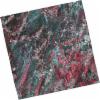
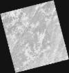
DE2_OPER_HRA_PSH_1C_20210808T110637_N40-783_W007-367_0001
Download Product | Product Info | Browse
Platform Short Name | GEOSAT |
Platform Serial Identifier | 2 |
Product Type | HRA_PSH_1C |
Start Date | 2021-08-08T11:06:37Z |
Stop Date | 2021-08-08T11:06:40Z |
Original Name | DE2_PSH_L1C_000000_20210808T110637_20210808T110640_DE2_38677_2D66.zip |
Footprint | 40.7284394017 -7.26224126176 40.8626278151 -7.29813247733 40.8377349529 -7.47202695405 40.7035497296 -7.43602785821 40.7284394017 -7.26224126176 |
Orbit Direction | ASCENDING |
Scene Centre Longitude | W007 |
Scene Centre Latitude | N40 |
Cloud Cover Percentage | -1 |
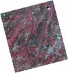
DE2_OPER_HRA_PM4_1C_20210808T110637_N40-783_W007-367_0001
Download Product | Product Info | Browse
Platform Short Name | GEOSAT |
Platform Serial Identifier | 2 |
Product Type | HRA_PM4_1C |
Start Date | 2021-08-08T11:06:37Z |
Stop Date | 2021-08-08T11:06:40Z |
Original Name | DE2_PM4_L1C_000000_20210808T110637_20210808T110640_DE2_38677_2D66.zip |
Footprint | 40.7284394017 -7.26224126176 40.8626278151 -7.29813247733 40.8377349529 -7.47202695405 40.7035497296 -7.43602785821 40.7284394017 -7.26224126176 |
Orbit Direction | ASCENDING |
Scene Centre Longitude | W007 |
Scene Centre Latitude | N40 |
Cloud Cover Percentage | -1 |
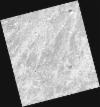
DE2_OPER_HRA_PSH_1C_20210808T110635_N40-661_W007-336_0001
Download Product | Product Info | Browse
Platform Short Name | GEOSAT |
Platform Serial Identifier | 2 |
Product Type | HRA_PSH_1C |
Start Date | 2021-08-08T11:06:35Z |
Stop Date | 2021-08-08T11:06:38Z |
Original Name | DE2_PSH_L1C_000000_20210808T110635_20210808T110638_DE2_38677_C92A.zip |
Footprint | 40.6063055203 -7.2330448681 40.7408430881 -7.26580892805 40.7159976589 -7.43925272252 40.5814204598 -7.40657656561 40.6063055203 -7.2330448681 |
Orbit Direction | ASCENDING |
Scene Centre Longitude | W007 |
Scene Centre Latitude | N40 |
Cloud Cover Percentage | -1 |
DE2_OPER_HRA_PM4_1C_20210808T110635_N40-661_W007-336_0001
Download Product | Product Info | Browse
Platform Short Name | GEOSAT |
Platform Serial Identifier | 2 |
Product Type | HRA_PM4_1C |
Start Date | 2021-08-08T11:06:35Z |
Stop Date | 2021-08-08T11:06:38Z |
Original Name | DE2_PM4_L1C_000000_20210808T110635_20210808T110638_DE2_38677_C92A.zip |
Footprint | 40.6063055203 -7.2330448681 40.7408430881 -7.26580892805 40.7159976589 -7.43925272252 40.5814204598 -7.40657656561 40.6063055203 -7.2330448681 |
Orbit Direction | ASCENDING |
Scene Centre Longitude | W007 |
Scene Centre Latitude | N40 |
Cloud Cover Percentage | -1 |
DE2_OPER_HRA_PSH_1C_20210506T105622_N40-764_W007-481_0001
Download Product | Product Info | Browse
Platform Short Name | GEOSAT |
Platform Serial Identifier | 2 |
Product Type | HRA_PSH_1C |
Start Date | 2021-05-06T10:56:22Z |
Stop Date | 2021-05-06T10:56:25Z |
Original Name | DE2_PSH_L1C_000000_20210506T105622_20210506T105625_DE2_37282_CE3D.zip |
Footprint | 40.7164019043 -7.38998965232 40.8389802325 -7.42844500555 40.8128158897 -7.57363260255 40.6902744314 -7.53493185203 40.7164019043 -7.38998965232 |
Orbit Direction | ASCENDING |
Scene Centre Longitude | W007 |
Scene Centre Latitude | N40 |
Cloud Cover Percentage | -1 |
DE2_OPER_HRA_PM4_1C_20210506T105622_N40-764_W007-481_0001
Download Product | Product Info | Browse
Platform Short Name | GEOSAT |
Platform Serial Identifier | 2 |
Product Type | HRA_PM4_1C |
Start Date | 2021-05-06T10:56:22Z |
Stop Date | 2021-05-06T10:56:25Z |
Original Name | DE2_PM4_L1C_000000_20210506T105622_20210506T105625_DE2_37282_CE3D.zip |
Footprint | 40.7164019043 -7.38998965232 40.8389802325 -7.42844500555 40.8128158897 -7.57363260255 40.6902744314 -7.53493185203 40.7164019043 -7.38998965232 |
Orbit Direction | ASCENDING |
Scene Centre Longitude | W007 |
Scene Centre Latitude | N40 |
Cloud Cover Percentage | -1 |
DE2_OPER_HRA_PSH_1C_20210506T105621_N40-653_W007-446_0001
Download Product | Product Info | Browse
Platform Short Name | GEOSAT |
Platform Serial Identifier | 2 |
Product Type | HRA_PSH_1C |
Start Date | 2021-05-06T10:56:21Z |
Stop Date | 2021-05-06T10:56:23Z |
Original Name | DE2_PSH_L1C_000000_20210506T105621_20210506T105623_DE2_37282_8BD4.zip |
Footprint | 40.6048983674 -7.35549123928 40.7278011771 -7.39350699993 40.7016306768 -7.53858908115 40.5787898619 -7.50023896932 40.6048983674 -7.35549123928 |
Orbit Direction | ASCENDING |
Scene Centre Longitude | W007 |
Scene Centre Latitude | N40 |
Cloud Cover Percentage | -1 |
DE2_OPER_HRA_PM4_1C_20210506T105621_N40-653_W007-446_0001
Download Product | Product Info | Browse
Platform Short Name | GEOSAT |
Platform Serial Identifier | 2 |
Product Type | HRA_PM4_1C |
Start Date | 2021-05-06T10:56:21Z |
Stop Date | 2021-05-06T10:56:23Z |
Original Name | DE2_PM4_L1C_000000_20210506T105621_20210506T105623_DE2_37282_8BD4.zip |
Footprint | 40.6048983674 -7.35549123928 40.7278011771 -7.39350699993 40.7016306768 -7.53858908115 40.5787898619 -7.50023896932 40.6048983674 -7.35549123928 |
Orbit Direction | ASCENDING |
Scene Centre Longitude | W007 |
Scene Centre Latitude | N40 |
Cloud Cover Percentage | -1 |