ESA TPM Map Catalogue - Product List
back to previous node |
list of download URLs
Collection G2_Portugal_2021
GEOSAT-2 Portugal Coverage 2021 collection. More details here.
List of available products (latitude from 40.557 to 40.6355 dg, longitude from -7.61188 to -7.4675 dg)..
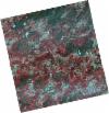
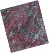
DE2_OPER_HRA_PSH_1C_20210714T110518_N40-659_W007-603_0001
Download Product | Product Info | Browse
Platform Short Name | GEOSAT |
Platform Serial Identifier | 2 |
Product Type | HRA_PSH_1C |
Start Date | 2021-07-14T11:05:18Z |
Stop Date | 2021-07-14T11:05:20Z |
Original Name | DE2_PSH_L1C_000000_20210714T110518_20210714T110520_DE2_38306_8BC4.zip |
Footprint | 40.6074611774 -7.50578580552 40.7365741318 -7.54076450252 40.7119377098 -7.70166365454 40.5828437913 -7.66660718513 40.6074611774 -7.50578580552 |
Orbit Direction | ASCENDING |
Scene Centre Longitude | W007 |
Scene Centre Latitude | N40 |
Cloud Cover Percentage | -1 |
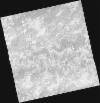
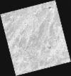
DE2_OPER_HRA_PM4_1C_20210714T110518_N40-659_W007-603_0001
Download Product | Product Info | Browse
Platform Short Name | GEOSAT |
Platform Serial Identifier | 2 |
Product Type | HRA_PM4_1C |
Start Date | 2021-07-14T11:05:18Z |
Stop Date | 2021-07-14T11:05:20Z |
Original Name | DE2_PM4_L1C_000000_20210714T110518_20210714T110520_DE2_38306_8BC4.zip |
Footprint | 40.6074611774 -7.50578580552 40.7365741318 -7.54076450252 40.7119377098 -7.70166365454 40.5828437913 -7.66660718513 40.6074611774 -7.50578580552 |
Orbit Direction | ASCENDING |
Scene Centre Longitude | W007 |
Scene Centre Latitude | N40 |
Cloud Cover Percentage | -1 |
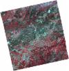
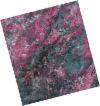
DE2_OPER_HRA_PSH_1C_20210714T110516_N40-542_W007-572_0001
Download Product | Product Info | Browse
Platform Short Name | GEOSAT |
Platform Serial Identifier | 2 |
Product Type | HRA_PSH_1C |
Start Date | 2021-07-14T11:05:16Z |
Stop Date | 2021-07-14T11:05:18Z |
Original Name | DE2_PSH_L1C_000000_20210714T110516_20210714T110518_DE2_38306_7B35.zip |
Footprint | 40.4900065117 -7.47663394995 40.6194850738 -7.50874528699 40.5947425548 -7.67019089912 40.4656299435 -7.63509990766 40.4900065117 -7.47663394995 |
Orbit Direction | ASCENDING |
Scene Centre Longitude | W007 |
Scene Centre Latitude | N40 |
Cloud Cover Percentage | -1 |
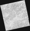
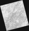
DE2_OPER_HRA_PM4_1C_20210714T110516_N40-542_W007-572_0001
Download Product | Product Info | Browse
Platform Short Name | GEOSAT |
Platform Serial Identifier | 2 |
Product Type | HRA_PM4_1C |
Start Date | 2021-07-14T11:05:16Z |
Stop Date | 2021-07-14T11:05:18Z |
Original Name | DE2_PM4_L1C_000000_20210714T110516_20210714T110518_DE2_38306_7B35.zip |
Footprint | 40.4900065117 -7.47663394995 40.6194850738 -7.50874528699 40.5947425548 -7.67019089912 40.4656299435 -7.63509990766 40.4900065117 -7.47663394995 |
Orbit Direction | ASCENDING |
Scene Centre Longitude | W007 |
Scene Centre Latitude | N40 |
Cloud Cover Percentage | -1 |
DE2_OPER_HRA_PSH_1C_20210506T105621_N40-653_W007-446_0001
Download Product | Product Info | Browse
Platform Short Name | GEOSAT |
Platform Serial Identifier | 2 |
Product Type | HRA_PSH_1C |
Start Date | 2021-05-06T10:56:21Z |
Stop Date | 2021-05-06T10:56:23Z |
Original Name | DE2_PSH_L1C_000000_20210506T105621_20210506T105623_DE2_37282_8BD4.zip |
Footprint | 40.6048983674 -7.35549123928 40.7278011771 -7.39350699993 40.7016306768 -7.53858908115 40.5787898619 -7.50023896932 40.6048983674 -7.35549123928 |
Orbit Direction | ASCENDING |
Scene Centre Longitude | W007 |
Scene Centre Latitude | N40 |
Cloud Cover Percentage | -1 |
DE2_OPER_HRA_PM4_1C_20210506T105621_N40-653_W007-446_0001
Download Product | Product Info | Browse
Platform Short Name | GEOSAT |
Platform Serial Identifier | 2 |
Product Type | HRA_PM4_1C |
Start Date | 2021-05-06T10:56:21Z |
Stop Date | 2021-05-06T10:56:23Z |
Original Name | DE2_PM4_L1C_000000_20210506T105621_20210506T105623_DE2_37282_8BD4.zip |
Footprint | 40.6048983674 -7.35549123928 40.7278011771 -7.39350699993 40.7016306768 -7.53858908115 40.5787898619 -7.50023896932 40.6048983674 -7.35549123928 |
Orbit Direction | ASCENDING |
Scene Centre Longitude | W007 |
Scene Centre Latitude | N40 |
Cloud Cover Percentage | -1 |
DE2_OPER_HRA_PSH_1C_20210506T105619_N40-541_W007-412_0001
Download Product | Product Info | Browse
Platform Short Name | GEOSAT |
Platform Serial Identifier | 2 |
Product Type | HRA_PSH_1C |
Start Date | 2021-05-06T10:56:19Z |
Stop Date | 2021-05-06T10:56:21Z |
Original Name | DE2_PSH_L1C_000000_20210506T105619_20210506T105621_DE2_37282_62DE.zip |
Footprint | 40.4933915324 -7.32064114942 40.616278668 -7.35901567159 40.590153389 -7.50384032325 40.4672942164 -7.46509848809 40.4933915324 -7.32064114942 |
Orbit Direction | ASCENDING |
Scene Centre Longitude | W007 |
Scene Centre Latitude | N40 |
Cloud Cover Percentage | -1 |
DE2_OPER_HRA_PM4_1C_20210506T105619_N40-541_W007-412_0001
Download Product | Product Info | Browse
Platform Short Name | GEOSAT |
Platform Serial Identifier | 2 |
Product Type | HRA_PM4_1C |
Start Date | 2021-05-06T10:56:19Z |
Stop Date | 2021-05-06T10:56:21Z |
Original Name | DE2_PM4_L1C_000000_20210506T105619_20210506T105621_DE2_37282_62DE.zip |
Footprint | 40.4933915324 -7.32064114942 40.616278668 -7.35901567159 40.590153389 -7.50384032325 40.4672942164 -7.46509848809 40.4933915324 -7.32064114942 |
Orbit Direction | ASCENDING |
Scene Centre Longitude | W007 |
Scene Centre Latitude | N40 |
Cloud Cover Percentage | -1 |