ESA TPM Map Catalogue - Product List
back to previous node |
list of download URLs

Collection G2_Portugal_2021
GEOSAT-2 Portugal Coverage 2021 collection. More details here.
List of available products (latitude from 40.557 to 40.6355 dg, longitude from -8.8325 to -8.68812 dg)..
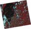
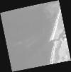
DE2_OPER_HRA_PSH_1C_20210915T111545_N40-662_W008-626_0001
Download Product | Product Info | Browse
Platform Short Name | GEOSAT |
Platform Serial Identifier | 2 |
Product Type | HRA_PSH_1C |
Start Date | 2021-09-15T11:15:45Z |
Stop Date | 2021-09-15T11:15:47Z |
Original Name | DE2_PSH_L1C_000000_20210915T111545_20210915T111547_DE2_39241_78E7.zip |
Footprint | 40.6023839344 -8.50640957546 40.747871429 -8.54060483779 40.7219136811 -8.74644792658 40.5764040488 -8.71190736215 40.6023839344 -8.50640957546 |
Orbit Direction | ASCENDING |
Scene Centre Longitude | W008 |
Scene Centre Latitude | N40 |
Cloud Cover Percentage | -1 |
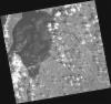
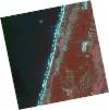
DE2_OPER_HRA_PM4_1C_20210915T111545_N40-662_W008-626_0001
Download Product | Product Info | Browse
Platform Short Name | GEOSAT |
Platform Serial Identifier | 2 |
Product Type | HRA_PM4_1C |
Start Date | 2021-09-15T11:15:45Z |
Stop Date | 2021-09-15T11:15:47Z |
Original Name | DE2_PM4_L1C_000000_20210915T111545_20210915T111547_DE2_39241_78E7.zip |
Footprint | 40.6023839344 -8.50640957546 40.747871429 -8.54060483779 40.7219136811 -8.74644792658 40.5764040488 -8.71190736215 40.6023839344 -8.50640957546 |
Orbit Direction | ASCENDING |
Scene Centre Longitude | W008 |
Scene Centre Latitude | N40 |
Cloud Cover Percentage | -1 |
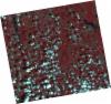
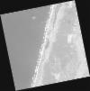
DE2_OPER_HRA_PSH_1C_20210915T111542_N40-530_W008-595_0001
Download Product | Product Info | Browse
Platform Short Name | GEOSAT |
Platform Serial Identifier | 2 |
Product Type | HRA_PSH_1C |
Start Date | 2021-09-15T11:15:42Z |
Stop Date | 2021-09-15T11:15:45Z |
Original Name | DE2_PSH_L1C_000000_20210915T111542_20210915T111545_DE2_39241_EA10.zip |
Footprint | 40.4703779215 -8.47557135661 40.6159296736 -8.50928903448 40.5899052545 -8.7151996702 40.444357076 -8.6810317522 40.4703779215 -8.47557135661 |
Orbit Direction | ASCENDING |
Scene Centre Longitude | W008 |
Scene Centre Latitude | N40 |
Cloud Cover Percentage | -1 |
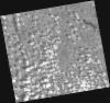
DE2_OPER_HRA_PM4_1C_20210915T111542_N40-530_W008-595_0001
Download Product | Product Info | Browse
Platform Short Name | GEOSAT |
Platform Serial Identifier | 2 |
Product Type | HRA_PM4_1C |
Start Date | 2021-09-15T11:15:42Z |
Stop Date | 2021-09-15T11:15:45Z |
Original Name | DE2_PM4_L1C_000000_20210915T111542_20210915T111545_DE2_39241_EA10.zip |
Footprint | 40.4703779215 -8.47557135661 40.6159296736 -8.50928903448 40.5899052545 -8.7151996702 40.444357076 -8.6810317522 40.4703779215 -8.47557135661 |
Orbit Direction | ASCENDING |
Scene Centre Longitude | W008 |
Scene Centre Latitude | N40 |
Cloud Cover Percentage | -1 |
DE2_OPER_HRA_PSH_1C_20210331T111553_N40-653_W008-805_0001
Download Product | Product Info | Browse
Platform Short Name | GEOSAT |
Platform Serial Identifier | 2 |
Product Type | HRA_PSH_1C |
Start Date | 2021-03-31T11:15:53Z |
Stop Date | 2021-03-31T11:15:55Z |
Original Name | DE2_PSH_L1C_000000_20210331T111553_20210331T111555_DE2_36748_6026.zip |
Footprint | 40.6002664571 -8.70308233874 40.733393436 -8.7375933234 40.7054799381 -8.90741319871 40.5753625578 -8.87314059306 40.6002664571 -8.70308233874 |
Orbit Direction | ASCENDING |
Scene Centre Longitude | W008 |
Scene Centre Latitude | N40 |
Cloud Cover Percentage | -1 |
DE2_OPER_HRA_PM4_1C_20210331T111553_N40-653_W008-805_0001
Download Product | Product Info | Browse
Platform Short Name | GEOSAT |
Platform Serial Identifier | 2 |
Product Type | HRA_PM4_1C |
Start Date | 2021-03-31T11:15:53Z |
Stop Date | 2021-03-31T11:15:55Z |
Original Name | DE2_PM4_L1C_000000_20210331T111553_20210331T111555_DE2_36748_6026.zip |
Footprint | 40.6002664571 -8.70308233874 40.733393436 -8.7375933234 40.7054799381 -8.90741319871 40.5753625578 -8.87314059306 40.6002664571 -8.70308233874 |
Orbit Direction | ASCENDING |
Scene Centre Longitude | W008 |
Scene Centre Latitude | N40 |
Cloud Cover Percentage | -1 |
DE2_OPER_HRA_PSH_1C_20210331T111551_N40-533_W008-774_0001
Download Product | Product Info | Browse
Platform Short Name | GEOSAT |
Platform Serial Identifier | 2 |
Product Type | HRA_PSH_1C |
Start Date | 2021-03-31T11:15:51Z |
Stop Date | 2021-03-31T11:15:53Z |
Original Name | DE2_PSH_L1C_000000_20210331T111551_20210331T111553_DE2_36748_84B4.zip |
Footprint | 40.4794337965 -8.67215885637 40.6125987036 -8.70627273714 40.5875362157 -8.87768192 40.4545549041 -8.84258652377 40.4794337965 -8.67215885637 |
Orbit Direction | ASCENDING |
Scene Centre Longitude | W008 |
Scene Centre Latitude | N40 |
Cloud Cover Percentage | -1 |
DE2_OPER_HRA_PM4_1C_20210331T111551_N40-533_W008-774_0001
Download Product | Product Info | Browse
Platform Short Name | GEOSAT |
Platform Serial Identifier | 2 |
Product Type | HRA_PM4_1C |
Start Date | 2021-03-31T11:15:51Z |
Stop Date | 2021-03-31T11:15:53Z |
Original Name | DE2_PM4_L1C_000000_20210331T111551_20210331T111553_DE2_36748_84B4.zip |
Footprint | 40.4794337965 -8.67215885637 40.6125987036 -8.70627273714 40.5875362157 -8.87768192 40.4545549041 -8.84258652377 40.4794337965 -8.67215885637 |
Orbit Direction | ASCENDING |
Scene Centre Longitude | W008 |
Scene Centre Latitude | N40 |
Cloud Cover Percentage | -1 |