ESA TPM Map Catalogue - Product List
back to previous node |
list of download URLs

Collection G2_Portugal_2021
GEOSAT-2 Portugal Coverage 2021 collection. More details here.
List of available products (latitude from 40.4786 to 40.557 dg, longitude from -8.39938 to -8.255 dg)..
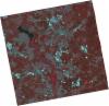
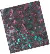
DE2_OPER_HRA_PSH_1C_20210626T111544_N40-542_W008-459_0001
Download Product | Product Info | Browse
Platform Short Name | GEOSAT |
Platform Serial Identifier | 2 |
Product Type | HRA_PSH_1C |
Start Date | 2021-06-26T11:15:44Z |
Stop Date | 2021-06-26T11:15:47Z |
Original Name | DE2_PSH_L1C_000000_20210626T111544_20210626T111547_DE2_38039_E087.zip |
Footprint | 40.4848583915 -8.34704822539 40.6257195454 -8.38120248168 40.6002399346 -8.57191558252 40.4593975123 -8.53711778628 40.4848583915 -8.34704822539 |
Orbit Direction | ASCENDING |
Scene Centre Longitude | W008 |
Scene Centre Latitude | N40 |
Cloud Cover Percentage | -1 |
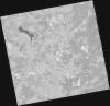
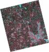
DE2_OPER_HRA_PM4_1C_20210626T111544_N40-542_W008-459_0001
Download Product | Product Info | Browse
Platform Short Name | GEOSAT |
Platform Serial Identifier | 2 |
Product Type | HRA_PM4_1C |
Start Date | 2021-06-26T11:15:44Z |
Stop Date | 2021-06-26T11:15:47Z |
Original Name | DE2_PM4_L1C_000000_20210626T111544_20210626T111547_DE2_38039_E087.zip |
Footprint | 40.4848583915 -8.34704822539 40.6257195454 -8.38120248168 40.6002399346 -8.57191558252 40.4593975123 -8.53711778628 40.4848583915 -8.34704822539 |
Orbit Direction | ASCENDING |
Scene Centre Longitude | W008 |
Scene Centre Latitude | N40 |
Cloud Cover Percentage | -1 |
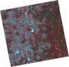
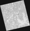
DE2_OPER_HRA_PSH_1C_20210626T111542_N40-414_W008-427_0001
Download Product | Product Info | Browse
Platform Short Name | GEOSAT |
Platform Serial Identifier | 2 |
Product Type | HRA_PSH_1C |
Start Date | 2021-06-26T11:15:42Z |
Stop Date | 2021-06-26T11:15:44Z |
Original Name | DE2_PSH_L1C_000000_20210626T111542_20210626T111544_DE2_38039_A915.zip |
Footprint | 40.3572703648 -8.31556527305 40.4979030681 -8.35019659673 40.4724638085 -8.54017781597 40.3317662068 -8.50581745614 40.3572703648 -8.31556527305 |
Orbit Direction | ASCENDING |
Scene Centre Longitude | W008 |
Scene Centre Latitude | N40 |
Cloud Cover Percentage | -1 |
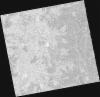
DE2_OPER_HRA_PM4_1C_20210626T111542_N40-414_W008-427_0001
Download Product | Product Info | Browse
Platform Short Name | GEOSAT |
Platform Serial Identifier | 2 |
Product Type | HRA_PM4_1C |
Start Date | 2021-06-26T11:15:42Z |
Stop Date | 2021-06-26T11:15:44Z |
Original Name | DE2_PM4_L1C_000000_20210626T111542_20210626T111544_DE2_38039_A915.zip |
Footprint | 40.3572703648 -8.31556527305 40.4979030681 -8.35019659673 40.4724638085 -8.54017781597 40.3317662068 -8.50581745614 40.3572703648 -8.31556527305 |
Orbit Direction | ASCENDING |
Scene Centre Longitude | W008 |
Scene Centre Latitude | N40 |
Cloud Cover Percentage | -1 |
DE2_OPER_HRA_PSH_1C_20210525T110149_N40-544_W008-315_0001
Download Product | Product Info | Browse
Platform Short Name | GEOSAT |
Platform Serial Identifier | 2 |
Product Type | HRA_PSH_1C |
Start Date | 2021-05-25T11:01:49Z |
Stop Date | 2021-05-25T11:01:52Z |
Original Name | DE2_PSH_L1C_000000_20210525T110149_20210525T110152_DE2_37564_EE03.zip |
Footprint | 40.4959678187 -8.22480219913 40.6189582351 -8.26192622841 40.5936579042 -8.40663506256 40.4706642872 -8.36926859303 40.4959678187 -8.22480219913 |
Orbit Direction | ASCENDING |
Scene Centre Longitude | W008 |
Scene Centre Latitude | N40 |
Cloud Cover Percentage | -1 |
DE2_OPER_HRA_PM4_1C_20210525T110149_N40-544_W008-315_0001
Download Product | Product Info | Browse
Platform Short Name | GEOSAT |
Platform Serial Identifier | 2 |
Product Type | HRA_PM4_1C |
Start Date | 2021-05-25T11:01:49Z |
Stop Date | 2021-05-25T11:01:52Z |
Original Name | DE2_PM4_L1C_000000_20210525T110149_20210525T110152_DE2_37564_EE03.zip |
Footprint | 40.4959678187 -8.22480219913 40.6189582351 -8.26192622841 40.5936579042 -8.40663506256 40.4706642872 -8.36926859303 40.4959678187 -8.22480219913 |
Orbit Direction | ASCENDING |
Scene Centre Longitude | W008 |
Scene Centre Latitude | N40 |
Cloud Cover Percentage | -1 |
DE2_OPER_HRA_PSH_1C_20210525T110147_N40-433_W008-281_0001
Download Product | Product Info | Browse
Platform Short Name | GEOSAT |
Platform Serial Identifier | 2 |
Product Type | HRA_PSH_1C |
Start Date | 2021-05-25T11:01:47Z |
Stop Date | 2021-05-25T11:01:50Z |
Original Name | DE2_PSH_L1C_000000_20210525T110147_20210525T110150_DE2_37564_1EE6.zip |
Footprint | 40.3845737069 -8.1908958556 40.5073355004 -8.2282741196 40.4820541613 -8.37263072706 40.3592711115 -8.33538331341 40.3845737069 -8.1908958556 |
Orbit Direction | ASCENDING |
Scene Centre Longitude | W008 |
Scene Centre Latitude | N40 |
Cloud Cover Percentage | -1 |
DE2_OPER_HRA_PM4_1C_20210525T110147_N40-433_W008-281_0001
Download Product | Product Info | Browse
Platform Short Name | GEOSAT |
Platform Serial Identifier | 2 |
Product Type | HRA_PM4_1C |
Start Date | 2021-05-25T11:01:47Z |
Stop Date | 2021-05-25T11:01:50Z |
Original Name | DE2_PM4_L1C_000000_20210525T110147_20210525T110150_DE2_37564_1EE6.zip |
Footprint | 40.3845737069 -8.1908958556 40.5073355004 -8.2282741196 40.4820541613 -8.37263072706 40.3592711115 -8.33538331341 40.3845737069 -8.1908958556 |
Orbit Direction | ASCENDING |
Scene Centre Longitude | W008 |
Scene Centre Latitude | N40 |
Cloud Cover Percentage | -1 |