ESA TPM Map Catalogue - Product List
back to previous node |
list of download URLs
Collection G2_Portugal_2021
GEOSAT-2 Portugal Coverage 2021 collection. More details here.
List of available products (latitude from 40.443 to 40.5214 dg, longitude from -7.75625 to -7.61188 dg)..
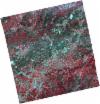
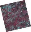
DE2_OPER_HRA_PSH_1C_20210714T110516_N40-542_W007-572_0001
Download Product | Product Info | Browse
Platform Short Name | GEOSAT |
Platform Serial Identifier | 2 |
Product Type | HRA_PSH_1C |
Start Date | 2021-07-14T11:05:16Z |
Stop Date | 2021-07-14T11:05:18Z |
Original Name | DE2_PSH_L1C_000000_20210714T110516_20210714T110518_DE2_38306_7B35.zip |
Footprint | 40.4900065117 -7.47663394995 40.6194850738 -7.50874528699 40.5947425548 -7.67019089912 40.4656299435 -7.63509990766 40.4900065117 -7.47663394995 |
Orbit Direction | ASCENDING |
Scene Centre Longitude | W007 |
Scene Centre Latitude | N40 |
Cloud Cover Percentage | -1 |
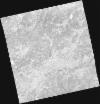
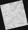
DE2_OPER_HRA_PM4_1C_20210714T110516_N40-542_W007-572_0001
Download Product | Product Info | Browse
Platform Short Name | GEOSAT |
Platform Serial Identifier | 2 |
Product Type | HRA_PM4_1C |
Start Date | 2021-07-14T11:05:16Z |
Stop Date | 2021-07-14T11:05:18Z |
Original Name | DE2_PM4_L1C_000000_20210714T110516_20210714T110518_DE2_38306_7B35.zip |
Footprint | 40.4900065117 -7.47663394995 40.6194850738 -7.50874528699 40.5947425548 -7.67019089912 40.4656299435 -7.63509990766 40.4900065117 -7.47663394995 |
Orbit Direction | ASCENDING |
Scene Centre Longitude | W007 |
Scene Centre Latitude | N40 |
Cloud Cover Percentage | -1 |
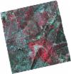
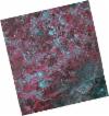
DE2_OPER_HRA_PSH_1C_20210714T110514_N40-425_W007-542_0001
Download Product | Product Info | Browse
Platform Short Name | GEOSAT |
Platform Serial Identifier | 2 |
Product Type | HRA_PSH_1C |
Start Date | 2021-07-14T11:05:14Z |
Stop Date | 2021-07-14T11:05:16Z |
Original Name | DE2_PSH_L1C_000000_20210714T110514_20210714T110516_DE2_38306_DC4E.zip |
Footprint | 40.3729116515 -7.44376155373 40.5019911422 -7.48013333883 40.4776576354 -7.63805926334 40.3479027525 -7.60726583392 40.3729116515 -7.44376155373 |
Orbit Direction | ASCENDING |
Scene Centre Longitude | W007 |
Scene Centre Latitude | N40 |
Cloud Cover Percentage | -1 |
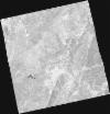
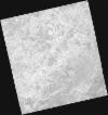
DE2_OPER_HRA_PM4_1C_20210714T110514_N40-425_W007-542_0001
Download Product | Product Info | Browse
Platform Short Name | GEOSAT |
Platform Serial Identifier | 2 |
Product Type | HRA_PM4_1C |
Start Date | 2021-07-14T11:05:14Z |
Stop Date | 2021-07-14T11:05:16Z |
Original Name | DE2_PM4_L1C_000000_20210714T110514_20210714T110516_DE2_38306_DC4E.zip |
Footprint | 40.3729116515 -7.44376155373 40.5019911422 -7.48013333883 40.4776576354 -7.63805926334 40.3479027525 -7.60726583392 40.3729116515 -7.44376155373 |
Orbit Direction | ASCENDING |
Scene Centre Longitude | W007 |
Scene Centre Latitude | N40 |
Cloud Cover Percentage | -1 |
DE2_OPER_HRA_PSH_1C_20210519T110509_N40-562_W007-719_0001
Download Product | Product Info | Browse
Platform Short Name | GEOSAT |
Platform Serial Identifier | 2 |
Product Type | HRA_PSH_1C |
Start Date | 2021-05-19T11:05:09Z |
Stop Date | 2021-05-19T11:05:12Z |
Original Name | DE2_PSH_L1C_000000_20210519T110509_20210519T110512_DE2_37475_A7BF.zip |
Footprint | 40.5119233572 -7.62524717663 40.6380526423 -7.6604183089 40.6134974622 -7.81336641239 40.4874301949 -7.77789198004 40.5119233572 -7.62524717663 |
Orbit Direction | ASCENDING |
Scene Centre Longitude | W007 |
Scene Centre Latitude | N40 |
Cloud Cover Percentage | -1 |
DE2_OPER_HRA_PM4_1C_20210519T110509_N40-562_W007-719_0001
Download Product | Product Info | Browse
Platform Short Name | GEOSAT |
Platform Serial Identifier | 2 |
Product Type | HRA_PM4_1C |
Start Date | 2021-05-19T11:05:09Z |
Stop Date | 2021-05-19T11:05:12Z |
Original Name | DE2_PM4_L1C_000000_20210519T110509_20210519T110512_DE2_37475_A7BF.zip |
Footprint | 40.5119233572 -7.62524717663 40.6380526423 -7.6604183089 40.6134974622 -7.81336641239 40.4874301949 -7.77789198004 40.5119233572 -7.62524717663 |
Orbit Direction | ASCENDING |
Scene Centre Longitude | W007 |
Scene Centre Latitude | N40 |
Cloud Cover Percentage | -1 |
DE2_OPER_HRA_PSH_1C_20210519T110508_N40-448_W007-687_0001
Download Product | Product Info | Browse
Platform Short Name | GEOSAT |
Platform Serial Identifier | 2 |
Product Type | HRA_PSH_1C |
Start Date | 2021-05-19T11:05:08Z |
Stop Date | 2021-05-19T11:05:10Z |
Original Name | DE2_PSH_L1C_000000_20210519T110508_20210519T110510_DE2_37475_D633.zip |
Footprint | 40.3972998753 -7.59606769096 40.5235827459 -7.62847084626 40.4990839717 -7.78097300215 40.3730587521 -7.74610792478 40.3972998753 -7.59606769096 |
Orbit Direction | ASCENDING |
Scene Centre Longitude | W007 |
Scene Centre Latitude | N40 |
Cloud Cover Percentage | -1 |
DE2_OPER_HRA_PM4_1C_20210519T110508_N40-448_W007-687_0001
Download Product | Product Info | Browse
Platform Short Name | GEOSAT |
Platform Serial Identifier | 2 |
Product Type | HRA_PM4_1C |
Start Date | 2021-05-19T11:05:08Z |
Stop Date | 2021-05-19T11:05:10Z |
Original Name | DE2_PM4_L1C_000000_20210519T110508_20210519T110510_DE2_37475_D633.zip |
Footprint | 40.3972998753 -7.59606769096 40.5235827459 -7.62847084626 40.4990839717 -7.78097300215 40.3730587521 -7.74610792478 40.3972998753 -7.59606769096 |
Orbit Direction | ASCENDING |
Scene Centre Longitude | W007 |
Scene Centre Latitude | N40 |
Cloud Cover Percentage | -1 |