ESA TPM Map Catalogue - Product List
back to previous node |
list of download URLs
Collection G2_Portugal_2021
GEOSAT-2 Portugal Coverage 2021 collection. More details here.
List of available products (latitude from 40.443 to 40.5214 dg, longitude from -8.68812 to -8.54375 dg)..
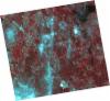
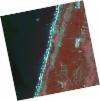
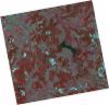
DE2_OPER_HRA_PSH_1C_20211010T111607_N40-418_W008-630_0001
Download Product | Product Info | Browse
Platform Short Name | GEOSAT |
Platform Serial Identifier | 2 |
Product Type | HRA_PSH_1C |
Start Date | 2021-10-10T11:16:07Z |
Stop Date | 2021-10-10T11:16:10Z |
Original Name | DE2_PSH_L1C_000000_20211010T111607_20211010T111610_DE2_39612_D741.zip |
Footprint | 40.3573538456 -8.50722053955 40.5056105816 -8.54142094713 40.4793346891 -8.75483982697 40.3310842504 -8.71999881445 40.3573538456 -8.50722053955 |
Orbit Direction | ASCENDING |
Scene Centre Longitude | W008 |
Scene Centre Latitude | N40 |
Cloud Cover Percentage | -1 |
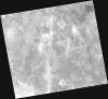
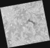
DE2_OPER_HRA_PM4_1C_20211010T111607_N40-418_W008-630_0001
Download Product | Product Info | Browse
Platform Short Name | GEOSAT |
Platform Serial Identifier | 2 |
Product Type | HRA_PM4_1C |
Start Date | 2021-10-10T11:16:07Z |
Stop Date | 2021-10-10T11:16:10Z |
Original Name | DE2_PM4_L1C_000000_20211010T111607_20211010T111610_DE2_39612_D741.zip |
Footprint | 40.3573538456 -8.50722053955 40.5056105816 -8.54142094713 40.4793346891 -8.75483982697 40.3310842504 -8.71999881445 40.3573538456 -8.50722053955 |
Orbit Direction | ASCENDING |
Scene Centre Longitude | W008 |
Scene Centre Latitude | N40 |
Cloud Cover Percentage | -1 |
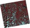
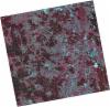
DE2_OPER_HRA_PSH_1C_20210915T111542_N40-530_W008-595_0001
Download Product | Product Info | Browse
Platform Short Name | GEOSAT |
Platform Serial Identifier | 2 |
Product Type | HRA_PSH_1C |
Start Date | 2021-09-15T11:15:42Z |
Stop Date | 2021-09-15T11:15:45Z |
Original Name | DE2_PSH_L1C_000000_20210915T111542_20210915T111545_DE2_39241_EA10.zip |
Footprint | 40.4703779215 -8.47557135661 40.6159296736 -8.50928903448 40.5899052545 -8.7151996702 40.444357076 -8.6810317522 40.4703779215 -8.47557135661 |
Orbit Direction | ASCENDING |
Scene Centre Longitude | W008 |
Scene Centre Latitude | N40 |
Cloud Cover Percentage | -1 |
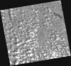
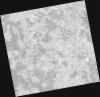
DE2_OPER_HRA_PM4_1C_20210915T111542_N40-530_W008-595_0001
Download Product | Product Info | Browse
Platform Short Name | GEOSAT |
Platform Serial Identifier | 2 |
Product Type | HRA_PM4_1C |
Start Date | 2021-09-15T11:15:42Z |
Stop Date | 2021-09-15T11:15:45Z |
Original Name | DE2_PM4_L1C_000000_20210915T111542_20210915T111545_DE2_39241_EA10.zip |
Footprint | 40.4703779215 -8.47557135661 40.6159296736 -8.50928903448 40.5899052545 -8.7151996702 40.444357076 -8.6810317522 40.4703779215 -8.47557135661 |
Orbit Direction | ASCENDING |
Scene Centre Longitude | W008 |
Scene Centre Latitude | N40 |
Cloud Cover Percentage | -1 |
DE2_OPER_HRA_PSH_1C_20210331T111551_N40-533_W008-774_0001
Download Product | Product Info | Browse
Platform Short Name | GEOSAT |
Platform Serial Identifier | 2 |
Product Type | HRA_PSH_1C |
Start Date | 2021-03-31T11:15:51Z |
Stop Date | 2021-03-31T11:15:53Z |
Original Name | DE2_PSH_L1C_000000_20210331T111551_20210331T111553_DE2_36748_84B4.zip |
Footprint | 40.4794337965 -8.67215885637 40.6125987036 -8.70627273714 40.5875362157 -8.87768192 40.4545549041 -8.84258652377 40.4794337965 -8.67215885637 |
Orbit Direction | ASCENDING |
Scene Centre Longitude | W008 |
Scene Centre Latitude | N40 |
Cloud Cover Percentage | -1 |
DE2_OPER_HRA_PM4_1C_20210331T111551_N40-533_W008-774_0001
Download Product | Product Info | Browse
Platform Short Name | GEOSAT |
Platform Serial Identifier | 2 |
Product Type | HRA_PM4_1C |
Start Date | 2021-03-31T11:15:51Z |
Stop Date | 2021-03-31T11:15:53Z |
Original Name | DE2_PM4_L1C_000000_20210331T111551_20210331T111553_DE2_36748_84B4.zip |
Footprint | 40.4794337965 -8.67215885637 40.6125987036 -8.70627273714 40.5875362157 -8.87768192 40.4545549041 -8.84258652377 40.4794337965 -8.67215885637 |
Orbit Direction | ASCENDING |
Scene Centre Longitude | W008 |
Scene Centre Latitude | N40 |
Cloud Cover Percentage | -1 |
DE2_OPER_HRA_PSH_1C_20210331T111549_N40-412_W008-743_0001
Download Product | Product Info | Browse
Platform Short Name | GEOSAT |
Platform Serial Identifier | 2 |
Product Type | HRA_PSH_1C |
Start Date | 2021-03-31T11:15:49Z |
Stop Date | 2021-03-31T11:15:51Z |
Original Name | DE2_PSH_L1C_000000_20210331T111549_20210331T111551_DE2_36748_01C4.zip |
Footprint | 40.3585150166 -8.64087694204 40.4918075524 -8.67530239764 40.4669242367 -8.84583100054 40.3336269682 -8.8110376575 40.3585150166 -8.64087694204 |
Orbit Direction | ASCENDING |
Scene Centre Longitude | W008 |
Scene Centre Latitude | N40 |
Cloud Cover Percentage | -1 |
DE2_OPER_HRA_PM4_1C_20210331T111549_N40-412_W008-743_0001
Download Product | Product Info | Browse
Platform Short Name | GEOSAT |
Platform Serial Identifier | 2 |
Product Type | HRA_PM4_1C |
Start Date | 2021-03-31T11:15:49Z |
Stop Date | 2021-03-31T11:15:51Z |
Original Name | DE2_PM4_L1C_000000_20210331T111549_20210331T111551_DE2_36748_01C4.zip |
Footprint | 40.3585150166 -8.64087694204 40.4918075524 -8.67530239764 40.4669242367 -8.84583100054 40.3336269682 -8.8110376575 40.3585150166 -8.64087694204 |
Orbit Direction | ASCENDING |
Scene Centre Longitude | W008 |
Scene Centre Latitude | N40 |
Cloud Cover Percentage | -1 |
DE2_OPER_HRA_PSH_1C_20210325T111902_N40-568_W008-548_0001
Download Product | Product Info | Browse
Platform Short Name | GEOSAT |
Platform Serial Identifier | 2 |
Product Type | HRA_PSH_1C |
Start Date | 2021-03-25T11:19:02Z |
Stop Date | 2021-03-25T11:19:05Z |
Original Name | DE2_PSH_L1C_000000_20210325T111902_20210325T111905_DE2_36659_BEB1.zip |
Footprint | 40.5106419883 -8.43556285543 40.651439173 -8.47036843905 40.6258564382 -8.66224802919 40.4850084342 -8.62764656688 40.5106419883 -8.43556285543 |
Orbit Direction | ASCENDING |
Scene Centre Longitude | W008 |
Scene Centre Latitude | N40 |
Cloud Cover Percentage | -1 |
DE2_OPER_HRA_PM4_1C_20210325T111902_N40-568_W008-548_0001
Download Product | Product Info | Browse
Platform Short Name | GEOSAT |
Platform Serial Identifier | 2 |
Product Type | HRA_PM4_1C |
Start Date | 2021-03-25T11:19:02Z |
Stop Date | 2021-03-25T11:19:05Z |
Original Name | DE2_PM4_L1C_000000_20210325T111902_20210325T111905_DE2_36659_BEB1.zip |
Footprint | 40.5106419883 -8.43556285543 40.651439173 -8.47036843905 40.6258564382 -8.66224802919 40.4850084342 -8.62764656688 40.5106419883 -8.43556285543 |
Orbit Direction | ASCENDING |
Scene Centre Longitude | W008 |
Scene Centre Latitude | N40 |
Cloud Cover Percentage | -1 |
DE2_OPER_HRA_PSH_1C_20210325T111900_N40-440_W008-517_0001
Download Product | Product Info | Browse
Platform Short Name | GEOSAT |
Platform Serial Identifier | 2 |
Product Type | HRA_PSH_1C |
Start Date | 2021-03-25T11:19:00Z |
Stop Date | 2021-03-25T11:19:02Z |
Original Name | DE2_PSH_L1C_000000_20210325T111900_20210325T111902_DE2_36659_D995.zip |
Footprint | 40.3828594718 -8.40489255699 40.5236642234 -8.43876513758 40.4980653498 -8.63064567259 40.3572596232 -8.59622638962 40.3828594718 -8.40489255699 |
Orbit Direction | ASCENDING |
Scene Centre Longitude | W008 |
Scene Centre Latitude | N40 |
Cloud Cover Percentage | -1 |
DE2_OPER_HRA_PM4_1C_20210325T111900_N40-440_W008-517_0001
Download Product | Product Info | Browse
Platform Short Name | GEOSAT |
Platform Serial Identifier | 2 |
Product Type | HRA_PM4_1C |
Start Date | 2021-03-25T11:19:00Z |
Stop Date | 2021-03-25T11:19:02Z |
Original Name | DE2_PM4_L1C_000000_20210325T111900_20210325T111902_DE2_36659_D995.zip |
Footprint | 40.3828594718 -8.40489255699 40.5236642234 -8.43876513758 40.4980653498 -8.63064567259 40.3572596232 -8.59622638962 40.3828594718 -8.40489255699 |
Orbit Direction | ASCENDING |
Scene Centre Longitude | W008 |
Scene Centre Latitude | N40 |
Cloud Cover Percentage | -1 |