ESA TPM Map Catalogue - Product List
back to previous node |
list of download URLs
Collection G2_Portugal_2021
GEOSAT-2 Portugal Coverage 2021 collection. More details here.
List of available products (latitude from 40.2861 to 40.3645 dg, longitude from -7.61188 to -7.4675 dg)..
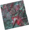
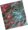
DE2_OPER_HRA_PSH_1C_20210714T110514_N40-425_W007-542_0001
Download Product | Product Info | Browse
Platform Short Name | GEOSAT |
Platform Serial Identifier | 2 |
Product Type | HRA_PSH_1C |
Start Date | 2021-07-14T11:05:14Z |
Stop Date | 2021-07-14T11:05:16Z |
Original Name | DE2_PSH_L1C_000000_20210714T110514_20210714T110516_DE2_38306_DC4E.zip |
Footprint | 40.3729116515 -7.44376155373 40.5019911422 -7.48013333883 40.4776576354 -7.63805926334 40.3479027525 -7.60726583392 40.3729116515 -7.44376155373 |
Orbit Direction | ASCENDING |
Scene Centre Longitude | W007 |
Scene Centre Latitude | N40 |
Cloud Cover Percentage | -1 |
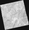
DE2_OPER_HRA_PM4_1C_20210714T110514_N40-425_W007-542_0001
Download Product | Product Info | Browse
Platform Short Name | GEOSAT |
Platform Serial Identifier | 2 |
Product Type | HRA_PM4_1C |
Start Date | 2021-07-14T11:05:14Z |
Stop Date | 2021-07-14T11:05:16Z |
Original Name | DE2_PM4_L1C_000000_20210714T110514_20210714T110516_DE2_38306_DC4E.zip |
Footprint | 40.3729116515 -7.44376155373 40.5019911422 -7.48013333883 40.4776576354 -7.63805926334 40.3479027525 -7.60726583392 40.3729116515 -7.44376155373 |
Orbit Direction | ASCENDING |
Scene Centre Longitude | W007 |
Scene Centre Latitude | N40 |
Cloud Cover Percentage | -1 |
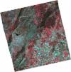
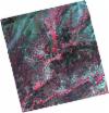
DE2_OPER_HRA_PSH_1C_20210714T110512_N40-307_W007-510_0001
Download Product | Product Info | Browse
Platform Short Name | GEOSAT |
Platform Serial Identifier | 2 |
Product Type | HRA_PSH_1C |
Start Date | 2021-07-14T11:05:12Z |
Stop Date | 2021-07-14T11:05:15Z |
Original Name | DE2_PSH_L1C_000000_20210714T110512_20210714T110515_DE2_38306_E1BD.zip |
Footprint | 40.255749664 -7.41122728142 40.3849459778 -7.44634730868 40.3598078714 -7.61063331133 40.2310346329 -7.57196725471 40.255749664 -7.41122728142 |
Orbit Direction | ASCENDING |
Scene Centre Longitude | W007 |
Scene Centre Latitude | N40 |
Cloud Cover Percentage | -1 |
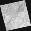
DE2_OPER_HRA_PM4_1C_20210714T110512_N40-307_W007-510_0001
Download Product | Product Info | Browse
Platform Short Name | GEOSAT |
Platform Serial Identifier | 2 |
Product Type | HRA_PM4_1C |
Start Date | 2021-07-14T11:05:12Z |
Stop Date | 2021-07-14T11:05:15Z |
Original Name | DE2_PM4_L1C_000000_20210714T110512_20210714T110515_DE2_38306_E1BD.zip |
Footprint | 40.255749664 -7.41122728142 40.3849459778 -7.44634730868 40.3598078714 -7.61063331133 40.2310346329 -7.57196725471 40.255749664 -7.41122728142 |
Orbit Direction | ASCENDING |
Scene Centre Longitude | W007 |
Scene Centre Latitude | N40 |
Cloud Cover Percentage | -1 |
DE2_OPER_HRA_PSH_1C_20210519T110506_N40-333_W007-656_0001
Download Product | Product Info | Browse
Platform Short Name | GEOSAT |
Platform Serial Identifier | 2 |
Product Type | HRA_PSH_1C |
Start Date | 2021-05-19T11:05:06Z |
Stop Date | 2021-05-19T11:05:08Z |
Original Name | DE2_PSH_L1C_000000_20210519T110506_20210519T110508_DE2_37475_2EBB.zip |
Footprint | 40.2830145589 -7.563286585 40.4090143807 -7.59929793323 40.3847959395 -7.74930973296 40.2585989935 -7.71461314982 40.2830145589 -7.563286585 |
Orbit Direction | ASCENDING |
Scene Centre Longitude | W007 |
Scene Centre Latitude | N40 |
Cloud Cover Percentage | -1 |
DE2_OPER_HRA_PM4_1C_20210519T110506_N40-333_W007-656_0001
Download Product | Product Info | Browse
Platform Short Name | GEOSAT |
Platform Serial Identifier | 2 |
Product Type | HRA_PM4_1C |
Start Date | 2021-05-19T11:05:06Z |
Stop Date | 2021-05-19T11:05:08Z |
Original Name | DE2_PM4_L1C_000000_20210519T110506_20210519T110508_DE2_37475_2EBB.zip |
Footprint | 40.2830145589 -7.563286585 40.4090143807 -7.59929793323 40.3847959395 -7.74930973296 40.2585989935 -7.71461314982 40.2830145589 -7.563286585 |
Orbit Direction | ASCENDING |
Scene Centre Longitude | W007 |
Scene Centre Latitude | N40 |
Cloud Cover Percentage | -1 |
DE2_OPER_HRA_PSH_1C_20210519T110504_N40-219_W007-623_0001
Download Product | Product Info | Browse
Platform Short Name | GEOSAT |
Platform Serial Identifier | 2 |
Product Type | HRA_PSH_1C |
Start Date | 2021-05-19T11:05:04Z |
Stop Date | 2021-05-19T11:05:06Z |
Original Name | DE2_PSH_L1C_000000_20210519T110504_20210519T110506_DE2_37475_ADB4.zip |
Footprint | 40.1684971479 -7.52904739013 40.2945423379 -7.56771910184 40.2703254701 -7.71736377173 40.1439842788 -7.68109163338 40.1684971479 -7.52904739013 |
Orbit Direction | ASCENDING |
Scene Centre Longitude | W007 |
Scene Centre Latitude | N40 |
Cloud Cover Percentage | -1 |
DE2_OPER_HRA_PM4_1C_20210519T110504_N40-219_W007-623_0001
Download Product | Product Info | Browse
Platform Short Name | GEOSAT |
Platform Serial Identifier | 2 |
Product Type | HRA_PM4_1C |
Start Date | 2021-05-19T11:05:04Z |
Stop Date | 2021-05-19T11:05:06Z |
Original Name | DE2_PM4_L1C_000000_20210519T110504_20210519T110506_DE2_37475_ADB4.zip |
Footprint | 40.1684971479 -7.52904739013 40.2945423379 -7.56771910184 40.2703254701 -7.71736377173 40.1439842788 -7.68109163338 40.1684971479 -7.52904739013 |
Orbit Direction | ASCENDING |
Scene Centre Longitude | W007 |
Scene Centre Latitude | N40 |
Cloud Cover Percentage | -1 |