ESA TPM Map Catalogue - Product List
back to previous node |
list of download URLs


Collection G2_Portugal_2021
GEOSAT-2 Portugal Coverage 2021 collection. More details here.
List of available products (latitude from 40.2861 to 40.3645 dg, longitude from -8.39938 to -8.255 dg)..
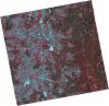
DE2_OPER_HRA_PSH_1C_20210626T111542_N40-414_W008-427_0001
Download Product | Product Info | Browse
Platform Short Name | GEOSAT |
Platform Serial Identifier | 2 |
Product Type | HRA_PSH_1C |
Start Date | 2021-06-26T11:15:42Z |
Stop Date | 2021-06-26T11:15:44Z |
Original Name | DE2_PSH_L1C_000000_20210626T111542_20210626T111544_DE2_38039_A915.zip |
Footprint | 40.3572703648 -8.31556527305 40.4979030681 -8.35019659673 40.4724638085 -8.54017781597 40.3317662068 -8.50581745614 40.3572703648 -8.31556527305 |
Orbit Direction | ASCENDING |
Scene Centre Longitude | W008 |
Scene Centre Latitude | N40 |
Cloud Cover Percentage | -1 |
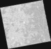
DE2_OPER_HRA_PM4_1C_20210626T111542_N40-414_W008-427_0001
Download Product | Product Info | Browse
Platform Short Name | GEOSAT |
Platform Serial Identifier | 2 |
Product Type | HRA_PM4_1C |
Start Date | 2021-06-26T11:15:42Z |
Stop Date | 2021-06-26T11:15:44Z |
Original Name | DE2_PM4_L1C_000000_20210626T111542_20210626T111544_DE2_38039_A915.zip |
Footprint | 40.3572703648 -8.31556527305 40.4979030681 -8.35019659673 40.4724638085 -8.54017781597 40.3317662068 -8.50581745614 40.3572703648 -8.31556527305 |
Orbit Direction | ASCENDING |
Scene Centre Longitude | W008 |
Scene Centre Latitude | N40 |
Cloud Cover Percentage | -1 |
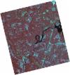
DE2_OPER_HRA_PSH_1C_20210626T111540_N40-287_W008-396_0001
Download Product | Product Info | Browse
Platform Short Name | GEOSAT |
Platform Serial Identifier | 2 |
Product Type | HRA_PSH_1C |
Start Date | 2021-06-26T11:15:40Z |
Stop Date | 2021-06-26T11:15:42Z |
Original Name | DE2_PSH_L1C_000000_20210626T111540_20210626T111542_DE2_38039_9C59.zip |
Footprint | 40.2297419339 -8.28458470546 40.3702724343 -8.31932077648 40.3447741648 -8.5092019011 40.2042710783 -8.47420835614 40.2297419339 -8.28458470546 |
Orbit Direction | ASCENDING |
Scene Centre Longitude | W008 |
Scene Centre Latitude | N40 |
Cloud Cover Percentage | -1 |
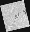
DE2_OPER_HRA_PM4_1C_20210626T111540_N40-287_W008-396_0001
Download Product | Product Info | Browse
Platform Short Name | GEOSAT |
Platform Serial Identifier | 2 |
Product Type | HRA_PM4_1C |
Start Date | 2021-06-26T11:15:40Z |
Stop Date | 2021-06-26T11:15:42Z |
Original Name | DE2_PM4_L1C_000000_20210626T111540_20210626T111542_DE2_38039_9C59.zip |
Footprint | 40.2297419339 -8.28458470546 40.3702724343 -8.31932077648 40.3447741648 -8.5092019011 40.2042710783 -8.47420835614 40.2297419339 -8.28458470546 |
Orbit Direction | ASCENDING |
Scene Centre Longitude | W008 |
Scene Centre Latitude | N40 |
Cloud Cover Percentage | -1 |
DE2_OPER_HRA_PSH_1C_20210525T110146_N40-321_W008-248_0001
Download Product | Product Info | Browse
Platform Short Name | GEOSAT |
Platform Serial Identifier | 2 |
Product Type | HRA_PSH_1C |
Start Date | 2021-05-25T11:01:46Z |
Stop Date | 2021-05-25T11:01:48Z |
Original Name | DE2_PSH_L1C_000000_20210525T110146_20210525T110148_DE2_37564_88B9.zip |
Footprint | 40.2730719804 -8.15774334155 40.3959694785 -8.1943474672 40.370649043 -8.33881406544 40.2478080036 -8.30194273413 40.2730719804 -8.15774334155 |
Orbit Direction | ASCENDING |
Scene Centre Longitude | W008 |
Scene Centre Latitude | N40 |
Cloud Cover Percentage | -1 |
DE2_OPER_HRA_PM4_1C_20210525T110146_N40-321_W008-248_0001
Download Product | Product Info | Browse
Platform Short Name | GEOSAT |
Platform Serial Identifier | 2 |
Product Type | HRA_PM4_1C |
Start Date | 2021-05-25T11:01:46Z |
Stop Date | 2021-05-25T11:01:48Z |
Original Name | DE2_PM4_L1C_000000_20210525T110146_20210525T110148_DE2_37564_88B9.zip |
Footprint | 40.2730719804 -8.15774334155 40.3959694785 -8.1943474672 40.370649043 -8.33881406544 40.2478080036 -8.30194273413 40.2730719804 -8.15774334155 |
Orbit Direction | ASCENDING |
Scene Centre Longitude | W008 |
Scene Centre Latitude | N40 |
Cloud Cover Percentage | -1 |
DE2_OPER_HRA_PSH_1C_20210325T111858_N40-312_W008-486_0001
Download Product | Product Info | Browse
Platform Short Name | GEOSAT |
Platform Serial Identifier | 2 |
Product Type | HRA_PSH_1C |
Start Date | 2021-03-25T11:18:58Z |
Stop Date | 2021-03-25T11:19:00Z |
Original Name | DE2_PSH_L1C_000000_20210325T111858_20210325T111900_DE2_36659_3E6A.zip |
Footprint | 40.2550611513 -8.37452918678 40.3958769079 -8.40825994505 40.3703117177 -8.59947017045 40.2295194676 -8.56469333444 40.2550611513 -8.37452918678 |
Orbit Direction | ASCENDING |
Scene Centre Longitude | W008 |
Scene Centre Latitude | N40 |
Cloud Cover Percentage | -1 |
DE2_OPER_HRA_PM4_1C_20210325T111858_N40-312_W008-486_0001
Download Product | Product Info | Browse
Platform Short Name | GEOSAT |
Platform Serial Identifier | 2 |
Product Type | HRA_PM4_1C |
Start Date | 2021-03-25T11:18:58Z |
Stop Date | 2021-03-25T11:19:00Z |
Original Name | DE2_PM4_L1C_000000_20210325T111858_20210325T111900_DE2_36659_3E6A.zip |
Footprint | 40.2550611513 -8.37452918678 40.3958769079 -8.40825994505 40.3703117177 -8.59947017045 40.2295194676 -8.56469333444 40.2550611513 -8.37452918678 |
Orbit Direction | ASCENDING |
Scene Centre Longitude | W008 |
Scene Centre Latitude | N40 |
Cloud Cover Percentage | -1 |