ESA TPM Map Catalogue - Product List
back to previous node |
list of download URLs
Collection G2_Portugal_2021
GEOSAT-2 Portugal Coverage 2021 collection. More details here.
List of available products (latitude from 40.2077 to 40.2861 dg, longitude from -7.2575 to -7.11312 dg)..
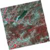
DE2_OPER_HRA_PSH_1C_20211022T110821_N40-329_W007-101_0001
Download Product | Product Info | BrowsePlatform Short Name | GEOSAT |
Platform Serial Identifier | 2 |
Product Type | HRA_PSH_1C |
Start Date | 2021-10-22T11:08:21Z |
Stop Date | 2021-10-22T11:08:24Z |
Original Name | DE2_PSH_L1C_000000_20211022T110821_20211022T110824_DE2_39790_3C85.zip |
Footprint | 40.2697374378 -6.9845646896 40.4153601033 -7.01687213471 40.3895052273 -7.22079688666 40.2442631029 -7.18477054885 40.2697374378 -6.9845646896 |
Orbit Direction | ASCENDING |
Scene Centre Longitude | W007 |
Scene Centre Latitude | N40 |
Cloud Cover Percentage | -1 |
DE2_OPER_HRA_PM4_1C_20211022T110821_N40-329_W007-101_0001
Download Product | Product Info | BrowsePlatform Short Name | GEOSAT |
Platform Serial Identifier | 2 |
Product Type | HRA_PM4_1C |
Start Date | 2021-10-22T11:08:21Z |
Stop Date | 2021-10-22T11:08:24Z |
Original Name | DE2_PM4_L1C_000000_20211022T110821_20211022T110824_DE2_39790_3C85.zip |
Footprint | 40.2697374378 -6.9845646896 40.4153601033 -7.01687213471 40.3895052273 -7.22079688666 40.2442631029 -7.18477054885 40.2697374378 -6.9845646896 |
Orbit Direction | ASCENDING |
Scene Centre Longitude | W007 |
Scene Centre Latitude | N40 |
Cloud Cover Percentage | -1 |
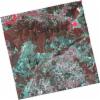
DE2_OPER_HRA_PSH_1C_20211022T110819_N40-197_W007-069_0001
Download Product | Product Info | BrowsePlatform Short Name | GEOSAT |
Platform Serial Identifier | 2 |
Product Type | HRA_PSH_1C |
Start Date | 2021-10-22T11:08:19Z |
Stop Date | 2021-10-22T11:08:22Z |
Original Name | DE2_PSH_L1C_000000_20211022T110819_20211022T110822_DE2_39790_E788.zip |
Footprint | 40.1382000536 -6.94858827426 40.2832110659 -6.98775500476 40.2577133788 -7.18809732801 40.1122496549 -7.15292776317 40.1382000536 -6.94858827426 |
Orbit Direction | ASCENDING |
Scene Centre Longitude | W007 |
Scene Centre Latitude | N40 |
Cloud Cover Percentage | -1 |
DE2_OPER_HRA_PM4_1C_20211022T110819_N40-197_W007-069_0001
Download Product | Product Info | BrowsePlatform Short Name | GEOSAT |
Platform Serial Identifier | 2 |
Product Type | HRA_PM4_1C |
Start Date | 2021-10-22T11:08:19Z |
Stop Date | 2021-10-22T11:08:22Z |
Original Name | DE2_PM4_L1C_000000_20211022T110819_20211022T110822_DE2_39790_E788.zip |
Footprint | 40.1382000536 -6.94858827426 40.2832110659 -6.98775500476 40.2577133788 -7.18809732801 40.1122496549 -7.15292776317 40.1382000536 -6.94858827426 |
Orbit Direction | ASCENDING |
Scene Centre Longitude | W007 |
Scene Centre Latitude | N40 |
Cloud Cover Percentage | -1 |
DE2_OPER_HRA_PSH_1C_20210808T110629_N40-295_W007-241_0001
Download Product | Product Info | BrowsePlatform Short Name | GEOSAT |
Platform Serial Identifier | 2 |
Product Type | HRA_PSH_1C |
Start Date | 2021-08-08T11:06:29Z |
Stop Date | 2021-08-08T11:06:32Z |
Original Name | DE2_PSH_L1C_000000_20210808T110629_20210808T110632_DE2_38677_2517.zip |
Footprint | 40.2407255066 -7.13775781732 40.3749239568 -7.17307866615 40.3502443765 -7.34457124396 40.2159030854 -7.30992998564 40.2407255066 -7.13775781732 |
Orbit Direction | ASCENDING |
Scene Centre Longitude | W007 |
Scene Centre Latitude | N40 |
Cloud Cover Percentage | -1 |
DE2_OPER_HRA_PM4_1C_20210808T110629_N40-295_W007-241_0001
Download Product | Product Info | BrowsePlatform Short Name | GEOSAT |
Platform Serial Identifier | 2 |
Product Type | HRA_PM4_1C |
Start Date | 2021-08-08T11:06:29Z |
Stop Date | 2021-08-08T11:06:32Z |
Original Name | DE2_PM4_L1C_000000_20210808T110629_20210808T110632_DE2_38677_2517.zip |
Footprint | 40.2407255066 -7.13775781732 40.3749239568 -7.17307866615 40.3502443765 -7.34457124396 40.2159030854 -7.30992998564 40.2407255066 -7.13775781732 |
Orbit Direction | ASCENDING |
Scene Centre Longitude | W007 |
Scene Centre Latitude | N40 |
Cloud Cover Percentage | -1 |
DE2_OPER_HRA_PSH_1C_20210808T110627_N40-173_W007-209_0001
Download Product | Product Info | BrowsePlatform Short Name | GEOSAT |
Platform Serial Identifier | 2 |
Product Type | HRA_PSH_1C |
Start Date | 2021-08-08T11:06:27Z |
Stop Date | 2021-08-08T11:06:30Z |
Original Name | DE2_PSH_L1C_000000_20210808T110627_20210808T110630_DE2_38677_9FB0.zip |
Footprint | 40.1189640668 -7.10557355462 40.2531934245 -7.14083745914 40.22835095 -7.31332290869 40.0941146202 -7.27786179602 40.1189640668 -7.10557355462 |
Orbit Direction | ASCENDING |
Scene Centre Longitude | W007 |
Scene Centre Latitude | N40 |
Cloud Cover Percentage | -1 |
DE2_OPER_HRA_PM4_1C_20210808T110627_N40-173_W007-209_0001
Download Product | Product Info | BrowsePlatform Short Name | GEOSAT |
Platform Serial Identifier | 2 |
Product Type | HRA_PM4_1C |
Start Date | 2021-08-08T11:06:27Z |
Stop Date | 2021-08-08T11:06:30Z |
Original Name | DE2_PM4_L1C_000000_20210808T110627_20210808T110630_DE2_38677_9FB0.zip |
Footprint | 40.1189640668 -7.10557355462 40.2531934245 -7.14083745914 40.22835095 -7.31332290869 40.0941146202 -7.27786179602 40.1189640668 -7.10557355462 |
Orbit Direction | ASCENDING |
Scene Centre Longitude | W007 |
Scene Centre Latitude | N40 |
Cloud Cover Percentage | -1 |
DE2_OPER_HRA_PSH_1C_20210506T105613_N40-207_W007-307_0001
Download Product | Product Info | BrowsePlatform Short Name | GEOSAT |
Platform Serial Identifier | 2 |
Product Type | HRA_PSH_1C |
Start Date | 2021-05-06T10:56:13Z |
Stop Date | 2021-05-06T10:56:16Z |
Original Name | DE2_PSH_L1C_000000_20210506T105613_20210506T105616_DE2_37282_37C6.zip |
Footprint | 40.1592873201 -7.21702099318 40.2819563215 -7.25493864174 40.2559006361 -7.39914201081 40.1332837146 -7.3607466932 40.1592873201 -7.21702099318 |
Orbit Direction | ASCENDING |
Scene Centre Longitude | W007 |
Scene Centre Latitude | N40 |
Cloud Cover Percentage | -1 |
DE2_OPER_HRA_PM4_1C_20210506T105613_N40-207_W007-307_0001
Download Product | Product Info | BrowsePlatform Short Name | GEOSAT |
Platform Serial Identifier | 2 |
Product Type | HRA_PM4_1C |
Start Date | 2021-05-06T10:56:13Z |
Stop Date | 2021-05-06T10:56:16Z |
Original Name | DE2_PM4_L1C_000000_20210506T105613_20210506T105616_DE2_37282_37C6.zip |
Footprint | 40.1592873201 -7.21702099318 40.2819563215 -7.25493864174 40.2559006361 -7.39914201081 40.1332837146 -7.3607466932 40.1592873201 -7.21702099318 |
Orbit Direction | ASCENDING |
Scene Centre Longitude | W007 |
Scene Centre Latitude | N40 |
Cloud Cover Percentage | -1 |


