ESA TPM Map Catalogue - Product List
back to previous node |
list of download URLs
Collection G2_Portugal_2021
GEOSAT-2 Portugal Coverage 2021 collection. More details here.
List of available products (latitude from 40.2077 to 40.2861 dg, longitude from -7.75625 to -7.61188 dg)..
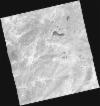
DE2_OPER_HRA_PSH_1C_20210727T111336_N40-209_W007-817_0001
Download Product | Product Info | BrowsePlatform Short Name | GEOSAT |
Platform Serial Identifier | 2 |
Product Type | HRA_PSH_1C |
Start Date | 2021-07-27T11:13:36Z |
Stop Date | 2021-07-27T11:13:39Z |
Original Name | DE2_PSH_L1C_000000_20210727T111336_20210727T111339_DE2_38499_E91F.zip |
Footprint | 40.1505403182 -7.70097930829 40.2935619374 -7.735781139 40.2679168336 -7.93261448257 40.1245540729 -7.90071689261 40.1505403182 -7.70097930829 |
Orbit Direction | ASCENDING |
Scene Centre Longitude | W007 |
Scene Centre Latitude | N40 |
Cloud Cover Percentage | -1 |
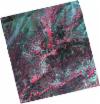
DE2_OPER_HRA_PM4_1C_20210727T111336_N40-209_W007-817_0001
Download Product | Product Info | BrowsePlatform Short Name | GEOSAT |
Platform Serial Identifier | 2 |
Product Type | HRA_PM4_1C |
Start Date | 2021-07-27T11:13:36Z |
Stop Date | 2021-07-27T11:13:39Z |
Original Name | DE2_PM4_L1C_000000_20210727T111336_20210727T111339_DE2_38499_E91F.zip |
Footprint | 40.1505403182 -7.70097930829 40.2935619374 -7.735781139 40.2679168336 -7.93261448257 40.1245540729 -7.90071689261 40.1505403182 -7.70097930829 |
Orbit Direction | ASCENDING |
Scene Centre Longitude | W007 |
Scene Centre Latitude | N40 |
Cloud Cover Percentage | -1 |
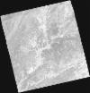
DE2_OPER_HRA_PSH_1C_20210720T110142_N40-333_W007-796_0001
Download Product | Product Info | BrowsePlatform Short Name | GEOSAT |
Platform Serial Identifier | 2 |
Product Type | HRA_PSH_1C |
Start Date | 2021-07-20T11:01:42Z |
Stop Date | 2021-07-20T11:01:45Z |
Original Name | DE2_PSH_L1C_000000_20210720T110142_20210720T110145_DE2_38395_C640.zip |
Footprint | 40.2834847718 -7.70437526533 40.4082346665 -7.73997516133 40.3836853996 -7.88794466301 40.2588770578 -7.85223481241 40.2834847718 -7.70437526533 |
Orbit Direction | ASCENDING |
Scene Centre Longitude | W007 |
Scene Centre Latitude | N40 |
Cloud Cover Percentage | -1 |
DE2_OPER_HRA_PM4_1C_20210720T110142_N40-333_W007-796_0001
Download Product | Product Info | BrowsePlatform Short Name | GEOSAT |
Platform Serial Identifier | 2 |
Product Type | HRA_PM4_1C |
Start Date | 2021-07-20T11:01:42Z |
Stop Date | 2021-07-20T11:01:45Z |
Original Name | DE2_PM4_L1C_000000_20210720T110142_20210720T110145_DE2_38395_C640.zip |
Footprint | 40.2834847718 -7.70437526533 40.4082346665 -7.73997516133 40.3836853996 -7.88794466301 40.2588770578 -7.85223481241 40.2834847718 -7.70437526533 |
Orbit Direction | ASCENDING |
Scene Centre Longitude | W007 |
Scene Centre Latitude | N40 |
Cloud Cover Percentage | -1 |
DE2_OPER_HRA_PSH_1C_20210720T110141_N40-220_W007-763_0001
Download Product | Product Info | BrowsePlatform Short Name | GEOSAT |
Platform Serial Identifier | 2 |
Product Type | HRA_PSH_1C |
Start Date | 2021-07-20T11:01:41Z |
Stop Date | 2021-07-20T11:01:43Z |
Original Name | DE2_PSH_L1C_000000_20210720T110141_20210720T110143_DE2_38395_6DF4.zip |
Footprint | 40.1702352788 -7.67168762458 40.2950303655 -7.70785203118 40.2703880403 -7.85606257332 40.1455258082 -7.82019384342 40.1702352788 -7.67168762458 |
Orbit Direction | ASCENDING |
Scene Centre Longitude | W007 |
Scene Centre Latitude | N40 |
Cloud Cover Percentage | -1 |
DE2_OPER_HRA_PM4_1C_20210720T110141_N40-220_W007-763_0001
Download Product | Product Info | BrowsePlatform Short Name | GEOSAT |
Platform Serial Identifier | 2 |
Product Type | HRA_PM4_1C |
Start Date | 2021-07-20T11:01:41Z |
Stop Date | 2021-07-20T11:01:43Z |
Original Name | DE2_PM4_L1C_000000_20210720T110141_20210720T110143_DE2_38395_6DF4.zip |
Footprint | 40.1702352788 -7.67168762458 40.2950303655 -7.70785203118 40.2703880403 -7.85606257332 40.1455258082 -7.82019384342 40.1702352788 -7.67168762458 |
Orbit Direction | ASCENDING |
Scene Centre Longitude | W007 |
Scene Centre Latitude | N40 |
Cloud Cover Percentage | -1 |
DE2_OPER_HRA_PSH_1C_20210519T110506_N40-333_W007-656_0001
Download Product | Product Info | BrowsePlatform Short Name | GEOSAT |
Platform Serial Identifier | 2 |
Product Type | HRA_PSH_1C |
Start Date | 2021-05-19T11:05:06Z |
Stop Date | 2021-05-19T11:05:08Z |
Original Name | DE2_PSH_L1C_000000_20210519T110506_20210519T110508_DE2_37475_2EBB.zip |
Footprint | 40.2830145589 -7.563286585 40.4090143807 -7.59929793323 40.3847959395 -7.74930973296 40.2585989935 -7.71461314982 40.2830145589 -7.563286585 |
Orbit Direction | ASCENDING |
Scene Centre Longitude | W007 |
Scene Centre Latitude | N40 |
Cloud Cover Percentage | -1 |
DE2_OPER_HRA_PM4_1C_20210519T110506_N40-333_W007-656_0001
Download Product | Product Info | BrowsePlatform Short Name | GEOSAT |
Platform Serial Identifier | 2 |
Product Type | HRA_PM4_1C |
Start Date | 2021-05-19T11:05:06Z |
Stop Date | 2021-05-19T11:05:08Z |
Original Name | DE2_PM4_L1C_000000_20210519T110506_20210519T110508_DE2_37475_2EBB.zip |
Footprint | 40.2830145589 -7.563286585 40.4090143807 -7.59929793323 40.3847959395 -7.74930973296 40.2585989935 -7.71461314982 40.2830145589 -7.563286585 |
Orbit Direction | ASCENDING |
Scene Centre Longitude | W007 |
Scene Centre Latitude | N40 |
Cloud Cover Percentage | -1 |
DE2_OPER_HRA_PSH_1C_20210519T110504_N40-219_W007-623_0001
Download Product | Product Info | BrowsePlatform Short Name | GEOSAT |
Platform Serial Identifier | 2 |
Product Type | HRA_PSH_1C |
Start Date | 2021-05-19T11:05:04Z |
Stop Date | 2021-05-19T11:05:06Z |
Original Name | DE2_PSH_L1C_000000_20210519T110504_20210519T110506_DE2_37475_ADB4.zip |
Footprint | 40.1684971479 -7.52904739013 40.2945423379 -7.56771910184 40.2703254701 -7.71736377173 40.1439842788 -7.68109163338 40.1684971479 -7.52904739013 |
Orbit Direction | ASCENDING |
Scene Centre Longitude | W007 |
Scene Centre Latitude | N40 |
Cloud Cover Percentage | -1 |
DE2_OPER_HRA_PM4_1C_20210519T110504_N40-219_W007-623_0001
Download Product | Product Info | BrowsePlatform Short Name | GEOSAT |
Platform Serial Identifier | 2 |
Product Type | HRA_PM4_1C |
Start Date | 2021-05-19T11:05:04Z |
Stop Date | 2021-05-19T11:05:06Z |
Original Name | DE2_PM4_L1C_000000_20210519T110504_20210519T110506_DE2_37475_ADB4.zip |
Footprint | 40.1684971479 -7.52904739013 40.2945423379 -7.56771910184 40.2703254701 -7.71736377173 40.1439842788 -7.68109163338 40.1684971479 -7.52904739013 |
Orbit Direction | ASCENDING |
Scene Centre Longitude | W007 |
Scene Centre Latitude | N40 |
Cloud Cover Percentage | -1 |


