ESA TPM Map Catalogue - Product List
back to previous node |
list of download URLs
Collection G2_Portugal_2021
GEOSAT-2 Portugal Coverage 2021 collection. More details here.
List of available products (latitude from 40.2077 to 40.2861 dg, longitude from -8.255 to -8.11063 dg)..
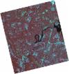
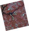
DE2_OPER_HRA_PSH_1C_20210525T110146_N40-321_W008-248_0001
Download Product | Product Info | Browse
Platform Short Name | GEOSAT |
Platform Serial Identifier | 2 |
Product Type | HRA_PSH_1C |
Start Date | 2021-05-25T11:01:46Z |
Stop Date | 2021-05-25T11:01:48Z |
Original Name | DE2_PSH_L1C_000000_20210525T110146_20210525T110148_DE2_37564_88B9.zip |
Footprint | 40.2730719804 -8.15774334155 40.3959694785 -8.1943474672 40.370649043 -8.33881406544 40.2478080036 -8.30194273413 40.2730719804 -8.15774334155 |
Orbit Direction | ASCENDING |
Scene Centre Longitude | W008 |
Scene Centre Latitude | N40 |
Cloud Cover Percentage | -1 |
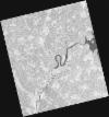
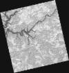
DE2_OPER_HRA_PM4_1C_20210525T110146_N40-321_W008-248_0001
Download Product | Product Info | Browse
Platform Short Name | GEOSAT |
Platform Serial Identifier | 2 |
Product Type | HRA_PM4_1C |
Start Date | 2021-05-25T11:01:46Z |
Stop Date | 2021-05-25T11:01:48Z |
Original Name | DE2_PM4_L1C_000000_20210525T110146_20210525T110148_DE2_37564_88B9.zip |
Footprint | 40.2730719804 -8.15774334155 40.3959694785 -8.1943474672 40.370649043 -8.33881406544 40.2478080036 -8.30194273413 40.2730719804 -8.15774334155 |
Orbit Direction | ASCENDING |
Scene Centre Longitude | W008 |
Scene Centre Latitude | N40 |
Cloud Cover Percentage | -1 |
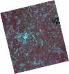
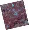
DE2_OPER_HRA_PSH_1C_20210525T110144_N40-210_W008-214_0001
Download Product | Product Info | Browse
Platform Short Name | GEOSAT |
Platform Serial Identifier | 2 |
Product Type | HRA_PSH_1C |
Start Date | 2021-05-25T11:01:44Z |
Stop Date | 2021-05-25T11:01:46Z |
Original Name | DE2_PSH_L1C_000000_20210525T110144_20210525T110146_DE2_37564_EF15.zip |
Footprint | 40.161416677 -8.12453986987 40.2844689744 -8.16120164666 40.259213972 -8.30534457467 40.1361638004 -8.2683997442 40.161416677 -8.12453986987 |
Orbit Direction | ASCENDING |
Scene Centre Longitude | W008 |
Scene Centre Latitude | N40 |
Cloud Cover Percentage | -1 |
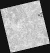
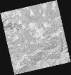
DE2_OPER_HRA_PM4_1C_20210525T110144_N40-210_W008-214_0001
Download Product | Product Info | Browse
Platform Short Name | GEOSAT |
Platform Serial Identifier | 2 |
Product Type | HRA_PM4_1C |
Start Date | 2021-05-25T11:01:44Z |
Stop Date | 2021-05-25T11:01:46Z |
Original Name | DE2_PM4_L1C_000000_20210525T110144_20210525T110146_DE2_37564_EF15.zip |
Footprint | 40.161416677 -8.12453986987 40.2844689744 -8.16120164666 40.259213972 -8.30534457467 40.1361638004 -8.2683997442 40.161416677 -8.12453986987 |
Orbit Direction | ASCENDING |
Scene Centre Longitude | W008 |
Scene Centre Latitude | N40 |
Cloud Cover Percentage | -1 |
DE2_OPER_HRA_PSH_1C_20210318T110635_N40-330_W008-099_0001
Download Product | Product Info | Browse
Platform Short Name | GEOSAT |
Platform Serial Identifier | 2 |
Product Type | HRA_PSH_1C |
Start Date | 2021-03-18T11:06:35Z |
Stop Date | 2021-03-18T11:06:38Z |
Original Name | DE2_PSH_L1C_000000_20210318T110635_20210318T110638_DE2_36555_177A.zip |
Footprint | 40.2801871372 -8.00775493346 40.4050284625 -8.04338186945 40.3803211135 -8.19149453187 40.255495621 -8.15566833714 40.2801871372 -8.00775493346 |
Orbit Direction | ASCENDING |
Scene Centre Longitude | W008 |
Scene Centre Latitude | N40 |
Cloud Cover Percentage | -1 |
DE2_OPER_HRA_PM4_1C_20210318T110635_N40-330_W008-099_0001
Download Product | Product Info | Browse
Platform Short Name | GEOSAT |
Platform Serial Identifier | 2 |
Product Type | HRA_PM4_1C |
Start Date | 2021-03-18T11:06:35Z |
Stop Date | 2021-03-18T11:06:38Z |
Original Name | DE2_PM4_L1C_000000_20210318T110635_20210318T110638_DE2_36555_177A.zip |
Footprint | 40.2801871372 -8.00775493346 40.4050284625 -8.04338186945 40.3803211135 -8.19149453187 40.255495621 -8.15566833714 40.2801871372 -8.00775493346 |
Orbit Direction | ASCENDING |
Scene Centre Longitude | W008 |
Scene Centre Latitude | N40 |
Cloud Cover Percentage | -1 |
DE2_OPER_HRA_PSH_1C_20210318T110634_N40-217_W008-067_0001
Download Product | Product Info | Browse
Platform Short Name | GEOSAT |
Platform Serial Identifier | 2 |
Product Type | HRA_PSH_1C |
Start Date | 2021-03-18T11:06:34Z |
Stop Date | 2021-03-18T11:06:36Z |
Original Name | DE2_PSH_L1C_000000_20210318T110634_20210318T110636_DE2_36555_D7D6.zip |
Footprint | 40.1669367039 -7.97620135315 40.2917362638 -8.01110672471 40.2670537604 -8.1589735031 40.1423405055 -8.12350813891 40.1669367039 -7.97620135315 |
Orbit Direction | ASCENDING |
Scene Centre Longitude | W008 |
Scene Centre Latitude | N40 |
Cloud Cover Percentage | -1 |
DE2_OPER_HRA_PM4_1C_20210318T110634_N40-217_W008-067_0001
Download Product | Product Info | Browse
Platform Short Name | GEOSAT |
Platform Serial Identifier | 2 |
Product Type | HRA_PM4_1C |
Start Date | 2021-03-18T11:06:34Z |
Stop Date | 2021-03-18T11:06:36Z |
Original Name | DE2_PM4_L1C_000000_20210318T110634_20210318T110636_DE2_36555_D7D6.zip |
Footprint | 40.1669367039 -7.97620135315 40.2917362638 -8.01110672471 40.2670537604 -8.1589735031 40.1423405055 -8.12350813891 40.1669367039 -7.97620135315 |
Orbit Direction | ASCENDING |
Scene Centre Longitude | W008 |
Scene Centre Latitude | N40 |
Cloud Cover Percentage | -1 |