ESA TPM Map Catalogue - Product List
back to previous node |
list of download URLs

Collection G2_Portugal_2021
GEOSAT-2 Portugal Coverage 2021 collection. More details here.
List of available products (latitude from 40.2077 to 40.2861 dg, longitude from -8.68812 to -8.54375 dg)..
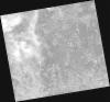
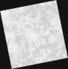
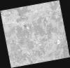
DE2_OPER_HRA_PSH_1C_20211010T111605_N40-282_W008-600_0001
Download Product | Product Info | Browse
Platform Short Name | GEOSAT |
Platform Serial Identifier | 2 |
Product Type | HRA_PSH_1C |
Start Date | 2021-10-10T11:16:05Z |
Stop Date | 2021-10-10T11:16:08Z |
Original Name | DE2_PSH_L1C_000000_20211010T111605_20211010T111608_DE2_39612_9391.zip |
Footprint | 40.2210496361 -8.4773665813 40.3693301849 -8.5111439904 40.3432058622 -8.7226597275 40.1949317682 -8.68890010512 40.2210496361 -8.4773665813 |
Orbit Direction | ASCENDING |
Scene Centre Longitude | W008 |
Scene Centre Latitude | N40 |
Cloud Cover Percentage | -1 |
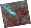
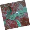
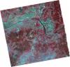
DE2_OPER_HRA_PM4_1C_20211010T111605_N40-282_W008-600_0001
Download Product | Product Info | Browse
Platform Short Name | GEOSAT |
Platform Serial Identifier | 2 |
Product Type | HRA_PM4_1C |
Start Date | 2021-10-10T11:16:05Z |
Stop Date | 2021-10-10T11:16:08Z |
Original Name | DE2_PM4_L1C_000000_20211010T111605_20211010T111608_DE2_39612_9391.zip |
Footprint | 40.2210496361 -8.4773665813 40.3693301849 -8.5111439904 40.3432058622 -8.7226597275 40.1949317682 -8.68890010512 40.2210496361 -8.4773665813 |
Orbit Direction | ASCENDING |
Scene Centre Longitude | W008 |
Scene Centre Latitude | N40 |
Cloud Cover Percentage | -1 |
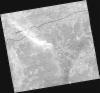
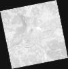
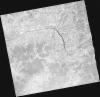
DE2_OPER_HRA_PSH_1C_20211010T111602_N40-149_W008-568_0001
Download Product | Product Info | Browse
Platform Short Name | GEOSAT |
Platform Serial Identifier | 2 |
Product Type | HRA_PSH_1C |
Start Date | 2021-10-10T11:16:02Z |
Stop Date | 2021-10-10T11:16:05Z |
Original Name | DE2_PSH_L1C_000000_20211010T111602_20211010T111605_DE2_39612_1892.zip |
Footprint | 40.0883946984 -8.44558495462 40.2368658045 -8.47840881981 40.2105274673 -8.69154335251 40.0621922092 -8.65726474394 40.0883946984 -8.44558495462 |
Orbit Direction | ASCENDING |
Scene Centre Longitude | W008 |
Scene Centre Latitude | N40 |
Cloud Cover Percentage | -1 |
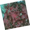
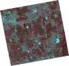
DE2_OPER_HRA_PM4_1C_20211010T111602_N40-149_W008-568_0001
Download Product | Product Info | Browse
Platform Short Name | GEOSAT |
Platform Serial Identifier | 2 |
Product Type | HRA_PM4_1C |
Start Date | 2021-10-10T11:16:02Z |
Stop Date | 2021-10-10T11:16:05Z |
Original Name | DE2_PM4_L1C_000000_20211010T111602_20211010T111605_DE2_39612_1892.zip |
Footprint | 40.0883946984 -8.44558495462 40.2368658045 -8.47840881981 40.2105274673 -8.69154335251 40.0621922092 -8.65726474394 40.0883946984 -8.44558495462 |
Orbit Direction | ASCENDING |
Scene Centre Longitude | W008 |
Scene Centre Latitude | N40 |
Cloud Cover Percentage | -1 |
DE2_OPER_HRA_PSH_1C_20210331T111547_N40-291_W008-711_0001
Download Product | Product Info | Browse
Platform Short Name | GEOSAT |
Platform Serial Identifier | 2 |
Product Type | HRA_PSH_1C |
Start Date | 2021-03-31T11:15:47Z |
Stop Date | 2021-03-31T11:15:49Z |
Original Name | DE2_PSH_L1C_000000_20210331T111547_20210331T111549_DE2_36748_3D46.zip |
Footprint | 40.2376664523 -8.60958999352 40.3708829416 -8.64396514439 40.3459906065 -8.81423533304 40.2127895516 -8.77960891068 40.2376664523 -8.60958999352 |
Orbit Direction | ASCENDING |
Scene Centre Longitude | W008 |
Scene Centre Latitude | N40 |
Cloud Cover Percentage | -1 |
DE2_OPER_HRA_PM4_1C_20210331T111547_N40-291_W008-711_0001
Download Product | Product Info | Browse
Platform Short Name | GEOSAT |
Platform Serial Identifier | 2 |
Product Type | HRA_PM4_1C |
Start Date | 2021-03-31T11:15:47Z |
Stop Date | 2021-03-31T11:15:49Z |
Original Name | DE2_PM4_L1C_000000_20210331T111547_20210331T111549_DE2_36748_3D46.zip |
Footprint | 40.2376664523 -8.60958999352 40.3708829416 -8.64396514439 40.3459906065 -8.81423533304 40.2127895516 -8.77960891068 40.2376664523 -8.60958999352 |
Orbit Direction | ASCENDING |
Scene Centre Longitude | W008 |
Scene Centre Latitude | N40 |
Cloud Cover Percentage | -1 |
DE2_OPER_HRA_PSH_1C_20210331T111545_N40-170_W008-680_0001
Download Product | Product Info | Browse
Platform Short Name | GEOSAT |
Platform Serial Identifier | 2 |
Product Type | HRA_PSH_1C |
Start Date | 2021-03-31T11:15:45Z |
Stop Date | 2021-03-31T11:15:47Z |
Original Name | DE2_PSH_L1C_000000_20210331T111545_20210331T111547_DE2_36748_29E0.zip |
Footprint | 40.116727848 -8.57881779283 40.2499956746 -8.61290548546 40.2251475805 -8.7828217333 40.0919338976 -8.74794757574 40.116727848 -8.57881779283 |
Orbit Direction | ASCENDING |
Scene Centre Longitude | W008 |
Scene Centre Latitude | N40 |
Cloud Cover Percentage | -1 |
DE2_OPER_HRA_PM4_1C_20210331T111545_N40-170_W008-680_0001
Download Product | Product Info | Browse
Platform Short Name | GEOSAT |
Platform Serial Identifier | 2 |
Product Type | HRA_PM4_1C |
Start Date | 2021-03-31T11:15:45Z |
Stop Date | 2021-03-31T11:15:47Z |
Original Name | DE2_PM4_L1C_000000_20210331T111545_20210331T111547_DE2_36748_29E0.zip |
Footprint | 40.116727848 -8.57881779283 40.2499956746 -8.61290548546 40.2251475805 -8.7828217333 40.0919338976 -8.74794757574 40.116727848 -8.57881779283 |
Orbit Direction | ASCENDING |
Scene Centre Longitude | W008 |
Scene Centre Latitude | N40 |
Cloud Cover Percentage | -1 |
DE2_OPER_HRA_PSH_1C_20210325T111858_N40-312_W008-486_0001
Download Product | Product Info | Browse
Platform Short Name | GEOSAT |
Platform Serial Identifier | 2 |
Product Type | HRA_PSH_1C |
Start Date | 2021-03-25T11:18:58Z |
Stop Date | 2021-03-25T11:19:00Z |
Original Name | DE2_PSH_L1C_000000_20210325T111858_20210325T111900_DE2_36659_3E6A.zip |
Footprint | 40.2550611513 -8.37452918678 40.3958769079 -8.40825994505 40.3703117177 -8.59947017045 40.2295194676 -8.56469333444 40.2550611513 -8.37452918678 |
Orbit Direction | ASCENDING |
Scene Centre Longitude | W008 |
Scene Centre Latitude | N40 |
Cloud Cover Percentage | -1 |
DE2_OPER_HRA_PM4_1C_20210325T111858_N40-312_W008-486_0001
Download Product | Product Info | Browse
Platform Short Name | GEOSAT |
Platform Serial Identifier | 2 |
Product Type | HRA_PM4_1C |
Start Date | 2021-03-25T11:18:58Z |
Stop Date | 2021-03-25T11:19:00Z |
Original Name | DE2_PM4_L1C_000000_20210325T111858_20210325T111900_DE2_36659_3E6A.zip |
Footprint | 40.2550611513 -8.37452918678 40.3958769079 -8.40825994505 40.3703117177 -8.59947017045 40.2295194676 -8.56469333444 40.2550611513 -8.37452918678 |
Orbit Direction | ASCENDING |
Scene Centre Longitude | W008 |
Scene Centre Latitude | N40 |
Cloud Cover Percentage | -1 |
DE2_OPER_HRA_PSH_1C_20210325T111856_N40-184_W008-455_0001
Download Product | Product Info | Browse
Platform Short Name | GEOSAT |
Platform Serial Identifier | 2 |
Product Type | HRA_PSH_1C |
Start Date | 2021-03-25T11:18:56Z |
Stop Date | 2021-03-25T11:18:58Z |
Original Name | DE2_PSH_L1C_000000_20210325T111856_20210325T111858_DE2_36659_513D.zip |
Footprint | 40.1272457363 -8.34419770842 40.2680265154 -8.37805277974 40.2425261964 -8.56814588632 40.1018559366 -8.53316148177 40.1272457363 -8.34419770842 |
Orbit Direction | ASCENDING |
Scene Centre Longitude | W008 |
Scene Centre Latitude | N40 |
Cloud Cover Percentage | -1 |
DE2_OPER_HRA_PM4_1C_20210325T111856_N40-184_W008-455_0001
Download Product | Product Info | Browse
Platform Short Name | GEOSAT |
Platform Serial Identifier | 2 |
Product Type | HRA_PM4_1C |
Start Date | 2021-03-25T11:18:56Z |
Stop Date | 2021-03-25T11:18:58Z |
Original Name | DE2_PM4_L1C_000000_20210325T111856_20210325T111858_DE2_36659_513D.zip |
Footprint | 40.1272457363 -8.34419770842 40.2680265154 -8.37805277974 40.2425261964 -8.56814588632 40.1018559366 -8.53316148177 40.1272457363 -8.34419770842 |
Orbit Direction | ASCENDING |
Scene Centre Longitude | W008 |
Scene Centre Latitude | N40 |
Cloud Cover Percentage | -1 |