ESA TPM Map Catalogue - Product List
back to previous node |
list of download URLs

Collection G2_Portugal_2021
GEOSAT-2 Portugal Coverage 2021 collection. More details here.
List of available products (latitude from 40.2077 to 40.2861 dg, longitude from -8.8325 to -8.68812 dg)..
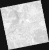
DE2_OPER_HRA_PSH_1C_20211010T111605_N40-282_W008-600_0001
Download Product | Product Info | Browse
Platform Short Name | GEOSAT |
Platform Serial Identifier | 2 |
Product Type | HRA_PSH_1C |
Start Date | 2021-10-10T11:16:05Z |
Stop Date | 2021-10-10T11:16:08Z |
Original Name | DE2_PSH_L1C_000000_20211010T111605_20211010T111608_DE2_39612_9391.zip |
Footprint | 40.2210496361 -8.4773665813 40.3693301849 -8.5111439904 40.3432058622 -8.7226597275 40.1949317682 -8.68890010512 40.2210496361 -8.4773665813 |
Orbit Direction | ASCENDING |
Scene Centre Longitude | W008 |
Scene Centre Latitude | N40 |
Cloud Cover Percentage | -1 |
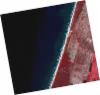
DE2_OPER_HRA_PM4_1C_20211010T111605_N40-282_W008-600_0001
Download Product | Product Info | Browse
Platform Short Name | GEOSAT |
Platform Serial Identifier | 2 |
Product Type | HRA_PM4_1C |
Start Date | 2021-10-10T11:16:05Z |
Stop Date | 2021-10-10T11:16:08Z |
Original Name | DE2_PM4_L1C_000000_20211010T111605_20211010T111608_DE2_39612_9391.zip |
Footprint | 40.2210496361 -8.4773665813 40.3693301849 -8.5111439904 40.3432058622 -8.7226597275 40.1949317682 -8.68890010512 40.2210496361 -8.4773665813 |
Orbit Direction | ASCENDING |
Scene Centre Longitude | W008 |
Scene Centre Latitude | N40 |
Cloud Cover Percentage | -1 |
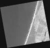
DE2_OPER_HRA_PSH_1C_20210331T111547_N40-291_W008-711_0001
Download Product | Product Info | Browse
Platform Short Name | GEOSAT |
Platform Serial Identifier | 2 |
Product Type | HRA_PSH_1C |
Start Date | 2021-03-31T11:15:47Z |
Stop Date | 2021-03-31T11:15:49Z |
Original Name | DE2_PSH_L1C_000000_20210331T111547_20210331T111549_DE2_36748_3D46.zip |
Footprint | 40.2376664523 -8.60958999352 40.3708829416 -8.64396514439 40.3459906065 -8.81423533304 40.2127895516 -8.77960891068 40.2376664523 -8.60958999352 |
Orbit Direction | ASCENDING |
Scene Centre Longitude | W008 |
Scene Centre Latitude | N40 |
Cloud Cover Percentage | -1 |
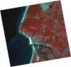
DE2_OPER_HRA_PM4_1C_20210331T111547_N40-291_W008-711_0001
Download Product | Product Info | Browse
Platform Short Name | GEOSAT |
Platform Serial Identifier | 2 |
Product Type | HRA_PM4_1C |
Start Date | 2021-03-31T11:15:47Z |
Stop Date | 2021-03-31T11:15:49Z |
Original Name | DE2_PM4_L1C_000000_20210331T111547_20210331T111549_DE2_36748_3D46.zip |
Footprint | 40.2376664523 -8.60958999352 40.3708829416 -8.64396514439 40.3459906065 -8.81423533304 40.2127895516 -8.77960891068 40.2376664523 -8.60958999352 |
Orbit Direction | ASCENDING |
Scene Centre Longitude | W008 |
Scene Centre Latitude | N40 |
Cloud Cover Percentage | -1 |
DE2_OPER_HRA_PSH_1C_20210331T111545_N40-170_W008-680_0001
Download Product | Product Info | Browse
Platform Short Name | GEOSAT |
Platform Serial Identifier | 2 |
Product Type | HRA_PSH_1C |
Start Date | 2021-03-31T11:15:45Z |
Stop Date | 2021-03-31T11:15:47Z |
Original Name | DE2_PSH_L1C_000000_20210331T111545_20210331T111547_DE2_36748_29E0.zip |
Footprint | 40.116727848 -8.57881779283 40.2499956746 -8.61290548546 40.2251475805 -8.7828217333 40.0919338976 -8.74794757574 40.116727848 -8.57881779283 |
Orbit Direction | ASCENDING |
Scene Centre Longitude | W008 |
Scene Centre Latitude | N40 |
Cloud Cover Percentage | -1 |
DE2_OPER_HRA_PM4_1C_20210331T111545_N40-170_W008-680_0001
Download Product | Product Info | Browse
Platform Short Name | GEOSAT |
Platform Serial Identifier | 2 |
Product Type | HRA_PM4_1C |
Start Date | 2021-03-31T11:15:45Z |
Stop Date | 2021-03-31T11:15:47Z |
Original Name | DE2_PM4_L1C_000000_20210331T111545_20210331T111547_DE2_36748_29E0.zip |
Footprint | 40.116727848 -8.57881779283 40.2499956746 -8.61290548546 40.2251475805 -8.7828217333 40.0919338976 -8.74794757574 40.116727848 -8.57881779283 |
Orbit Direction | ASCENDING |
Scene Centre Longitude | W008 |
Scene Centre Latitude | N40 |
Cloud Cover Percentage | -1 |
DE2_OPER_HRA_PSH_1C_20210319T112208_N40-305_W008-887_0001
Download Product | Product Info | Browse
Platform Short Name | GEOSAT |
Platform Serial Identifier | 2 |
Product Type | HRA_PSH_1C |
Start Date | 2021-03-19T11:22:08Z |
Stop Date | 2021-03-19T11:22:11Z |
Original Name | DE2_PSH_L1C_000000_20210319T112208_20210319T112211_DE2_36570_9BB7.zip |
Footprint | 40.2463873963 -8.77004696813 40.3906237867 -8.80422426082 40.3648429063 -9.00403398336 40.2204689233 -8.97039709121 40.2463873963 -8.77004696813 |
Orbit Direction | ASCENDING |
Scene Centre Longitude | W008 |
Scene Centre Latitude | N40 |
Cloud Cover Percentage | -1 |
DE2_OPER_HRA_PM4_1C_20210319T112208_N40-305_W008-887_0001
Download Product | Product Info | Browse
Platform Short Name | GEOSAT |
Platform Serial Identifier | 2 |
Product Type | HRA_PM4_1C |
Start Date | 2021-03-19T11:22:08Z |
Stop Date | 2021-03-19T11:22:11Z |
Original Name | DE2_PM4_L1C_000000_20210319T112208_20210319T112211_DE2_36570_9BB7.zip |
Footprint | 40.2463873963 -8.77004696813 40.3906237867 -8.80422426082 40.3648429063 -9.00403398336 40.2204689233 -8.97039709121 40.2463873963 -8.77004696813 |
Orbit Direction | ASCENDING |
Scene Centre Longitude | W008 |
Scene Centre Latitude | N40 |
Cloud Cover Percentage | -1 |
DE2_OPER_HRA_PSH_1C_20210319T112206_N40-174_W008-856_0001
Download Product | Product Info | Browse
Platform Short Name | GEOSAT |
Platform Serial Identifier | 2 |
Product Type | HRA_PSH_1C |
Start Date | 2021-03-19T11:22:06Z |
Stop Date | 2021-03-19T11:22:09Z |
Original Name | DE2_PSH_L1C_000000_20210319T112206_20210319T112209_DE2_36570_7D7F.zip |
Footprint | 40.1155106228 -8.73914738485 40.2597389313 -8.77327393472 40.2338216075 -8.97319492256 40.0896173973 -8.93871117806 40.1155106228 -8.73914738485 |
Orbit Direction | ASCENDING |
Scene Centre Longitude | W008 |
Scene Centre Latitude | N40 |
Cloud Cover Percentage | -1 |
DE2_OPER_HRA_PM4_1C_20210319T112206_N40-174_W008-856_0001
Download Product | Product Info | Browse
Platform Short Name | GEOSAT |
Platform Serial Identifier | 2 |
Product Type | HRA_PM4_1C |
Start Date | 2021-03-19T11:22:06Z |
Stop Date | 2021-03-19T11:22:09Z |
Original Name | DE2_PM4_L1C_000000_20210319T112206_20210319T112209_DE2_36570_7D7F.zip |
Footprint | 40.1155106228 -8.73914738485 40.2597389313 -8.77327393472 40.2338216075 -8.97319492256 40.0896173973 -8.93871117806 40.1155106228 -8.73914738485 |
Orbit Direction | ASCENDING |
Scene Centre Longitude | W008 |
Scene Centre Latitude | N40 |
Cloud Cover Percentage | -1 |