ESA TPM Map Catalogue - Product List
back to previous node |
list of download URLs


Collection G2_Portugal_2021
GEOSAT-2 Portugal Coverage 2021 collection. More details here.
List of available products (latitude from 40.1293 to 40.2077 dg, longitude from -7.4675 to -7.32313 dg)..
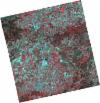
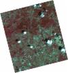
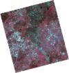
DE2_OPER_HRA_PSH_1C_20210714T110510_N40-190_W007-477_0001
Download Product | Product Info | Browse
Platform Short Name | GEOSAT |
Platform Serial Identifier | 2 |
Product Type | HRA_PSH_1C |
Start Date | 2021-07-14T11:05:10Z |
Stop Date | 2021-07-14T11:05:13Z |
Original Name | DE2_PSH_L1C_000000_20210714T110510_20210714T110513_DE2_38306_C52D.zip |
Footprint | 40.1387114794 -7.38009855354 40.2677128909 -7.41447546547 40.2430434602 -7.57488029125 40.1141213674 -7.53996199351 40.1387114794 -7.38009855354 |
Orbit Direction | ASCENDING |
Scene Centre Longitude | W007 |
Scene Centre Latitude | N40 |
Cloud Cover Percentage | -1 |
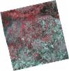
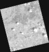
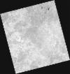
DE2_OPER_HRA_PM4_1C_20210714T110510_N40-190_W007-477_0001
Download Product | Product Info | Browse
Platform Short Name | GEOSAT |
Platform Serial Identifier | 2 |
Product Type | HRA_PM4_1C |
Start Date | 2021-07-14T11:05:10Z |
Stop Date | 2021-07-14T11:05:13Z |
Original Name | DE2_PM4_L1C_000000_20210714T110510_20210714T110513_DE2_38306_C52D.zip |
Footprint | 40.1387114794 -7.38009855354 40.2677128909 -7.41447546547 40.2430434602 -7.57488029125 40.1141213674 -7.53996199351 40.1387114794 -7.38009855354 |
Orbit Direction | ASCENDING |
Scene Centre Longitude | W007 |
Scene Centre Latitude | N40 |
Cloud Cover Percentage | -1 |
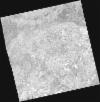
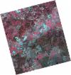
DE2_OPER_HRA_PSH_1C_20210714T110508_N40-073_W007-445_0001
Download Product | Product Info | Browse
Platform Short Name | GEOSAT |
Platform Serial Identifier | 2 |
Product Type | HRA_PSH_1C |
Start Date | 2021-07-14T11:05:08Z |
Stop Date | 2021-07-14T11:05:11Z |
Original Name | DE2_PSH_L1C_000000_20210714T110508_20210714T110511_DE2_38306_6044.zip |
Footprint | 40.0218206174 -7.34815230943 40.1506871392 -7.38319517898 40.1260927326 -7.54304184191 39.9972220055 -7.50775242994 40.0218206174 -7.34815230943 |
Orbit Direction | ASCENDING |
Scene Centre Longitude | W007 |
Scene Centre Latitude | N40 |
Cloud Cover Percentage | -1 |
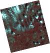
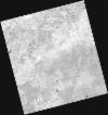
DE2_OPER_HRA_PM4_1C_20210714T110508_N40-073_W007-445_0001
Download Product | Product Info | Browse
Platform Short Name | GEOSAT |
Platform Serial Identifier | 2 |
Product Type | HRA_PM4_1C |
Start Date | 2021-07-14T11:05:08Z |
Stop Date | 2021-07-14T11:05:11Z |
Original Name | DE2_PM4_L1C_000000_20210714T110508_20210714T110511_DE2_38306_6044.zip |
Footprint | 40.0218206174 -7.34815230943 40.1506871392 -7.38319517898 40.1260927326 -7.54304184191 39.9972220055 -7.50775242994 40.0218206174 -7.34815230943 |
Orbit Direction | ASCENDING |
Scene Centre Longitude | W007 |
Scene Centre Latitude | N40 |
Cloud Cover Percentage | -1 |
DE2_OPER_HRA_PSH_1C_20210531T105820_N40-218_W007-416_0001
Download Product | Product Info | Browse
Platform Short Name | GEOSAT |
Platform Serial Identifier | 2 |
Product Type | HRA_PSH_1C |
Start Date | 2021-05-31T10:58:20Z |
Stop Date | 2021-05-31T10:58:22Z |
Original Name | DE2_PSH_L1C_000000_20210531T105820_20210531T105822_DE2_37653_39A7.zip |
Footprint | 40.1701087223 -7.32634788972 40.2930509945 -7.36312108787 40.2677725941 -7.50733491999 40.144857394 -7.47030343581 40.1701087223 -7.32634788972 |
Orbit Direction | ASCENDING |
Scene Centre Longitude | W007 |
Scene Centre Latitude | N40 |
Cloud Cover Percentage | -1 |
DE2_OPER_HRA_PM4_1C_20210531T105820_N40-218_W007-416_0001
Download Product | Product Info | Browse
Platform Short Name | GEOSAT |
Platform Serial Identifier | 2 |
Product Type | HRA_PM4_1C |
Start Date | 2021-05-31T10:58:20Z |
Stop Date | 2021-05-31T10:58:22Z |
Original Name | DE2_PM4_L1C_000000_20210531T105820_20210531T105822_DE2_37653_39A7.zip |
Footprint | 40.1701087223 -7.32634788972 40.2930509945 -7.36312108787 40.2677725941 -7.50733491999 40.144857394 -7.47030343581 40.1701087223 -7.32634788972 |
Orbit Direction | ASCENDING |
Scene Centre Longitude | W007 |
Scene Centre Latitude | N40 |
Cloud Cover Percentage | -1 |
DE2_OPER_HRA_PSH_1C_20210531T105818_N40-107_W007-383_0001
Download Product | Product Info | Browse
Platform Short Name | GEOSAT |
Platform Serial Identifier | 2 |
Product Type | HRA_PSH_1C |
Start Date | 2021-05-31T10:58:18Z |
Stop Date | 2021-05-31T10:58:20Z |
Original Name | DE2_PSH_L1C_000000_20210531T105818_20210531T105820_DE2_37653_4FEB.zip |
Footprint | 40.0584985868 -7.29283686063 40.181502931 -7.32979410371 40.1562402258 -7.4737112532 40.0332507447 -7.43659407326 40.0584985868 -7.29283686063 |
Orbit Direction | ASCENDING |
Scene Centre Longitude | W007 |
Scene Centre Latitude | N40 |
Cloud Cover Percentage | -1 |
DE2_OPER_HRA_PM4_1C_20210531T105818_N40-107_W007-383_0001
Download Product | Product Info | Browse
Platform Short Name | GEOSAT |
Platform Serial Identifier | 2 |
Product Type | HRA_PM4_1C |
Start Date | 2021-05-31T10:58:18Z |
Stop Date | 2021-05-31T10:58:20Z |
Original Name | DE2_PM4_L1C_000000_20210531T105818_20210531T105820_DE2_37653_4FEB.zip |
Footprint | 40.0584985868 -7.29283686063 40.181502931 -7.32979410371 40.1562402258 -7.4737112532 40.0332507447 -7.43659407326 40.0584985868 -7.29283686063 |
Orbit Direction | ASCENDING |
Scene Centre Longitude | W007 |
Scene Centre Latitude | N40 |
Cloud Cover Percentage | -1 |
DE2_OPER_HRA_PSH_1C_20210506T105613_N40-207_W007-307_0001
Download Product | Product Info | Browse
Platform Short Name | GEOSAT |
Platform Serial Identifier | 2 |
Product Type | HRA_PSH_1C |
Start Date | 2021-05-06T10:56:13Z |
Stop Date | 2021-05-06T10:56:16Z |
Original Name | DE2_PSH_L1C_000000_20210506T105613_20210506T105616_DE2_37282_37C6.zip |
Footprint | 40.1592873201 -7.21702099318 40.2819563215 -7.25493864174 40.2559006361 -7.39914201081 40.1332837146 -7.3607466932 40.1592873201 -7.21702099318 |
Orbit Direction | ASCENDING |
Scene Centre Longitude | W007 |
Scene Centre Latitude | N40 |
Cloud Cover Percentage | -1 |
DE2_OPER_HRA_PM4_1C_20210506T105613_N40-207_W007-307_0001
Download Product | Product Info | Browse
Platform Short Name | GEOSAT |
Platform Serial Identifier | 2 |
Product Type | HRA_PM4_1C |
Start Date | 2021-05-06T10:56:13Z |
Stop Date | 2021-05-06T10:56:16Z |
Original Name | DE2_PM4_L1C_000000_20210506T105613_20210506T105616_DE2_37282_37C6.zip |
Footprint | 40.1592873201 -7.21702099318 40.2819563215 -7.25493864174 40.2559006361 -7.39914201081 40.1332837146 -7.3607466932 40.1592873201 -7.21702099318 |
Orbit Direction | ASCENDING |
Scene Centre Longitude | W007 |
Scene Centre Latitude | N40 |
Cloud Cover Percentage | -1 |
DE2_OPER_HRA_PSH_1C_20210506T105611_N40-096_W007-273_0001
Download Product | Product Info | Browse
Platform Short Name | GEOSAT |
Platform Serial Identifier | 2 |
Product Type | HRA_PSH_1C |
Start Date | 2021-05-06T10:56:11Z |
Stop Date | 2021-05-06T10:56:14Z |
Original Name | DE2_PSH_L1C_000000_20210506T105611_20210506T105614_DE2_37282_C5BC.zip |
Footprint | 40.0479473651 -7.18244687795 40.1706664401 -7.22059851276 40.1446590214 -7.36435595236 40.0219504077 -7.32612516065 40.0479473651 -7.18244687795 |
Orbit Direction | ASCENDING |
Scene Centre Longitude | W007 |
Scene Centre Latitude | N40 |
Cloud Cover Percentage | -1 |
DE2_OPER_HRA_PM4_1C_20210506T105611_N40-096_W007-273_0001
Download Product | Product Info | Browse
Platform Short Name | GEOSAT |
Platform Serial Identifier | 2 |
Product Type | HRA_PM4_1C |
Start Date | 2021-05-06T10:56:11Z |
Stop Date | 2021-05-06T10:56:14Z |
Original Name | DE2_PM4_L1C_000000_20210506T105611_20210506T105614_DE2_37282_C5BC.zip |
Footprint | 40.0479473651 -7.18244687795 40.1706664401 -7.22059851276 40.1446590214 -7.36435595236 40.0219504077 -7.32612516065 40.0479473651 -7.18244687795 |
Orbit Direction | ASCENDING |
Scene Centre Longitude | W007 |
Scene Centre Latitude | N40 |
Cloud Cover Percentage | -1 |