ESA TPM Map Catalogue - Product List
back to previous node |
list of download URLs
Collection G2_Portugal_2021
GEOSAT-2 Portugal Coverage 2021 collection. More details here.
List of available products (latitude from 40.1293 to 40.2077 dg, longitude from -8.18938 to -8.045 dg)..
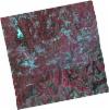
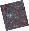
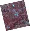
DE2_OPER_HRA_PSH_1C_20210702T111210_N40-233_W008-008_0001
Download Product | Product Info | Browse
Platform Short Name | GEOSAT |
Platform Serial Identifier | 2 |
Product Type | HRA_PSH_1C |
Start Date | 2021-07-02T11:12:10Z |
Stop Date | 2021-07-02T11:12:13Z |
Original Name | DE2_PSH_L1C_000000_20210702T111210_20210702T111213_DE2_38128_3391.zip |
Footprint | 40.1768615371 -7.90375787517 40.314438649 -7.93493629701 40.2893741079 -8.1140144722 40.1518264623 -8.08239567961 40.1768615371 -7.90375787517 |
Orbit Direction | ASCENDING |
Scene Centre Longitude | W008 |
Scene Centre Latitude | N40 |
Cloud Cover Percentage | -1 |
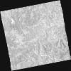
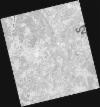
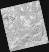
DE2_OPER_HRA_PM4_1C_20210702T111210_N40-233_W008-008_0001
Download Product | Product Info | Browse
Platform Short Name | GEOSAT |
Platform Serial Identifier | 2 |
Product Type | HRA_PM4_1C |
Start Date | 2021-07-02T11:12:10Z |
Stop Date | 2021-07-02T11:12:13Z |
Original Name | DE2_PM4_L1C_000000_20210702T111210_20210702T111213_DE2_38128_3391.zip |
Footprint | 40.1768615371 -7.90375787517 40.314438649 -7.93493629701 40.2893741079 -8.1140144722 40.1518264623 -8.08239567961 40.1768615371 -7.90375787517 |
Orbit Direction | ASCENDING |
Scene Centre Longitude | W008 |
Scene Centre Latitude | N40 |
Cloud Cover Percentage | -1 |
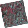
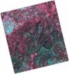
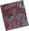
DE2_OPER_HRA_PSH_1C_20210702T111208_N40-108_W007-978_0001
Download Product | Product Info | Browse
Platform Short Name | GEOSAT |
Platform Serial Identifier | 2 |
Product Type | HRA_PSH_1C |
Start Date | 2021-07-02T11:12:08Z |
Stop Date | 2021-07-02T11:12:11Z |
Original Name | DE2_PSH_L1C_000000_20210702T111208_20210702T111211_DE2_38128_89A4.zip |
Footprint | 40.0524042963 -7.87139245347 40.189488414 -7.90785410591 40.1634629164 -8.08421182987 40.0274715237 -8.04920434302 40.0524042963 -7.87139245347 |
Orbit Direction | ASCENDING |
Scene Centre Longitude | W007 |
Scene Centre Latitude | N40 |
Cloud Cover Percentage | -1 |
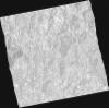
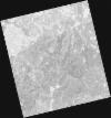
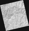
DE2_OPER_HRA_PM4_1C_20210702T111208_N40-108_W007-978_0001
Download Product | Product Info | Browse
Platform Short Name | GEOSAT |
Platform Serial Identifier | 2 |
Product Type | HRA_PM4_1C |
Start Date | 2021-07-02T11:12:08Z |
Stop Date | 2021-07-02T11:12:11Z |
Original Name | DE2_PM4_L1C_000000_20210702T111208_20210702T111211_DE2_38128_89A4.zip |
Footprint | 40.0524042963 -7.87139245347 40.189488414 -7.90785410591 40.1634629164 -8.08421182987 40.0274715237 -8.04920434302 40.0524042963 -7.87139245347 |
Orbit Direction | ASCENDING |
Scene Centre Longitude | W007 |
Scene Centre Latitude | N40 |
Cloud Cover Percentage | -1 |
DE2_OPER_HRA_PSH_1C_20210525T110144_N40-210_W008-214_0001
Download Product | Product Info | Browse
Platform Short Name | GEOSAT |
Platform Serial Identifier | 2 |
Product Type | HRA_PSH_1C |
Start Date | 2021-05-25T11:01:44Z |
Stop Date | 2021-05-25T11:01:46Z |
Original Name | DE2_PSH_L1C_000000_20210525T110144_20210525T110146_DE2_37564_EF15.zip |
Footprint | 40.161416677 -8.12453986987 40.2844689744 -8.16120164666 40.259213972 -8.30534457467 40.1361638004 -8.2683997442 40.161416677 -8.12453986987 |
Orbit Direction | ASCENDING |
Scene Centre Longitude | W008 |
Scene Centre Latitude | N40 |
Cloud Cover Percentage | -1 |
DE2_OPER_HRA_PM4_1C_20210525T110144_N40-210_W008-214_0001
Download Product | Product Info | Browse
Platform Short Name | GEOSAT |
Platform Serial Identifier | 2 |
Product Type | HRA_PM4_1C |
Start Date | 2021-05-25T11:01:44Z |
Stop Date | 2021-05-25T11:01:46Z |
Original Name | DE2_PM4_L1C_000000_20210525T110144_20210525T110146_DE2_37564_EF15.zip |
Footprint | 40.161416677 -8.12453986987 40.2844689744 -8.16120164666 40.259213972 -8.30534457467 40.1361638004 -8.2683997442 40.161416677 -8.12453986987 |
Orbit Direction | ASCENDING |
Scene Centre Longitude | W008 |
Scene Centre Latitude | N40 |
Cloud Cover Percentage | -1 |
DE2_OPER_HRA_PSH_1C_20210525T110142_N40-098_W008-181_0001
Download Product | Product Info | Browse
Platform Short Name | GEOSAT |
Platform Serial Identifier | 2 |
Product Type | HRA_PSH_1C |
Start Date | 2021-05-25T11:01:42Z |
Stop Date | 2021-05-25T11:01:44Z |
Original Name | DE2_PSH_L1C_000000_20210525T110142_20210525T110144_DE2_37564_31BE.zip |
Footprint | 40.0497233957 -8.09138070608 40.1728283422 -8.12799588776 40.1475846099 -8.27182572714 40.0245229576 -8.23506907418 40.0497233957 -8.09138070608 |
Orbit Direction | ASCENDING |
Scene Centre Longitude | W008 |
Scene Centre Latitude | N40 |
Cloud Cover Percentage | -1 |
DE2_OPER_HRA_PM4_1C_20210525T110142_N40-098_W008-181_0001
Download Product | Product Info | Browse
Platform Short Name | GEOSAT |
Platform Serial Identifier | 2 |
Product Type | HRA_PM4_1C |
Start Date | 2021-05-25T11:01:42Z |
Stop Date | 2021-05-25T11:01:44Z |
Original Name | DE2_PM4_L1C_000000_20210525T110142_20210525T110144_DE2_37564_31BE.zip |
Footprint | 40.0497233957 -8.09138070608 40.1728283422 -8.12799588776 40.1475846099 -8.27182572714 40.0245229576 -8.23506907418 40.0497233957 -8.09138070608 |
Orbit Direction | ASCENDING |
Scene Centre Longitude | W008 |
Scene Centre Latitude | N40 |
Cloud Cover Percentage | -1 |
DE2_OPER_HRA_PSH_1C_20210318T110634_N40-217_W008-067_0001
Download Product | Product Info | Browse
Platform Short Name | GEOSAT |
Platform Serial Identifier | 2 |
Product Type | HRA_PSH_1C |
Start Date | 2021-03-18T11:06:34Z |
Stop Date | 2021-03-18T11:06:36Z |
Original Name | DE2_PSH_L1C_000000_20210318T110634_20210318T110636_DE2_36555_D7D6.zip |
Footprint | 40.1669367039 -7.97620135315 40.2917362638 -8.01110672471 40.2670537604 -8.1589735031 40.1423405055 -8.12350813891 40.1669367039 -7.97620135315 |
Orbit Direction | ASCENDING |
Scene Centre Longitude | W008 |
Scene Centre Latitude | N40 |
Cloud Cover Percentage | -1 |
DE2_OPER_HRA_PM4_1C_20210318T110634_N40-217_W008-067_0001
Download Product | Product Info | Browse
Platform Short Name | GEOSAT |
Platform Serial Identifier | 2 |
Product Type | HRA_PM4_1C |
Start Date | 2021-03-18T11:06:34Z |
Stop Date | 2021-03-18T11:06:36Z |
Original Name | DE2_PM4_L1C_000000_20210318T110634_20210318T110636_DE2_36555_D7D6.zip |
Footprint | 40.1669367039 -7.97620135315 40.2917362638 -8.01110672471 40.2670537604 -8.1589735031 40.1423405055 -8.12350813891 40.1669367039 -7.97620135315 |
Orbit Direction | ASCENDING |
Scene Centre Longitude | W008 |
Scene Centre Latitude | N40 |
Cloud Cover Percentage | -1 |
DE2_OPER_HRA_PSH_1C_20210318T110632_N40-103_W008-035_0001
Download Product | Product Info | Browse
Platform Short Name | GEOSAT |
Platform Serial Identifier | 2 |
Product Type | HRA_PSH_1C |
Start Date | 2021-03-18T11:06:32Z |
Stop Date | 2021-03-18T11:06:34Z |
Original Name | DE2_PSH_L1C_000000_20210318T110632_20210318T110634_DE2_36555_9AF2.zip |
Footprint | 40.0537568743 -7.94389454676 40.1785534619 -7.9794358812 40.1539262327 -8.12674069627 40.0291133834 -8.09129385815 40.0537568743 -7.94389454676 |
Orbit Direction | ASCENDING |
Scene Centre Longitude | W008 |
Scene Centre Latitude | N40 |
Cloud Cover Percentage | -1 |
DE2_OPER_HRA_PM4_1C_20210318T110632_N40-103_W008-035_0001
Download Product | Product Info | Browse
Platform Short Name | GEOSAT |
Platform Serial Identifier | 2 |
Product Type | HRA_PM4_1C |
Start Date | 2021-03-18T11:06:32Z |
Stop Date | 2021-03-18T11:06:34Z |
Original Name | DE2_PM4_L1C_000000_20210318T110632_20210318T110634_DE2_36555_9AF2.zip |
Footprint | 40.0537568743 -7.94389454676 40.1785534619 -7.9794358812 40.1539262327 -8.12674069627 40.0291133834 -8.09129385815 40.0537568743 -7.94389454676 |
Orbit Direction | ASCENDING |
Scene Centre Longitude | W008 |
Scene Centre Latitude | N40 |
Cloud Cover Percentage | -1 |