ESA TPM Map Catalogue - Product List
back to previous node |
list of download URLs
Collection G2_Portugal_2021
GEOSAT-2 Portugal Coverage 2021 collection. More details here.
List of available products (latitude from 40.0152 to 40.0936 dg, longitude from -7.40187 to -7.2575 dg)..
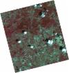
DE2_OPER_HRA_PSH_1C_20210808T110626_N40-051_W007-177_0001
Download Product | Product Info | BrowsePlatform Short Name | GEOSAT |
Platform Serial Identifier | 2 |
Product Type | HRA_PSH_1C |
Start Date | 2021-08-08T11:06:26Z |
Stop Date | 2021-08-08T11:06:28Z |
Original Name | DE2_PSH_L1C_000000_20210808T110626_20210808T110628_DE2_38677_F09F.zip |
Footprint | 39.9970297644 -7.07378156045 40.1314221969 -7.10881897358 40.1065686148 -7.2811378307 39.9721469578 -7.24625600837 39.9970297644 -7.07378156045 |
Orbit Direction | ASCENDING |
Scene Centre Longitude | W007 |
Scene Centre Latitude | N40 |
Cloud Cover Percentage | -1 |
DE2_OPER_HRA_PM4_1C_20210808T110626_N40-051_W007-177_0001
Download Product | Product Info | BrowsePlatform Short Name | GEOSAT |
Platform Serial Identifier | 2 |
Product Type | HRA_PM4_1C |
Start Date | 2021-08-08T11:06:26Z |
Stop Date | 2021-08-08T11:06:28Z |
Original Name | DE2_PM4_L1C_000000_20210808T110626_20210808T110628_DE2_38677_F09F.zip |
Footprint | 39.9970297644 -7.07378156045 40.1314221969 -7.10881897358 40.1065686148 -7.2811378307 39.9721469578 -7.24625600837 39.9970297644 -7.07378156045 |
Orbit Direction | ASCENDING |
Scene Centre Longitude | W007 |
Scene Centre Latitude | N40 |
Cloud Cover Percentage | -1 |
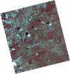
DE2_OPER_HRA_PSH_1C_20210714T110508_N40-073_W007-445_0001
Download Product | Product Info | BrowsePlatform Short Name | GEOSAT |
Platform Serial Identifier | 2 |
Product Type | HRA_PSH_1C |
Start Date | 2021-07-14T11:05:08Z |
Stop Date | 2021-07-14T11:05:11Z |
Original Name | DE2_PSH_L1C_000000_20210714T110508_20210714T110511_DE2_38306_6044.zip |
Footprint | 40.0218206174 -7.34815230943 40.1506871392 -7.38319517898 40.1260927326 -7.54304184191 39.9972220055 -7.50775242994 40.0218206174 -7.34815230943 |
Orbit Direction | ASCENDING |
Scene Centre Longitude | W007 |
Scene Centre Latitude | N40 |
Cloud Cover Percentage | -1 |
DE2_OPER_HRA_PM4_1C_20210714T110508_N40-073_W007-445_0001
Download Product | Product Info | BrowsePlatform Short Name | GEOSAT |
Platform Serial Identifier | 2 |
Product Type | HRA_PM4_1C |
Start Date | 2021-07-14T11:05:08Z |
Stop Date | 2021-07-14T11:05:11Z |
Original Name | DE2_PM4_L1C_000000_20210714T110508_20210714T110511_DE2_38306_6044.zip |
Footprint | 40.0218206174 -7.34815230943 40.1506871392 -7.38319517898 40.1260927326 -7.54304184191 39.9972220055 -7.50775242994 40.0218206174 -7.34815230943 |
Orbit Direction | ASCENDING |
Scene Centre Longitude | W007 |
Scene Centre Latitude | N40 |
Cloud Cover Percentage | -1 |
DE2_OPER_HRA_PSH_1C_20210714T110506_N39-956_W007-413_0001
Download Product | Product Info | BrowsePlatform Short Name | GEOSAT |
Platform Serial Identifier | 2 |
Product Type | HRA_PSH_1C |
Start Date | 2021-07-14T11:05:06Z |
Stop Date | 2021-07-14T11:05:09Z |
Original Name | DE2_PSH_L1C_000000_20210714T110506_20210714T110509_DE2_38306_CF73.zip |
Footprint | 39.9047607163 -7.31644395606 40.0337778821 -7.35130949258 40.0091689366 -7.51095433668 39.8801382037 -7.47619431793 39.9047607163 -7.31644395606 |
Orbit Direction | ASCENDING |
Scene Centre Longitude | W007 |
Scene Centre Latitude | N39 |
Cloud Cover Percentage | -1 |
DE2_OPER_HRA_PM4_1C_20210714T110506_N39-956_W007-413_0001
Download Product | Product Info | BrowsePlatform Short Name | GEOSAT |
Platform Serial Identifier | 2 |
Product Type | HRA_PM4_1C |
Start Date | 2021-07-14T11:05:06Z |
Stop Date | 2021-07-14T11:05:09Z |
Original Name | DE2_PM4_L1C_000000_20210714T110506_20210714T110509_DE2_38306_CF73.zip |
Footprint | 39.9047607163 -7.31644395606 40.0337778821 -7.35130949258 40.0091689366 -7.51095433668 39.8801382037 -7.47619431793 39.9047607163 -7.31644395606 |
Orbit Direction | ASCENDING |
Scene Centre Longitude | W007 |
Scene Centre Latitude | N39 |
Cloud Cover Percentage | -1 |
DE2_OPER_HRA_PSH_1C_20210531T105818_N40-107_W007-383_0001
Download Product | Product Info | BrowsePlatform Short Name | GEOSAT |
Platform Serial Identifier | 2 |
Product Type | HRA_PSH_1C |
Start Date | 2021-05-31T10:58:18Z |
Stop Date | 2021-05-31T10:58:20Z |
Original Name | DE2_PSH_L1C_000000_20210531T105818_20210531T105820_DE2_37653_4FEB.zip |
Footprint | 40.0584985868 -7.29283686063 40.181502931 -7.32979410371 40.1562402258 -7.4737112532 40.0332507447 -7.43659407326 40.0584985868 -7.29283686063 |
Orbit Direction | ASCENDING |
Scene Centre Longitude | W007 |
Scene Centre Latitude | N40 |
Cloud Cover Percentage | -1 |
DE2_OPER_HRA_PM4_1C_20210531T105818_N40-107_W007-383_0001
Download Product | Product Info | BrowsePlatform Short Name | GEOSAT |
Platform Serial Identifier | 2 |
Product Type | HRA_PM4_1C |
Start Date | 2021-05-31T10:58:18Z |
Stop Date | 2021-05-31T10:58:20Z |
Original Name | DE2_PM4_L1C_000000_20210531T105818_20210531T105820_DE2_37653_4FEB.zip |
Footprint | 40.0584985868 -7.29283686063 40.181502931 -7.32979410371 40.1562402258 -7.4737112532 40.0332507447 -7.43659407326 40.0584985868 -7.29283686063 |
Orbit Direction | ASCENDING |
Scene Centre Longitude | W007 |
Scene Centre Latitude | N40 |
Cloud Cover Percentage | -1 |
DE2_OPER_HRA_PSH_1C_20210531T105816_N39-995_W007-349_0001
Download Product | Product Info | BrowsePlatform Short Name | GEOSAT |
Platform Serial Identifier | 2 |
Product Type | HRA_PSH_1C |
Start Date | 2021-05-31T10:58:16Z |
Stop Date | 2021-05-31T10:58:19Z |
Original Name | DE2_PSH_L1C_000000_20210531T105816_20210531T105819_DE2_37653_BBC8.zip |
Footprint | 39.9468979515 -7.25934069239 40.0698800039 -7.29625521851 40.0446278134 -7.43999142819 39.9216863288 -7.40283849835 39.9468979515 -7.25934069239 |
Orbit Direction | ASCENDING |
Scene Centre Longitude | W007 |
Scene Centre Latitude | N39 |
Cloud Cover Percentage | -1 |
DE2_OPER_HRA_PM4_1C_20210531T105816_N39-995_W007-349_0001
Download Product | Product Info | BrowsePlatform Short Name | GEOSAT |
Platform Serial Identifier | 2 |
Product Type | HRA_PM4_1C |
Start Date | 2021-05-31T10:58:16Z |
Stop Date | 2021-05-31T10:58:19Z |
Original Name | DE2_PM4_L1C_000000_20210531T105816_20210531T105819_DE2_37653_BBC8.zip |
Footprint | 39.9468979515 -7.25934069239 40.0698800039 -7.29625521851 40.0446278134 -7.43999142819 39.9216863288 -7.40283849835 39.9468979515 -7.25934069239 |
Orbit Direction | ASCENDING |
Scene Centre Longitude | W007 |
Scene Centre Latitude | N39 |
Cloud Cover Percentage | -1 |
DE2_OPER_HRA_PSH_1C_20210506T105611_N40-096_W007-273_0001
Download Product | Product Info | BrowsePlatform Short Name | GEOSAT |
Platform Serial Identifier | 2 |
Product Type | HRA_PSH_1C |
Start Date | 2021-05-06T10:56:11Z |
Stop Date | 2021-05-06T10:56:14Z |
Original Name | DE2_PSH_L1C_000000_20210506T105611_20210506T105614_DE2_37282_C5BC.zip |
Footprint | 40.0479473651 -7.18244687795 40.1706664401 -7.22059851276 40.1446590214 -7.36435595236 40.0219504077 -7.32612516065 40.0479473651 -7.18244687795 |
Orbit Direction | ASCENDING |
Scene Centre Longitude | W007 |
Scene Centre Latitude | N40 |
Cloud Cover Percentage | -1 |
DE2_OPER_HRA_PM4_1C_20210506T105611_N40-096_W007-273_0001
Download Product | Product Info | BrowsePlatform Short Name | GEOSAT |
Platform Serial Identifier | 2 |
Product Type | HRA_PM4_1C |
Start Date | 2021-05-06T10:56:11Z |
Stop Date | 2021-05-06T10:56:14Z |
Original Name | DE2_PM4_L1C_000000_20210506T105611_20210506T105614_DE2_37282_C5BC.zip |
Footprint | 40.0479473651 -7.18244687795 40.1706664401 -7.22059851276 40.1446590214 -7.36435595236 40.0219504077 -7.32612516065 40.0479473651 -7.18244687795 |
Orbit Direction | ASCENDING |
Scene Centre Longitude | W007 |
Scene Centre Latitude | N40 |
Cloud Cover Percentage | -1 |
DE2_OPER_HRA_PSH_1C_20210506T105610_N39-984_W007-238_0001
Download Product | Product Info | BrowsePlatform Short Name | GEOSAT |
Platform Serial Identifier | 2 |
Product Type | HRA_PSH_1C |
Start Date | 2021-05-06T10:56:10Z |
Stop Date | 2021-05-06T10:56:12Z |
Original Name | DE2_PSH_L1C_000000_20210506T105610_20210506T105612_DE2_37282_DEA3.zip |
Footprint | 39.9364414039 -7.14793026021 40.05929994 -7.18597901418 40.0332983555 -7.32962738338 39.9104758625 -7.29142035032 39.9364414039 -7.14793026021 |
Orbit Direction | ASCENDING |
Scene Centre Longitude | W007 |
Scene Centre Latitude | N39 |
Cloud Cover Percentage | -1 |
DE2_OPER_HRA_PM4_1C_20210506T105610_N39-984_W007-238_0001
Download Product | Product Info | BrowsePlatform Short Name | GEOSAT |
Platform Serial Identifier | 2 |
Product Type | HRA_PM4_1C |
Start Date | 2021-05-06T10:56:10Z |
Stop Date | 2021-05-06T10:56:12Z |
Original Name | DE2_PM4_L1C_000000_20210506T105610_20210506T105612_DE2_37282_DEA3.zip |
Footprint | 39.9364414039 -7.14793026021 40.05929994 -7.18597901418 40.0332983555 -7.32962738338 39.9104758625 -7.29142035032 39.9364414039 -7.14793026021 |
Orbit Direction | ASCENDING |
Scene Centre Longitude | W007 |
Scene Centre Latitude | N39 |
Cloud Cover Percentage | -1 |


