ESA TPM Map Catalogue - Product List
back to previous node |
list of download URLs
Collection G2_Portugal_2021
GEOSAT-2 Portugal Coverage 2021 collection. More details here.
List of available products (latitude from 40.0152 to 40.0936 dg, longitude from -8.54375 to -8.39938 dg)..
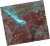
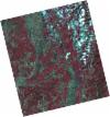
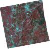
DE2_OPER_HRA_PSH_1C_20211010T111602_N40-149_W008-568_0001
Download Product | Product Info | Browse
Platform Short Name | GEOSAT |
Platform Serial Identifier | 2 |
Product Type | HRA_PSH_1C |
Start Date | 2021-10-10T11:16:02Z |
Stop Date | 2021-10-10T11:16:05Z |
Original Name | DE2_PSH_L1C_000000_20211010T111602_20211010T111605_DE2_39612_1892.zip |
Footprint | 40.0883946984 -8.44558495462 40.2368658045 -8.47840881981 40.2105274673 -8.69154335251 40.0621922092 -8.65726474394 40.0883946984 -8.44558495462 |
Orbit Direction | ASCENDING |
Scene Centre Longitude | W008 |
Scene Centre Latitude | N40 |
Cloud Cover Percentage | -1 |
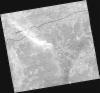
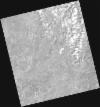
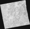
DE2_OPER_HRA_PM4_1C_20211010T111602_N40-149_W008-568_0001
Download Product | Product Info | Browse
Platform Short Name | GEOSAT |
Platform Serial Identifier | 2 |
Product Type | HRA_PM4_1C |
Start Date | 2021-10-10T11:16:02Z |
Stop Date | 2021-10-10T11:16:05Z |
Original Name | DE2_PM4_L1C_000000_20211010T111602_20211010T111605_DE2_39612_1892.zip |
Footprint | 40.0883946984 -8.44558495462 40.2368658045 -8.47840881981 40.2105274673 -8.69154335251 40.0621922092 -8.65726474394 40.0883946984 -8.44558495462 |
Orbit Direction | ASCENDING |
Scene Centre Longitude | W008 |
Scene Centre Latitude | N40 |
Cloud Cover Percentage | -1 |
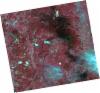
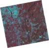
DE2_OPER_HRA_PSH_1C_20211010T111600_N40-014_W008-537_0001
Download Product | Product Info | Browse
Platform Short Name | GEOSAT |
Platform Serial Identifier | 2 |
Product Type | HRA_PSH_1C |
Start Date | 2021-10-10T11:16:00Z |
Stop Date | 2021-10-10T11:16:03Z |
Original Name | DE2_PSH_L1C_000000_20211010T111600_20211010T111603_DE2_39612_5BDC.zip |
Footprint | 39.9538650183 -8.41549366653 40.1021139085 -8.44886137858 40.0759450379 -8.66017767722 39.9277068715 -8.62637400911 39.9538650183 -8.41549366653 |
Orbit Direction | ASCENDING |
Scene Centre Longitude | W008 |
Scene Centre Latitude | N40 |
Cloud Cover Percentage | -1 |
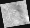
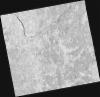
DE2_OPER_HRA_PM4_1C_20211010T111600_N40-014_W008-537_0001
Download Product | Product Info | Browse
Platform Short Name | GEOSAT |
Platform Serial Identifier | 2 |
Product Type | HRA_PM4_1C |
Start Date | 2021-10-10T11:16:00Z |
Stop Date | 2021-10-10T11:16:03Z |
Original Name | DE2_PM4_L1C_000000_20211010T111600_20211010T111603_DE2_39612_5BDC.zip |
Footprint | 39.9538650183 -8.41549366653 40.1021139085 -8.44886137858 40.0759450379 -8.66017767722 39.9277068715 -8.62637400911 39.9538650183 -8.41549366653 |
Orbit Direction | ASCENDING |
Scene Centre Longitude | W008 |
Scene Centre Latitude | N40 |
Cloud Cover Percentage | -1 |
DE2_OPER_HRA_PSH_1C_20210820T105916_N39-987_W008-417_0001
Download Product | Product Info | Browse
Platform Short Name | GEOSAT |
Platform Serial Identifier | 2 |
Product Type | HRA_PSH_1C |
Start Date | 2021-08-20T10:59:16Z |
Stop Date | 2021-08-20T10:59:19Z |
Original Name | DE2_PSH_L1C_000000_20210820T105916_20210820T105919_DE2_38855_9F3A.zip |
Footprint | 39.9385346222 -8.32737498875 40.0609404646 -8.36409287805 40.0355622976 -8.50742587261 39.9132196555 -8.47039458023 39.9385346222 -8.32737498875 |
Orbit Direction | ASCENDING |
Scene Centre Longitude | W008 |
Scene Centre Latitude | N39 |
Cloud Cover Percentage | -1 |
DE2_OPER_HRA_PM4_1C_20210820T105916_N39-987_W008-417_0001
Download Product | Product Info | Browse
Platform Short Name | GEOSAT |
Platform Serial Identifier | 2 |
Product Type | HRA_PM4_1C |
Start Date | 2021-08-20T10:59:16Z |
Stop Date | 2021-08-20T10:59:19Z |
Original Name | DE2_PM4_L1C_000000_20210820T105916_20210820T105919_DE2_38855_9F3A.zip |
Footprint | 39.9385346222 -8.32737498875 40.0609404646 -8.36409287805 40.0355622976 -8.50742587261 39.9132196555 -8.47039458023 39.9385346222 -8.32737498875 |
Orbit Direction | ASCENDING |
Scene Centre Longitude | W008 |
Scene Centre Latitude | N39 |
Cloud Cover Percentage | -1 |
DE2_OPER_HRA_PSH_1C_20210626T111538_N40-159_W008-365_0001
Download Product | Product Info | Browse
Platform Short Name | GEOSAT |
Platform Serial Identifier | 2 |
Product Type | HRA_PSH_1C |
Start Date | 2021-06-26T11:15:38Z |
Stop Date | 2021-06-26T11:15:40Z |
Original Name | DE2_PSH_L1C_000000_20210626T111538_20210626T111540_DE2_38039_FC5F.zip |
Footprint | 40.1019233527 -8.25429176078 40.2428212168 -8.2875067268 40.217319238 -8.47725421499 40.0764270346 -8.44403715213 40.1019233527 -8.25429176078 |
Orbit Direction | ASCENDING |
Scene Centre Longitude | W008 |
Scene Centre Latitude | N40 |
Cloud Cover Percentage | -1 |
DE2_OPER_HRA_PM4_1C_20210626T111538_N40-159_W008-365_0001
Download Product | Product Info | Browse
Platform Short Name | GEOSAT |
Platform Serial Identifier | 2 |
Product Type | HRA_PM4_1C |
Start Date | 2021-06-26T11:15:38Z |
Stop Date | 2021-06-26T11:15:40Z |
Original Name | DE2_PM4_L1C_000000_20210626T111538_20210626T111540_DE2_38039_FC5F.zip |
Footprint | 40.1019233527 -8.25429176078 40.2428212168 -8.2875067268 40.217319238 -8.47725421499 40.0764270346 -8.44403715213 40.1019233527 -8.25429176078 |
Orbit Direction | ASCENDING |
Scene Centre Longitude | W008 |
Scene Centre Latitude | N40 |
Cloud Cover Percentage | -1 |
DE2_OPER_HRA_PSH_1C_20210626T111535_N40-031_W008-335_0001
Download Product | Product Info | Browse
Platform Short Name | GEOSAT |
Platform Serial Identifier | 2 |
Product Type | HRA_PSH_1C |
Start Date | 2021-06-26T11:15:35Z |
Stop Date | 2021-06-26T11:15:38Z |
Original Name | DE2_PSH_L1C_000000_20210626T111535_20210626T111538_DE2_38039_F793.zip |
Footprint | 39.9740051501 -8.22480329099 40.1150623636 -8.25688537563 40.0894832079 -8.44712453092 39.9484807837 -8.41308996649 39.9740051501 -8.22480329099 |
Orbit Direction | ASCENDING |
Scene Centre Longitude | W008 |
Scene Centre Latitude | N40 |
Cloud Cover Percentage | -1 |
DE2_OPER_HRA_PM4_1C_20210626T111535_N40-031_W008-335_0001
Download Product | Product Info | Browse
Platform Short Name | GEOSAT |
Platform Serial Identifier | 2 |
Product Type | HRA_PM4_1C |
Start Date | 2021-06-26T11:15:35Z |
Stop Date | 2021-06-26T11:15:38Z |
Original Name | DE2_PM4_L1C_000000_20210626T111535_20210626T111538_DE2_38039_F793.zip |
Footprint | 39.9740051501 -8.22480329099 40.1150623636 -8.25688537563 40.0894832079 -8.44712453092 39.9484807837 -8.41308996649 39.9740051501 -8.22480329099 |
Orbit Direction | ASCENDING |
Scene Centre Longitude | W008 |
Scene Centre Latitude | N40 |
Cloud Cover Percentage | -1 |