ESA TPM Map Catalogue - Product List
back to previous node |
list of download URLs
Collection G2_Portugal_2021
GEOSAT-2 Portugal Coverage 2021 collection. More details here.
List of available products (latitude from 39.9368 to 40.0152 dg, longitude from -7.75625 to -7.61188 dg)..
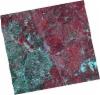
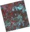
DE2_OPER_HRA_PSH_1C_20210727T111332_N39-949_W007-754_0001
Download Product | Product Info | Browse
Platform Short Name | GEOSAT |
Platform Serial Identifier | 2 |
Product Type | HRA_PSH_1C |
Start Date | 2021-07-27T11:13:32Z |
Stop Date | 2021-07-27T11:13:35Z |
Original Name | DE2_PSH_L1C_000000_20210727T111332_20210727T111335_DE2_38499_BEE2.zip |
Footprint | 39.8910980667 -7.63800420282 40.0339754404 -7.67288491234 40.0083337391 -7.86922768837 39.8650164835 -7.83806115574 39.8910980667 -7.63800420282 |
Orbit Direction | ASCENDING |
Scene Centre Longitude | W007 |
Scene Centre Latitude | N39 |
Cloud Cover Percentage | -1 |
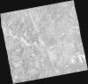
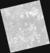
DE2_OPER_HRA_PM4_1C_20210727T111332_N39-949_W007-754_0001
Download Product | Product Info | Browse
Platform Short Name | GEOSAT |
Platform Serial Identifier | 2 |
Product Type | HRA_PM4_1C |
Start Date | 2021-07-27T11:13:32Z |
Stop Date | 2021-07-27T11:13:35Z |
Original Name | DE2_PM4_L1C_000000_20210727T111332_20210727T111335_DE2_38499_BEE2.zip |
Footprint | 39.8910980667 -7.63800420282 40.0339754404 -7.67288491234 40.0083337391 -7.86922768837 39.8650164835 -7.83806115574 39.8910980667 -7.63800420282 |
Orbit Direction | ASCENDING |
Scene Centre Longitude | W007 |
Scene Centre Latitude | N39 |
Cloud Cover Percentage | -1 |
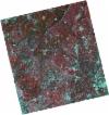
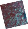
DE2_OPER_HRA_PSH_1C_20210720T110137_N39-993_W007-699_0001
Download Product | Product Info | Browse
Platform Short Name | GEOSAT |
Platform Serial Identifier | 2 |
Product Type | HRA_PSH_1C |
Start Date | 2021-07-20T11:01:37Z |
Stop Date | 2021-07-20T11:01:39Z |
Original Name | DE2_PSH_L1C_000000_20210720T110137_20210720T110139_DE2_38395_9C59.zip |
Footprint | 39.9437221316 -7.60727160046 40.0684916118 -7.64327177 40.0439513408 -7.79038477097 39.9190849323 -7.7551041763 39.9437221316 -7.60727160046 |
Orbit Direction | ASCENDING |
Scene Centre Longitude | W007 |
Scene Centre Latitude | N39 |
Cloud Cover Percentage | -1 |
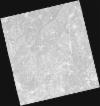
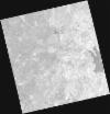
DE2_OPER_HRA_PM4_1C_20210720T110137_N39-993_W007-699_0001
Download Product | Product Info | Browse
Platform Short Name | GEOSAT |
Platform Serial Identifier | 2 |
Product Type | HRA_PM4_1C |
Start Date | 2021-07-20T11:01:37Z |
Stop Date | 2021-07-20T11:01:39Z |
Original Name | DE2_PM4_L1C_000000_20210720T110137_20210720T110139_DE2_38395_9C59.zip |
Footprint | 39.9437221316 -7.60727160046 40.0684916118 -7.64327177 40.0439513408 -7.79038477097 39.9190849323 -7.7551041763 39.9437221316 -7.60727160046 |
Orbit Direction | ASCENDING |
Scene Centre Longitude | W007 |
Scene Centre Latitude | N39 |
Cloud Cover Percentage | -1 |
DE2_OPER_HRA_PSH_1C_20210720T110135_N39-880_W007-666_0001
Download Product | Product Info | Browse
Platform Short Name | GEOSAT |
Platform Serial Identifier | 2 |
Product Type | HRA_PSH_1C |
Start Date | 2021-07-20T11:01:35Z |
Stop Date | 2021-07-20T11:01:37Z |
Original Name | DE2_PSH_L1C_000000_20210720T110135_20210720T110137_DE2_38395_3CE6.zip |
Footprint | 39.8304008889 -7.57520744855 39.9553099021 -7.61060128434 39.930648983 -7.75849329923 39.8058555925 -7.7222969541 39.8304008889 -7.57520744855 |
Orbit Direction | ASCENDING |
Scene Centre Longitude | W007 |
Scene Centre Latitude | N39 |
Cloud Cover Percentage | -1 |
DE2_OPER_HRA_PM4_1C_20210720T110135_N39-880_W007-666_0001
Download Product | Product Info | Browse
Platform Short Name | GEOSAT |
Platform Serial Identifier | 2 |
Product Type | HRA_PM4_1C |
Start Date | 2021-07-20T11:01:35Z |
Stop Date | 2021-07-20T11:01:37Z |
Original Name | DE2_PM4_L1C_000000_20210720T110135_20210720T110137_DE2_38395_3CE6.zip |
Footprint | 39.8304008889 -7.57520744855 39.9553099021 -7.61060128434 39.930648983 -7.75849329923 39.8058555925 -7.7222969541 39.8304008889 -7.57520744855 |
Orbit Direction | ASCENDING |
Scene Centre Longitude | W007 |
Scene Centre Latitude | N39 |
Cloud Cover Percentage | -1 |
DE2_OPER_HRA_PM4_1C_20210519T110500_N39-990_W007-559_0001
Download Product | Product Info | Browse
Platform Short Name | GEOSAT |
Platform Serial Identifier | 2 |
Product Type | HRA_PM4_1C |
Start Date | 2021-05-19T11:05:00Z |
Stop Date | 2021-05-19T11:05:03Z |
Original Name | DE2_PM4_L1C_000000_20210519T110500_20210519T110503_DE2_37475_AA3E.zip |
Footprint | 39.9397377407 -7.46562955475 40.0656224988 -7.50201311778 40.0412344186 -7.65314853338 39.915303652 -7.61701743897 39.9397377407 -7.46562955475 |
Orbit Direction | ASCENDING |
Scene Centre Longitude | W007 |
Scene Centre Latitude | N39 |
Cloud Cover Percentage | -1 |
DE2_OPER_HRA_PSH_1C_20210519T110500_N39-990_W007-559_0001
Download Product | Product Info | Browse
Platform Short Name | GEOSAT |
Platform Serial Identifier | 2 |
Product Type | HRA_PSH_1C |
Start Date | 2021-05-19T11:05:00Z |
Stop Date | 2021-05-19T11:05:03Z |
Original Name | DE2_PSH_L1C_000000_20210519T110500_20210519T110503_DE2_37475_AA3E.zip |
Footprint | 39.9397377407 -7.46562955475 40.0656224988 -7.50201311778 40.0412344186 -7.65314853338 39.915303652 -7.61701743897 39.9397377407 -7.46562955475 |
Orbit Direction | ASCENDING |
Scene Centre Longitude | W007 |
Scene Centre Latitude | N39 |
Cloud Cover Percentage | -1 |